There’s no doubt that the Oregon Coast is a place filled with stunning scenery, beautiful beaches and landscapes that stretch the imagination. But there are some attractions that are in a quirky class by themselves. Around the public coastline, you can discover mystifying natural wonders, historical oddities and curious sites — if you know where to look. This list of the Oregon Coast’s most offbeat attractions offers a north to south itinerary for those interested in the most unique sights and a little bit of the bizarre.
A Historic Shipwreck, No Diving Required
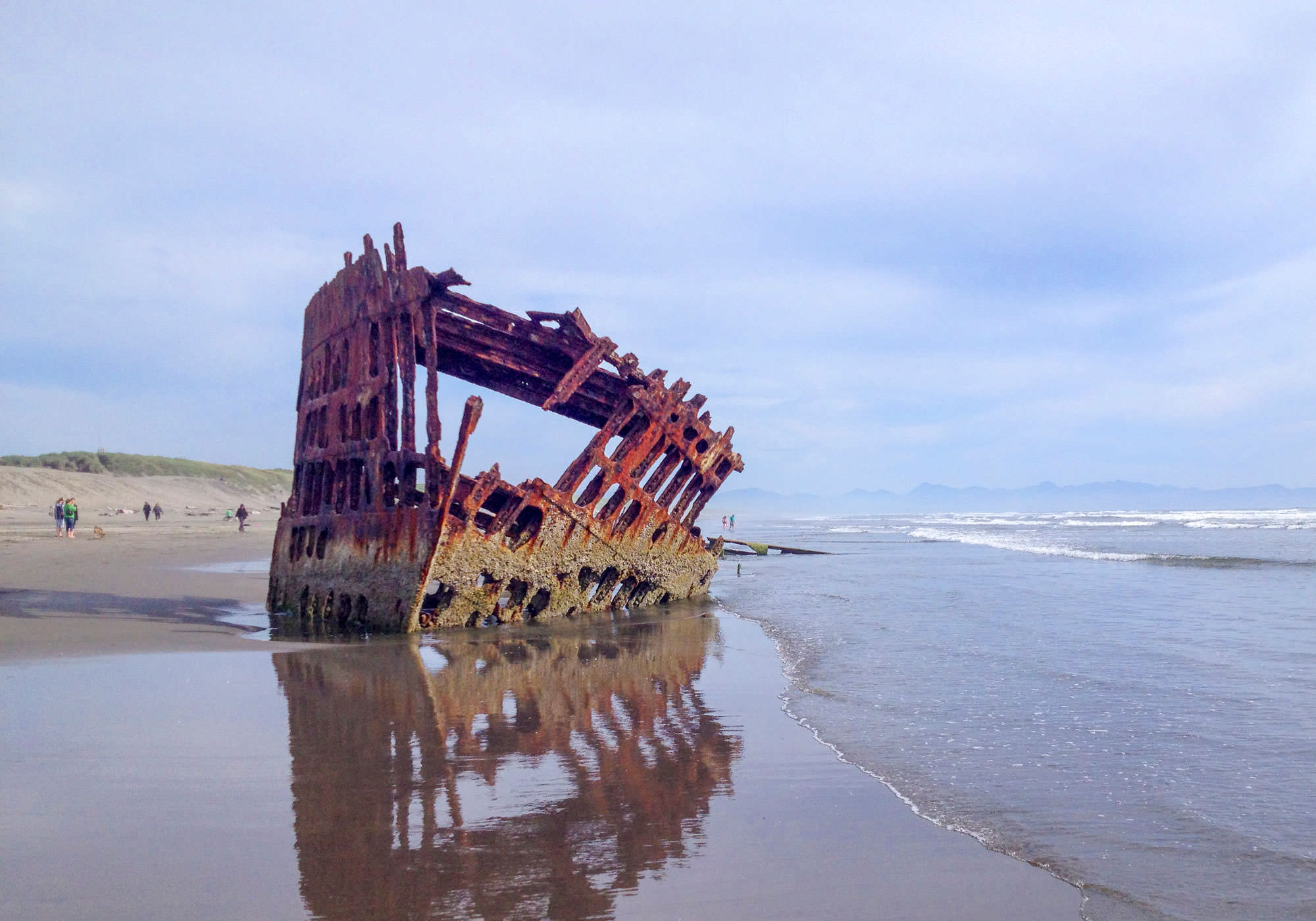
Oregon’s North Coast has a notorious reputation for shipwrecks, particular near the mouth of the Columbia River, known as the Graveyard of the Pacific. More than 2,000 ships have met their fate near the treacherous Columbia River bar where the giant river collides with violent Pacific waves. The sea floor is littered with shipwrecks, but only one has been visible on the shoreline for more than 100 years. In 1906, the Peter Iredale, a nearly 300-foot long sailing ship, was pushed ashore by high seas and driving winds in a heavy mist. It’s been there ever since and now mostly just the steel framework of the bow remains standing on the beach. You can see the Peter Iredale on the beach at Fort Steven State Park.
The Oregon Coast’s Oldest Roadway
Before Highway 101 was completed in the 1920s, the beaches were the main thoroughfare on the Oregon Coast and tides regularly made travel a challenge. Just south of Cannon Beach, you can get a glimpse of the Coast’s oldest surviving roadway, carved into a cliffside around a point where even low tides limited beach travel. You can still see the stagecoach wheel ruts worn into the sandstone on this small portion of roadway that dates from the early 20th century. The name Hug Point likely derived from this portion of the roadway where travelers had to “hug” the point to travel the Oregon Coast. The roadway can be found a short walk north on the beach from the Hug Point State Recreation Site parking area, but plan your visit for a low tide to get around the nearby point and enjoy the pretty nearby waterfall.
A Mountain Tunnel to a Secluded Beach
The next stop on this oddities tour is not one for the claustrophobic. In the 1920s, the little town of Oceanside on Oregon’s Three Capes Scenic Route was envisioned to be the home of one of the finest beach resorts on the Pacific Coast. It once boasted a skating rink, dance hall and public bath house. To provide access to beaches north of town at Maxwell Point, a pedestrian tunnel was blasted through the base in 1926. Passing through this tunnel, visitors could reach agate-strewn beaches and views of sea lions and sea birds inhabiting the offshore Three Arch Rocks. The Pacific Coast’s storms have not been kind to the tunnel that lost its ornamental façade and was often filled with debris from storms. You can still walk through the tunnel at your own risk, but watch your step and your head.
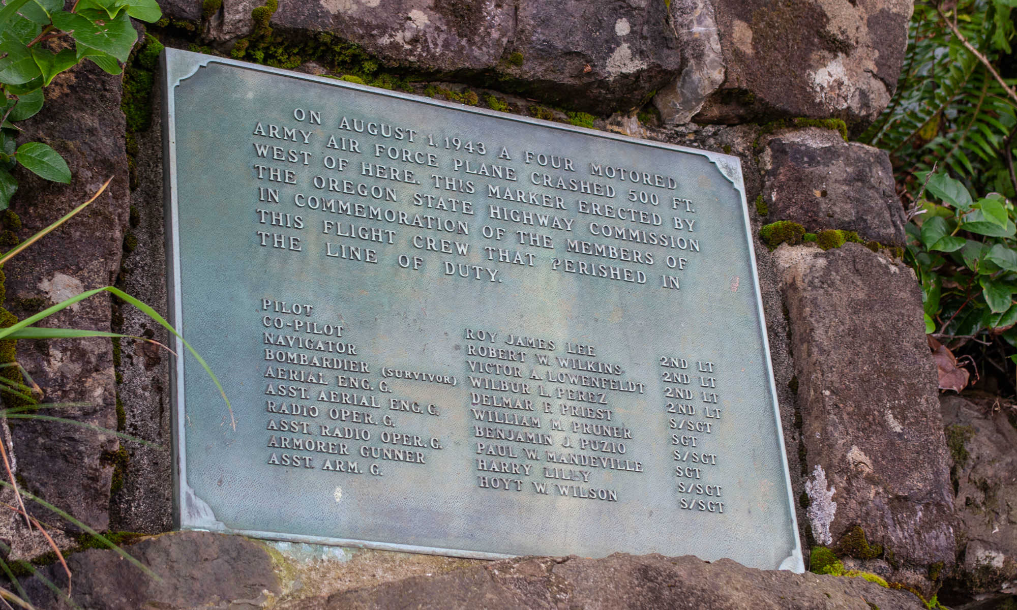
World War II Crash Site
The hike to the end of Cape Lookout southwest of Tillamook is one of the Coast’s prettiest, winding through old-growth forest to jaw dropping views at the western edge of the headland. Just over a half-mile into the hike from the Cape Lookout trailhead, you’ll pass a historic site now marked simply with a bronze plaque. In 1943, a B-17 “Flying Fortress” bomber on a training mission was flying through a disorienting thick fog and crashed into the south side of the nearly 1,000-foot-tall headland. Ten crew members were on board and miraculously one survived the tragic accident. The surviving crew member, the bombardier positioned in the nose of the plane, recounted finding himself hanging only by his shoestring from a tree after the crash. The plane was flying far lower than it was supposed to in an attempt to visually locate the cape and the pilot attempted to climb when he spotted it approaching, but missed clearing the cape by just 50 feet.

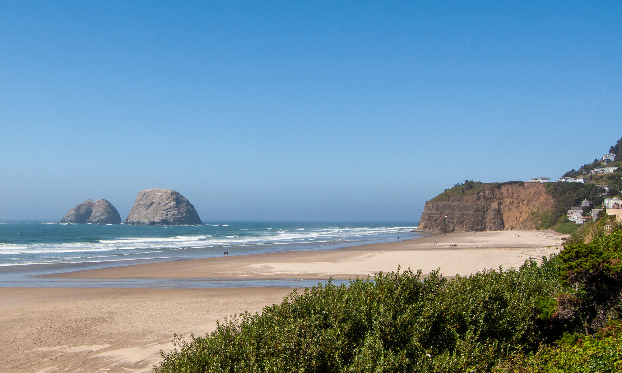
Ancient Ghost Forest on the Beach
The origins of many of the Oregon Coast’s natural wonders are difficult to explain unless you’re a geologist. The Neskowin Ghost Forest is such a place. At low tide, particularly when winter’s heavy surf action scours sand from the beach, an ancient forest is revealed. An ancient forest of stumps, that is. The stumps are from a forest of trees estimated at 2,000 years old. This forest on the beach is believed to be the result of an earthquake that abruptly lowered the trees that were then buried by a landslide. The buried and submerged trunks were preserved due to lack of exposure to oxygen. Over the years, the ghost forest was seen occasionally by locals after particularly heavy storms stripped sand off the beach, but they were quickly reburied until significant storms in the late 1990s scoured the beach of sand and the ghost forest has been regularly visible since that time. Low winter tides are still the best time to visit. The ghost forest is located just a short walk from the parking area at Neskowin Beach State Recreation Site near Proposal Rock.
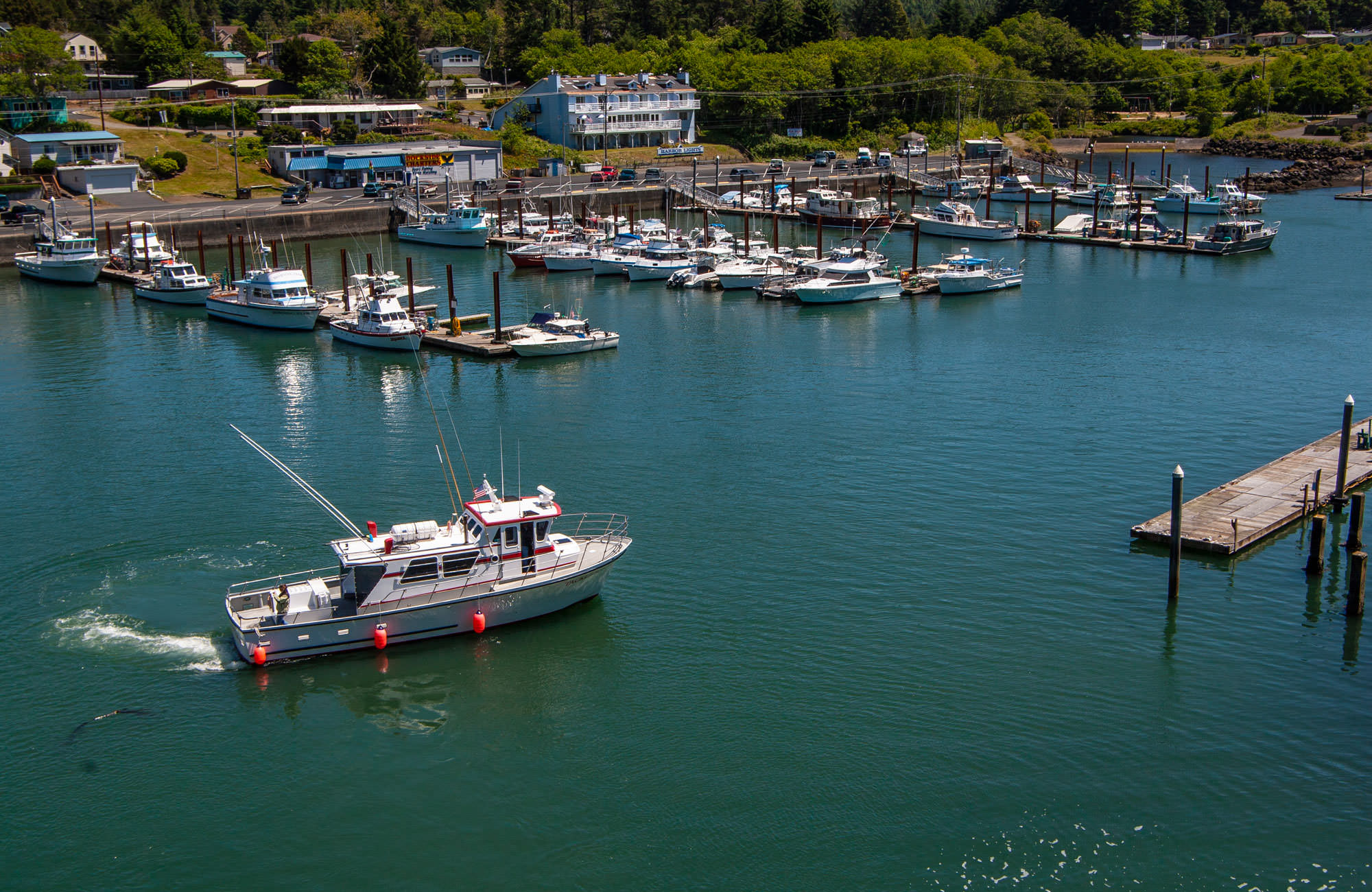
World’s Smallest Natural Navigable Harbor
It’s obviously not the top reason to visit Depoe Bay, the Whale Watching Capital of Oregon, but when you visit, you can claim to have seen the world’s smallest natural navigable harbor. The tiny harbor is home to a small fishing fleet and whale watching boats that once had to navigate a narrow 30-foot wide entrance under the Depoe Bay Bridge. What you see today is slightly larger than the original natural harbor that was expanded in the mid 1950s. Prior to that, at low tides fishing boats at the docks were left listing in just a few inches of water and mud. When first completed in 1939, the harbor was only 375 feet long and 125 feet wide. Depoe Bay is an easy stop between Lincoln City and Newport.
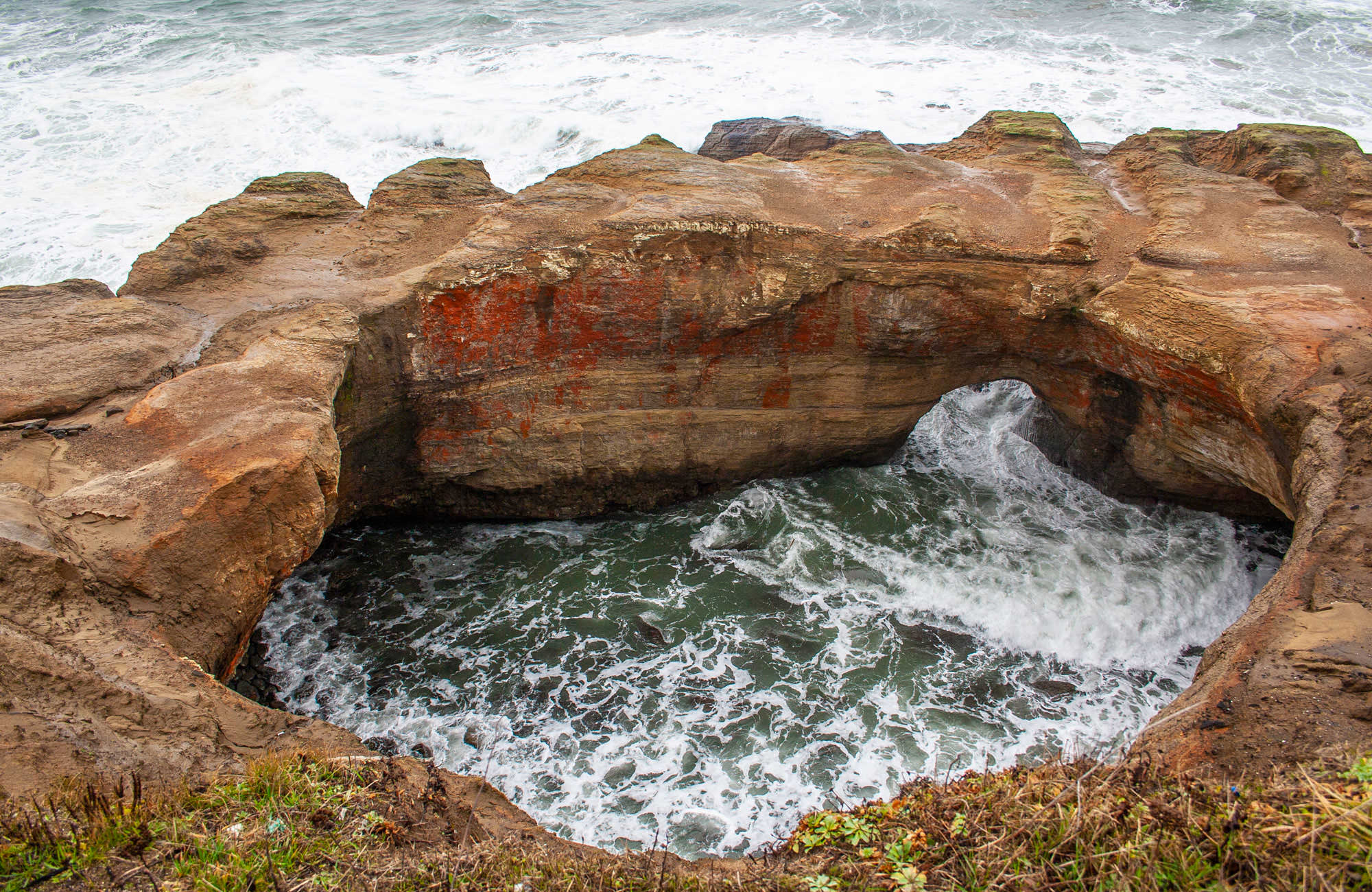
A Foamy Ocean Cauldron
The geological history of the Oregon Coast has resulted in many dramatic landmarks including nearly 2,000 near-shore sea stacks and small islands, but soft sandstone, delicately sculpted over thousands of years, accounts for some of the most interesting rock formations. A short detour off Highway 101 north of Newport leads to the community of Otter Rock, where Devils Punchbowl is the top attraction. At the road’s end, you’ll peer down into a natural circular basin approximately 75 feet in diameter. At higher tides, ocean waves gush in through an opening to the west, sometimes creating a foamy devilish brew. It’s believed the sea level opening was the origin of the unique formation, starting out as a sea cave worn into the sandstone by constant wave action before the roof collapsed leaving the cauldron you see today.
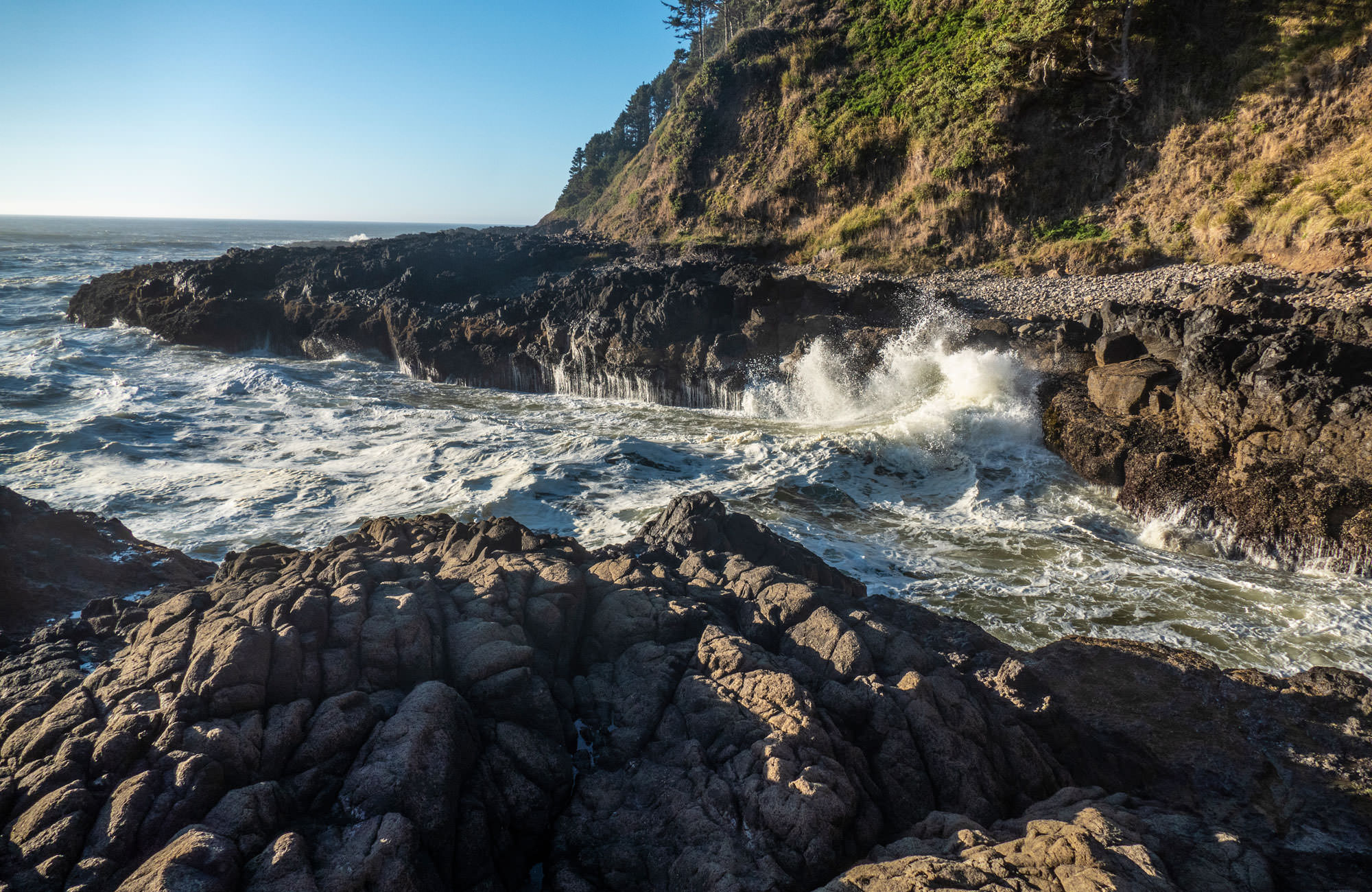
Waves Churned by Lava Rock
The Cape Perpetua Scenic Area south of Yachats offers some truly surprising attractions related to its volcanic beginnings. The shoreline, formed of black basalt lava rock, has been shaped for millions of years by constant wave action leaving some uniquely remarkable places to watch the power of the ocean. Devil’s Churn is a narrow opening in the rock that funnels the ocean waves into an increasingly smaller channel where waves crash, churn and explode; the waves race up the approximately 500-foot long channel, sometimes working the surf into a thick, foamy milkshake consistency. Not far away is Cook’s Chasm, a similar formation where two other sights are the highlights: Spouting Horn and Thor’s Well. At the edge of the chasm, Spouting Horn forces surging waves through a small opening in the top of the rock ejecting regular geysers of water and mist into the air with a whoosh! On the rocky reef, just to the northwest is Thor’s Well that looks like a large hole in the rock. Waves move underneath, surge up and gush out of the opening, then drain back into the hole like a 360-degree waterfall. Both attractions can be viewed safely from viewing areas just off the highway.
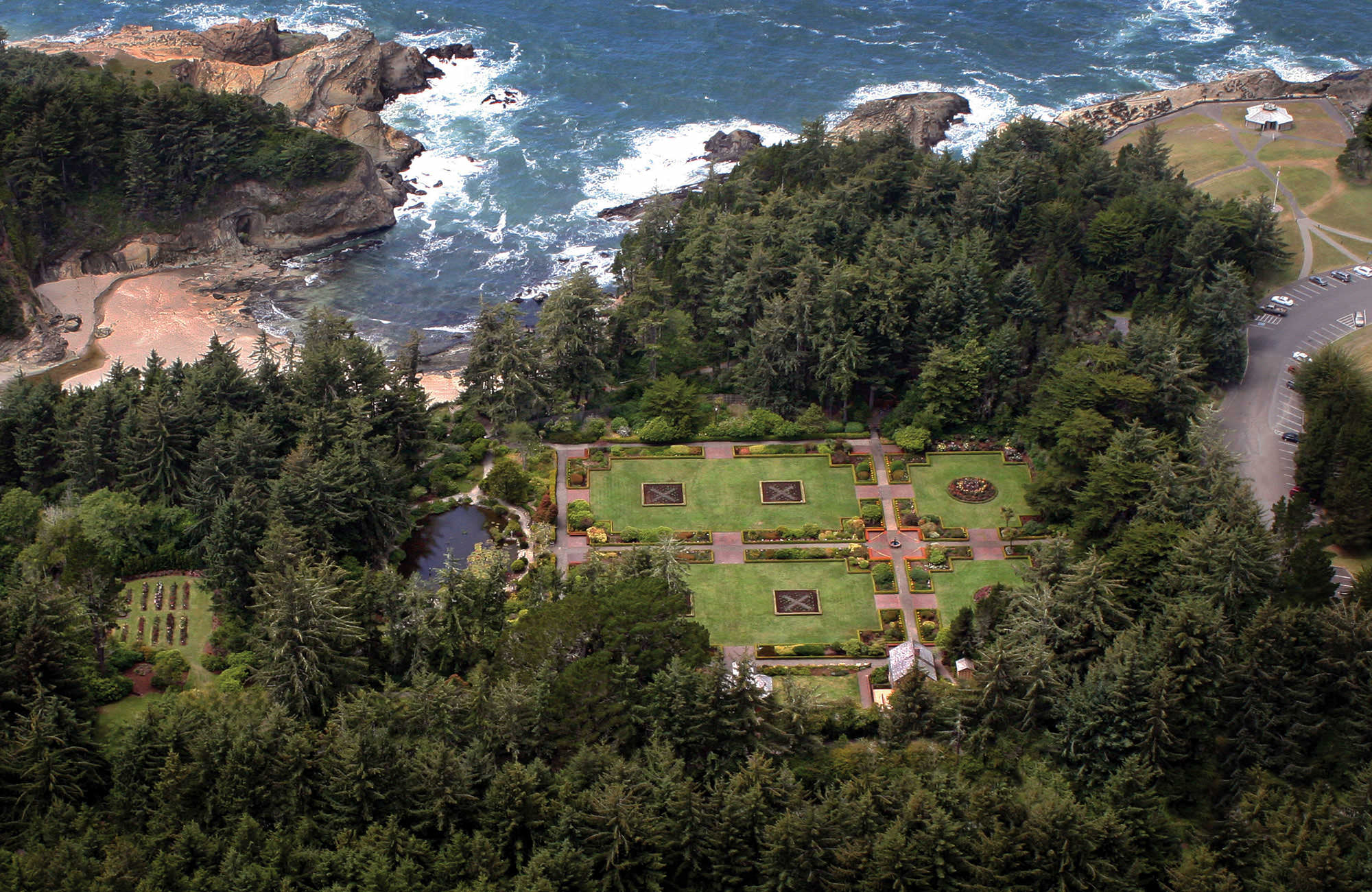
Oceanfront Formal Gardens
The sandstone cliffside views and explosive wave action at Shore Acres State Park are among the Oregon Coast’s best scenic stops, but garden lovers are in for a surprise here too. The park is home to a seemingly out of place five-acre formal garden where European and Asian-style gardens sit surrounded by coastal rainforest. The meticulously maintained formal gardens are what remains of a one-time oceanfront estate owned by Louis J. Simpson, a Coos Bay timber baron. The Simpson home, built during the first decade of the 20th century, burned to the ground in 1921, leaving the improbable gardens and carekeepers cottage without context. The garden makes a good visit any time of year, but it is also home to an equally surprising display of more than 300,000 holiday lights between Thanksgiving and New Year’s Eve.
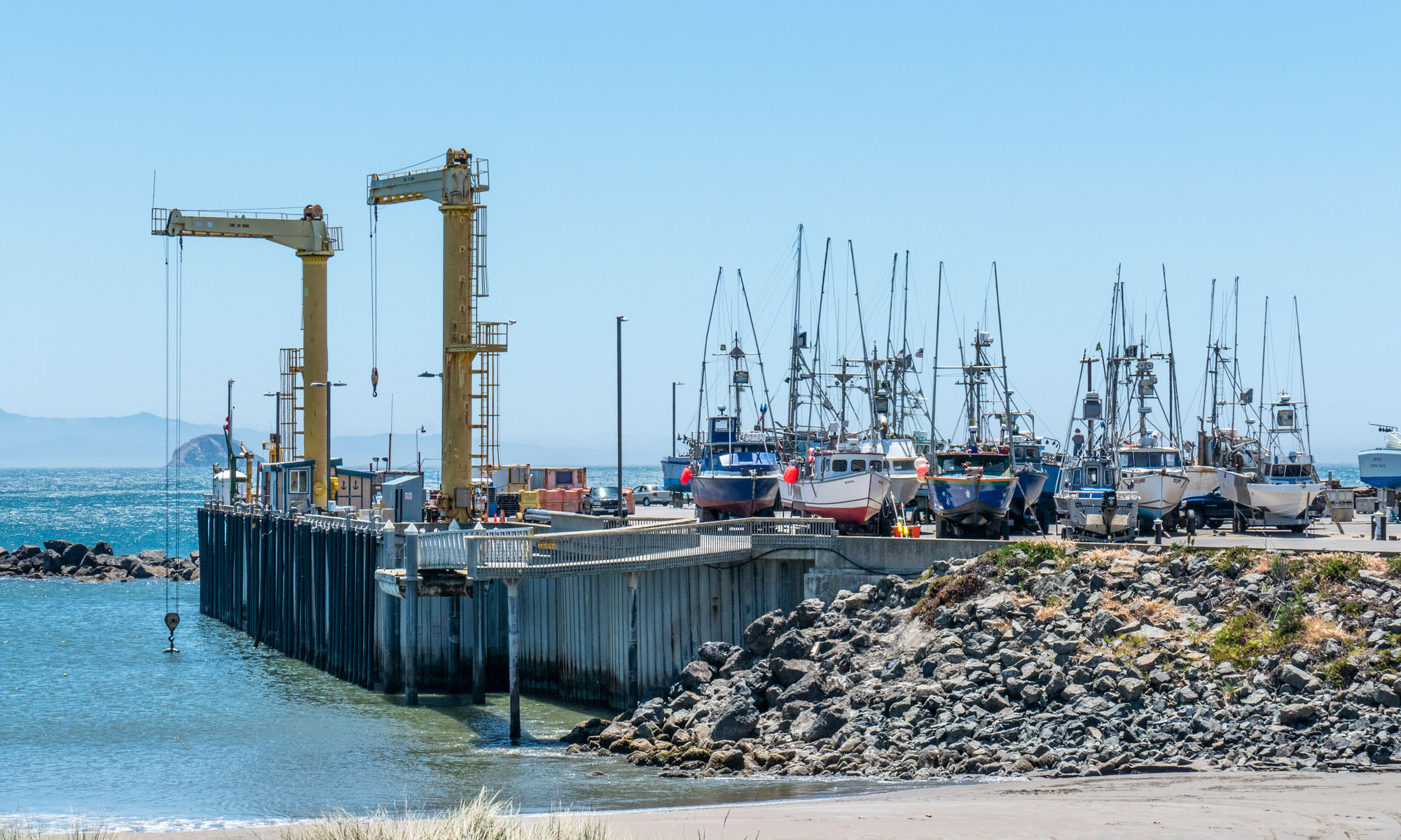
A Fishing Dock Like No Other
All of the Oregon Coast’s fishing ports are located on bays or rivers safely away from the Pacific Ocean’s raging storms – except for one. The Port of Port Orford sits in a naturally protected harbor, sheltered from ocean storms by a headland and offshore rocks. Its precarious location makes it one of the most unique ports anywhere. There’s no typical harbor moorage. Each boat is lifted in and out of the water and are placed on dolly trailers for storage on the dock. It is believed to be one of only six dolly docks in the world. The port has been in use since the 1850s and today is home to a small fleet of fishing boats. It’s open to visitors who can watch the daily catch being lifted off boats before boats are hoisted out of the water to be placed on their dolly trailers.
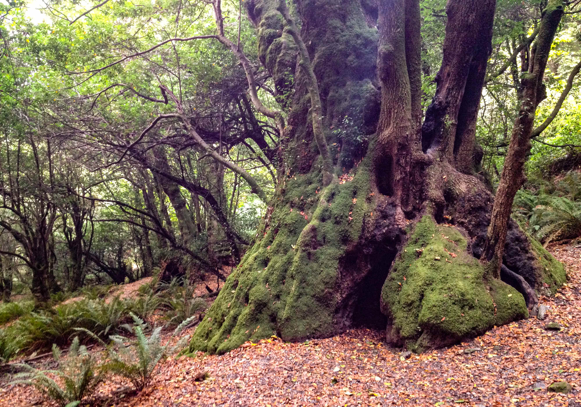
Tree House for Hobbits
The Oregon Coast is famous for myrtlewood, and when you travel the region you’re likely to run into souvenir shops that specialize in products from the beautifully grained, multi-colored hardwood. Myrtle trees grow in a narrow range along the Pacific Coast from California to Oregon. While most of Oregon’s coastal forests are a mix of towering sitka spruce, western hemlock, Douglas fir and western red cedar, there are some beautiful stands of Oregon myrtle, including what may be the largest Myrtle tree in the world that can be seen on a short hike on the Myrtle Tree Trail near Gold Beach. The tree trunk is believed to be 400 years old with a sprawling 70-foot canopy. Its gnarled, moss-covered and fire-hollowed trunk will have you imagining it’s home to mythical forest dwelling creatures. The myrtle is a relative of eucalyptus and has a similar aromatic fragrance as you walk through fallen leaves.
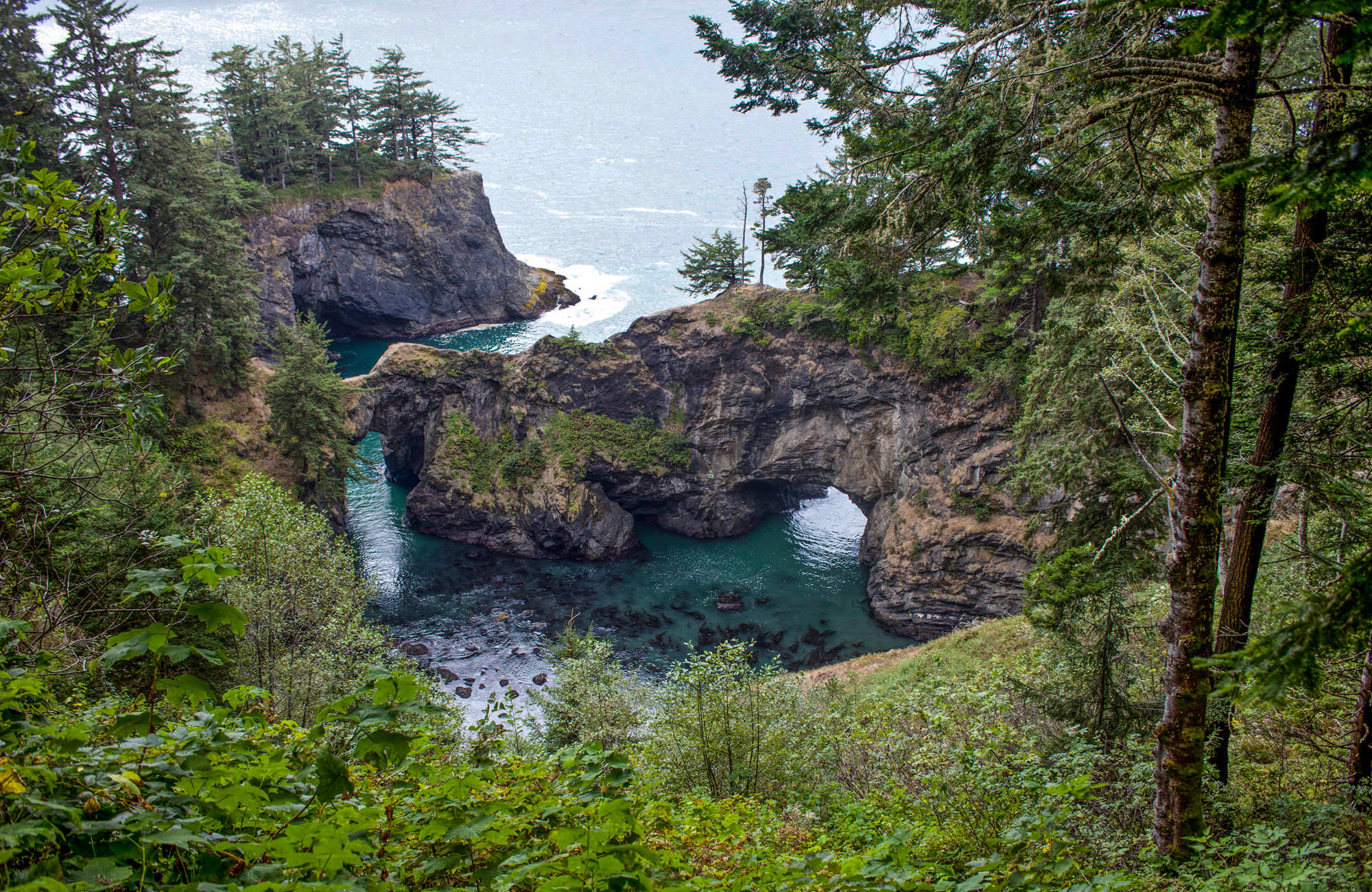
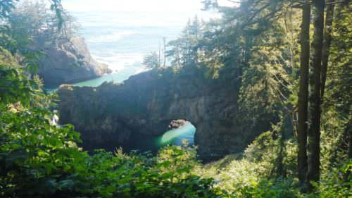
Scenic Natural Bridges
The Oregon Coast is known for its bridges. Many of them were built in the 1920s and 1930s to complete the Oregon Coast Highway and they are known for graceful arches, Gothic spires and art-deco details. Still, the coast’s most beautiful bridges can only be attributed to Mother Nature. On Oregon’s South Coast is the Samuel H. Boardman State Scenic Corridor, a 12-mile stretch of arched rock formations, small tree-covered islands, fairy-tale coves and natural bridges. Just off the highway in the Boardman Corridor, a short walk leads to the Natural Bridges overlook. Though perspectives are limited, the view showcases two natural bridges over a beautiful cove where the water glitters in gem-like greens. Nearby, a short walk to Thunder Rock Cove offers more views of similar natural bridges.