


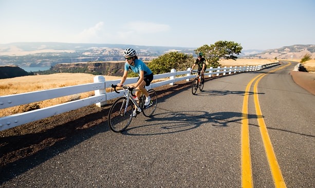
If you think experiencing the sun-drenched hills and winding roads of the Columbia River Gorge by car is epic, it’s even more spectacular on two wheels.
In fact, it’s now easier than ever to explore the glorious landscape of the Gorge and Historic Columbia River Highway by bicycle thanks to an updated bike map featuring six of 25 popular rides in The Dalles area, east of Mt. Hood.
From beginner-friendly trail rides to more challenging day trips to Hood River and Mosier, the routes are ideal for spring, when the Gorge is typically drier and sunnier than other parts of the state — nearly 30 inches of rain less per year.
The Dalles might be one of the better kept secrets of the Gorge. At the eastern entrance, there’s less car traffic but still plenty to see, including lesser-known trails and waterfalls. And you’ll see even more slowed down on two wheels.
Families can out with the paved 10.6-mile Riverfront Trail round-trip to the Columbia Gorge Discovery Center, where visitors can explore the Rock Fort marking the spot Lewis and Clark camped. Starting at Lewis & Clark Festival Park, the scenic ride along the river includes two new bike fix-it stations and other amenities along the trail.
When tummies start to rumble there’s no shortage of family-friendly brewpubs in The Dalles, which has undergone a craft brew renaissance in recent years.
When tummies start to rumble there’s no shortage of family-friendly brewpubs in The Dalles, which has undergone a craft brew renaissance in recent years. Grab a pint at Freebridge Brewing, Clock Tower Ales, Liberty Tapworks or Sedition Brewing.
There’s also Sunshine Mill artisan plaza (a former Cheez-It factory that is now houses the Quenett and Copa Di Vino wineries); and Route 30 Bottles & Brews, a bottle shop, growler fill and pub that opened earlier in 2016.
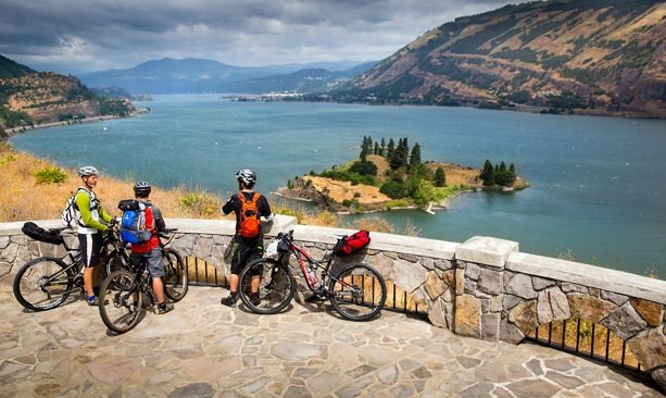
Happily fueled, adventurous riders can venture out along the Mosier Loop, a 34-mile route leading into Mosier, with 2,980 feet of elevation gain. Riders are rewarded with the panoramic views at the Rowena Crest Viewpoint before they head into Hood River, the last section through the newly paved tunnels, which are gated off to cars.
While in Mosier, quench your thirst with a tasting at Analemma Wines (through November) or a pint at Rack & Cloth cidery, or stop into the Mosier Market and Deli for supplies.
Intrepid cyclists may continue onward along The Dalles-Hood River trail, which is 46.5 miles round-trip with 3,760 feet of elevation gain. Riders can stop at Mark O. Hatfield Trailhead State Park and enjoy cruising around Twin Tunnel Road, closed to vehicles but open to bikes and pedestrians.
In Hood River, pFriem Family Brewers and Solstice Wood Fire Cafe & Bar are surefire bets for bike-friendly refueling.