Editor’s note: Be prepared for changing conditions due to weather, fires and other natural hazards. As of July 13, 2026, the Salmon, Olive Butte and Anthony wildfires have closed parts of the Blue Mountains Trail. Use the Watch Duty app or contact the local Blue Mountain Ranger District for updated information. Hikers currently on trail can reach out Greater Hells Canyon Council for assistance with other routing options to navigate any closed section of the trail.
Oregon’s newest long-distance hiking trail has some pretty incredible claims to fame. Stretching 530 miles through Northeast Oregon, the Blue Mountains Trail plunges into the deepest canyon in the United States, shows off a majority of Oregon’s peaks over 9,000 feet and meanders through a prairie with more than 100 species of wildflowers. And that’s just the beginning.
Starting at Wallowa Lake near Joseph, the trail spirals counterclockwise north to the Umatilla National Forest before zigzagging south to John Day. Along the way, it passes through seven wilderness areas, three state parks, three national forests and the ancestral lands of regional tribes. With its diverse mix of adventure built into it, the Blue Mountains Trail highlights a corner of the state that has something to offer everyone — even the most veteran of Oregon travelers.
“It’s a really diverse and challenging ecosystem,” says Whitney La Ruffa, one of the trail’s inaugural thru-hikers who helped with ground truthing. “For a long-distance hiker looking to step into that next realm … [the Blue Mountains Trail] requires a higher level of self-sufficiency than other trails force you to have, and I think you can grow a lot from that.”
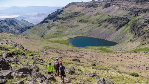
Because of its remote landscape, the Blue Mountains Trail is an exciting new addition to Oregon’s longest trails. You’ll find impressive rock formations in the Joseph Canyon, unforgettable views from Elkhorn Crest and picturesque alpine lakes in the Strawberry Mountain Wilderness.
The trail officially launched in summer 2021, with a seasonal hiking window that begins in mid-July and runs through mid-October. Here’s what to know before you go.
Beginner-Friendly and Expert Thru-Hiker Routes
The origin of the Blue Mountains Trail dates back nearly 50 years, with an effort in the 1970s to create the Blue Mountain Heritage Trail, a hopeful 870-mile loop aimed at putting the region on the international hiking map.
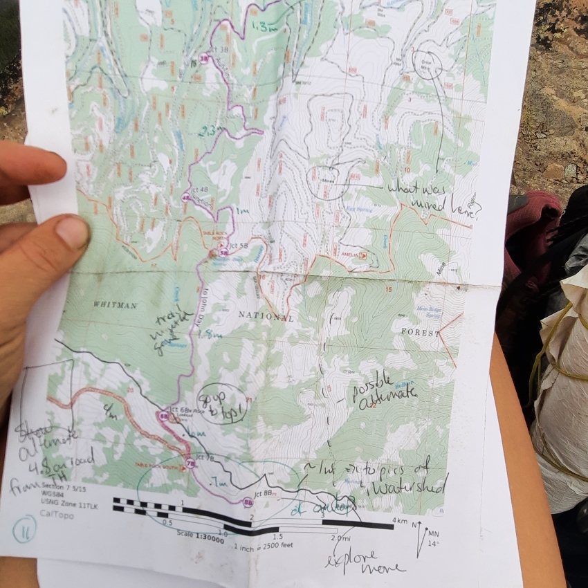
Recently, Jared Kennedy, development director of the Greater Hells Canyon Council, built off of those decades of work. Kennedy mapped waypoints and created an accompanying data book that hikers can use to learn about trail conditions and find water sources, all of which can be accessed through the website. But be warned: Because of the trail’s remote nature, only experienced backpackers should attempt to tackle long sections or attempt a thru-hike.
If you’re a beginner or don’t want to tackle a serious thru-hike, you can still plan a great outing with a collection of day hikes and shorter backpacking trips that connect to the Blue Mountains Trail. These trips, compiled by the Greater Hells Canyon Council, are recommended by visitors and residents of the Blue Mountains. For instance, the Anthony Lakes Loop is 8 miles and rated moderate, and features spectacular views of alpine lakes and the Elkhorn Mountains. The West Fork Wallowa trail near Joseph and Enterprise leads 5.8 miles into the Eagle Cap Wilderness, making it a great day hike or backpacking trip if you want to camp along the way and return along the same route. It’s also rated moderate with easy logistics.
“What makes the Blues so special is also the sort of thing that doesn’t make it the best place to learn how to backpack for the first time,” Kennedy says. “If you’re out 10 miles away from anybody else and you have no chance of seeing anybody else for quite some time, you can get yourself into trouble. … It’s a place you can still go to find mountain and forest solitude.”
Hikers should check the website for detailed maps and information about day hikes, spur loops and shorter multiday excursions, and to receive updates on the trails’ progress.
Resupply in Friendly Trail Towns
Organizers have designated trail towns along the way to act as resupply stops for thru-hikers. A resource guide indicates which towns have full services available — meaning they are towns with ample food, stores and lodging options — and others that may require you to mail a resupply box to a business in the town ahead of time.
Each of these rural trail towns has a unique culture all their own. Joseph, near where the trail begins, is a small town located at the base of the Wallowa Mountains that attracts visitors for its art scene, artisan goods and alluring culture. La Grande, which just about marks the halfway point of the trail, has plenty of things to keep you entertained, and it is also an exciting stop for history buffs as it is home to the Oregon Trail Interpretive Park at Blue Mountain Crossing and the Eastern Oregon Fire Museum.
Bookending the trail to the south and east, the town of John Day makes you feel as if you’ve entered the set of a western movie. One of the town’s coolest historic attractions is Kam Wah Chung State Heritage Site (open May-Oct), a National Historic Landmark that offers a fascinating glimpse into the region’s past. The tiny 1866 building once housed a Chinese medical clinic, general store, community center and residence and served as a social, medical and religious center for Oregon’s Chinese community for over 60 years. The site is only open by guided tour, which must be booked by phone ahead of time.
Hikers are invited to be a part of the evolution of the Blue Mountains Trail. Those who try out sections themselves this summer are encouraged to send their notes of improvement to trail organizers.
Seven Sections to Explore
Here are the seven sections of the Blue Mountains Trail to help inform your adventure.
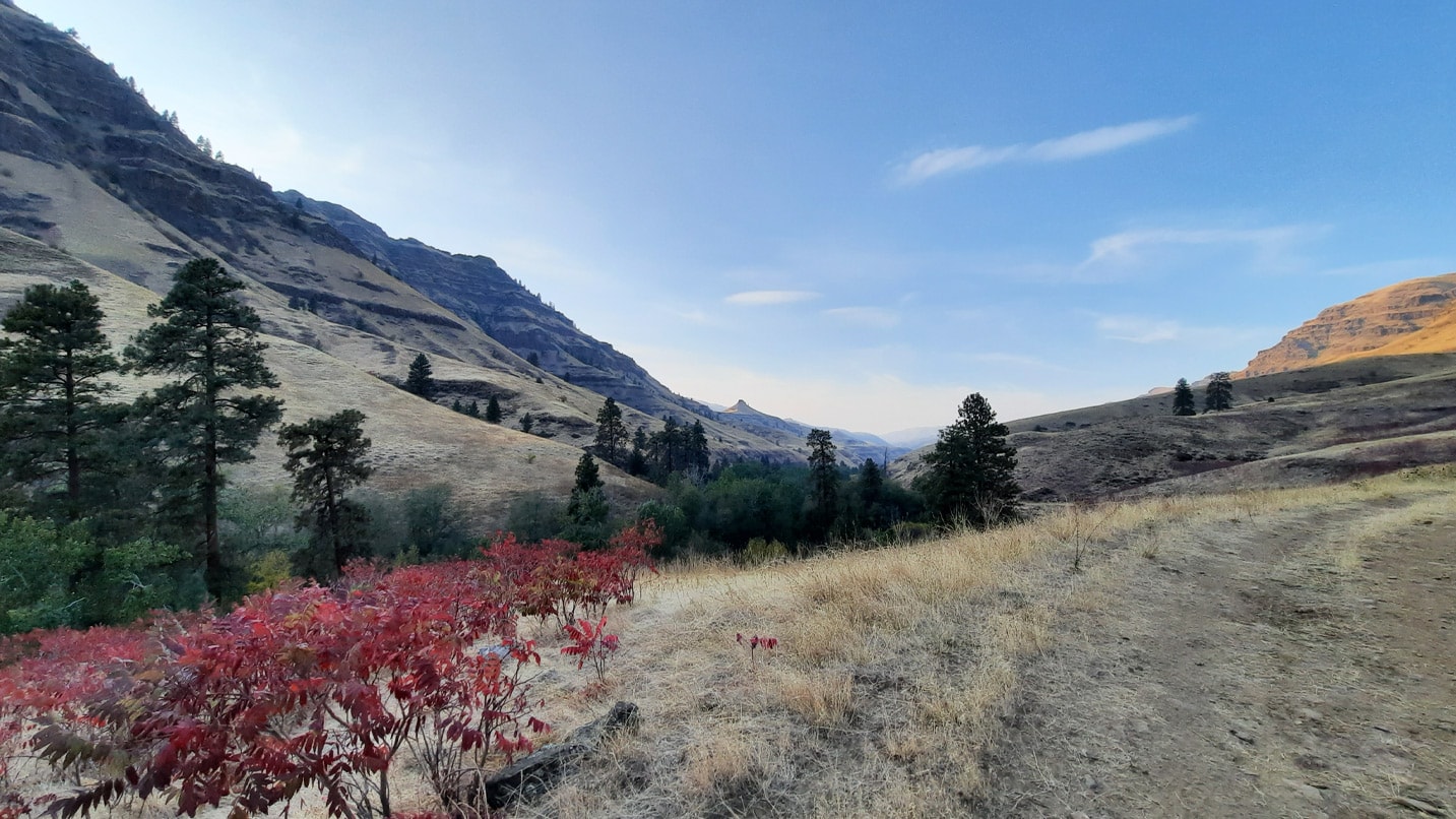
Section 1: Wallowa Lake State Park to Hells Canyon Overlook (59.7 miles)
Highlights of this section are the Eagle Cap Wilderness and headwaters of the Imnaha River. Anticipate some challenging wayfinding (unmarked trails) and longer water hauls.
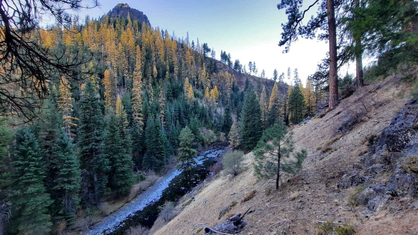
Section 2 (split into two subsections): Hells Canyon Overlook to Troy (120.6 miles)
Highlights include the Western Rim Trail and Joseph Canyon. Expect some very challenging terrain through Joseph Canyon and sun exposure in Hells Canyon. Thru-hikers will likely want to coordinate a resupply at Buckhorn Overlook. Work in summer 2021 aims at clearing and marking multiple parts of this section.
Section 3 (split into two subsections): Troy to La Grande (101.5 miles)
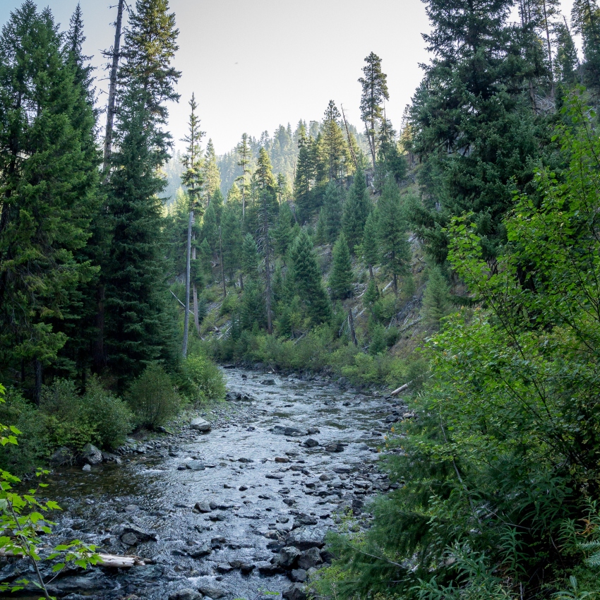
This is the most in-progress section of the Blue Mountains Trail, and work planned for summer 2021 and beyond is expected to change the route. This section currently runs through the Wenaha River Canyon and along the south rim before crossing to Tollgate. From there it runs along the paved Summit Road to La Grande.
Section 4: La Grande to Anthony Lakes (40.7 miles)
This is a short connector section mostly running along gravel Ladd Canyon Road to Anthony Lakes and the Elkhorn Crest Trail. This can be completed in two days with easy camping options along the road.
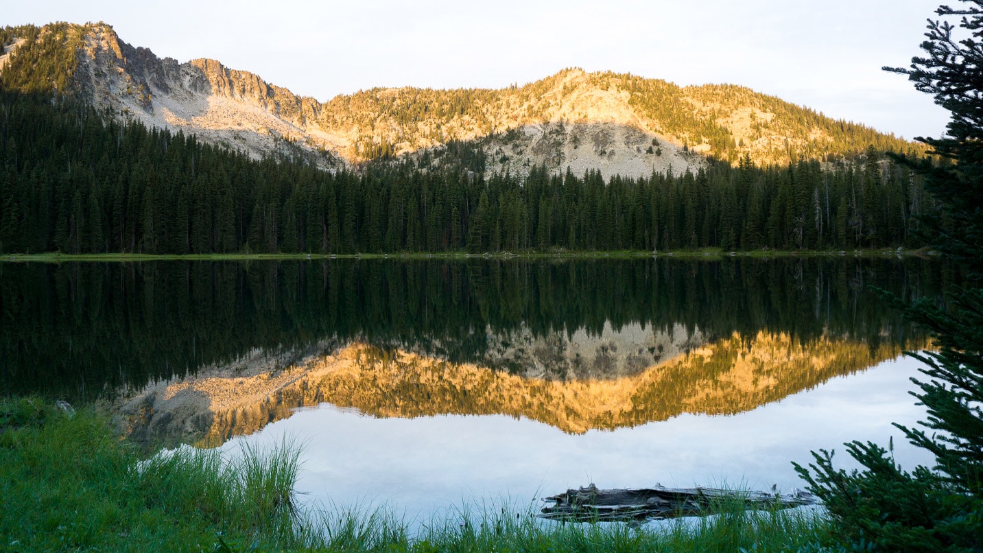
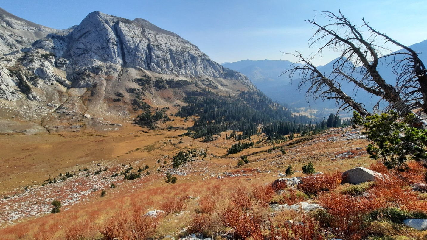
Section 5: Anthony Lake to Sumpter (34.1 miles)
The majority of this section is on the Elkhorn Crest Trail, a true highlight of the Blue Mountains Trail and trails in Northeast Oregon in general.
Section 6: Sumpter to Austin Junction (72.1 miles)
This section takes a trip through gold-rush country and over the Greenhorn Mountains at Vinegar Hill, and immerses hikers in the amazing solitude of the North Fork John Day Wilderness. There are currently some wayfinding challenges in this section, though there is work planned in summer 2021 to clear up those issues.
Section 7 (split into two subsections): Austin Junction to John Day (98 miles)
This section runs through the Monument Rock Wilderness with a visit to the fire lookout atop Table Mountain. It then crosses over to the Strawberry Mountain Wilderness, running along the Strawberry Mountain crest for about 40 miles before dropping down to John Day. There are numerous recent burn areas, but the trail is well marked in most places with lots of good trail clearing done by the U.S. Forest Service in the past few years.
If You Go:
When visiting the area, have a good set of tires on your car and carry a spare. Consider using a four-wheel drive vehicle to get to rural destinations as roads may not be well maintained. If you have dietary restrictions, you’ll want to plan ahead by bringing food, as you’ll be visiting rural towns that may not be able to accommodate. Hikers should be on the lookout for and respectful of wildlife in remote areas. Remember to pack out everything you brought with you and follow other Take Care Out There practices. Also be mindful of trail-town etiquette, including being courteous to staff and other lodging guests, and asking to charge your phone and use Wi-Fi.