Oregon is a place of well-known and oversize natural beauty. Towering Mt. Hood. Plunging Multnomah Falls. The rugged Oregon Coast. The deep, deep blue of Crater Lake.
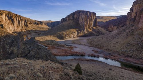
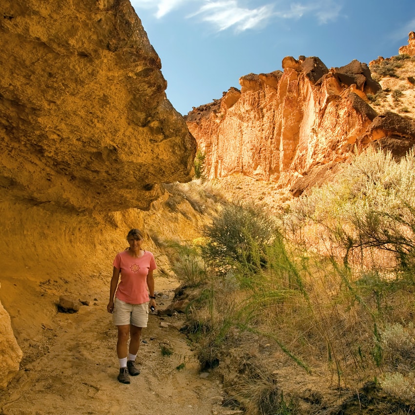
But while many of the wonders of Oregon have become incredibly and deservedly popular, there are still some secret and special places out there. Places where wild rivers have carved monumental canyons through ancient volcanic ruins. Places where petroglyphs etched eons ago hide beneath soaring rock walls. Places where cellphones barely work, where bighorn sheep perch on high cliffs and where pitch-black nighttime skies shimmer with stars. Places like the Owyhee Canyonlands.
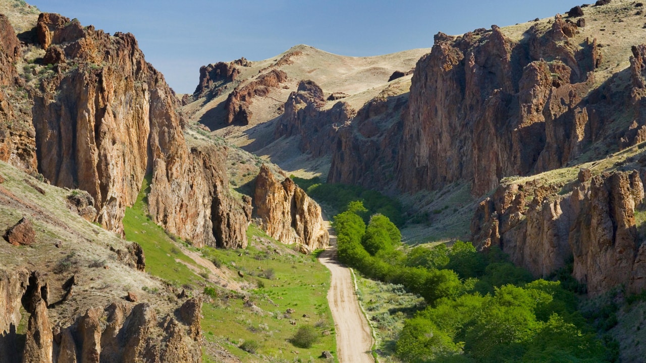
Located along the far eastern border of Oregon — about six hours from Portland and 4.5 hours from Bend — the Owyhee Canyonlands unfold over more than 2 million acres. Cut by just three paved roads, it’s considered one of the largest expanses of undeveloped land in the lower 48 states.
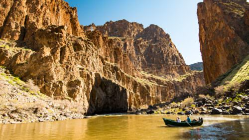
Named to honor three Hawaiian members of a fur-trapping party who were lost in the region in 1819, the Owyhee River has sculpted the land into stunning canyons amidst colorful remnant volcanic features, rock formations and rolling sagebrush hills. Pronghorn antelope, bighorn sheep, badgers, horned lizards and rattlesnakes are just a few of the wild creatures who call the Owyhee Canyonlands home.
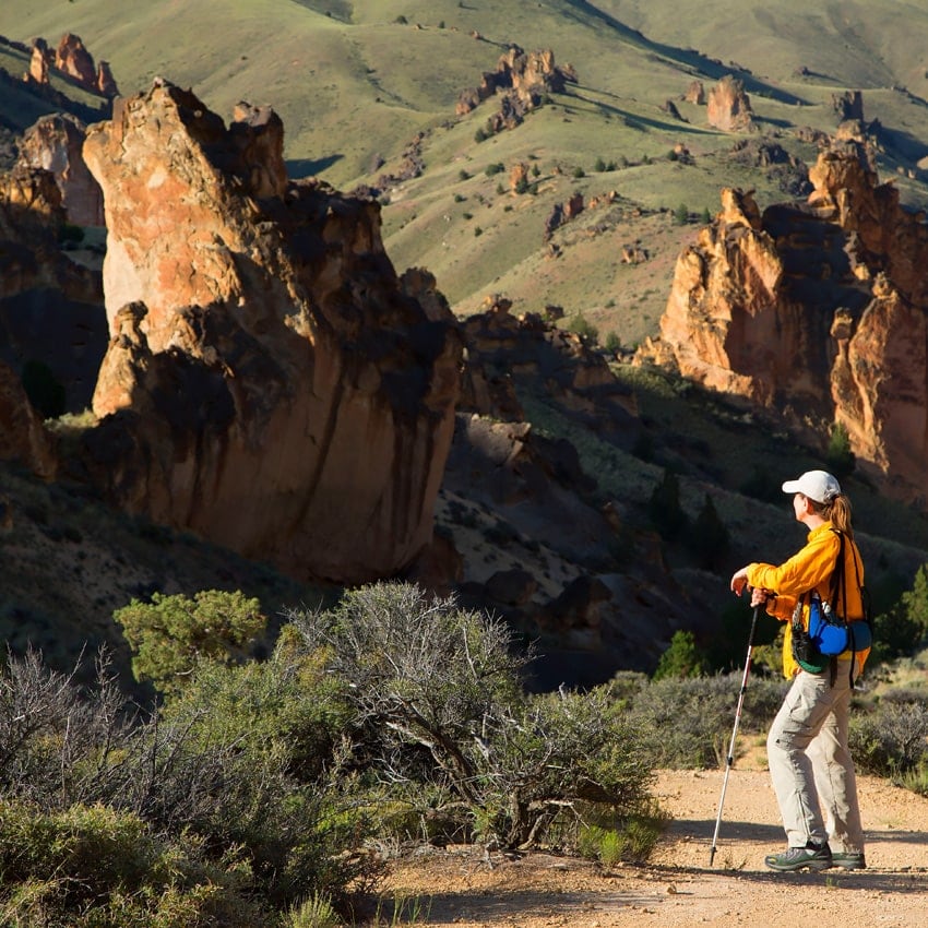
Though it’s a rugged and isolated place, the Owyhee Canyonlands is nevertheless a hiker’s paradise — and one that is accessible to hikers of just about any ability. You won’t need a monstrous pack with days and days of supplies. Instead, a decent hiking setup, some scenic car-camping sites for home base and a healthy dose of appreciation for one of the most unique pockets of Oregon will be more than enough to help you discover and explore the Owyhee Canyonlands.
Know Before You Go
The Owyhee Canyonlands is an incredible pocket of natural beauty and wonder in Southeastern Oregon. Its remoteness makes it attractive, but it also requires some extra preparation. Know that cellphone service can be very limited, and roadside amenities are few and far between. It’s wise to travel with extra supplies, including water and fuel, and make sure your spare tire is in good shape. When exploring this and any natural area, take steps to leave the space cleaner than you found it and be sure to Take Care Out There.
Before you go, check each recreation site’s status before you go, understanding closures can happen without notice.

Top Treks
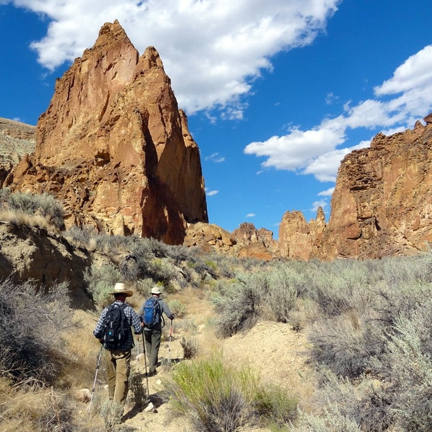
Driving around the Owyhee Canyonlands can give you a good glimpse of the region’s beauty. But to really get to know the place, grab a pack and head out on two feet. Trails in these parts can be rugged and steep, and since it’s such a remote area, it’s even more important to prepare. Plan ahead, be ready with your Ten Essentials and make sure you choose hikes that match the abilities of those in your group since the landscape is rough and hospitals are far.
Juniper Gulch
Up to 2.3 miles, 1,300 feet elevation gain. Easy to moderate
This short, scenic stroll takes you through Leslie Gulch to an incredible natural amphitheater set among honeycombed rock faces. Hike an additional — and steep — .75 miles beyond the amphitheater for some amazing views of the canyonlands and nearby Lake Owyhee.
Timber Gulch
1.2 miles, 350 feet elevation gain. Easy
You’ll feel humbled surrounded by the 200-foot cliffs that form the amphitheater on this mild hike, which makes for a nice way to start or end your day.
Painted Canyon Loop
8.5 miles, 1,200 feet elevation gain. Expert
This is the granddaddy of hiking trails in the Owyhee Canyonlands — the one to hike if you want to experience colorful, soaring canyon walls; rock towers and spires; old-growth sagebrush; and everything else that makes this area unforgettable. It’s also a challenging hike, best suited for those with experience in route finding and rough terrain.
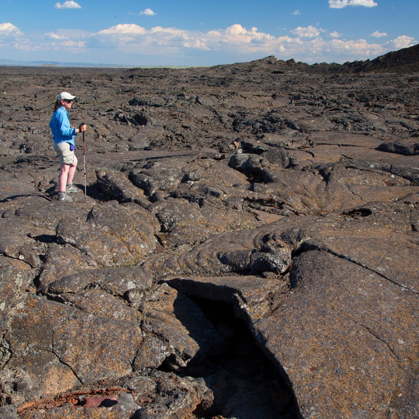
Jordan Craters
1 mile, 150 feet elevation gain if you hike into the crater. Easy
Traipse around Jordan Craters for a captivating look at one of the youngest lava flows in Oregon. The lava spewed out of the Coffee Pot Crater and created a fascinating field full of caves, tubes and other volcanic signatures.
Getting There and Getting Around
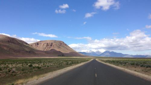
Unless you live in Southeastern Oregon, the Owyhee Canyonlands are going to be a bit of a haul, but every mile will be worth it. The region stretches roughly from the tiny town of Adrian in the north to Jordan Valley in the south.
There are just a few paved roads in the area. Most roads that provide access are rough gravel and dirt — which can quickly turn into sucking, immobilizing mud that can strand your car if you’re not careful. Make sure you plan ahead: Check weather and road conditions before you travel, and be aware that some areas are only accessible by high-clearance or four-wheel-drive vehicles and may not be suitable for RVs or trailers.
When to Go
You can avoid most chances of that rain and mud if you travel to the Owyhee Canyonlands in the summer, but you’ll also deal with some high temperatures. Instead, plan a trip for late summer or early fall, when temperatures are cooler.
Where to Stay
There’s only one way to get a true Owyhee Canyonlands experience, and that’s by sleeping under the stars. The area is popular with backpackers, but it’s also home to several rustic campgrounds that offer up some of the characteristic natural beauty that the Owyhee Canyonlands are known for. Even better: They’re located within striking distance of some of the best hikes around. Check conditions and availability in advance, and know that not all roads and camping areas can accommodate RVs or trailers. RV campers may try Succor Creek State Natural Area, which has no electrical hookups or water but is most accessible to RVs — and is also a top spot to find thunder eggs, Oregon’s state rock. (If you’re looking for a hotel or motel instead, the closest city is Ontario, 30 miles north. Try the Clarion Ontario or The Ontario Inn.) Here’s where to camp.
- Rockhounding paradise: Surrounded by some of the signature cliffs and rocky outcrops that define the Owyhee Canyonlands, Succor Creek State Natural Area is a quiet campground with primitive campsites. Rockhounds set out from here in search of geodes, and the creek and surrounding vegetation also draw in birds from far and wide.
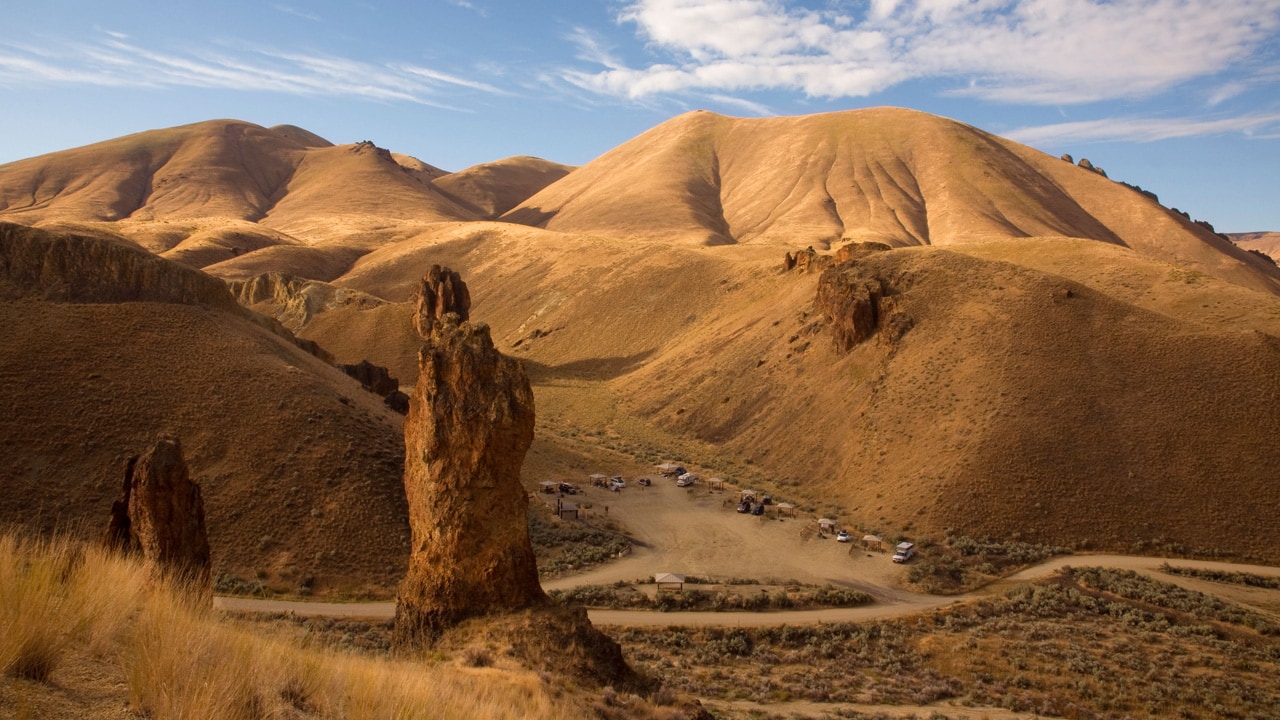
- Rocky spires and rolling hills: The geologic setting of the stripped-down campground at Slocum Creek may be enough to keep you at camp all day. Rocky bronze spires reach up out of rolling green hills, while honeycombed formations evoke intrigue. It’s also a great home base for several nearby hikes.
- Rivers and wildlife galore: Named for the three rivers that meet here — the North Fork Owyhee, the Middle Fork Owyhee and the Owyhee — Three Forks Recreation Site is set deep in the heart of the Owyhee Canyonlands. It’s an ideal spot for relaxing in scenic terrain, possibly spotting a bighorn sheep or antelope, and hiking up to Three Forks Hot Springs for a soak.
- Sheer cliffs and truly remote: About as remote and undeveloped a camping area as you can find in Oregon (with a bit of a challenging drive), Anderson Crossing is primitive and offers only dispersed camping. That said, it also serves as the starting point for a strenuous hike up to Louse Canyon, carved out by the West Little Owyhee River. Colorful sheer cliffs, chill river-water pools and wildlife-spotting opportunities abound.