Planning a trip to Oregon starts with getting a feel for the place. Oregon is bigger than many travelers expect. This guide offers an easy way to understand the state’s layout, how long it takes to get from place to place and the best ways to arrive.
How Big is Oregon?
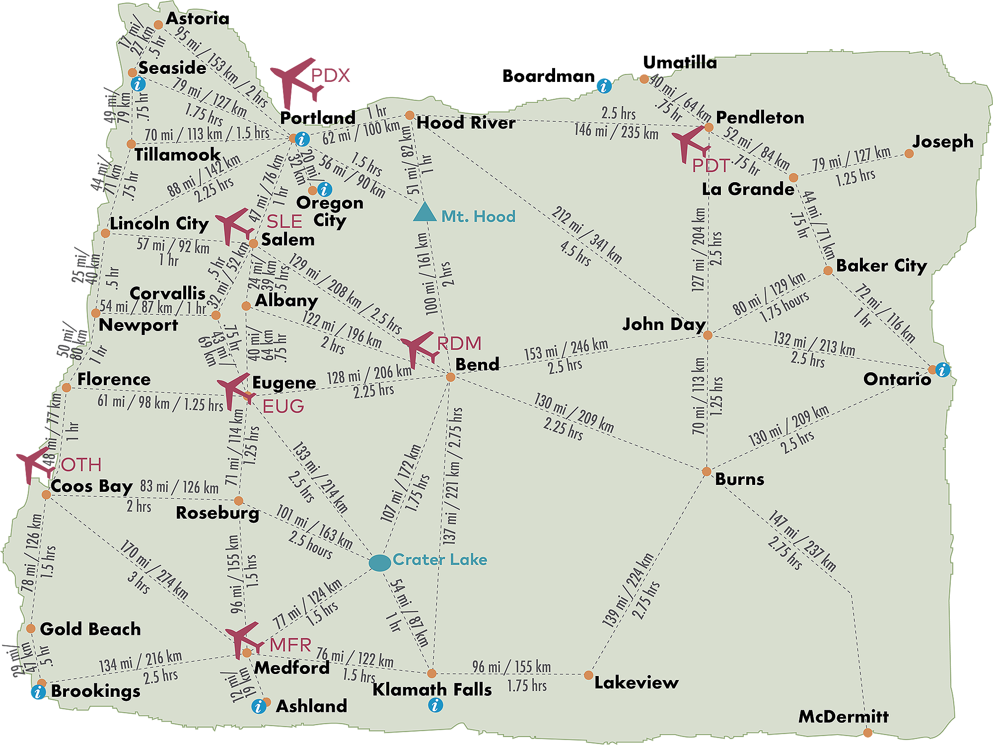
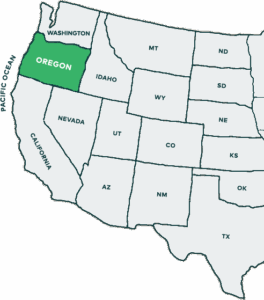
Oregon is on the West Coast, right between Washington and California. Oregon covers more than 98,000 square miles making it roughly the size of the United Kingdom. From north to south it’s about 635 miles (a solid day’s drive) and from west to east it’s about 450 miles (7 to 8 hours).
- I-5 runs north–south through Portland, Salem, Eugene and Medford.
- US-101 traces the full length of the Oregon Coast.
- US-97 is the main highway through Central Oregon, including Bend.
How long should you plan your trip for? Read Your Perfect Oregon Trip, Based on Your Vacation Days.
Oregon Regions
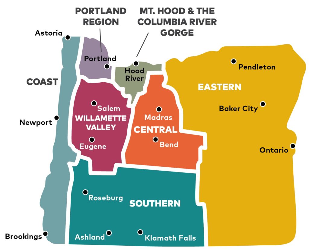
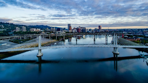
- Portland Region: Known for great food, abundant parks, art in every corner and easy access to the outdoors.
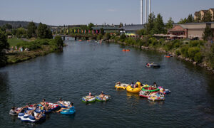
- Oregon Coast: 363 miles of public coastline with lighthouses, tide pools and small coastal towns.
- Willamette Valley: Vineyards, farms, covered bridges and Oregon’s historic cities.
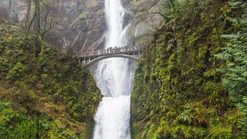
- Mt. Hood & Columbia River Gorge: Waterfalls, windy viewpoints and the state’s highest peak.
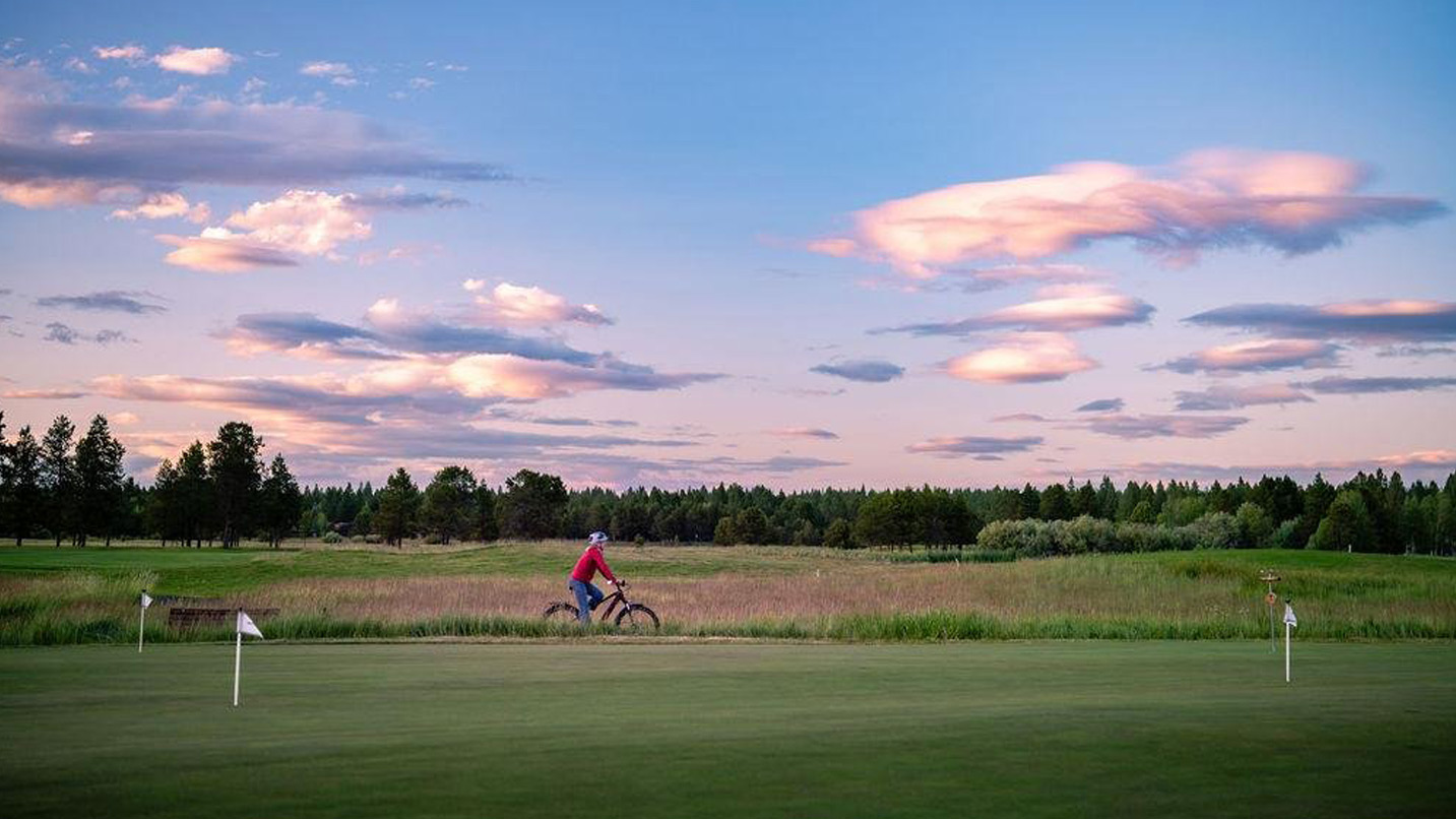
- Central Oregon: High desert, lava landscapes, stargazing and the towns of Bend, Sisters and Redmond.
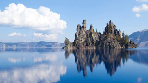
- Southern Oregon: Crater Lake, Shakespeare in Ashland, Rogue Valley wine and river adventures.
- Eastern Oregon: Steens Mountain, ranch country, dark skies and long scenic byways.
Learn more on our regions pages.
Which Airport Should I Fly Into?
Choosing an airport often means choosing a starting point, which can cut hours off your drive.
Portland International Airport (PDX): Best for exploring Portland, the Columbia River Gorge, Mount Hood, the North Coast and routes to Central Oregon.
Eugene Airport (EUG): A good starting point for the Willamette Valley, Salem, the mid-Coast and the University of Oregon or Oregon State University.
Rogue Valley International–Medford Airport (MFR): Closest to Crater Lake, Ashland, Rogue River adventures and the Southern Oregon Coast.
Redmond Municipal Airport (RDM): Your gateway to Bend, Sisters, high-desert scenery, Smith Rock and the Painted Hills.

Understanding Distances and Drive Times
These drive times give a sense of scale and help you plan a route that feels relaxed rather than rushed.

From Portland
Portland → Cannon Beach | 80 miles (≈ 129 km) | 90 minutes
Portland → Salem | 45 miles (≈ 72 km) | 1 hour
Portland → Crater Lake | 250 miles (≈ 402 km) | 5 hours
Portland → Bend | 160 miles (≈ 257 km) | 3 hours
Portland → Pendleton | 210 miles (≈ 338 km) | 3.5 hours

From Eugene
Eugene → Florence | 60 miles (≈ 97 km) | 1 hour
Eugene → Bend | 115 miles (≈ 185 km) | 2 hours
Eugene → Crater Lake | 130 miles (≈ 209 km) | 3 hours
Eugene → Portland | 110 miles (≈ 177 km) | 2 hours
From Bend
Bend → Painted Hills | 90 miles (≈ 145 km) | 1.5 hours
Bend → Smith Rock | 27 miles (≈ 43 km) | 30 minutes
Bend → Crater Lake | 110 miles (≈ 177 km) | 2 hours
Bend → Portland | 160 miles (≈ 257 km) | 3–3.5 hours
National Park and Iconic Sites
Crater Lake National Park → Medford | 75 miles (≈ 121 km) | 1.5 hours
Painted Hills → Bend | 90 miles (≈ 145 km) | 1.5 hours
Multnomah Falls → Portland | 35 miles (≈ 56 km) | 30–40 minutes
Smith Rock → Bend | 27 miles (≈ 43 km) | 30 minutes
Steens Mountain → Bend | 215 miles (≈ 346 km) | 4 hours
Oregon Dunes (Florence) → Eugene | 60 miles (≈ 97 km) | 1 hour
Cross-State Distances
Astoria → Brookings | 340 miles (≈ 547 km) | 7–8 hours
Newport → Bend | 130 miles (≈ 209 km) | 2.5–3 hours
Tillamook → Portland | 75 miles (≈ 121 km) | 1.5 hours
Coos Bay → Crater Lake | 150 miles (≈ 241 km) | 3 hours
Baker City → Portland | 300 miles (≈ 483 km) | 4.5–5 hours
Bend → Ontario | 185 miles (≈ 298 km) | 3 hours
Order a map of Oregon
Oregon’s geography
The Cascade Range runs north to south through the middle of the state, with major mountain passes such as U.S. 26 over Mount Hood, U.S. 20 over Santiam Pass, Highway 58 over Willamette Pass, and Highways 66 and 140 in Southern Oregon. These routes can see snow, ice, or temporary closures in winter, so it’s smart to check The Oregon Department of Transportation’s TripCheck.com before you go, and to carry chains or traction tires when required.
To the west, the Coast Range separates the Willamette Valley from the Pacific Ocean. Roads like Highway 6 to Tillamook, Highway 18 to Lincoln City, and Highway 20 to Newport stay open most of the year but can be slick, foggy, or slow after storms. Read Scenic Drives through Oregon’s Coast Range.
If weather is stormy or snowy, plan extra time and watch for debris or low visibility. Learn more at “Oregon Winter Weather.“
Do You Need a Car?
While a car or RV gives you the most flexibility for visiting multiple regions, many cities are walkable and served by buses, trains and bike routes.
- Learn about traveling by train.
- Learn about bicycling around Oregon.
- See our Transportation page for regional busses, seasonal shuttles, Electric Vehicle charging stations and tour companies.
Explore Our State
-
- You can search for businesses, landmarks, hotels and more on our interactive map.
- You can also order free maps and visitor guides online.
- Traveling from outside the U.S.? Our international visitors page can help you.
- Travel Oregon has eight Welcome Centers at key entry points around the state. Our friendly staff can provide information, resources and personalized recommendations for your trip.
Oregon’s Connections to Neighboring States
Oregon borders Washington to the north, Idaho to the east, Nevada and California to the south. From almost any direction, Oregon is easy to reach by highway, with scenic transitions from desert, forest, or mountain terrain as you cross state lines.
- Portland is just minutes from Vancouver, WA.
- Ontario, Oregon sits on the eastern border near Idaho, across the Snake River from Fruitland, ID, a key route for travelers coming from Boise. It’s 210 miles or 338 km from Coeur d’Alene to Joseph, Oregon, which takes about 4.5 hours to drive.
- In the southeast, Denio and McDermitt connect to Nevada along U.S. 95.
- Ashland and Klamath Falls lead directly into California, connecting to Interstate 5 toward Redding and U.S. 97 toward Lassen and Mt. Shasta.