What do 1,675,407 acres look like? If you unfold a map of Oregon, the Willamette National Forest takes the shape of a sprawling evergreen patch to the east of the Willamette Valley — the lush heart of a state where conifer forests carpet nearly half the landscape. It appears both magnificent and intimidating.
Hikers trekking the nearly 1,700 miles of trails get a far more intimate perspective: ancient Douglas firs tower overhead, sword ferns sway in the breeze, and Wild and Scenic rivers babble in the distance. The massive scale of the national forest, a 100-plus-mile slice of the Cascade Mountains, conceals a cache of hidden viewpoints, alpine lakes, challenging single-track, scenic drives and pristine waterways. This makes it a hub for camping and cabining, with more than 70 developed campgrounds and many more primitive spots to pitch a tent. The news that the forest supplied the 2018 Capitol Christmas Tree, illuminated on the West Lawn of the U.S. Capitol throughout December, shines a brighter spotlight on what the communities on its fringes already know: that few wild spaces in the West rival these sweeping vistas.
There is, of course, no single way to “see” the Willamette National Forest — its topography is too varied for a single feature to define it. Knowing it really well requires sequential visits, but this helpful primer will get you started by introducing the distinct features of the forest’s four ranger districts and a handful of highlights within each.
Know before you go: Make “be prepared” your mantra when traveling anywhere in the Willamette National Forest. While it’s not far from many of Oregon’s major towns and cities, the forest remains remote and wild, with varied weather and occasional wildfires causing some sites to close seasonally. Check road conditions and official forest alerts before setting out, secure passes and permits where required, and contact the local ranger offices with questions. Some of the most popular sites in the forest such as Three Pools and Tamolitch Falls are experiencing overcrowding; if you visit, plan a weekday trip and leave early or arrive late to avoid peak times. Wherever you go, tread lightly and leave no trace.
Detroit Ranger District
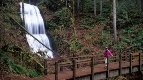
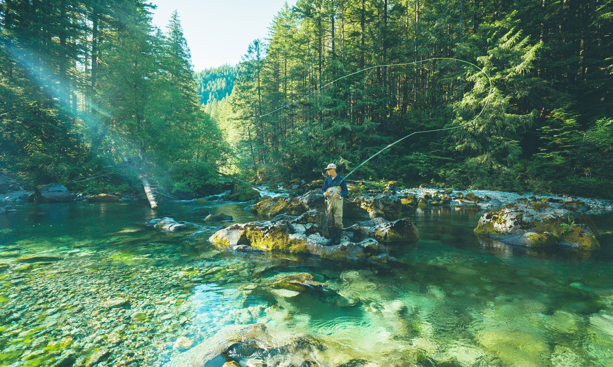
The little city of Detroit has big adventures right at its doorstep. It’s perhaps best known for the neighboring Detroit Lake, a canyon reservoir with serene campgrounds on its shores (such as the Forest Service-operated Cove Creek, Hoover, Piety Island, Santiam Flats and Southshore campgrounds). Fishers come here for the North Santiam State Recreation Area in the nearby town of Lyons, a popular spot to cast lines in the North Santiam River, equally beloved by white-water rafters and kayakers. But nothing defines Detroit more than its locale — smack in the middle of the national forest’s northern end and the headquarters to the Detroit Ranger District. This section of the forest has ancient woodlands, epic vistas for backpackers and accessible trails for day hikers.
Stahlman Point Trail
For a glimpse of the area, day hikers can climb up year-round to the site of a former lookout tower for views of French Creek Ridge, Mt. Jefferson and the reservoir below. From the trailhead, it’s a moderate 4.8-mile out-and-back hike on the lesser-known Stahlman Point Trail #3449, with about 1,300 feet of elevation gain. For the final 200-foot ascent, a series of steep switchbacks leads to the viewpoint, where wood pilings are all that remains of the old lookout. Plop down with a packed lunch to enjoy the panoramic vista.
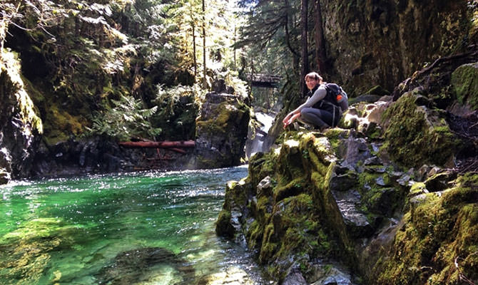
Opal Creek Wilderness
Adventurous hikers and backpackers trek the miles of trails lacing through old-growth forests in the Opal Creek Wilderness and the adjacent Opal Creek Scenic Recreation Area. Several of the most popular trails begin at or near the Opal Creek Ancient Forest Center, including the 6.25-mile round-trip hike to Jawbone Flats and the emerald-green Opal Pool. The forest center offers a wide range of year-round programs aimed at families and children with a variety of outdoor workshops, expeditions and more. Another popular spot in the Detroit Ranger District for backcountry trips and day hikes is the Mt. Jefferson Wilderness.
Coffin Mountain Lookout
The only staffed fire lookout tower in the Detroit Ranger District crowns Coffin Mountain, named for its looming ridge that looks more like a jagged cathedral than a casket. The modern flattop lookout was built here in 1984, but the mountain has hosted several similar structures since 1905. At an elevation of 5,771 feet, it remains an integral aspect of the regional fire-detection system. To take in the wide views from the summit, follow Coffin Lookout Trail #3392 for a moderate 2.5-mile hike, which pleasantly zigzags through bear-grass and wildflower meadows. Upon reaching the top, soak in the views of the Cascades, but be respectful of the ranger stationed in the lookout. Her home here is closed to visitors.
Sweet Home Ranger District
Surprises await all around the pioneer city of Sweet Home, a Willamette Valley hub for outdoor recreation along the Over the Rivers & Through the Woods Scenic Byway. Its apt nickname sums it all up: The “Gateway to the Santiam Playground” is a short drive to the little-known and Linn County-operated McDowell Creek Falls Park, lakes and reservoirs such as Foster Lake, the South Santiam and Calapooia rivers, and the Cascade Mountains. The central Sweet Home Ranger District is a straight shot east of Sweet Home on Highway 20, where verdant trails burst with wildflowers, mountain bikers shred remote trails and hikers get a taste of the sweet life. You’ll find the ranger station in town, west of forest lands.
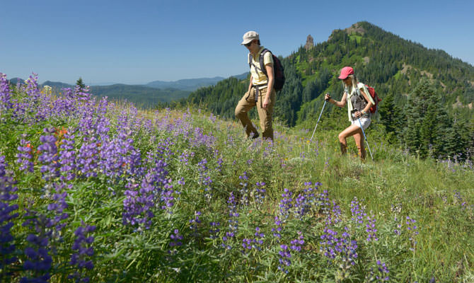
Iron Mountain and Cone Peak Trails / Santiam Pass
Butterfly watchers, take note — in spring and summer, some 300 species of wildflowers dapple the hillsides along Cone Peak Trail #3408, which tends to reach its peak in July. Connect to Tombstone Nature Trail #3420 for a moderate 5.4-mile round-trip trek. With the changing elevation ascending through several wildflower habitats, it’s one of the most diverse — and popular — subalpine blooms in the state. The gentle vistas make it a scenic and less-crowded hike after the flowers fade, especially on clear fall days through early November. Visit when the white stuff falls for snowshoeing and cross-country skiing. From mid-November through April, the Tombstone Sno-Park is one of several popular sno-parks in the Santiam Pass Winter Recreation Area; make sure you have a sno-park pass before heading out.
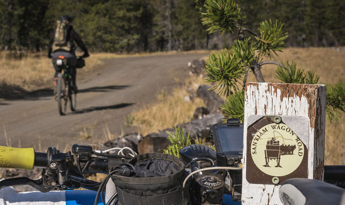
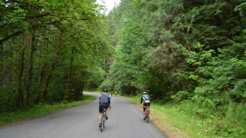
Santiam Wagon Road Trail
Unlike most other westbound historic trails in Oregon, the Santiam Wagon Road originally led pioneers nearly 400 miles eastward from the Willamette Valley to the ranching pastures in Central Oregon. U.S. Highway 20 (aka the Santiam Highway) closely follows the original route, while the old trail today attracts day hikers, history buffs and mountain bikers, as many legs of the historic trail are open to bikers and equestrians. The Snow Creek Section especially appeals to bikers, as it connects to other timber roads for riding. Segments of the Santiam Wagon Road form part of the epic 670-mile Oregon Timber Trail.
Nature and Heritage Tours
From late spring through autumn, the Sweet Home Ranger District links visitors with experts for a calendar full of excursions in the national forest. These reservation-required Nature and Heritage Tours guide you to out-of-the-way sites while introducing the varied flora, fauna, geology and cultural history of the Sweet Home area. Recent outings have included walks through wildflower-filled meadows, river rockhounding and huckleberry picking. Find the latest lineup here. All tours, which should be booked in advance via Recreation.gov, depart promptly from the Sweet Home Ranger Station.
McKenzie River Ranger District
Take a spin on Highway 126 heading east out of the Eugene-Springfield area and you’ll pass through the McKenzie River Valley, where a string of tiny riverside towns dots the banks of the Wild and Scenic McKenzie. As the road arcs north, following the course of the river, you hit one segment of the McKenzie Pass-Santiam Pass Scenic Byway, a seasonal loop popular with pleasure drivers and road cyclists alike that typically closes November to June (check the status from the Oregon Department of Transportation here). It captures much of what defines the McKenzie River Ranger District — very blue waterways for rafting, trails for biking and hiking, and thick evergreen forests at every turn.
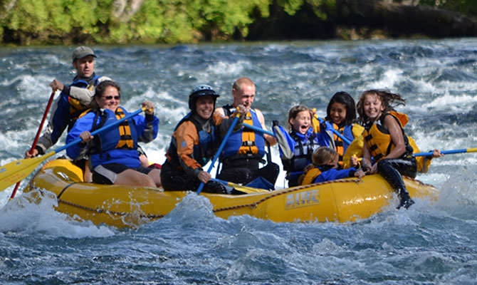
Rafting the McKenzie River
Strap on a life vest for one of the most thrilling ways to see the national forest. The fast-flowing but relatively mellow Class II and III rapids on the McKenzie are a rite of passage for Oregon river rats. Guided half- and full-day rafting trips make it easy to tackle the dancing whitewater. The chilly river makes it a cool escape in the summer months, though outfitters offer rafting and fishing trips in spring and fall as well. Riding with a pro makes the whole experience easier, as they provide all the gear you need and help you improve your skills. Find a list of officially permitted river guides here.

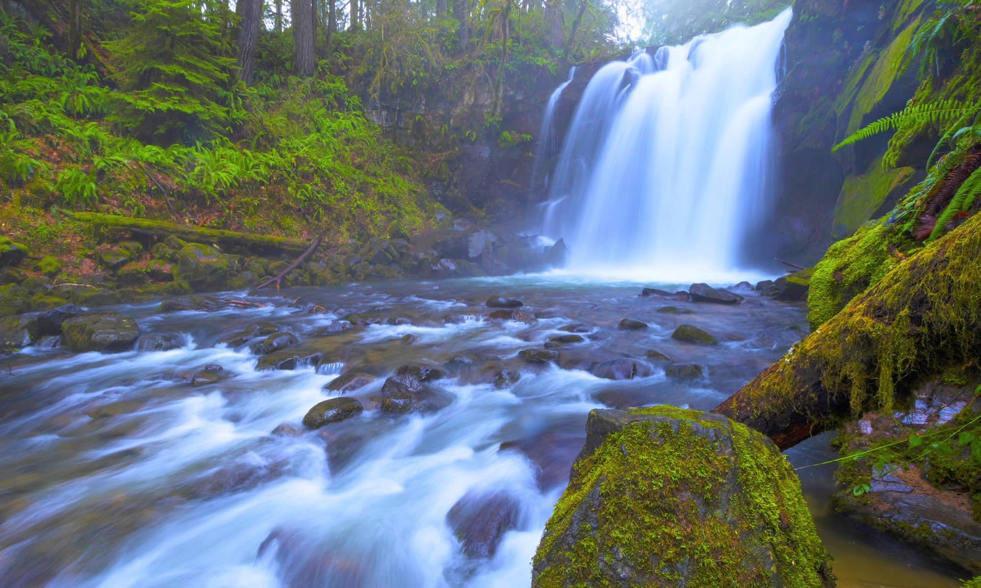
McKenzie River National Recreation Trail
Over the course of 26.5 miles, the McKenzie River National Recreation Trail passes through landscapes shifting from dense old-growth forest to misty cascades to lava beds. Nearly a dozen clearly marked trailheads provide easy access to the most noteworthy sites, such as the 3-mile Waterfalls Loop Trail #3503, which leads to Sahalie and Koosah falls — two foamy wonders plunging over basalt ledges to pools below. Sightseers in wheelchairs can access the observation deck at Sahalie Falls. Avoid the danger of parking along the highway and instead park in one of the designated areas; you’ll find more spaces at the Koosah Falls lot.
Dee Wright Observatory
Peer out across a 65-square-mile landscape shaped by lava flows at the Dee Wright Observatory, a sight so otherworldly that NASA conducted drills here in 1964 to prepare astronauts for moon travel. Built in 1935 with black basalt stones found on-site, the observation tower appears to blend into its surroundings. It’s an iconic project of the Civilian Conservation Corps. Inside the observatory, portal windows frame views of some of Oregon’s best-known mountains and buttes, including Mt. Washington, Mt. Jefferson, Black Butte, the Three Sisters and even Mt. Hood. Nearby, stroll the half-mile Lava River National Recreation Trail #3540, where a series of interpretive signs narrate the area’s natural and cultural history. Access to both the observatory and the trail depends on the seasonal section of the McKenzie Highway, which generally closes November to June; check the status here.
Middle Fork Ranger District
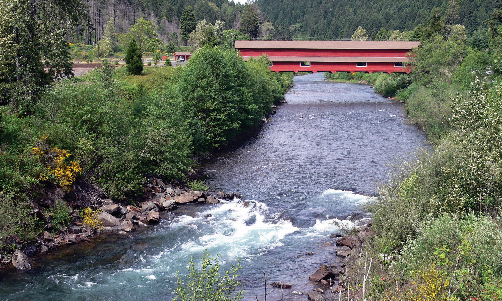
Follow the enchanting Aufderheide Scenic Highway 60 miles south from McKenzie Bridge as it winds past old-growth Douglas firs, gurgling streams and scenic turnouts. The seasonal highway — generally not maintained from November through April — forms the final leg of the majestic West Cascades Scenic Byway, concluding in the southernmost section of the national forest. (Note that a portion of the Aufderheide closed due to the 2018 Terwilliger Fire, so check here for current conditions.) It’s not the fastest way to get here, but it’s certainly the most unforgettable. Bordering the Umpqua and Deschutes national forests, the Middle Fork Ranger District lays claim to glistening alpine lakes, a secret ski area and legendary mountain-biking territory. Two former logging towns anchor the district: Oakridge is a mountain-biking hub, and Westfir is home to the ranger office and the beloved, barn-red Office Covered Bridge.
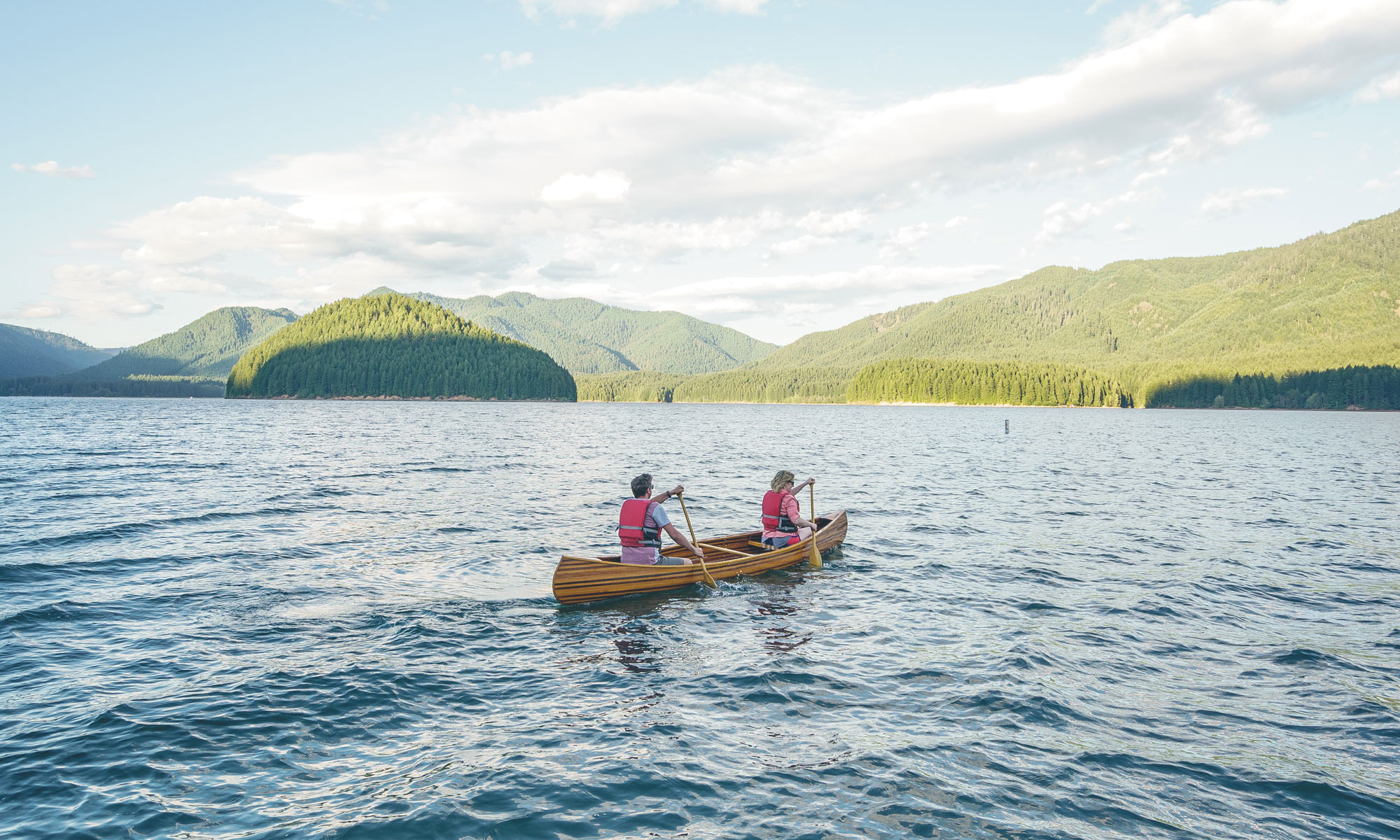
Waldo Lake
An “Epic Ride,” as designated by IMBA (International Mountain Bicycling Association), rings this truly pristine lake, considered one of the purest in the world and a recreation dream in the Cascades. One of the many alpine lakes in the forest, Waldo Lake covers some 10 square miles and reaches depths of more than 400 feet. It’s a paddler’s haven, with kayaks, SUPs and canoes making ripples on every clear day. You’ll spot a few hikers on sections of the 21-mile Waldo Lake Loop, but it remains an overwhelming favorite of mountain bikers, who can circumnavigate the entire lake for quite a challenging ride. Pitch a tent at North Waldo, Islet and Shadow Bay campgrounds, which together claim more than 200 developed sites as well as boat ramps and access to trails.
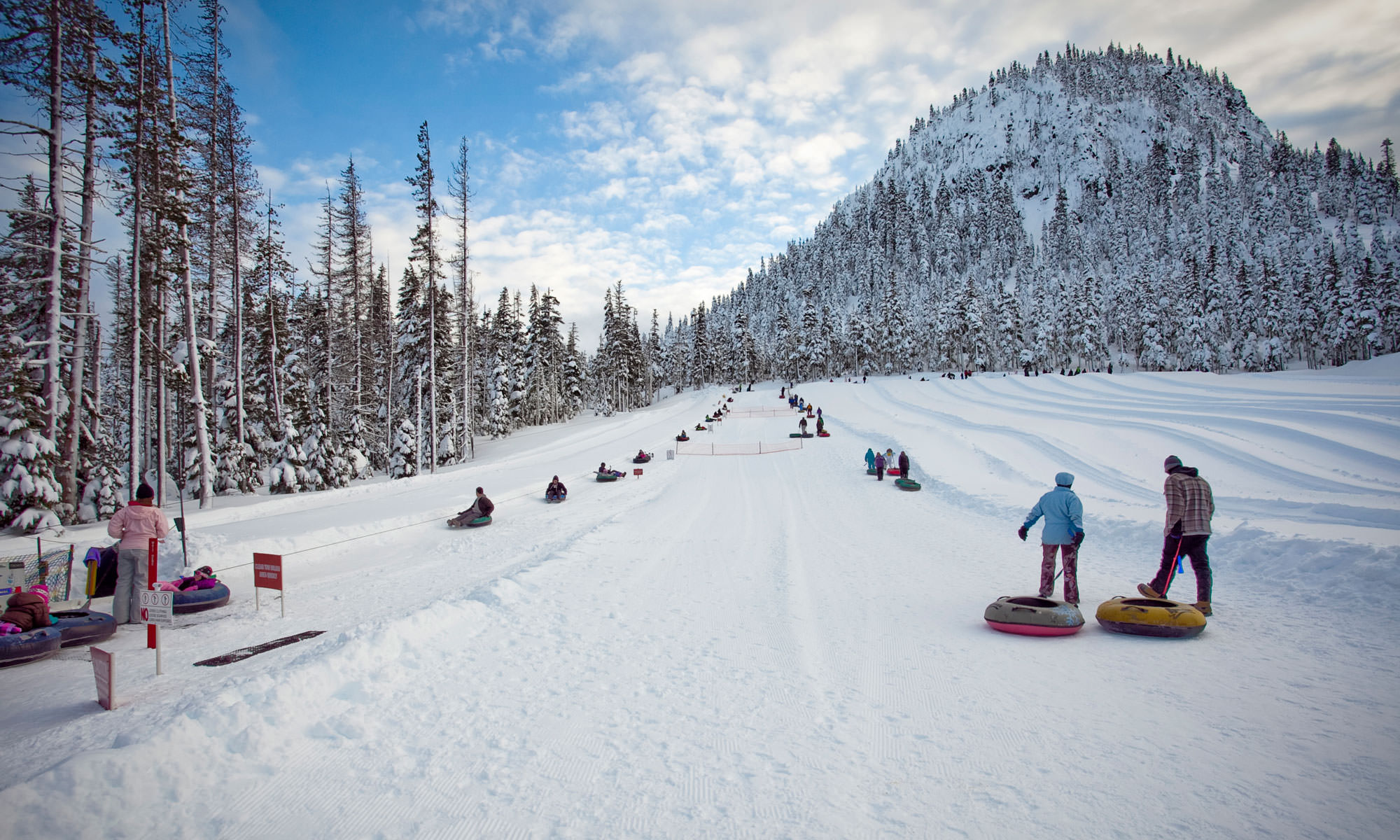
Skiing and tubing
One of two ski resorts in the national forest, the Willamette Pass Ski Area is one of Oregon’s snowy secrets — a lesser-known winter spot that’s perfect for families and beginners, and just a little more than an hour east of Eugene. Downhill skiers and snowboarders can carve 29 different runs, totaling 555 acres of skiable terrain serviced by six chairlifts. Want to learn to ski? Willamette Pass offers group and private lessons. You’ll also find a tubing hill as well as 20 kilometers of Nordic trails. The other ski area operating in the Willamette National Forest is the Hoodoo Ski Area, located a mere half-hour drive from the Central Oregon town of Sisters.
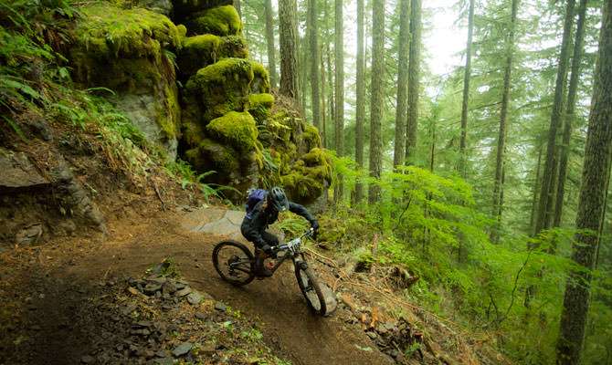
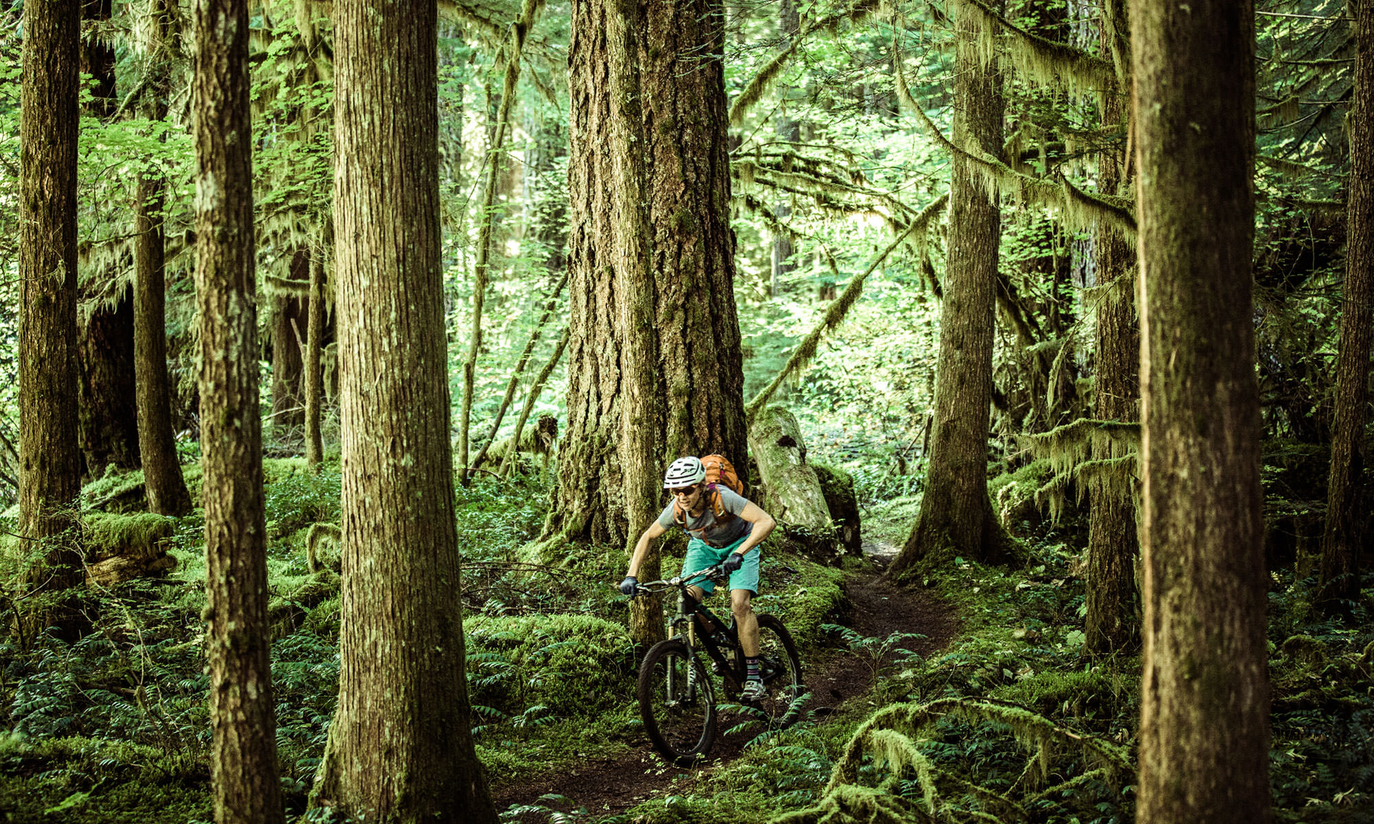
Oakridge mountain biking
World-class mountain biking awaits in Oakridge, known as the mountain-biking capital of the Pacific Northwest. Its lucky proximity to stellar rides in the national forest makes Oakridge one of only six cities in the world designated by IMBA as a gold-level “Ride Center.” That all translates to hundreds of miles of single-track to explore not far from the town center. Popular multiuse trails include Middle Fork National Recreation Trail #3609 — 95 percent of its 30-plus miles are single-track — and Dead Mountain Trail #3566. You don’t even need to drive, as both Cog Wild and Oregon Adventures offer shuttle options for cyclists wishing to go car-free.