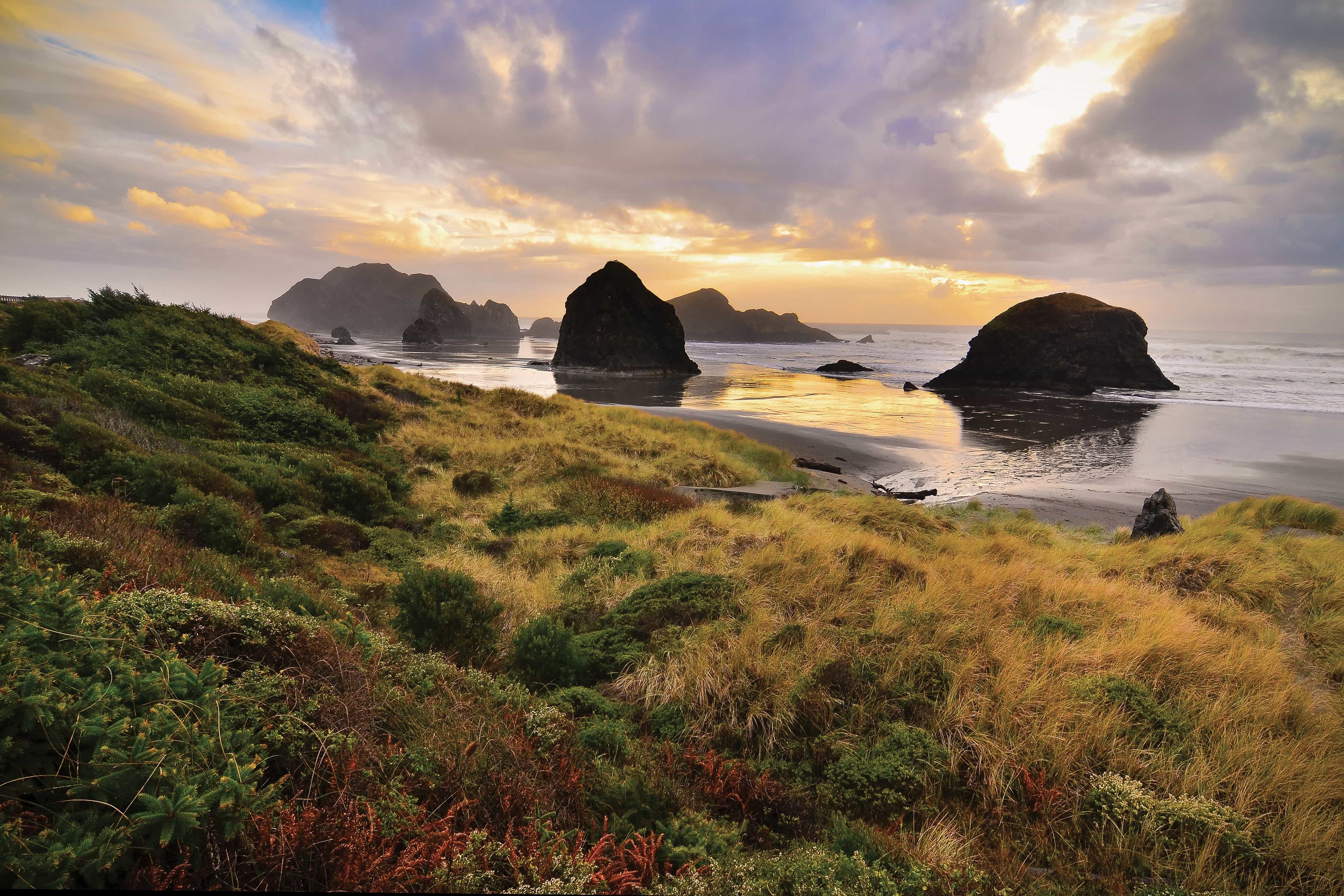
It only takes about 30 minutes to drive between Gold Beach and Brookings, but this stretch of coastline deserves a few days—or better yet a week—to get off the road, down a trail or onto one of its secluded hike-in beaches. Lingering on this stretch of the Pacific, you’ll discover magical coves, rainforest capes, arch rock formations and dramatic overlooks along one of the most rugged and jaw-droppingly beautiful stretches of the Oregon Coast.
The scenic wonders begin as soon as you head out of Gold Beach. Just south of downtown, explore Hunter Creek and the aptly named Turtle Rock.
Turtle Rock & Cape Sebastian
Pull over at the highway wayside to get a look at this rock formation and notice Cape Sebastian looming to the south. As you continue the drive, the highway climbs the cape and you’ll spot the entrance for Cape Sebastian State Scenic Corridor, a good stop whether you want to devote part of your day to a hike or just take in the expansive views. From the south parking lot enjoy views up to 50 miles looking south, dominated by Hunters Island just offshore and multiple rock formations on the beach.
Epic Sitka Spruce Hike to Beach
The hike from Cape Sebastian’s south lot down to Hunters Cove is well worth the trek. Gorgeous vistas give way to thick stands of Sitka spruce rainforest, then to the edge of the rocky cape. It’s approximately a three-mile down and back. Or for a real adventure, hike all the way south to the Pistol River and ride horses on the beach with Hawk’s Rest Ranch.
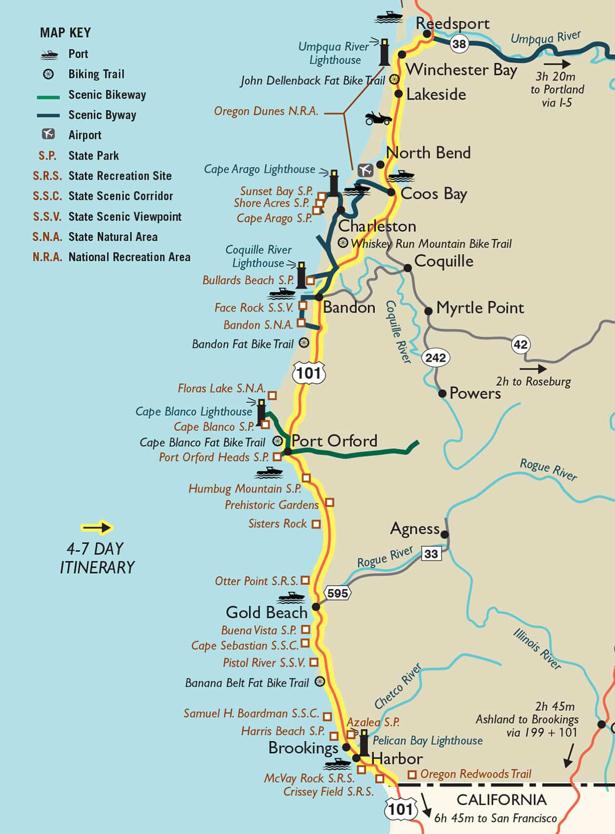
Windsurfers at Meyers Beach
From there, Meyers Creek Beach is just a five minute drive to the south with easy beach access points from roadside pullouts for viewing or exploring the scenic, intertidal rock formations. This is one of the top spots for windsurfing on the Oregon Coast, so you’re likely to catch some of the action if winds are right.
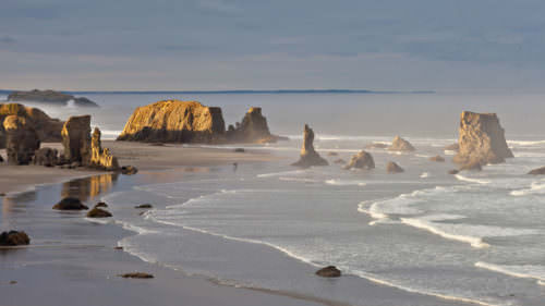
Samuel H. Boardman State Scenic Corridor
Next up, the Samuel H. Boardman State Scenic Corridor, a stunning 12-mile stretch of coastline with multiple wow vistas and trailheads. You can easily spend an entire day exploring just this scenic corridor. Hiking trails connect all of the viewpoints along the way, so you can choose just about any length of hike you’re up for, or simply car hop between the best lookouts.
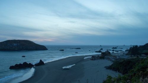
Picnic at Arch Rock
The first must-stop is the Arch Rock Picnic Area. A short loop trail leads around this promontory with captivating scenes north, south and west. Arch Rock can be seen from the western end of the loop trail just offshore. North and south vantage points showcase small islands whose miraculous Sitka Spruce trees teeter on the edge of sheer rock walls which plummet to the ocean.
Thunder Rock Cove
Just a mile from the Arch Rock viewpoint is the trailhead to Thunder Rock Cove (mile marker 345.8). A short trail rewards adventurers with a mysterious cove whose arched openings give way to a small promontory with ocean views. Continuing further north on this trail leads about three quarters of a mile to Miner Creek and secluded Secret Beach.
Natural Bridges
Natural Bridges is another easy stop, approximately a quarter-mile further south. Just a few steps from the parking area are views of a fairytale-like cove framed by a basalt rock wall with two arches that open to the sea and create natural bridges. Just to the south, parking areas offer additional trail access for hikes to secluded China Beach; a viewpoint of the Thomas Creek Bridge, one of the highest highway bridges in Oregon spanning the 350-foot Thomas Creek Canyon; and Indian Sands, a curious geological phenomenon of rolling dunes perched on a bluff high above the ocean.
The southernmost stop in the Boardman Corridor is the Lone Ranch Picnic Area (milemarker 352.6), one of the most accessible stops along this stretch of coastline. A paved trail leads to the beach with views of many offshore and intertidal rock formations. Plan your visit for a low tide to explore tidepools or walk the extended beach north toward Cape Ferrelo or south toward Black Point. A trailhead to the north climbs Cape Ferrelo where you can connect with its loop trail.
Follow the Birds
Just north of downtown Brookings, Harris Beach State Park boasts sandy beaches, craggy rock formations, teeming tide pools and outstanding bird watching. At the south end of this beach, Arch Rock shelters an intertidal area designated as one of Oregon’s seven Marine Garden protected areas. Just offshore you’ll spy Goat Island, also known as Bird Island, a nod to the massive seabird population it hosts during the nesting season (estimated at more than 100,000).
Stay:
Gold Beach: Tu Tu’ Tun Lodge – Luxurious riverfront lodge, exceptional farm to table food
Brookings Area: Little Redwood Campground – On a sunny river bar with more trees than people
Harris Beach State Park – Magic campground near beach and seastacks
Eat:
Gold Beach: Barnacle Bistro
Brookings: Chetco Brewing, Bakery by the Sea
Don’t Miss:
Paddle sea caves and ocean rivers with South Coast Tours
Global windsurfers gather each June for the Pistol
River Wave Bash
Throughout the month of April look for hidden glass floats during the Beach Treasure Hunt
Thrill seekers welcome on Jerry’s Rogue River Jets