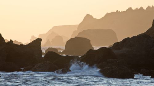
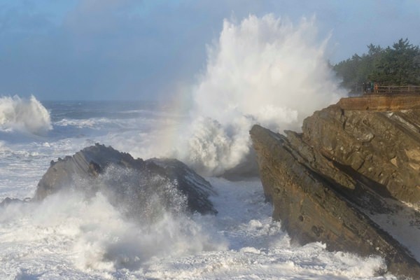
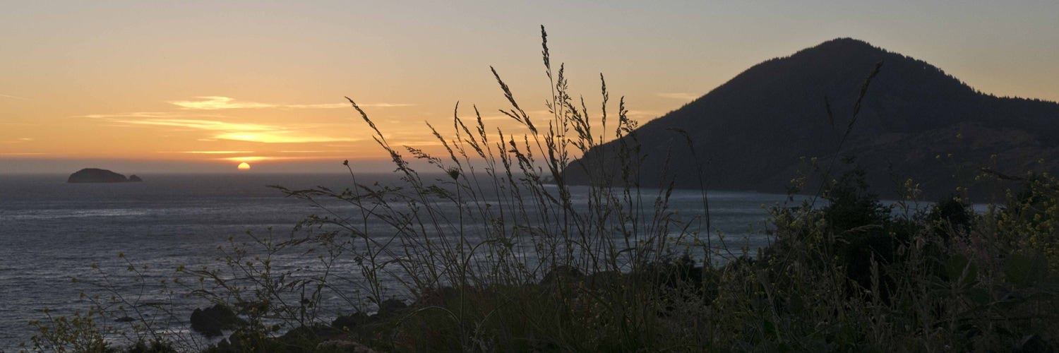
Trails through lush rainforest emerge to stunning ocean views and wild crashing waves, but there’s much more awaiting hikers on the South Oregon Coast. You can climb to the top of a forest-covered peak that plunges nearly 1,800 feet into the Pacific Ocean, look out on a reef covered with barking sea lions, wander through a fragrant riverside grove of Myrtle trees or explore the largest stand of giant Redwoods in Oregon. Hikers on the Wild Rivers Coast are rewarded with unmatched scenic views and a dizzying array of diverse landscapes and ecosystems.
There are many miles of trails from which to choose on the South Oregon Coast, but I’ve selected six of my favorites that range from two to six miles, making them easily accomplished in a half day with time to really experience these remarkable locations.
You can start your Wild Rivers Coast hiking tour at Cape Arago, about a 25-minute drive west of downtown Coos Bay or 35 minutes north of Bandon, making either town a good base for this hiking experience. Then, make your way south for five more great hikes.
Cape Arago
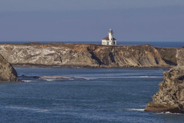
The trail climbs the bluffs on the south side of the Sunset Bay State Park, offers views of the Cape Arago Lighthouse, passes along the stunning cliff-side vistas of Shore Acres State Park, drops into the tiny Simpson Beach cove and continues through woodlands, finally emerging at the Simpson Reef overlook where offshore rocks and islands are usually crowded with sea lions whose barking resonates along this stretch of the Coast. This part of the trail is about two miles, making it altogether four miles down and back, though those looking for a longer hike can continue down the roadside from Simpson Reef to Cape Arago State Park and more viewpoints, then have the option of returning via an upper trail offering an alternative return route to Shore Acres State Park. The formal gardens at Shore Acres, the remnants of the one-time estate on this site, make an interesting visit.
Difficulty: Easy
Trailhead: Just south of entrance to Sunset Bay State Park campground
Humbug Mountain
A 5.5-mile loop leads through lush rainforest and crosses babbling creeks as it winds its way to the top of 1,756-foot Humbug Mountain. You’ll catch some limited ocean views on the loop trail, but the hike is best for experiencing coastal rainforest habitat including old-growth Douglas Fir, Big-Leaf Maple, fragrant Oregon Myrtle and a lush understory.
Difficulty: Intermediate to difficult for elevation gain
Trailhead: Six miles south of Port Orford at Humbug Mountain State Park day-use area

Cape Sebastian
You’ll be teased by a few expansive ocean views as you wend your way through Sitka Spruce forest to the end of Cape Sebastian and its scenic rocky shoreline. It’s a 3.2-mile out-and-back, though at the end of the trail, you’ll be enticed to lower yourself down to the beach by the rope and railing at Hunters Cove. You can extend the hike by continuing on the beach another 1.5 miles to the sea stacks at Myers Creek.
Difficulty: Moderate-plus, due to elevation gain on return trip
Trailhead: Cape Sebastian State Scenic Corridor south parking area
Arch Rock to Natural Bridges
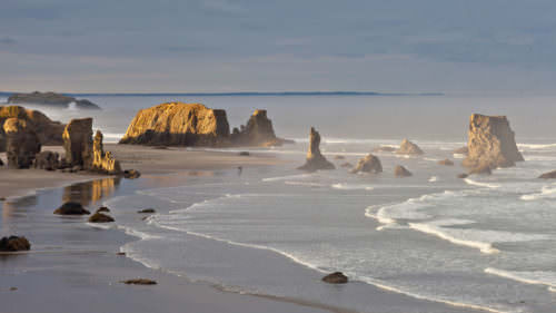
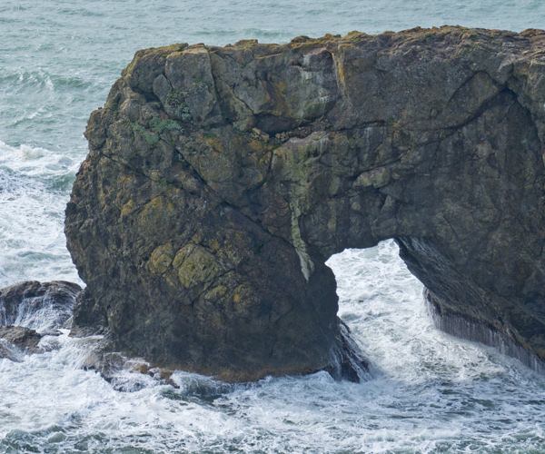
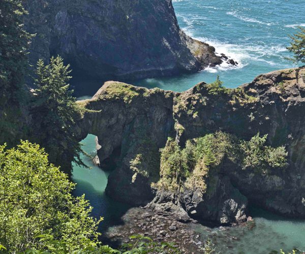
There’s no doubt about it, the 12-mile stretch of the Samuel H. Boardman State Scenic Corridor north of Brookings is one of the most scenic portions of the Oregon Coast. There are at least 18 miles of trails to explore from end to end. With multiple trailheads along Highway 101, you can select between portions of the trail that fit your hiking desires. The trail between Arch Rock and Natural Bridges offers a moderate-length hike of about four miles out-and-back that passes some of Boardman’s top attractions. The Arch Rock viewpoint itself offers a loop trail just off the parking area with inspiring views from several viewpoints including Arch Rock offshore to the west, as well as other scenic rocks and small tree-covered islands north and south. The trail to the south drops quickly into thick Sitka Spruce rainforest, offers views of isolated fairy-tale coves and access to secluded beaches. Highlights include the tiny Secret Beach, complete with waterfall, the magically picturesque Thunder Rock Cove and a view of Natural Bridges, a scenic inlet with multiple arched rocks. You can extend this hike by continuing south to secluded China Beach, an additional mile-plus.
Difficulty: Easy to intermediate-plus depending on the length you choose
Trailhead: Southeast end of Arch Rock parking area

Chetco Riverview Trail and Redwood Nature Trail
This hike parallels the Chetco River through a fragrant grove of Myrtle trees for three-quarters of a mile, then you can cross the road to the trailhead for the Redwood Nature Trail, a 1.1-mile loop through the northernmost Redwood grove in Oregon. By combining the two trails, this is an easy hike of less than two miles out and back.
Difficulty: Easy
Trailhead: Alfred A. Loeb State Park day use (picnic) area