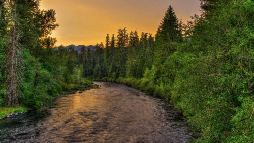
It’s not an unusual experience for Oregon hikers. While walking on a verdant, shaded trail, you spy a brightening in the forest ahead. Stepping forward, you find not a lake or meadow but a wildfire scar. Perhaps it’s spangled with wildflowers and brushy new growth — or maybe it’s fresh enough to catch the lingering scent of charcoal in the air.
Few forces can alter a landscape more profoundly than fire. Major wildfires can destroy homes and lead to loss of life. Yet fire is also as integral to Oregon’s forest ecology as the sun and rain, and human-managed fire has a very long history in Oregon’s landscape.
“Tribal communities, for thousands of years, before there was ever a Forest Service or Bureau of Land Management, had been putting fire on the ground intentionally for land-management purposes,” says Merv George Jr., forest supervisor of the Rogue River-Siskiyou National Forest east of Grants Pass, and a member of the Hoopa Valley Tribe in Northern California. He says Tribes relied on managed fires to serve critical ecological functions, like reducing fuel buildup so inevitable lightning fires didn’t burn long or hot enough to destroy food resources or pollute watersheds.
Over the past century, land managers in Oregon and elsewhere in the West adopted an aggressive strategy of suppressing wildfires — even the kinds of fires that George refers to as “good” fires, or low- and moderate-intensity fires that burn during cool weather and don’t threaten people living nearby. “Because we haven’t had enough good fires in the last 100 years, we’re starting to see more bad fires,” says George.
For hikers, walking through an area burned by a “bad” fire can be shocking. Yet even severely burned landscapes can and do regenerate — and hiking offers a front-row seat for that process of renewal. “For a lot of the species that hang out in the understory, [after a fire] is their window of opportunity,” says Meg Krawchuk, assistant professor of Forestry at Oregon State University. Wildflowers, berries and grasses often thrive in the open spaces created by fire, basking in abundant sunlight otherwise rare in Oregon’s coniferous forests. (Note: Areas burned by the 2020 wildfires are starting to re-open but still pose a serious safety risk, so proceed with caution. Respect all closures.)
Krawchuk encourages forest lovers to acknowledge the real grief wildfire can bring while also embracing fire’s longstanding transformative role in ushering in new growth. “We lost this old forest, but we gained this baby, this young forest,” she says. “Every tree out there was born at some point and was young at some point. The fires we talk about as having been part of our history are what generated these forests we love.”
Oregon trails offer abundant opportunities to see the impacts of recent or historic fire on a landscape. Here are a few ideas to get you started.

Eastern Oregon
Hurricane Creek Trail, Eagle Cap Wilderness
Distance: 6 miles round-trip to Slick Rock Gorge; moderate
Elevation gain: 750 feet
Season: June-October
Evidence of the 2018 Hurricane Creek Fire is still apparent on the first few miles of this backcountry trail, which extends just over 19 miles into the Eagle Cap Wilderness of the Wallowa Mountains. Slick Rock Gorge, a dramatic waterfall-filled gorge, makes a good day-hike turnaround point at about 3 miles in.
On the first section of the trail, hikers pass through an example of what foresters call the “fire mosaic” — heavily burned ribbons of forest interspersed with bands that are entirely unburned.
“We call those unburned areas ‘fire refugia,’” says Krawchuk. “They’re living legacies that are incredibly important, in many ways, for the recovery of those seeding species that need a seed source.” On the Hurricane Creek trail, you can see seeded wildflowers like lupine, paintbrush and fireweed already returning to the burned areas.

Oregon Coast
Wilson River Trail, Tillamook State Forest
Distance: 7.6 miles round-trip for Dog Creek segment; moderate
Elevation gain: 1,105 feet
Season: Year-round, although it can be muddy
One of Oregon’s most legendary wildfires, the Tillamook Burn, was actually a series of fires on Oregon’s North Coast that took place between 1933 and 1951. Today the forest has passed the first stage of regrowth and is entering what we might reasonably term middle age.
“It’s a really exciting stage for a forest,” says Krawchuk. “It’s reimagining itself. Trees are starting to die, which means more space and more light, as well as earlier stages of old growth.” For hikers, that means you’ll see a tighter canopy overhead, with larger and more structurally complex trees, as well as new growth in areas where sunlight still reaches the forest floor.
Still, remnants of the Tillamook Burn aren’t entirely gone. At the Dog Creek crossing on the eastern segment of the 22.6-mile Wilson River Trail, look for a huge charred cedar snag at the east end of the footbridge as a reminder of this massive historic fire.

Southern Oregon
Babyfoot Lake, Kalmiopsis Wilderness
Distance: 2.5 miles round-trip; easy
Elevation gain: 360 feet
Season: May-October
Several significant fires over the past 20 years — including the 2002 Biscuit Fire, the 2017 Chetco Bar Fire and the 2018 Klondike Fire — have left almost no corner of the rugged Kalmiopsis Wilderness untouched by flame. Fires are tough on trails, and many in this area remain choked with debris or shrub growth that make travel difficult.
You can still get up close and personal with the Kalmiopsis on trails maintained by the Siskiyou Mountain Club, a wilderness-stewardship organization dedicated to maintaining trails in the Southern Oregon region. One great option is Babyfoot Lake Trail, a short out-and-back journey through an otherworldly landscape of black and white snags protruding through thick, brushy understory. At the turnaround is Babyfoot Lake, an eminently swimmable watering hole.
The Kalmiopsis is a very different landscape than the fir- and spruce-cloaked western slopes of the Cascade mountains. Hotter temperatures, drier conditions and soils with low organic content support a unique range of plants, including Ceanothus, manzanita, several rare species of kalmiopsis (a flowering shrub that gives the wilderness its name) and carnivorous Darlingtonia, or pitcher plant.

Columbia River Gorge
Sherrard Point Trail, Columbia River Gorge National Scenic Area
Distance: 0.6 miles round-trip; easy
Elevation gain: 170 feet
Season: Year-round
Sherrard Point Trail, near Corbett, is a short, paved trail that includes 100 stairs. At the top — if it’s a clear day — hikers can see five of the Cascade’s tallest peaks: Mt. Rainier, Mt. St. Helens, Mt. Adams, Mt. Hood and Mt. Jefferson.
From this bird’s-eye viewpoint, you can also see ribbons of burned and unburned forest in the hills below. “Some of those green patches that didn’t burn under high severity, even though it looked like they should, were actually old lightning fires that burned several acres before the suppression crew got there,” says John Bailey, professor of forestry at Oregon State University — a vivid illustration of the role of “good” fires in reducing the intensity and extent of future burns.

Willamette Valley
Patjens Lake Loop Trail, Willamette National Forest
Distance: 6.9 miles; moderate
Elevation gain: 400 feet
Season: June-October
This flattish loop trail passes through forest burned in the 2011 Shadow Lake Fire to dish up views of Mt. Washington and Three Sisters, made broader by 2003’s B&B Fire. The trail begins at Big Lake, a popular boating destination about two hours east of Corvallis, and visits four smaller alpine lakes deeper in the mixed forest of lodgepole pine, western hemlock and alpine fir. June and July bring a carpet of wildflowers to the burned forest, including lupine, aster and bear grass. Make sure to secure an advance Central Cascades Wilderness Permit to backpack on this trail between June 15 and Oct. 15, 2022.
Lodgepole pine (identify it by looking for needles held in pairs, rather than the bundles of three seen in ponderosa) is famous for producing serotinous cones, which actually need fire to release seed. That trait seems to be less pronounced among Oregon’s lodgepole pine population than in areas in the Rocky Mountains, but it’s still a fascinating arboreal adaptation to the reality of wildfire — and a vivid reminder of fire’s millenia-long evolutionary role in western forests.
If You Go:
- Hikers should consider weather and conditions before hiking through burned areas. Snags — standing dead trees — that are stable under calmer conditions can fall during high winds.
- Reduced canopy cover means more direct sun. Be prepared for heat with sunscreen, a hat and plenty of water. Find your full list of Ten Essentials, plus lots more tips on how to Take Care Out There when you’re out adventuring.
- Stay on the trail for your safety (wildfire-impacted areas may have hidden dangers) and to protect the landscape. If you need to step off the trail temporarily to allow for safe passing by other hikers, tread lightly.
- No matter where you’re exploring, be vigilant about campfires, camp stoves or other potential sources of fire, especially when conditions are hot, dry or windy. “Any ignition source in the middle of summer makes it really difficult for us land managers to keep people safe,” says George. No fire — even inside a ring at a campground — should ever be left unattended until it’s cold out.
- Consider giving back to Oregon’s wildfire-affected communities through a number of statewide efforts to help forests and families recover.