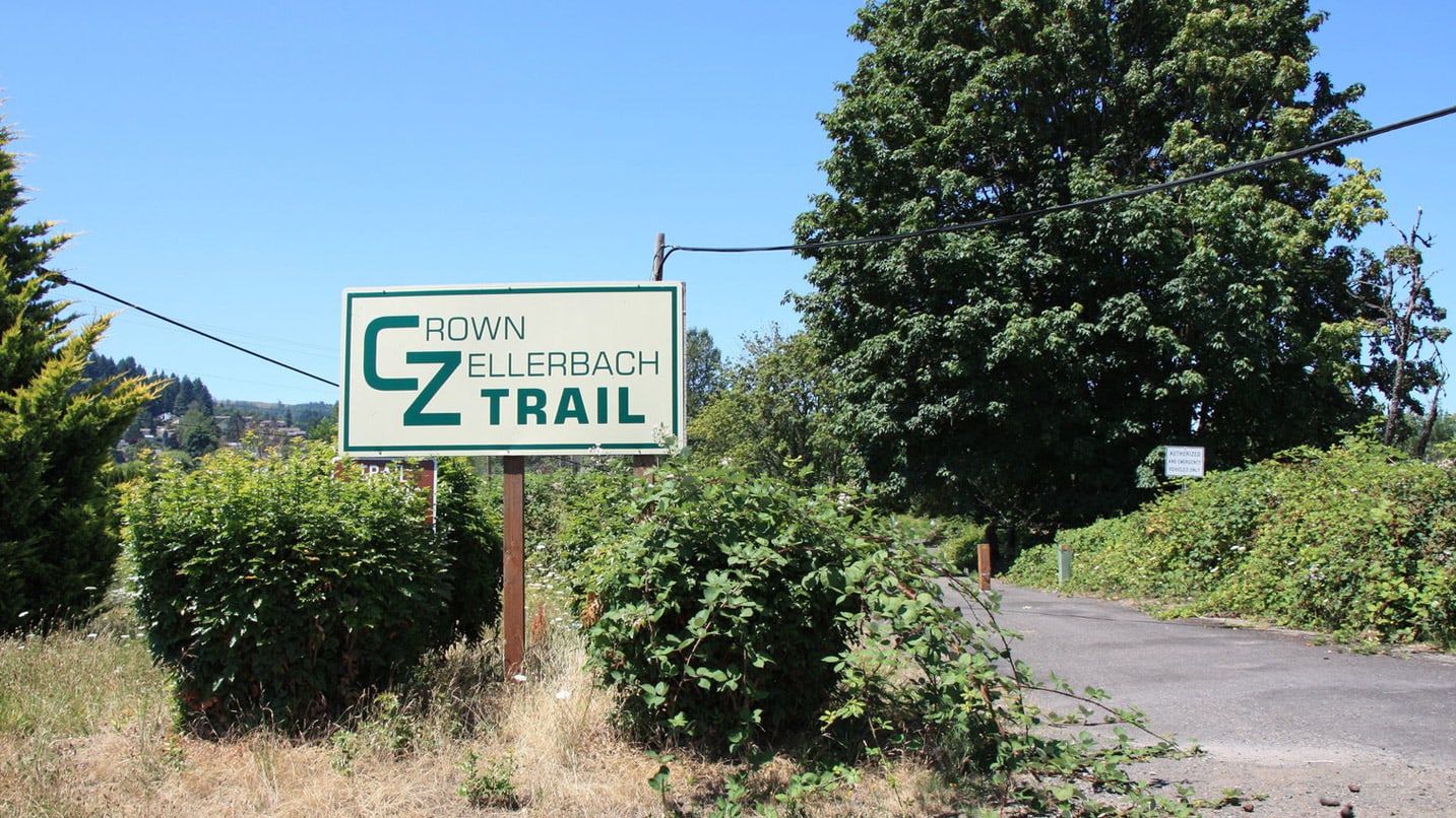
Just a half-hour drive northwest of Portland, a 23-mile trail along a historic railroad takes you deep into the forested foothills of the Coast Range. Connecting the towns of Scappoose and Vernonia and passing through several small communities along the way, the Crown Zellerbach Trail — newly designated as a National Recreation Trail — offers an opportunity to take a road less traveled.
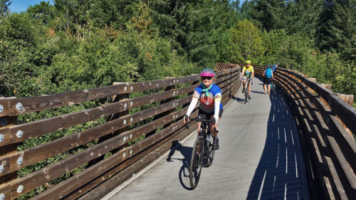
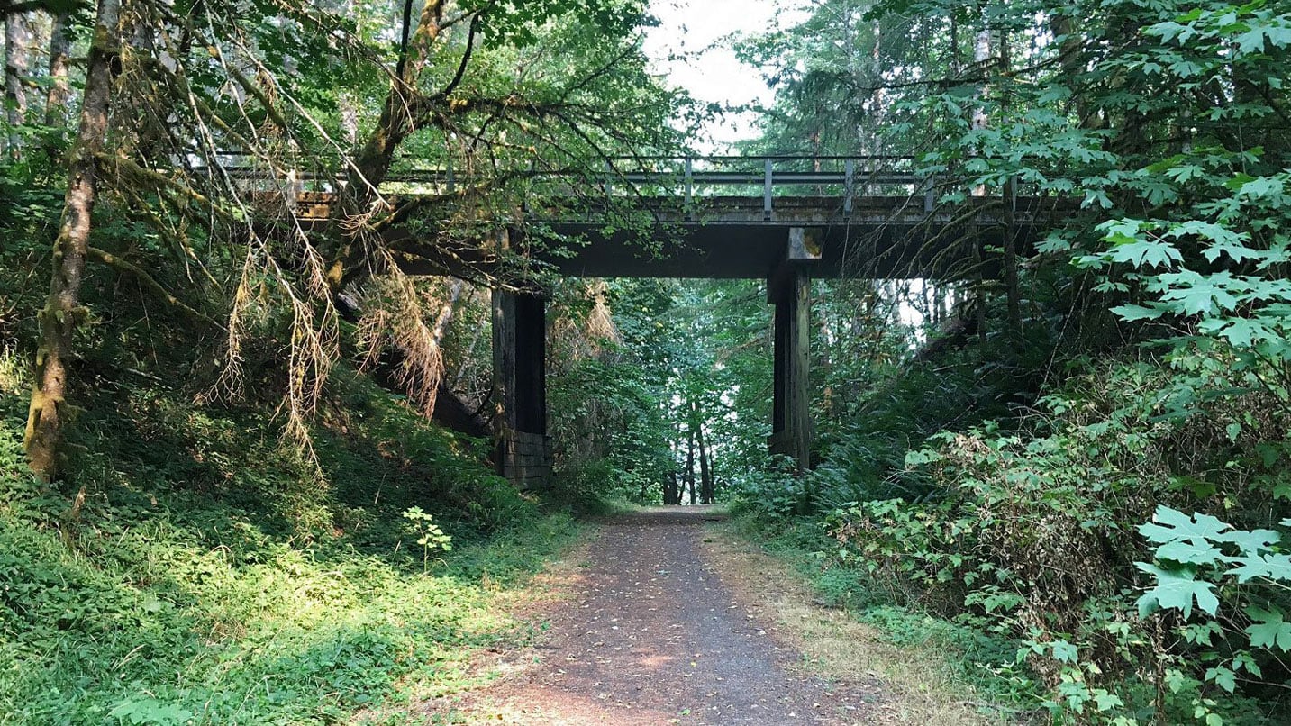
Nicknamed the Crown Z or CZ Trail, the rail-to-trail Crown Zellerbach immerses hikers and cyclists in a thick curtain of trees for the majority of the trek. It snakes along the North Scappoose Creek, popular for fishing; crosses over numerous footbridges; and connects with many logging roads for bonus excursions. The trail itself is mostly smooth-packed gravel, though there are also parts that are asphalt or dirt. While it’s good to traverse in any season, be warned: It’s known to get muddy after rainfall, especially in the parts where the trail dips. Here’s how to explore.
Surprises Around Every Corner
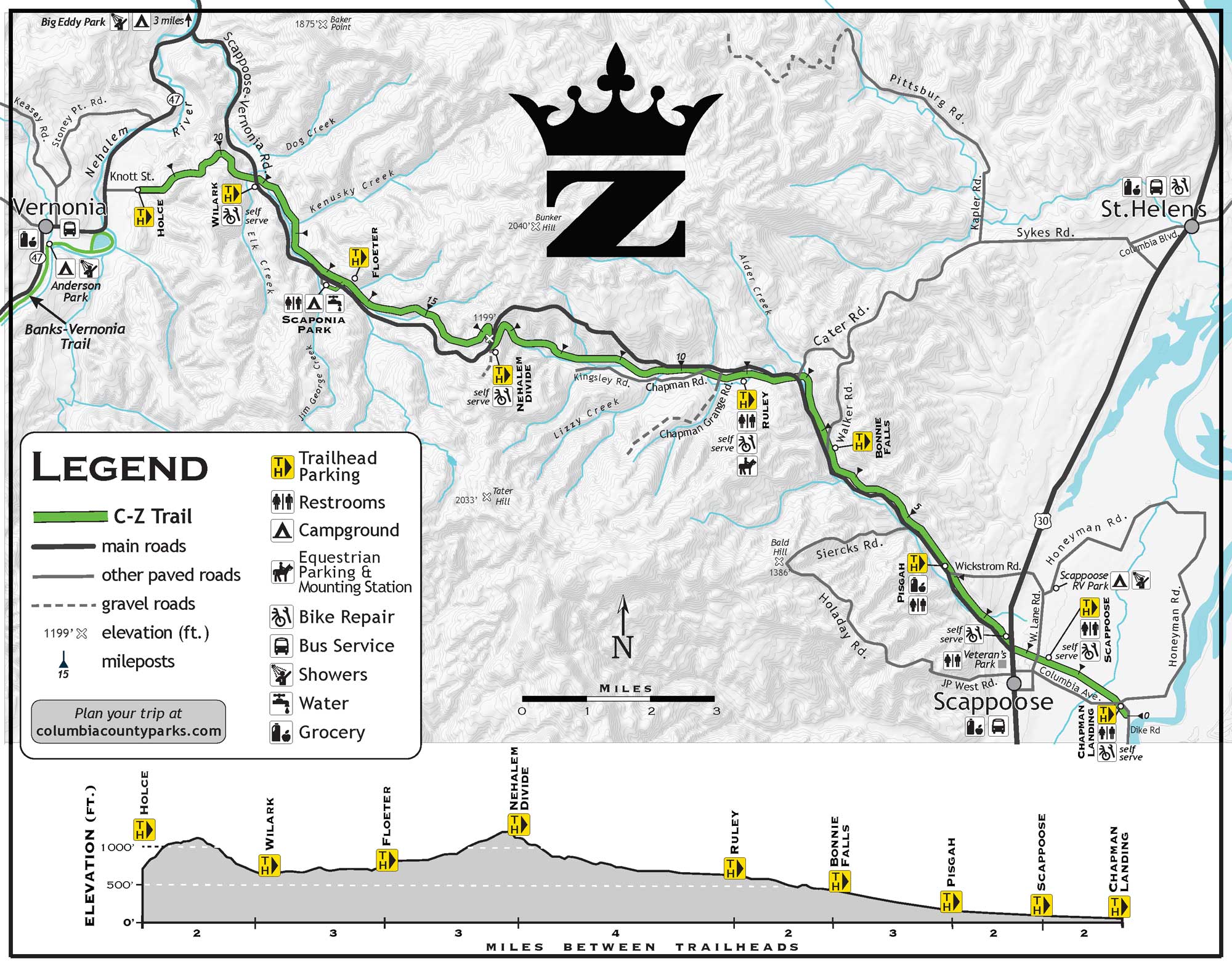
You can hike or bike the trail in either direction, but starting at the east end (while parking at the Chapman Landing trailhead) gives you about 6 miles of mostly flat surface to Bonnie Falls, a 15-foot waterfall that plunges into a pool that is great for swimming in the summer. After crossing over Highway 30, the trail follows the Scappoose-Vernonia Highway before plunging deep into the forest. Before long, trailgoers are enveloped in Oregon ash, maple and oak trees. About 2 miles in, the path begins a steady climb, steepening at one point to a 10% grade before reaching the highest point on the trail at 1,000 feet, Nehalem Divide Railroad Tunnel. Here you can see the abandoned 1920 railroad tunnel by taking an offshoot path. Though you can’t go inside (it’s filled with debris and could crumble at any time), the 1,712-foot tunnel marks a massive undertaking for a logging road.
Continuing west from this point, the trail takes a slow, steady descent amidst quiet forestland, an escape from reminders of the civilized world. Bookending the trail to the west, Vernonia Lake is a serene, cattail-rimmed lake with a 1.2-mile loop trail around the perimeter. The Vernonia Lake Trailhead, where the Crown Zellerbach Trail ends, is also the beginning of the 21-mile paved Banks-Vernonia State Trail. This makes connecting the two trails a breeze and adds even more options for a variety of outings.
Build Your Own Adventure
You can bike or hike the 23-mile trail end-to-end with a shuttle car or take on the path in segments. Taking on the entire trail in one go is a moderately difficult endeavor, but breaking it into smaller pieces makes for an easy outing. There are numerous trailheads along the route and two campgrounds with restrooms: Scaponia Park and Vernonia Lake. These are great spots for beginners to try out bike-packing, which combines bicycle touring with minimalist camping. The east end of the trail starts at the Chapman Landing Trailhead in Scappoose, a decent-sized but unmarked parking lot off of Dike Road. Here the path is a flat patchwork of smooth and broken asphalt that snakes through farm fields and wetlands, presenting a good spot to spy cormorants and bald eagles. And on clear days, you can catch views of Mt. Hood, Mt. St. Helens, Mt. Adams and, if you’re lucky, Mt. Rainier. Because of its accessibility, this section of the trail is great for families with small children to create an out-and-back excursion of any length, according to comfort level. Another good option for taking on a smaller section of the Crown Zellerbach Trail is to start at the Floeter Trailhead or Scaponia Park and hike to the Nehalem Divide, which is about 5 to 6 miles out and back
If You Go:
- Plan for a midweek excursion to avoid the crowds, especially those that crop up on the east end near the Chapman Landing Trailhead. There is free parking at the trailheads along the trail, though capacities vary. There is a $5 day-use fee at Scaponia Park and Vernonia Lake, so bring cash for the on-site kiosk.
- Remember to bring your Ten Essentials, and be respectful to other trail users and nature by packing all of your trash out. Note that cell service may be limited, so travel with a friend and, if you’re biking, bring a tire-repair kit.
Support local businesses while you’re in Columbia County. Pick up takeout post-ride at Ixtapa Mexican Restaurant or Fultano’s Pizza; rent gear or stop in for friendly tips at Barlow Bikes & Boards; and consider making it a mini getaway with a luxurious stay at a property like the Scappoose Creek Inn or the Twilight Swan House in nearby St. Helens. As the filming location of the first “Twilight” movie, the rooms come complete with cardboard cutouts of actors Taylor Lautner and Kristen Stewart.