It would be easy to believe that the only place to discover stunning waterfalls in Oregon is the Columbia River Gorge — it’s home to dozens of falls cascading off basalt cliffs.
Two million people visit Multnomah Falls each year — the Gorge’s most-visited attraction — while crowds almost as large swarm nearby cascades such as Horsetail, Wahkeena and Bridal Veil falls.
Yet when it comes to the multitude of waterfalls dotting the Oregon landscape, Multnomah Falls (which doesn’t require advanced ticketing in fall, winter or spring) and the Gorge barely scratch the surface.
Spectacular waterfalls can be found in the Central Cascades and Coast Range — in the high desert, Oregon Coast and North Umpqua canyon — on trails and viewpoints where solitude is the norm and crowds are the exception.
Heck, even the Gorge has a few secrets if you know where to look.
Included here are six of Oregon’s most beautiful but lesser-known waterfalls. All six feature easy access from the road, family-friendly trails and a quieter experience.
Hug Point Falls
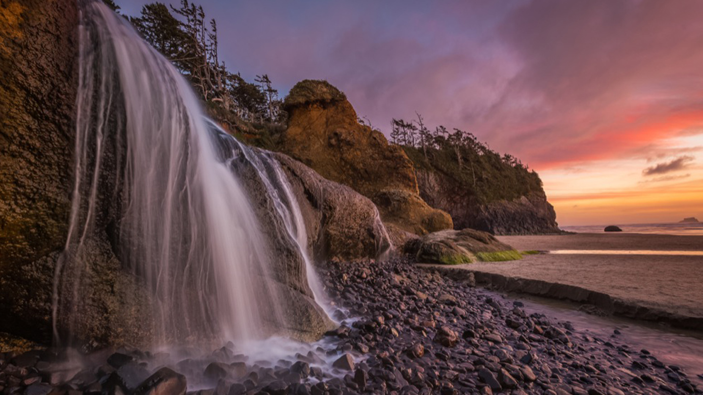
Stroll down an Oregon Coast beach and feel the spray of a 15-foot waterfall on an adventure where even the name drips with romance. Hug Point Falls isn’t the tallest cascade in Oregon, but it’s among the only ones where viewing is limited by the incoming tide. Five miles south of Cannon Beach, park at Hug Point Recreation Site and hike the beach to the north — but only at low tide. After walking around Hug Point, you’ll find the pretty little falls dropping 15 feet off a sandstone ledge.
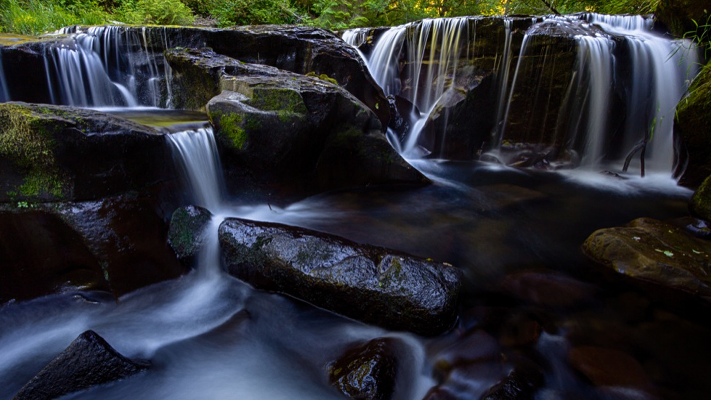
Sweet Creek Trail
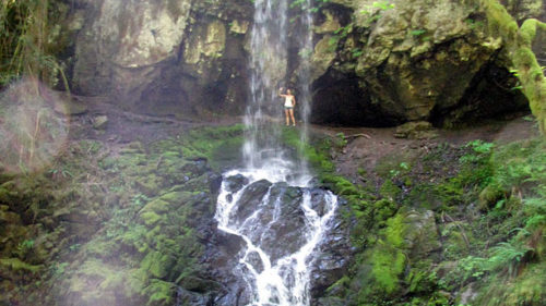
There are no boring moments on this sweet and easy trail south of Mapleton, where you’ll pass 11 waterfalls in just 1.1 miles. Sweet Creek Trail is something of an engineering marvel, using catwalk-style bridges to allow hikers up-close views of a stream that drops like a slinky down basalt ledges in this narrow, mossy canyon. From Mapleton — east of Florence — follow Sweet Creek Road for 10 miles to Homestead Trailhead. The hike is 2.2 miles round-trip to Sweet Creek Falls, the largest cascade among the nearly dozen you’ll find here.
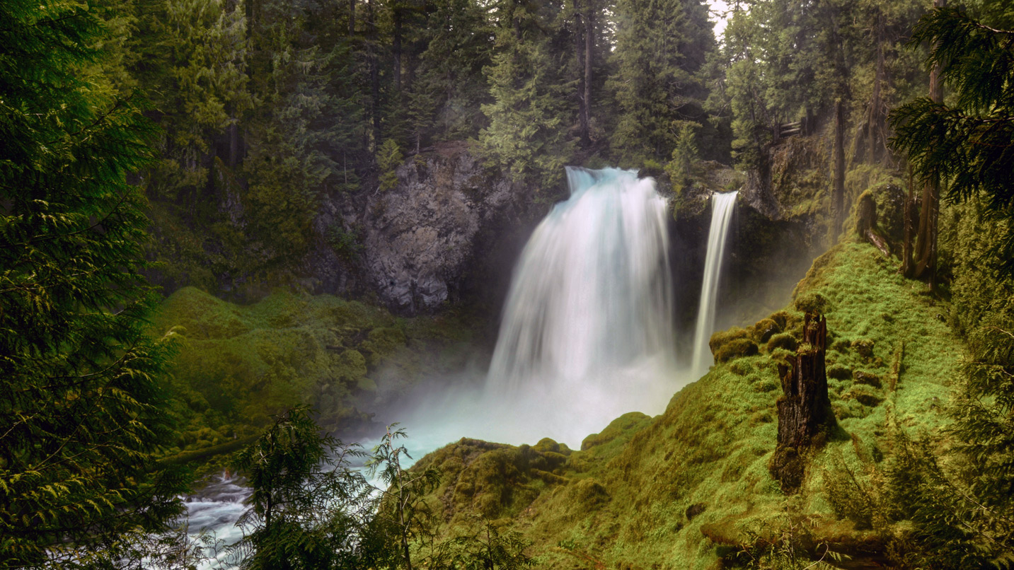
Sahalie and Koosah Falls
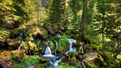
Even in the late summer, when many waterfalls have dried to little more than a trickle, you’ll still want a rain jacket to hike past the McKenzie River’s two most iconic cascades. Sahalie and Koosah falls roar with spectacular fury in all seasons, spitting clouds of mist into the air and saturating anyone visiting these waterfalls south of Santiam Pass on Highway 126. Enjoy these Willamette Valley waterfalls from separate viewpoints or hike a 2.4-mile loop that passes both waterfalls and explores old-growth forest on the McKenzie River Trail. Be wary of snow in spring and early summer.
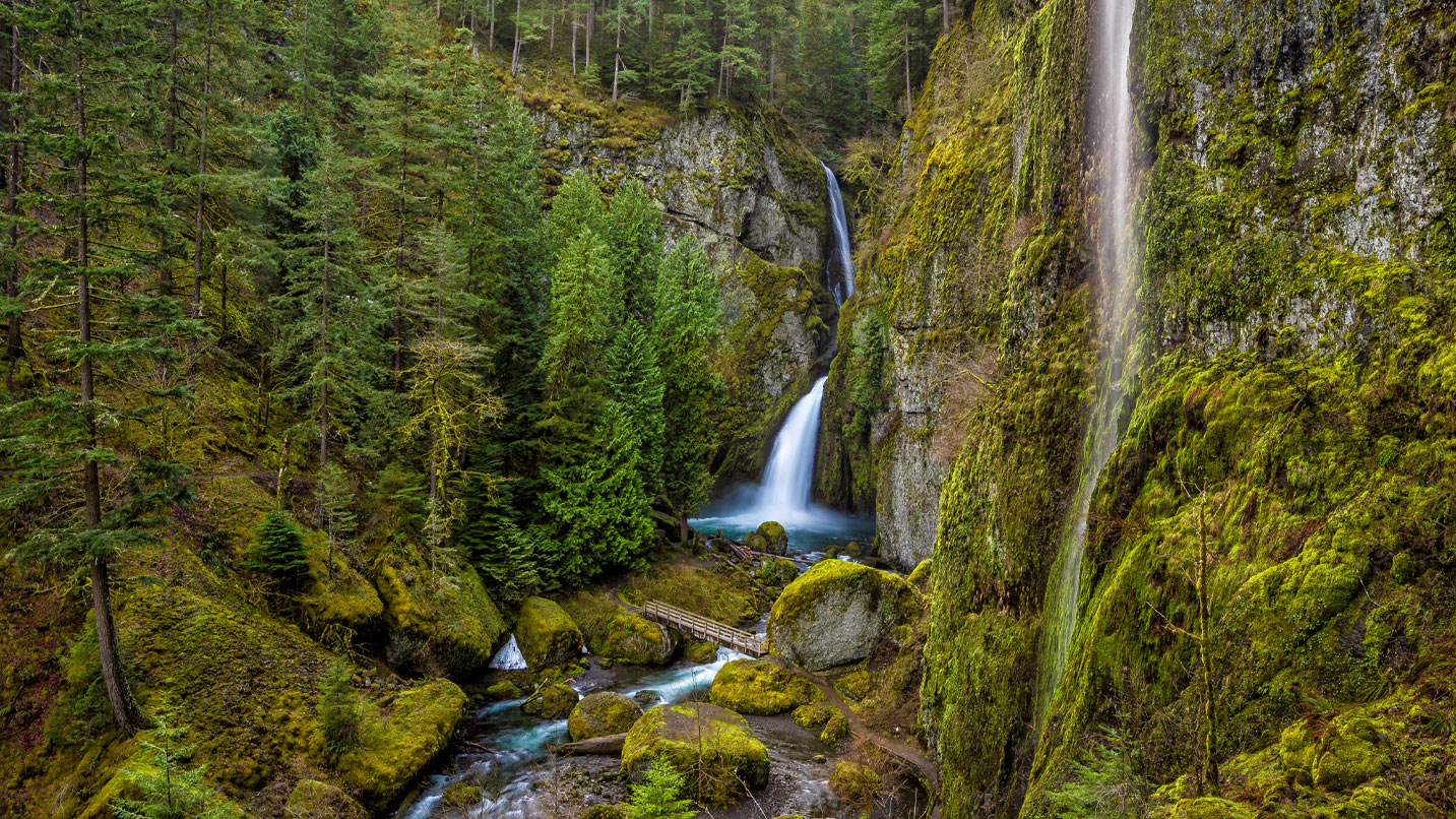
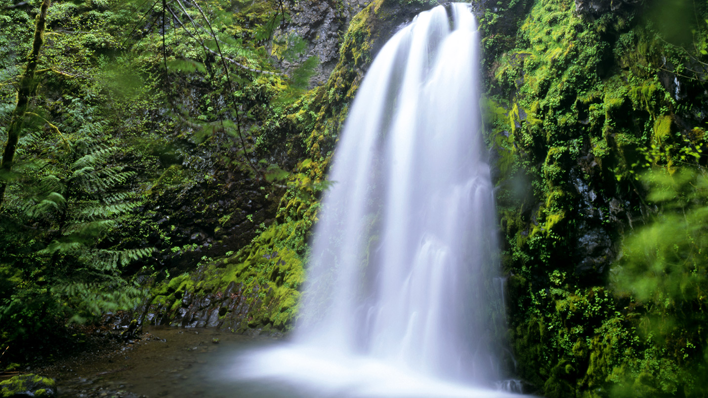
Wahclella Falls
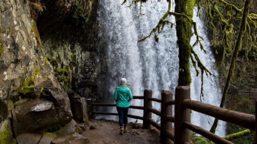
In the crowded corridors of the Columbia River Gorge, Wahclella Falls Trail stands out for its solute and sense of adventure. A short hike — just 2.2 miles — takes you into a deep and narrow canyon, where thin waterfalls drop from overhead cliffs and emerald-blue Tanner Creek twists between boulders the size of apartment buildings. Wahclella Falls provides the grand finale, plunging down two 60-foot drops into a cavern bellowing with mist. The trailhead can be found off Interstate 84 near Cascade Locks at exit 40.
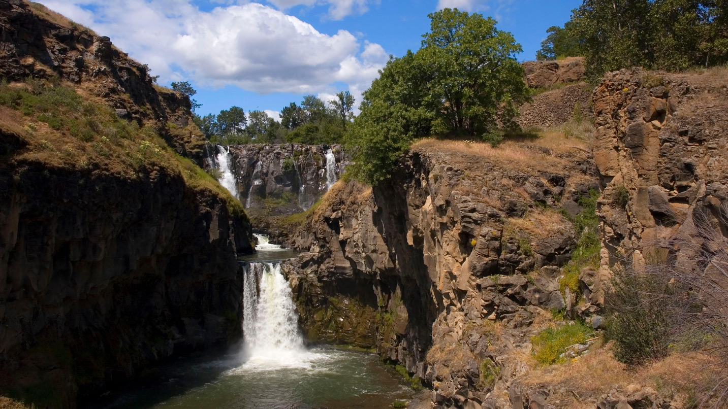
White River Falls
The roaring tumult of waterfalls feels more than a little out of place amid the dry, rolling foothills of White River Falls State Park near Maupin in Central Oregon. Fed by snow from Mount Hood, the White River arrives in the Tygh Valley with a full head of steam and blasts down three waterfalls — White River Falls (75 feet), Celestial Falls (41 feet) and Lower White River Falls (21 feet). A hike of 1 mile round-trip, beginning at the state park trailhead, will bring you to all three falls, and provide memorable views.
Fall Creek Falls
The North Umpqua River canyon could easily be considered the Columbia River Gorge of Southern Oregon. The Rogue-Umpqua Scenic Byway has been called the highway of waterfalls, and 17 different falls dot the landscape around Highway 138 east of Roseburg. Among these, few offer a more enjoyable day-hike than Fall Creek Falls. Following a lush canyon, the cuts through a crevasse in a gigantic boulder before arriving at the misty base of the tiered, 85-foot Fall Creek Falls (temporarily closed due to wildfire damage). The hike is 1.8 miles-round trip and begins at milepost 32.2 on Highway 138.
If You Go:
Always check weather and road conditions before you head out, and make sure to fuel up and carry plenty of water, snacks and your Ten Essentials for hiking since some services and local amenities may be limited. Cell service may also be limited so download any trail maps and GPS routes you might need. It’s also a good idea to check the air quality in the region you’ll be visiting since some communities are feeling the impacts of regional wildfires. Finally, remember to be kind to those you meet along the way, and support local communities whenever possible.