Editor’s note: Never before have we so deeply experienced the effects of a changing planet. This four-part series dives into the effects of climate change on some of Oregon’s destinations, attractions and industries. We also explore the resilience of local communities and the innovations of local leaders determined to keep Oregon one of the greenest places in the world to visit and live.
Part 1: Land | Part 2: Wildfire | Part 3: Water | Part 4: Air
There’s no doubt about it — wildfires are transforming Oregon summers. They impact residents, businesses, communities and beloved institutions like the Oregon Shakespeare Festival in Ashland, which has been forced to pivot and adapt in various ways, like moving to an indoor venue when air quality is poor.
Experts at the Oregon Climate Change Research Institute note that the acreage burned throughout Oregon has increased substantially over the last three decades, and predict that climate change will greatly increase the occurrence and risk of large wildfires over the next 50 years. So what are local leaders doing, and what can we do to help?
Fires Shape Ecosystems
As devastating as wildfires can be, fire is an integral part of forest and grassland ecosystems. Fire clears dead vegetation and creates pockets of habitat for wildlife. Following a fire, many birds, mammals and plants thrive in so-called snag forests, which are populated by the charred husks of trees, and in fact, the seeds of some plants and trees depend on fire to germinate.
Until the last century, landscapes in the West experienced frequent fire as a result of lightning strikes and the actions of Indigenous people, who strategically burned forests and grasslands to promote food plants and habitat for favored game animals.
For most of the 20th century, the U.S. Forest Service’s policy was to quickly suppress every wildfire as soon as it started. This has led trees to grow unnaturally close together, and the unpruned lower limbs of these trees can carry fire up into the canopy. At the same time, climate change is making forests warmer and drier, especially in drought years. This combination is sparking megafires like we’ve seen throughout Oregon in the past several years.
Burns Planned by Experts Can Make Better Forests
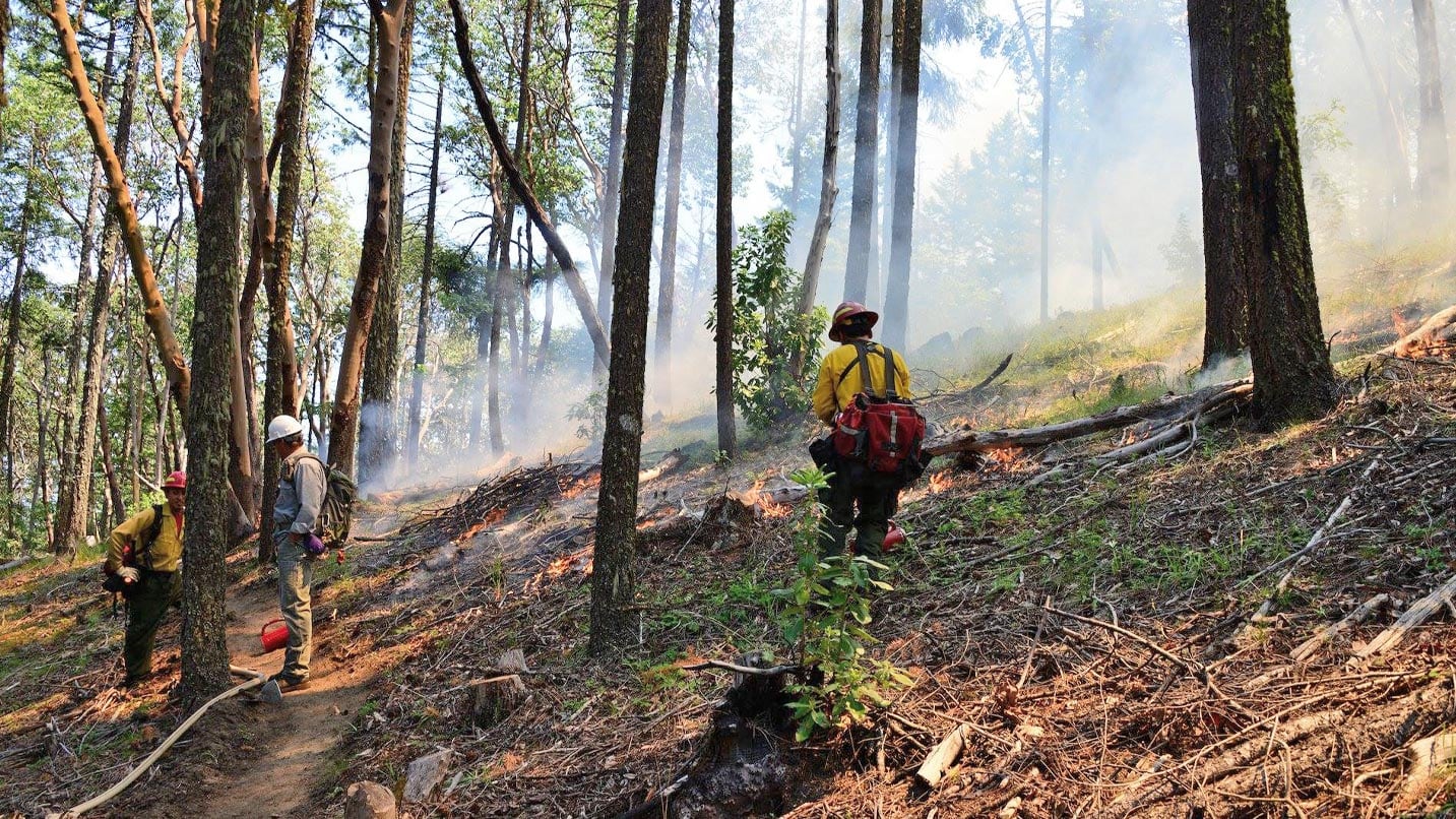
Experts are reconsidering the strategy of suppressing every wildfire. Controlled burning is being increasingly used as a tool to manage forests and grasslands. This practice can help protect forests — in particular large, old trees — from catastrophic fires by reducing fuel loads.
In the Ashland watershed, for example, crews have spent years thinning foliage and burning the vegetation in hundreds of small piles for the ongoing Ashland Forest Resiliency Stewardship Project. It aims to safeguard Ashland’s source of drinking water, preserve old trees and wildlife habitat, and protect popular mountain biking trails and the community from a catastrophic wildfire.
These kinds of strategies — thinnings and prescribed burning — have been conducted by tribes in the West since long before colonization, and still are. Work performed by the Klamath Tribes, for example, minimized damage in an area burned in the 2021 Bootleg Fire.
“Many of the techniques being discussed in numerous academic and professional circles directly derive from [the] tribal cultural way of setting fires,” says David Lewis, a member of the Confederated Tribes of Grand Ronde and an assistant professor of anthropology and Native studies at Oregon State University. Lewis believes agencies can learn from Native stewards how best to wield this powerful tool. “Technology has a place as well, but thinking about our relationship in relation to the forests and prairies is essential to using fire in ways that can help everyone,” he says.
Helping With Wildfire Relief
Many Oregon communities are still recovering from devastating fires in recent years. If you have special memories connected to these places — rafting the Clackamas River, fishing the McKenzie River, hiking the North Umpqua Trail — there are many ways to show your love to local businesses, as well as donate to the many organizations leading ongoing relief efforts in those areas.
Many remember the dramatic Eagle Creek Fire in 2017 in the Columbia River Gorge, which closed more than 100 trails in the area amidst 48,000 acres of land burned. Thanks to community rebuilding efforts and partnerships led by groups like Friends of the Columbia Gorge, nearly all of the impacted trails have reopened. Still, visitors are advised to be extra alert when hiking in burned areas. Falling trees, landslides and debris flows are more likely because of unstable soil due to less vegetation to hold it in place.
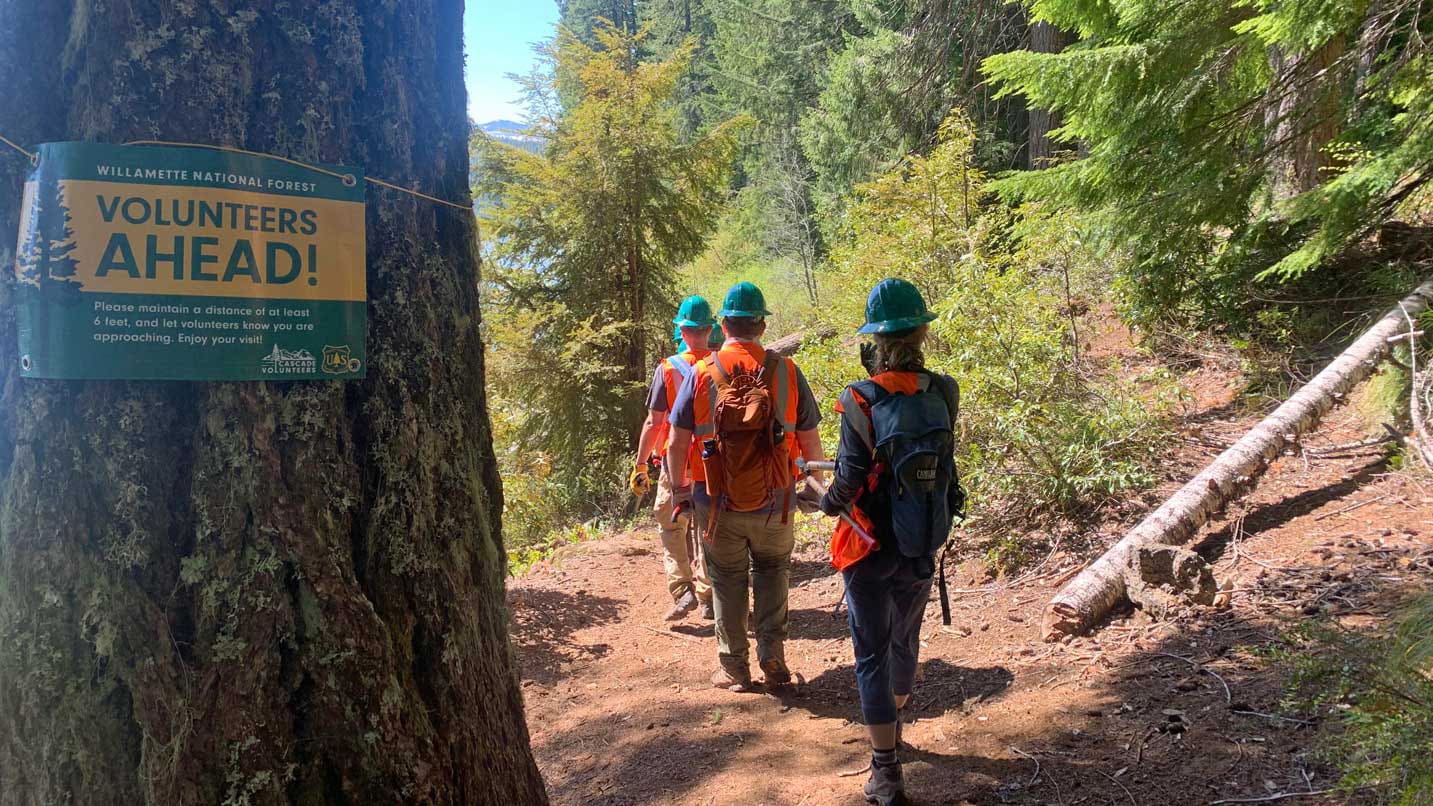
If you feel compelled to help other fire-impacted areas bounce back, consider taking part in a regenerative volunteer project — a term to describe ways that locals or visitors can have a meaningful experience with a natural area and leave that place better than they found it. Often public trails are damaged in wildfires, requiring many hours of painstaking labor to repair by groups like Trailkeepers of Oregon.
For Kieron Wilde, owner of First Nature Tours, regenerative travel involves creating meaningful and transformative experiences while making a positive impact on the environment, economy and communities of Oregon. Visitors can book a sustainable guided experience with his group like a microplastics cleanup, native oak tree planting, trail restoration, forest regeneration or salmon rehabilitation. Wilde sees this model as the future of travel. “I’m hoping this concept can go viral and that we see [organizations] around the country creating regenerative-tourism opportunities,” he says.
If you’d like to help on any other regenerative trail project in Oregon, check out opportunities with other groups like the Oregon Timber Trail Alliance, Trailhead Baker City, the Pacific Crest Trail Association and Go Wild American Adventures.
Traveling With Wildfires in Mind
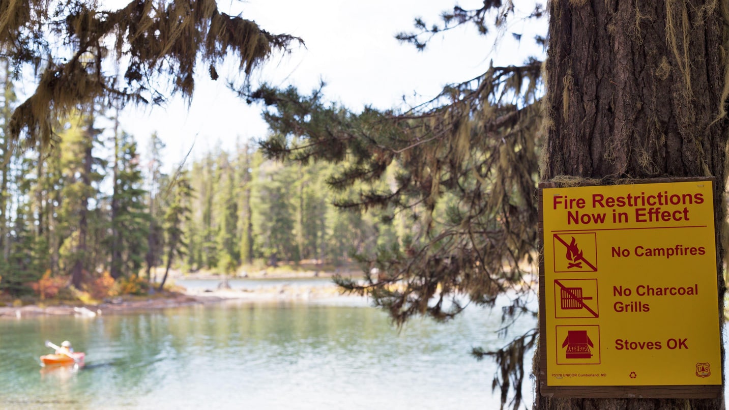
If you’re visiting Oregon in summer and early fall, it’s essential to be aware of fire season and smoke conditions. The Oregon Department of Environmental Quality maintains an Air Quality Index website and app that provides real-time information about air quality across the state.
The Northwest Interagency Coordination Center maintains a Large Fires Map, which provides updated information on major fire incidents, and the Oregon Department of Forestry’s network of regional offices does a good job of keeping the public informed of incidents on state lands. If you’re camping or backpacking, call ahead to your ranger station and park headquarters for conditions.
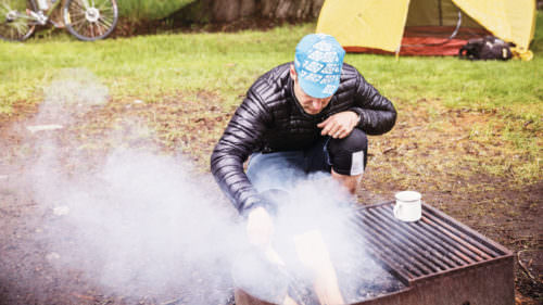
The National Weather Service is a good source for weather conditions, including Red Flag Warnings, where warm temperatures, very low humidity and stronger winds combine to heighten the risk of fire danger. If you’re planning a camping trip during the warm months, be sure to check for public fire restrictions at your destination before you go.
Exploring Areas Affected by Burns
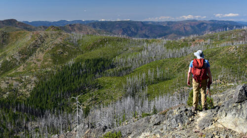
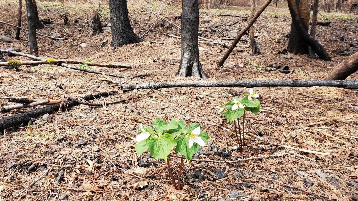
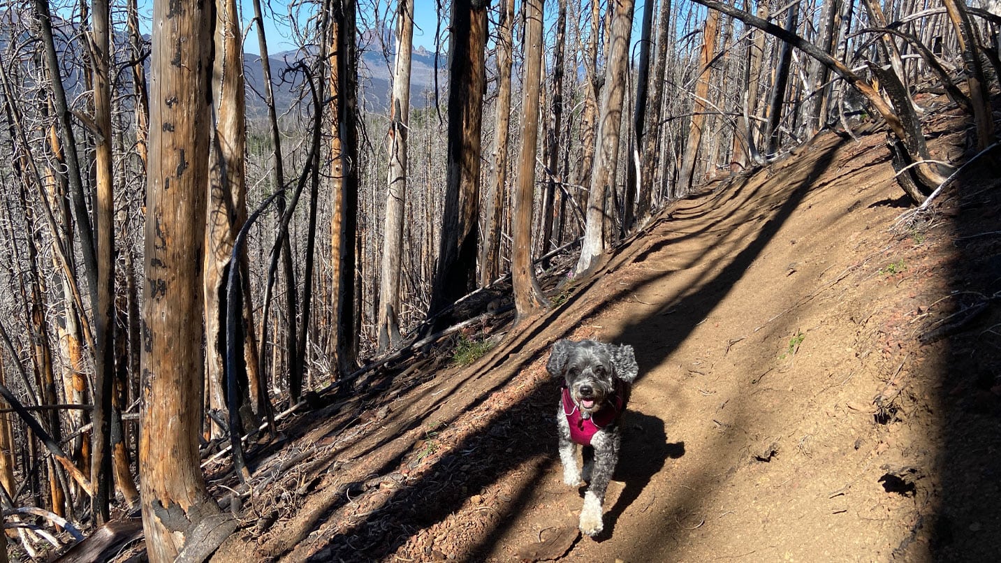
Hiking through burned forests is a good way to appreciate the changes wrought by wildfire, as long as you stay aware of potential dangers. New plants and wildflowers emerge. The drumming of woodpeckers resonates through the opened landscape. Deer and elk browse in the sunny clearings. Once a trail in a burned area reopens, be sure not only to watch for falling trees and branches, but also to stay on the path to avoid trampling new vegetation.
The U.S. Forest Service recommends ways in which you can minimize your exposure to natural hazards:
- Check the weather before you go for the possibility of high winds or storms.
- Turn back if necessary on the trail, especially if the wind picks up.
- Respect all signs and barriers.
- Don’t panic if you get lost; stay on the trail or road and call 911 if you can.
- Sign up for Oregon Emergency Notifications alerts.
To ensure you have a safe trip, also check the Travel Alerts page and more about what you need to know about wildfires in Oregon.
Part 1: Land | Part 2: Wildfire | Part 3: Water | Part 4: Air