As a seasonal park ranger in Oregon. I’m always on the move, staying no more than six months at a time in one location. To make the cross-state drives more enjoyable, I’ve learned the value of the road less traveled — routes that bring much more joy and meaning than just getting from point A to point B.
This summer I’m moving from my winter home near Portland to temporary housing in Merlin, 50 miles from Oregon’s southern border. Crossing the state via Interstate 5 is a four-hour drive if I’m in a hurry, but I’m rarely in a rush to get anywhere. I’m going to take a whole day and treat myself to a mini road trip. I’ll be cranking up the radio, enjoying a sunny day on Oregon’s back roads and numerous Scenic Byways with warm wind in my hair, supporting local businesses and communities along the way, and still making it to my destination by bedtime.
As you go out this summer, whether it’s for work or pleasure, alone or with a travel pod, remember that most of Oregon’s highways have alternative routes that will make the journey part of the adventure. If it’s your first time, I recommend a free paper map and a co-navigator to keep you grounded and safe during your experience. These are some of my favorite options.
Columbia River Gorge
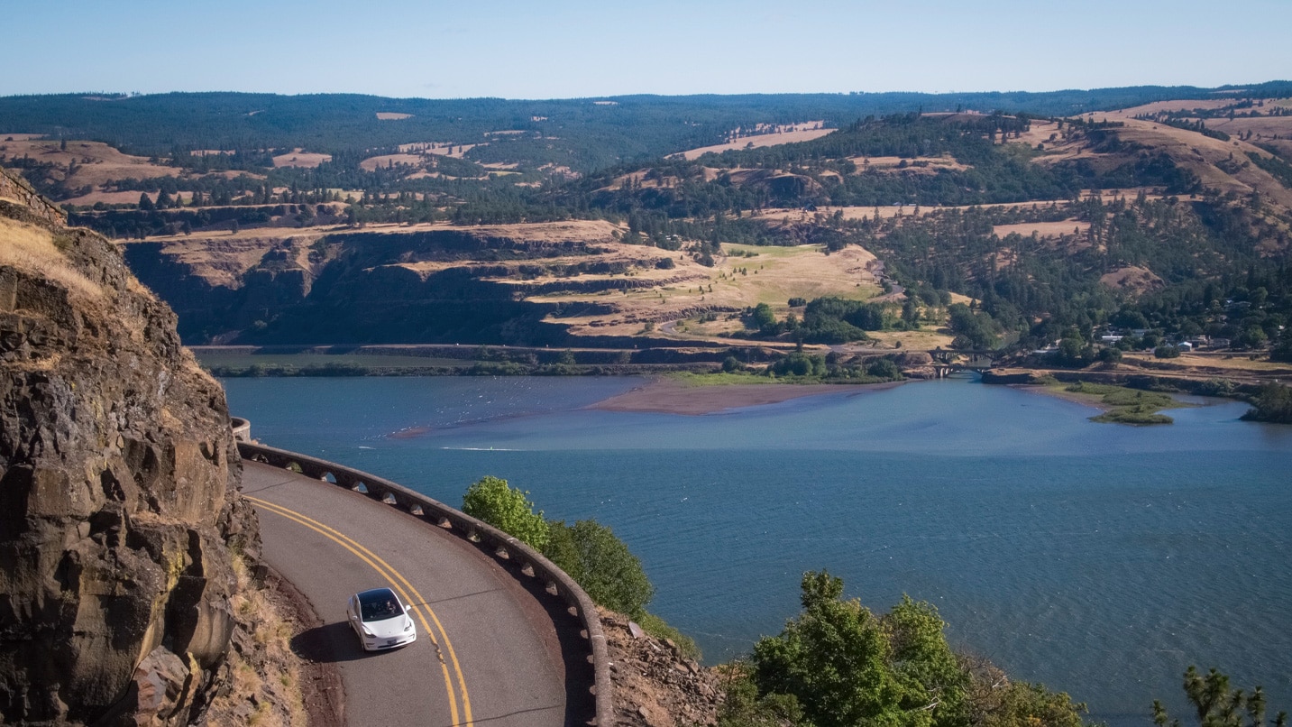
Instead of Interstate 84, Take the Columbia River Highway
Just east of Portland, Interstate 84 is the newer replacement of one of the oldest paved roads in the state. The Columbia River Highway was built in 1916 to give the first car owners in Portland a place to drive, and it is still a fantastic day trip. These tight curves wind along the cliffside and take you to famous viewpoints like Portland Women’s Forum State Scenic Viewpoint and Rowena Crest Overlook. Corbett Country Market has a surprising variety of fresh, healthy snacks for the road. I like to build up an appetite by getting out and hiking part of the Historic Columbia River Highway State Trail. These road segments are closed to motor vehicles and tend to be less crowded than the waterfall trails in the Gorge. If you do visit any of the waterfalls, avoid weekends and holidays for the fewest crowds, and go early in the day.
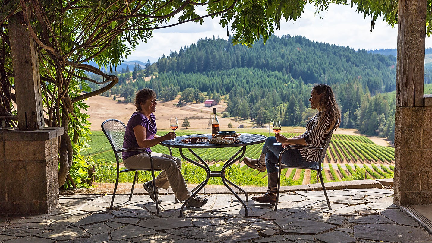
Willamette Valley
Instead of I-5, Take Oregon Route 99 to the Old Territorial Highway
Highway 99 West parallels I-5 and connects to Oregon Route 200, also known as Old Territorial Highway, south of Monroe. This is part of Oregon wine country, sprinkled with vineyards, homesteads, orchards and tasting rooms. I like to pick up a sausage sandwich for the road at the Pepper Tree Sausage House in Albany and eat it while watching the birds at William L. Finley National Wildlife Refuge. I take the back roads at least as far south as Eugene, possibly through Lorane and down to Curtin if it’s a particularly nice day. The road is almost as straight as I-5, but I’ve been known to miss a turn in McMinnville or Cheshire and go halfway to the Coast before correcting my route. Find more amazing eateries along the Mid-Willamette Food Trail, around Corvallis, and the South Willamette Valley Food Trail, around Eugene.
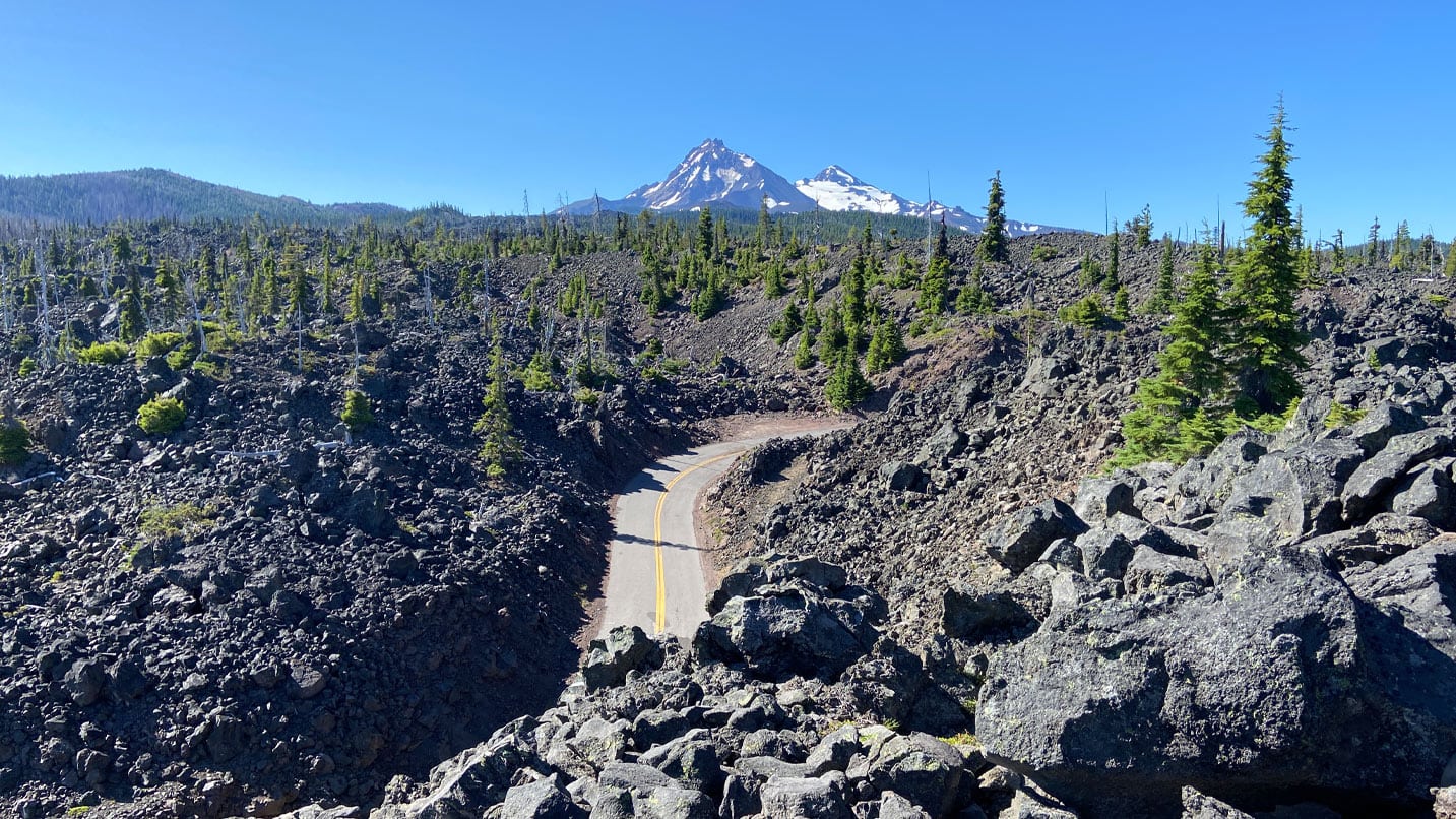
Willamette Valley / Central Oregon
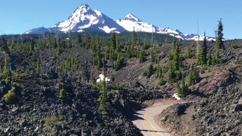
Instead of U.S. Route 20 Santiam Pass, Take Oregon Route 242
McKenzie Pass opens up for a few months each summer and offers a higher-elevation alternative to the Santiam Pass between the Willamette Valley and Central Oregon. Stand on the top of the Cascades and look out across the mountains from Dee Wright Observatory, or hike a segment of the Pacific Crest Trail. Willamette National Forest provides day-use areas every few miles, and Scott Lake is a personal favorite. Twisted Juniper Coffee in Sisters uses real huckleberries in their drinks and pastries, so I usually stop for a milkshake when I take this drive. This road is narrow and not recommended if you are pulling a boat or trailer. (Check your destination for Central Cascades Wilderness permits, required May through September.)
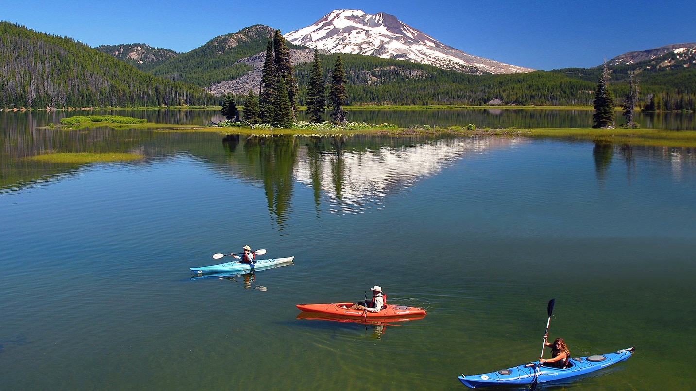
Central Oregon
Instead of U.S. Route 97, Take the Cascade Lakes Scenic Byway
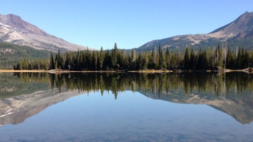
Between Bend and Klamath Falls, Cascade Lakes Scenic Byway is a good alternative to Highway 97 in the summer. The road is wide and relatively straight, but dense lodgepole pine forest can block the view and make it hard to appreciate the outstanding number of lakes on this route. Stop by the Cascade Lakes Welcome Station to check conditions and pick up a map before you leave cell service near Mt. Bachelor. Pull off a bit at Cultus Lake or Wickiup Reservoir to find a nice patch of lakeside and skip a few stones. The farther you get from Bend, the less likely you are to meet locals taking day hikes. That being said, I would never miss eating takeout from Dump City Dumplings beneath the Three Sisters at Dutchman Flat. (Check to see what wilderness permits you’ll need for your destination, required May through September.)
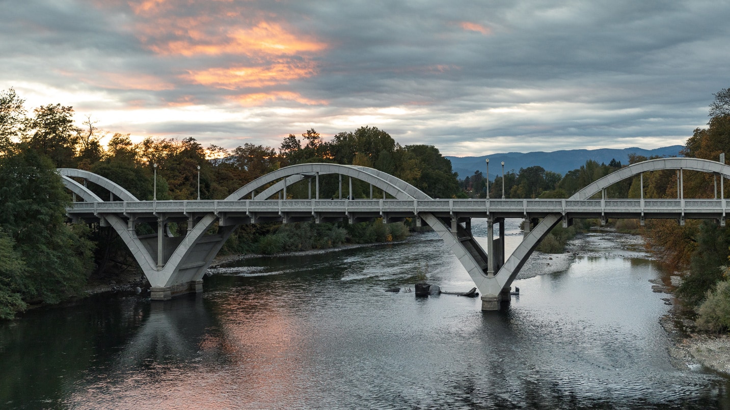
Southern Oregon
Instead of I-5, Take Rogue River Highway
Rogue River Highway uses bridges and underpasses to go over and under to the southern sections of I-5 and becomes Highway 99 again heading south. This meandering route has better views of the river than I-5 and takes you directly through the towns of Gold Hill and Ashland. This is gold-rush country, and while most of the surface deposits are long gone, there’s still gold in the rivers. I’ve mostly given up on recreational gold panning myself, but you might have better luck. I still sometimes scrutinize the pea-gravel riverside at the Rogue River Chamber Office and Visitor Center for stray nuggets. With culinary delights along the Rogue Valley Food Trail as your guide, you won’t go hungry after your adventures.
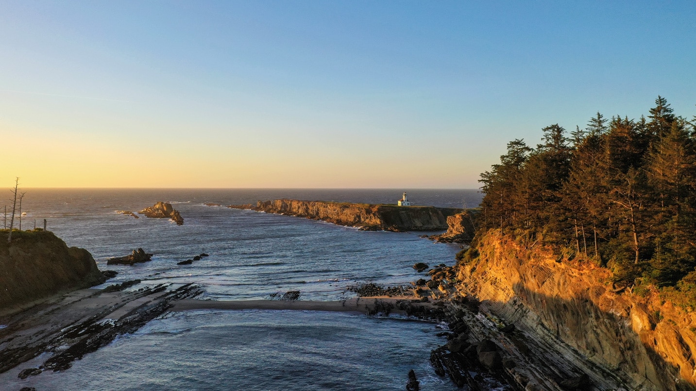
Oregon Coast
Instead of Oregon Coast Highway 101, Take the Charleston to Bandon Tour Route
U.S. Highway 101, which spans all of Oregon’s 363 miles of public coastline, is part of the larger Pacific Coast Scenic Byway. But on the Southern Oregon Coast, I always take any opportunity to drive farther west, even if it’s just a little diversion like Bandon’s Beach Loop Drive or Oceanview Drive in Brookings. A longer example is Seven Devils Road, connecting Coos Bay to Bandon — part of the 41-mile Charleston to Bandon Tour Route. Lots of people visit Shore Acres State Park and Cape Arago State Park, but there’s no need to backtrack to Highway 101 when the beautiful wooded backside of the mountains is less traveled. Pick up a cup of chowder from Miller’s at the Cove on the docks in Charleston and eat it at Bastendorff Beach before heading to the trails at South Slough National Estuarine Research Reserve. If motion sickness is a concern, consider giving this route a pass, as Seven Devils earns its name by not just twisting side to side but dipping up and down as well.
For more inspiration, check out the rest of Oregon’s Scenic Byways. They include most of these routes, along with more trip ideas and roads less traveled.
If You Go:
- Plan ahead to support your public lands by purchasing state and federal recreation passes in advance.
- If parking lots look too busy or keeping 6 feet of physical distance looks unmanageable, keep driving — there’s another spot just around the corner.
- Pack your own disinfectant and wash your hands regularly. Know that services such as restrooms and trash cans may be limited, so plan ahead. Wherever you go, pack out your trash and your pet’s waste, and leave the area cleaner than you found it.
- Getting away from the most popular highway segments will confuse GPS navigation systems that are programmed to find the fastest route, so pack a paper map or download your route and be aware of where the turns are.
- Keep an eye on your gas tank — the stations will be farther apart away from the main highways, and cell service will likely be limited. Always check weather and road conditions before you go, and say hello to those you meet along the way. Find more ways to Take Care Out There.