


Seemingly secret mountains, prairies, rivers and lakes come as a pleasant surprise to the relatively few travelers who venture to Oregon’s most remote corners — the kind of “unplugged” territory where your phone serves best as a pocket-size camera.
Over the years, I’ve driven the state’s quietest and wildest loops, along which it can be easier to find a cowboy bar than a cell-signal bar. And that’s what I love about these analog adventures — the gigantic skies, rolling sagebrush seas, exposed geology and sleepy towns lull you into an easier rhythm.
Do you crave an off-the-grid road trip? Then point the car toward Eastern and Southern Oregon, where blacktop winds for thousands of miles through thick forests, windswept hills and rippled volcanic landscapes.
Here’s a quick guide to four of my most memorable driving routes for away-from-it-all escapes. These four routes merge a few of Oregon’s many designated scenic byways. You’ll find complete turn-by-turn itineraries for all of the state’s scenic drives here.
Gorgeous Views in Hells Canyon
Go for: Wild and Scenic Rivers, deep gorges and snowcapped mountains
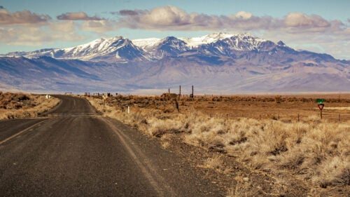
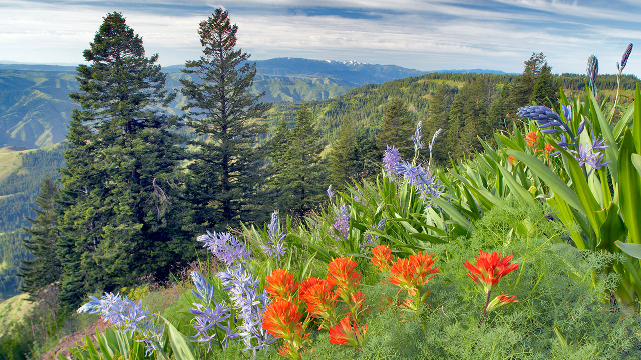
Bring your hiking shoes, a bathing suit and your curiosity for this route. Hells Canyon Scenic Byway’s 208-mile route from La Grande to Baker City loops in a semicircle through Northeastern Oregon. Here you’ll find the continent’s deepest river gorge, a mountain range of 9,000-foot peaks and a handful of federally designated Wild and Scenic rivers. It’s a place defined by rodeos, outdoor recreation and inspired artistry. The scenic byway was just named as one of the top “rustic routes” in the U.S., in a roundup of “America’s best hidden gem road trips.”
From the university town of La Grande, the route passes through fields of mint, turf and barley, and beside the pristine whitewater of the Grande Ronde and Minam rivers, before following the Wallowa River to its source in the deep blue Wallowa Lake. Trails lead through golden grasslands and up valleys of forested, snowcapped peaks. Nearby the town of Joseph attracts creative types to its charmingly rustic setting.
From Joseph the route passes an overlook where visitors can gaze 1 mile down into the Hells Canyon gorge. A short detour leads to the dam where I once began a raft trip descending the rowdy waves and quiet bends of the mighty Snake River. Before you reach the end of the route at Baker City, stop in the funky outdoorsy town of Halfway, which sits in the heart of the remote Pine Valley.
Gateway to the Blue Mountains
Go for: Alpine lakes, cowboy culture and ghost towns
Combine two scenic routes into one lollipop course that departs from the Columbia River and climbs over the Blue Mountains into Baker City.
Ranching and gold put this section of Northeast Oregon on the map. Beginning at the Columbia River, the Blue Mountain Scenic Byway angles southeast, up rolling grasslands and into jagged, pine-shrouded mountains. From there the Elkhorn Drive Scenic Byway loops from mountain ridges into Baker City and the Powder River valley, the heart of Oregon’s cowboy country. Ranchers still move their stock from lowlands to mountains for the summer months, with thousands of elk following the same pattern.
At the center of this route, the old mining town of Granite isn’t quite a ghost town, though it’s getting there, with a population down to roughly 30 residents from its heyday of 5,000. Nearby, the North Fork John Day River begins its long journey to the Columbia.
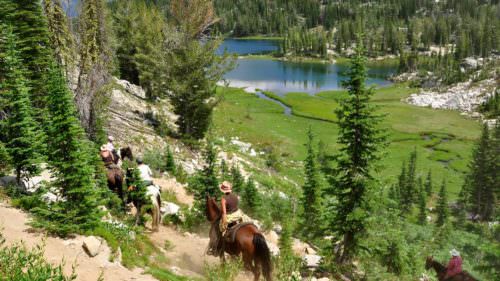
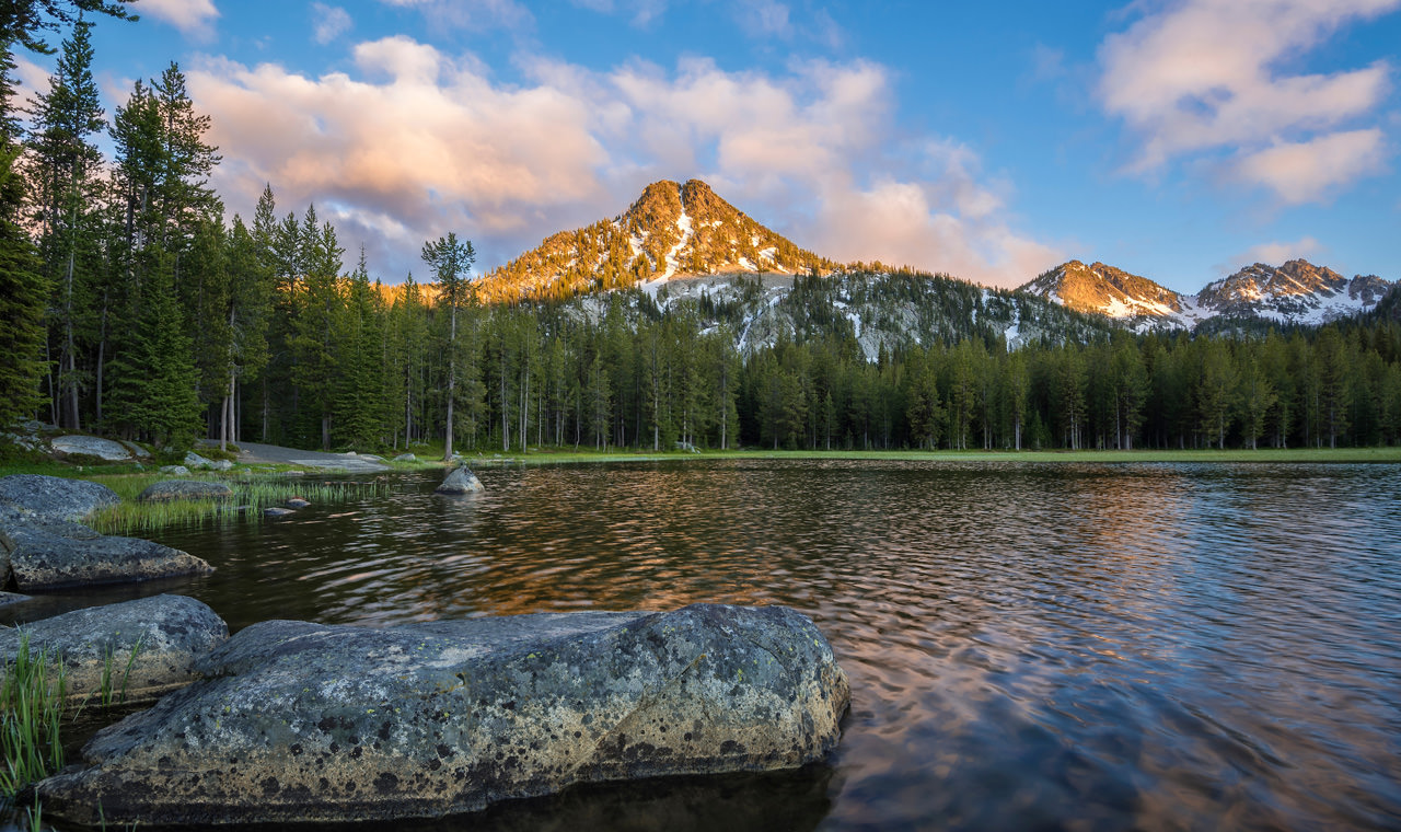
The Elkhorn section stays in the high country, passing by Anthony Lakes Mountain Resort, which sits next to a serene alpine lake in summer. The loop passes through Baker City’s historic downtown, where the mining and ranching legacy lives on in restored hotels, shops and restaurants.
Dramatic Scenery at Steens Mountain
Go for: Volcanic landscapes, towering cliffs and moon-like dry lakes
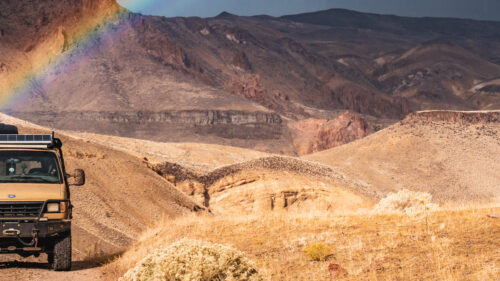
The far-southeastern corner of Oregon holds three distinct, stunning drives that form a meandering route heading south from the town of Burns. If you have the time, I suggest combining them into one trip, as each drive has its own surprises.
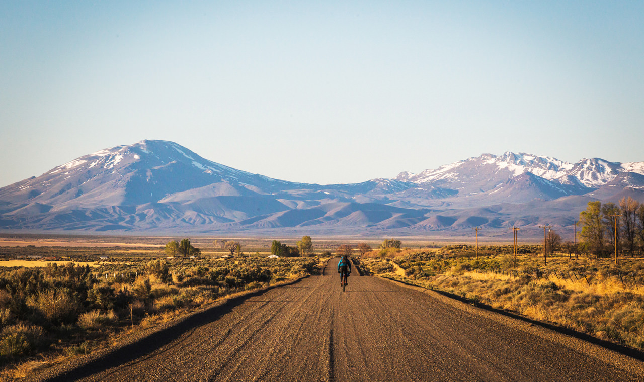
I first read of Steens Mountain and the Alvord Desert in a 1997 issue of National Geographic. The author said he was drawn to “a void on my road map.” The hulking Steens Mountain still looms over the region like a 50-mile-long ship beached on its side, its hull sloping gradually to the west. Its eastern escarpment drops 4,000 feet into the cakey desert.
The High Desert Discovery Scenic Byway provides the quickest path from Burns down the western base of the Steens, passing through the lush Malheur National Wildlife Refuge. From here it travels through the tiny town of Frenchglen with its historic hotel, then onto the high sagebrush steppe. Take an optional detour from Frenchglen that heads 4,000 feet higher to the Steens Mountain rim on the Steens Loop Tour Route, where alpine meadows overlook valleys that glaciers carved out like ice cream scoops.
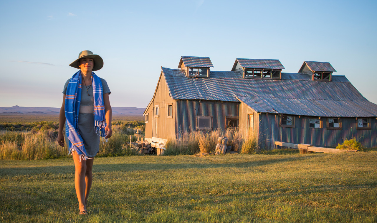
Back in Frenchglen, continue on the High Desert Discovery Scenic Byway to the southern edge of Steens Mountain — and take a quick detour to soak at Alvord Hot Springs, a series of steaming pools where you can also pitch a tent for the night at the on-site campground. (Be sure to call ahead for day-use availability.)
The geology continues on the Diamond Loop Tour Route. Short trails lead into pockets of swirled rock considered some of the country’s most diverse volcanic features.
Ancient History in Oregon’s Outback
Go for: Hot springs, wide-open skies and Old West saloons
Looking at the map, the diagonal line angling southeast from La Pine to the Oregon border offers breathtaking geology and fascinating human history.
Along the 171-mile Oregon Outback Scenic Byway, there are petroglyphs, natural hot springs and a geyser. In a cave in the red-rock island of Fort Rock, researchers found a pair of 9,300-year-old sandals, the oldest known shoes in the world.
As with much of Oregon’s high desert, the Outback region acts as a life-size geologic textbook. If you want to understand faults, drive slowly below the 30-mile-long, 2,500-foot-high Abert Rim, North America’s longest exposed fault scarp. It’s easy to imagine Summer Lake and neighbor Lake Abert, both now dry, having once been connected and filled with ice-age meltwater.
In the cliffs falling off the Winter Rim, you can spot bighorn sheep or track the slender, orange-and-white pronghorn on Hart Mountain National Antelope Refuge’s gentle sage slopes — a worthy detour from the scenic byway.
My favorite stops include the short trails at Fort Rock, the petroglyphs at Picture Rock Pass, the thermal features at Summer Lake Hot Springs, a short walk onto the squishy bed of Lake Abert, the Pioneer Saloon and Restaurant in Paisley, fishing and camping near the Chewaucan River, and marveling at Lakeview’s geyser at the Neon Cowboy Roadhouse + Hot Springs.
If You Go:
From off-the-grid camping to restored grand hotels, you’ll find a wide range of lodging options along these scenic routes. Once you’ve chosen your route, search here for the perfect places to stay.
Roads in more remote corners of the state often experience seasonal closures, so check your route on TripCheck before heading out. Steens Mountain Loop Road and portions of Elkhorn Drive, Blue Mountain and Hells Canyon scenic byways may close in winter due to snowfall. Whenever you go, don’t only rely on your phone’s GPS — bring a print map for when you venture beyond the reaches of cell towers.
For more detailed information about these and other scenic drives, order a free copy of the official Oregon Scenic Byways driving guide or view it online here.