Deep in its forests, stretched across high-desert plains and hugging the dramatic coastline, Oregon’s long-distance trails captivate adventurers from across the state and around the country. Hikers, cyclists and horseback riders connect with the natural world in an intimate, slow-paced way that comes from traveling long distances without a vehicle.
To some these trails are the ultimate goal, a pie-in-the-sky dream should life ever hand them a few free months. But even if an end-to-end journey isn’t in the cards, you can still do a smaller portion of the state’s most epic trails.
“It’s something that you have to plan for and work for to really make it a reality,” says Gabriel Amadeus Tiller, founder and former executive director of the Oregon Timber Trail Alliance. “Even if you’re doing it as a section, it really feels like you’re part of it.”
Here are some great places to begin and helpful tips for biting off a chunk of Oregon’s longest trails.
Know the Major Trails
Before you go, be sure to understand where you’ll need a permit or campsite reservation for each destination. You won’t need a wilderness permit for the segments mentioned here except for one on the Oregon Timber Trail in the Central Cascades at certain times of the year.
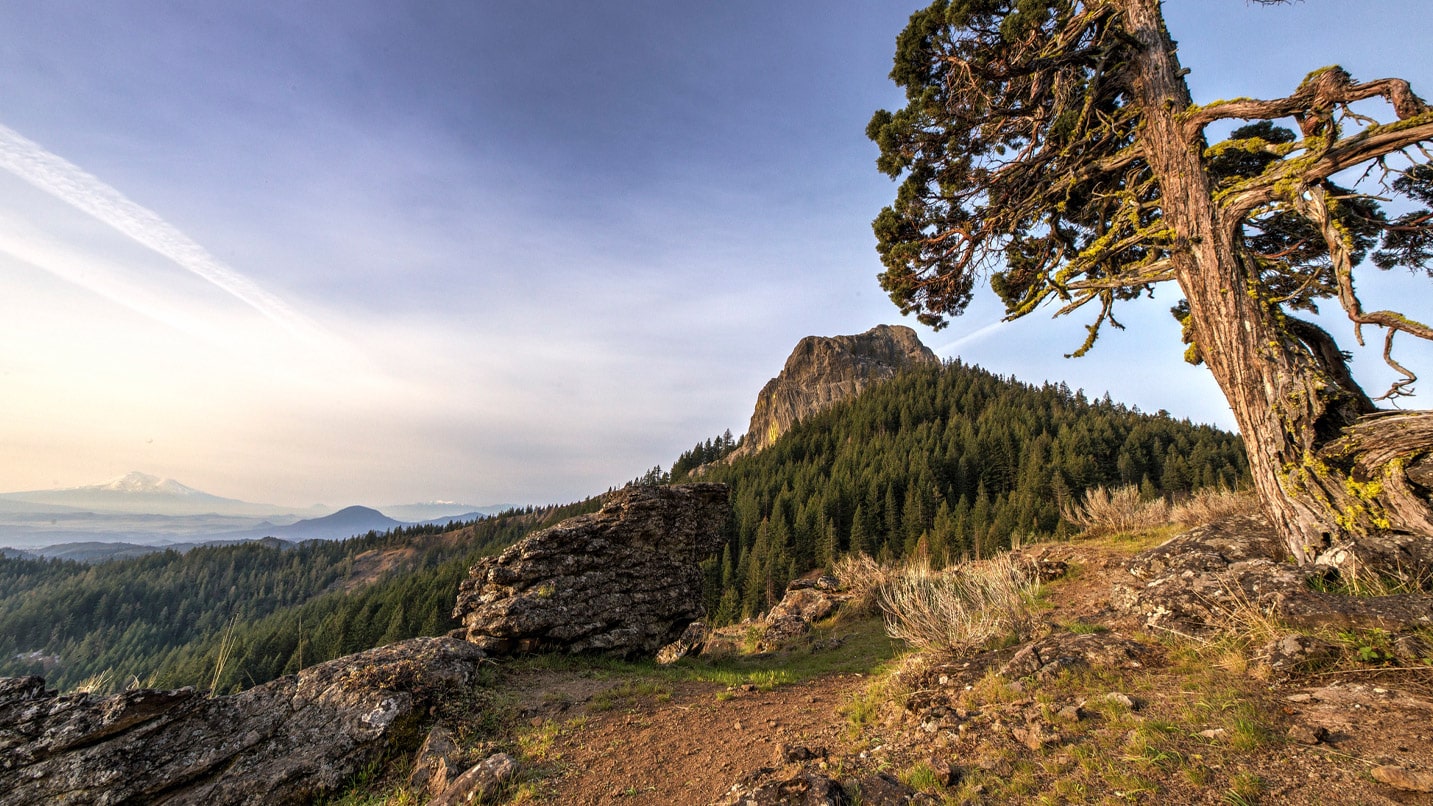
Pacific Crest Trail
Headed from North to Central America on an epic journey? Even if you’re not, the famous Pacific Crest Trail — a thru-hiking trail that, in its entirety, stretches more than 2,000 miles from Canada to Mexico — is probably already on your radar. Consider taking on a segment of Oregon’s 455-mile portion of this trail. The 24-mile out-and-back section between Green Springs Summit and Pilot Rock in Southern Oregon takes hikers through the spectacular Cascade-Siskiyou National Monument, a hot spot for biodiversity including more than 200 species of birds. Stop at one of the national monument’s top highlights: Pilot Rock, a craggy basalt outcrop that is a remnant of a feeder vent from an eroded volcano. Reached by a side trail, it has long been a beacon for travelers crossing Siskiyou Pass between Oregon and California.
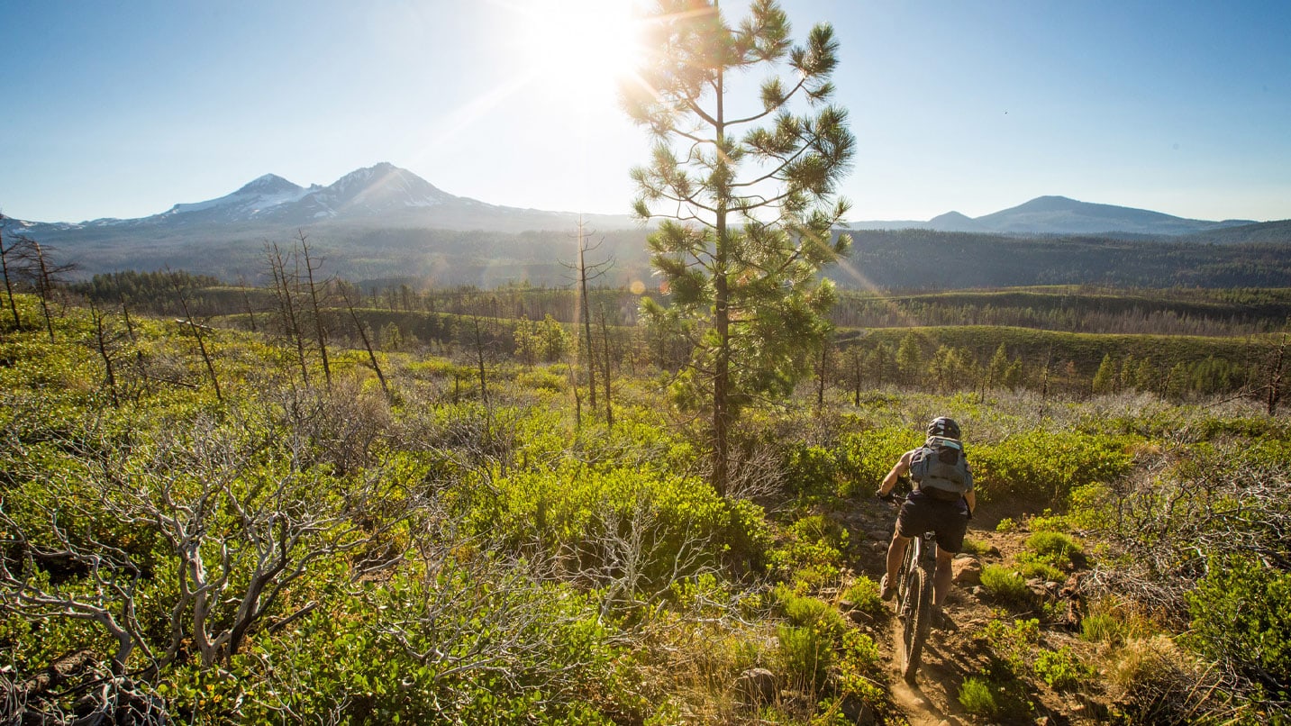
Oregon Timber Trail
With sections that are perfect for mountain bikers as well as hikers and horseback riders, the Oregon Timber Trail features forests galore on a 670-mile span from north to south in the center of the state. Though there are a number of ways to get a taste of this epic trail, the Deschutes Tier is often considered the easiest section. Meandering through the volcanic eastern flank of the Cascade Range, this 113-mile stretch gains 8,000 feet in elevation and is expected to take three to six days for mountain bikers to complete. If you visit this section of the trail between Jun 15 and Oct. 15, keep in mind that you will need to secure a wilderness permit. A number of shorter segments between 20 and 50 miles long in Southern Oregon’s Fremont Tier can be tackled in a day or two.
Oregon Coast Trail
For those who prefer an ocean view, the Oregon Coast Trail leads hikers on roughly 425 miles along the breathtaking coastline on Oregon’s western edge. On the South Coast, try section eight, which connects Bandon to Humbug Mountain. Best done with a shuttle, this 40-mile segment offers hikers a mix of beach walking and visits to small coastal towns. The trail starts at the Coquille River Bridge just north of Bandon, a charming town known for its iconic sea stacks, fresh seafood and a public art trail — so keep your camera handy. The Coquille River Lighthouse is worth visiting at the mouth of the Coquille River; then admire the rugged coastline around Port Orford to Humbug Mountain State Park. Never turn your back on the ocean, and heed signs for campgrounds and water sources, as well as safety information.
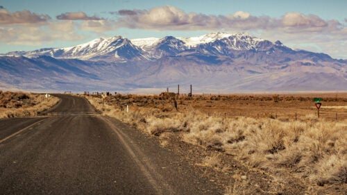
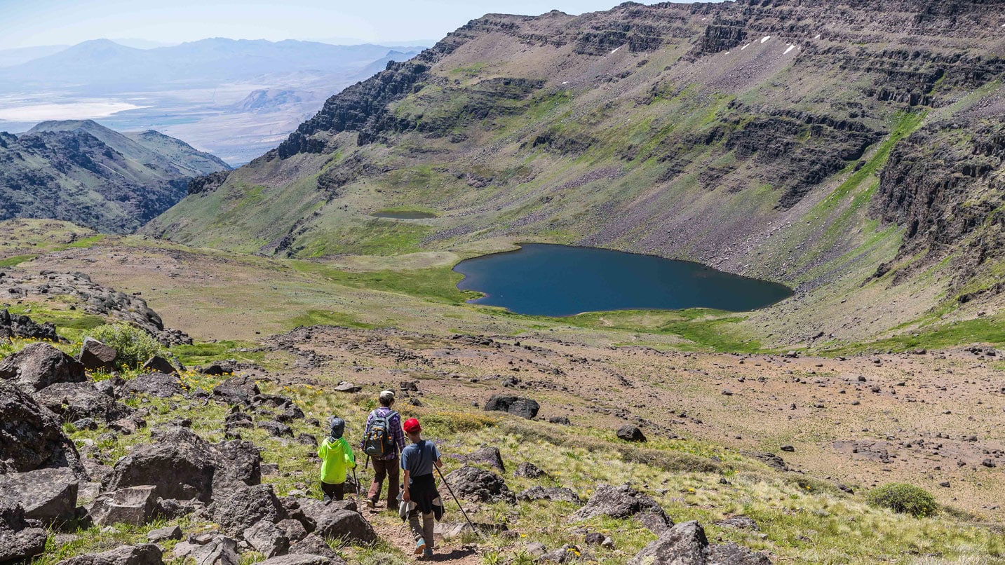
Oregon Desert Trail
If deserts appeal more than ocean views, tackle the Oregon Desert Trail, a 750-mile, W-shaped path through the arid landscape of Eastern Oregon. The Steens Loop section of the Oregon Desert Trail is a special segment because it takes hikers to the top of Steens Mountain, a 50-mile-long mountain in the southeast corner of the state. The 21-mile trail is considered difficult, as it gains 4,000 feet in elevation, but the stunning views are well worth the effort. The trail meanders through Big Indian Gorge and Little Blitzen Gorge, two valleys carved by ancient glaciers that offer a peek into the rugged landscape of Oregon’s desert. Snow on the mountaintop lasts until June and July most years, so late summer is the best time to go.
How to Choose Your Perfect Trail
Each of these 100-plus-mile trails have websites that are full of pertinent information for those hoping to go. This includes maps, suggestions for spots to camp, whether fires are allowed and the best time of year to go.
For example, the Oregon Coast Trail information page, run by Oregon State Parks, alerts hikers to the fact that about 10% of the route (roughly 40 miles in total) is disconnected, unsafe or inaccessible during certain seasons.
Covering such a vast distance, these trails tend to vary drastically in difficulty, so it’s a good idea to do some digging into which section best fits your skill level. The Oregon Timber Trail, which is broken into four geographical tiers, has pages dedicated to day rides and multiday loops.
The Oregon Desert Trail, too, provides suggestions for shorter trips, GPS data and details on where to find one of the most important desert resources: water.
There are a number of resources for finding day hikes on the Pacific Crest Trail.
Stay Safe and Plan for Options on the Trail
Even after mountain biking for 25 years, Tiller says he still has trouble planning his rides.
“I still probably overestimate how far I can ride 90% of the time,” he says. That’s why he advises against a rigid itinerary that perfectly maps out how far you’ll travel and, if opting for a multiday excursion, where you’ll camp along the way.
“Have a bunch of options in case things don’t go as quickly or as efficiently as you planned,” he says. “I think it’s good to say, ‘This is our camp goal, but here’s Plan B, Plan C and Plan D.’”
That flexibility, Tiller says, also allows for wondrous surprises.
“Maybe you find a sweet swimming hole and want to lay around for the day,” he says. “That’s what’s really cool about this. It’s not an organized event; there’s no one way to do it or experience it, so feel comfortable taking it at your own pace.”
If you’re planning a route that requires a shuttle, you’ll have less flexibility with your planning. Research which recreation pass you’ll need for the area you’re going, and always carry a printed map or download digital maps as you can’t rely on cell service in remote areas.
Wherever you choose to adventure, check road and weather conditions before leaving. Carry your Ten Essentials, pack out everything you bring in, stay on designated trails and do your part to prevent human-caused wildfires.