I didn’t even know how possible it was for me. Will my bad hip and knee hold up? What is the best route? Which direction would be most scenic? What gear do I need? Honestly, the answers on the internet are slim to none.
For the last couple years, I have wanted to complete the Three Sisters circumnavigation. The trail is legendary among backpackers, just as the namesake mountains are iconic in Central Oregon. Finally my dad and I were able to schedule the trip for summer 2018.
We originally planned on taking four days and three nights to complete the loop, but we ended up finishing it in three days and two nights. Each day, we couldn’t stop wondering what was around every corner, so we kept walking. There are many ways to complete this route, including different entrances or exit points and clockwise or counterclockwise routes. The loop is about 47 miles, so our days were divided into about 14 miles, 17 miles and 16 miles — long distances with heavy packs!
Hopefully my trip into the Three Sisters Wilderness will inspire you to tackle a similar trip, with extra preparation. But I won’t give away too many details… this is an area that is hard to describe, and you just need to see for yourself.
The route
We started and ended at the Pole Creek Trailhead for several reasons. We wanted to divide the Pole Creek burn area of the route into two half days instead of one long day. The Pole Creek Trailhead also has the shortest entrance/exit point, making the route roughly 47 miles and the out-and-back section only about 2 miles.
Our chosen route was clockwise, heading south from Pole Creek to Moraine Lake on the Green Lakes Trail connecting via the Moraine Lake Trail and the LeConte Crater Trail. From there, we would then connect with the Pacific Crest Trail and head north towards South Matthieu Lake, then connect on the Scott Pass Trail back to the Green Lakes Trail to Pole Creek.
Day 1
14 miles
It was an early start. After a quick breakfast stop at Angeline’s in Sisters, we were off to the Pole Creek Trailhead.
At the time, self-issued wilderness permits were available at the trailhead; they are required for both day use and overnight stays. However, a new permit system will likely be enacted in 2020, regulating access to some of the most popular areas.


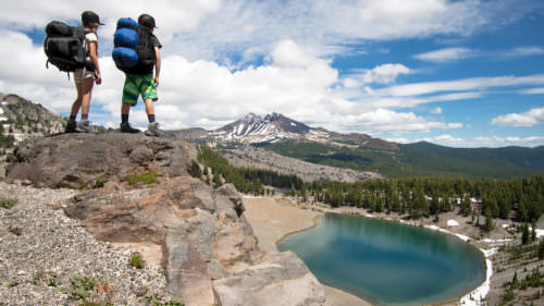
Being middle of the summer with lot of miles through the burn area, it could get really hot with no shade and limited water. The predicted temperature of the day was going to be around 90°F. We saw very few people on this section of the trail until we got to the popular Green Lakes area. It was a beautiful afternoon, so we stopped for a late lunch at one of the smaller lakes in the back and had a nice nap in the sun with no other people around.
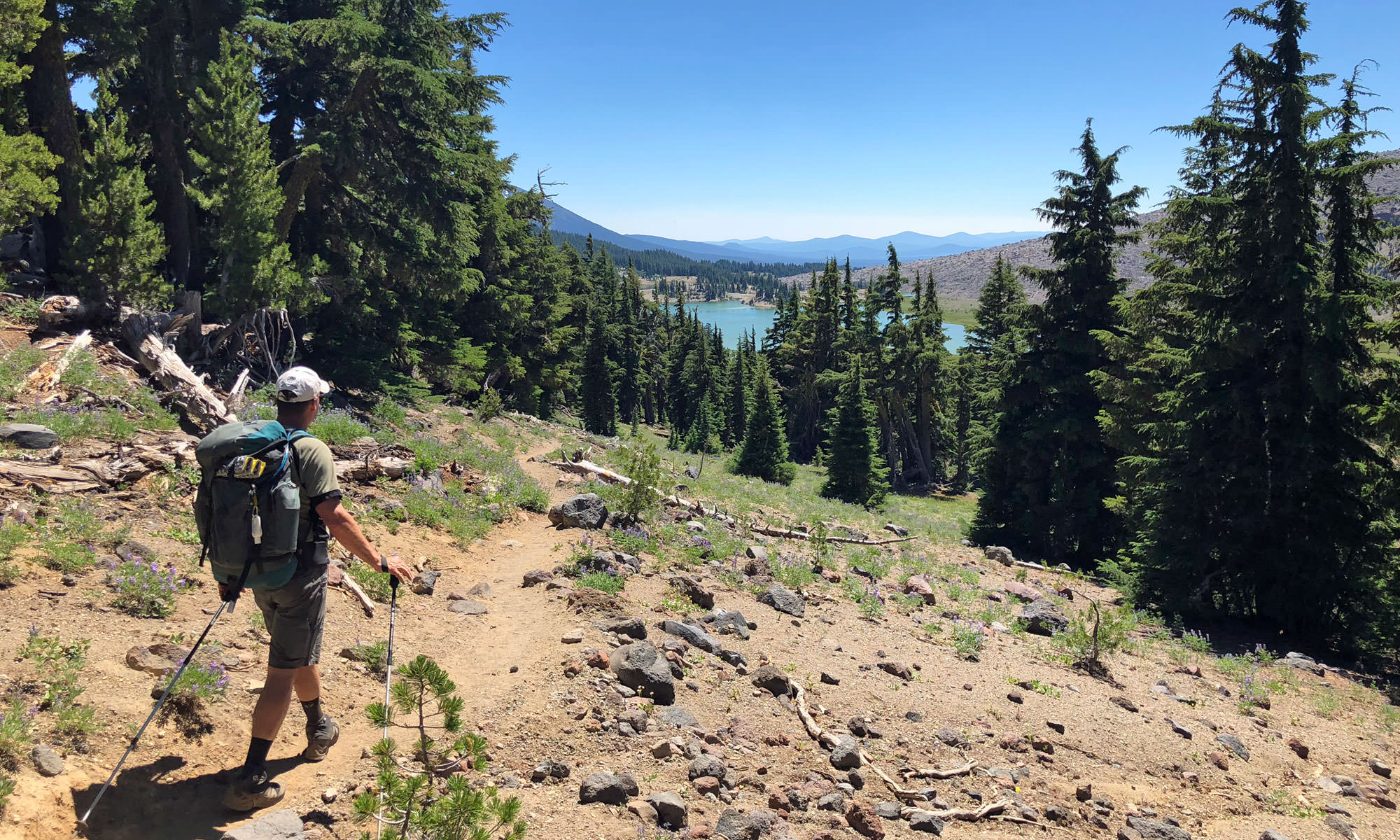
As soon as we continued on down the trail to the main area where the Green Lake Trail meets with the first major lake, there were probably, easily, 20+ people in sight. We hiked until we met the Moraine Lake Trail and lost the crowds. We set up camp in a designated site with a view of Broken Top to our right and South Sister to our left and Moraine Lake just a few hundred yards away. It was perfect.

Day 2
17 miles
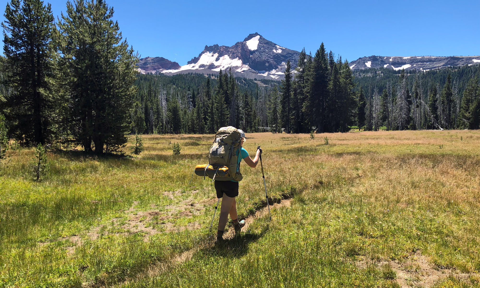
We were up with the sun. Then it was time to head east on the Moraine Lake trail, connecting to the LeConte Crater trail and finally onto the Pacific Crest Trail. I was particularly excited about connecting onto the PCT to see all the thru hikers.

Since we were traveling in the same direction as the thru hikers, I wasn’t sure if we were really going to see that many — but I was wrong. So many blew past us like we weren’t even moving. It makes sense, since at this point in their journey they have things very well-dialed and even more distance to cover. I noticed their packs were much smaller than ours. Most of them used Sawyer water filters and would just drink their water at the source, taking a few big gulps before moving along. It was really inspiring to be on this section of the trail and witness these long-haul trekkers blazing through.


Originally we expected to camp somewhere around Reese Lake or down into the Linton Spring meadow. We ended up hiking so quickly that we had lunch at Reese and weren’t ready to call it a day. This is where we realized that we could shorten our four-day trip down to three days.
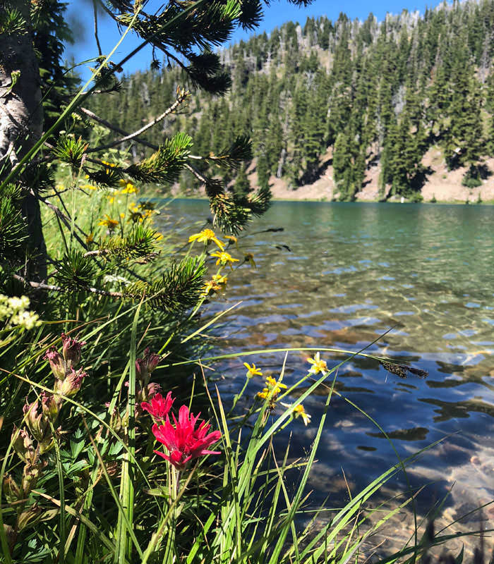
So we hiked until dinnertime and soon found ourselves approaching the Obsidian Limited Entry Area, a special landscape featuring young lava flows, obsidian cliffs and a number of lakes and streams, as well as the stunning Obsidian Falls. Sadly we didn’t have the required permit for Obsidian Limited Entry Area, meaning we had to continue on to the Sawyer Bar.
There is no water in the Sawyer Bar area (although maps may have you thinking otherwise), so we made sure we filled up with fresh spring water in the Obsidian area. The Sawyer Bar is a dried up river bed that has virtually unobstructed views of North Sister.

Day 3
16 miles
Our final day! We woke up before the sun this day, knowing we had our final stretch through a lot of the Pole Creek burn area. The maps show that there are creeks, but it being August and a low snow year, coupled with our experiences so far on the trail, we knew we had to approach that area with as much water in our packs and ideally as early in the day as possible.

While camping at the Sawyer Bar was beautiful, there was no water source. Running out of water, we had to hike an unknown distance in hopes of replenishing our supply. Opie Dilldock Pass was a bit of a climb, but luckily it was early and chilly, so we weren’t too thirsty yet.


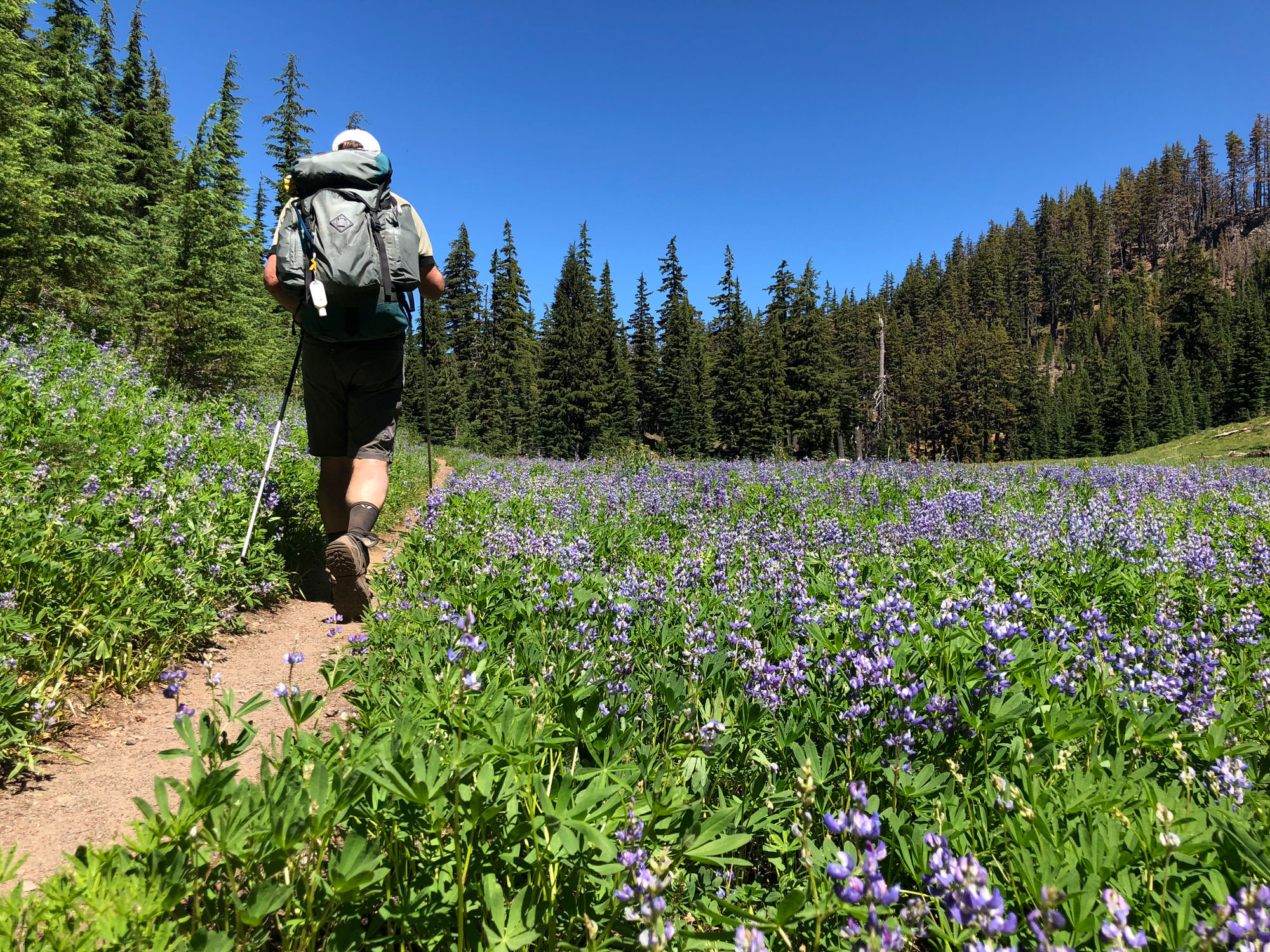
Our map didn’t show that just past Opie Dilldock, there is another spring. There were lots of PCT hikers camped out here and, again, beautiful mountain views and lush greenery with wildflowers everywhere. This was the spot. We filled our tanks and continued down the trail.

Later we made a quick pit stop at South Matthieu Lake, the last water source on our journey. Our packs were heavy. Our shoulders, knees and backs were tired. But this was the final push, the last of the shade, the final long haul. And that it was.

It was about noon when we made it through the green forested area and into the burn area. The charcoaled trees added to the intensified heat of the day, which was nearing 100°F. The dirt was no longer dirt, rather, it was more like a sand. Everything was hot. At this point, I was very much mentally and physically done with the hike. Part of me didn’t want it to end, but I was not really enjoying the pain in my body paired with the unbearable heat.

It finally ended though. We made it back to our car, covered in silty dirt and salt… and really, really big smiles. We had done it. Years and years of dreaming about this trek, we did it. And it was so much more than I had even imagined.
We woke up every day with the sun and put up a tent as the sun was setting. We got REALLY dirty, a little bit sunburned and a couple mosquito bites. Most of all, we soaked up some incredible views that we have loved for many years, but in entirely new perspectives. This area is one not to miss, and if you have the opportunity, explore it over and over.

If You Go
The Three Sisters Wilderness Area covers 281,190 total acres, making it Oregon’s second largest wilderness areas as well as one of the most popular. Avoid summer weekends if you’re averse to crowds. Approximately 260 miles of trail are marked in the wilderness, including 40 miles of the Pacific Crest National Scenic Trail.
Wilderness permits are required for both day use and overnight stays from Memorial Day weekend through October. Currently free permits are self-issued at the trailhead, however due to heavy use, the Three Sisters Wilderness Area will likely incorporate a permit quota system in 2020.
Motorized and mechanical equipment (including bicycles and drones) are prohibited in the wilderness. Groups must be less than 12 people. Build campfires at least 100 feet away from water. For more details visit the Forest Service website.
Before setting out, review your route on TripCheck.com, which will alert you of current road conditions and potential closures. Also be vigilant about wildfires in Oregon; you can check the Northwest Interagency Coordination Center web page to see if the area is affected by fires. Always be prepared by packing layers, carrying an emergency roadside kit, and bringing paper road and trail maps. When hitting the trails, tread lightly and aim to leave no trace — take only pictures and leave only footprints.

Gear
- 1 t-shirt
- 1 long shirt
- 1 pair of shorts
- 1 pair of tights
- 3 pairs of hiking socks
- Lightweight sleeping bag
- Lightweight sleeping pad
- Lightweight 2P tent
- Jetboil + extra fuel
- Hat
- Sunscreen
- Sunglasses
- Trekking poles
- Hiking shoes
- Trail map
- Water filtration
- Gaiters
Food
- Bars
- Trail mix
- Dehydrated meals
Wish I had
- Permit to camp in Obsidian Limited Entry Area
- A smaller compact camera instead of just my mobile phone