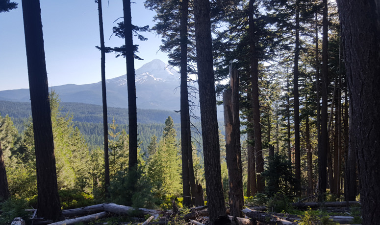
Photogenic and majestic, Mt. Hood is one of the iconic spots (and images) in Oregon. In the mountain-biking world, Surveyors Ridge occupies a similar status – along with the likes of the NUT and the McKenzie River Trail, it’s one of the routes that define single-track riding in the state. And for good reason: besides all the goodies you’d expect from an epic trail itself, it gives you some of the most fantastic views of Mt. Hood you can find – you’ll see the peak from angles most people will never experience.
The trail is like an all-you-can-eat buffet of your favorite riding: lung-busting climbs, rolling traverses through alpine meadows full of wildflowers, and a rocket descent down to the finish that will test your mettle. The highlight, though, is the unparalleled views of the back side of Mt. Hood.
You can do Surveyors Ridge as a one-way or out-and-back, but we’ve set it up as a loop for you, incorporating the Dog River Trail too. To get started, park your vehicle at the Oak Ridge trailhead just off Smullin Dr. on the east side of Highway 35 near Parkdale. You’ll begin with an easy warm-up spin, heading south on the highway toward the Dog River trailhead. Highway 35 has generally decent shoulders, and this is a regularly trafficked stretch for road bikes, too, so motorists are used to seeing riders.
Once you hit the Dog River Trail – just over 4 miles up the road, where it curves west – you get an easy break-in period… right until you hit the switchbacks. Inhale plenty of that high-mountain, forest-scented air; you won’t really have much choice, so enjoy it. But the terrain gives you a great preview of the rest of your ride: after the trail levels out a bit and the climb becomes a bit more Zen, you plunge deep into the forest, with lush ferns and scattered flowers on the forest floor and towering Douglas fir trees rising to the sky all around you.
Find your rhythm and tune in to your surroundings. The sense of splendid isolation is exhilarating, and you’ll start to feel that endorphin high. And that’s a good thing, because you’re not close to being done working. Cross a small bridge over the Dog River, and then set to work earning the descent you’re going to get later on. Between miles 6 and 10, pick up 1,600 feet, at grades that are regularly 10-percent-plus, and occasionally hit 20 percent and more. Stay strong, because about the time you think your legs are going to explode, here comes a pleasant descent through forest that’s thick with firs and pines, letting you catch back up to yourself like a mid-morning coffee. As you tackle one final upward push, be on the lookout for people riding the trail the other way – if they’re coming, they’ll be coming fast.
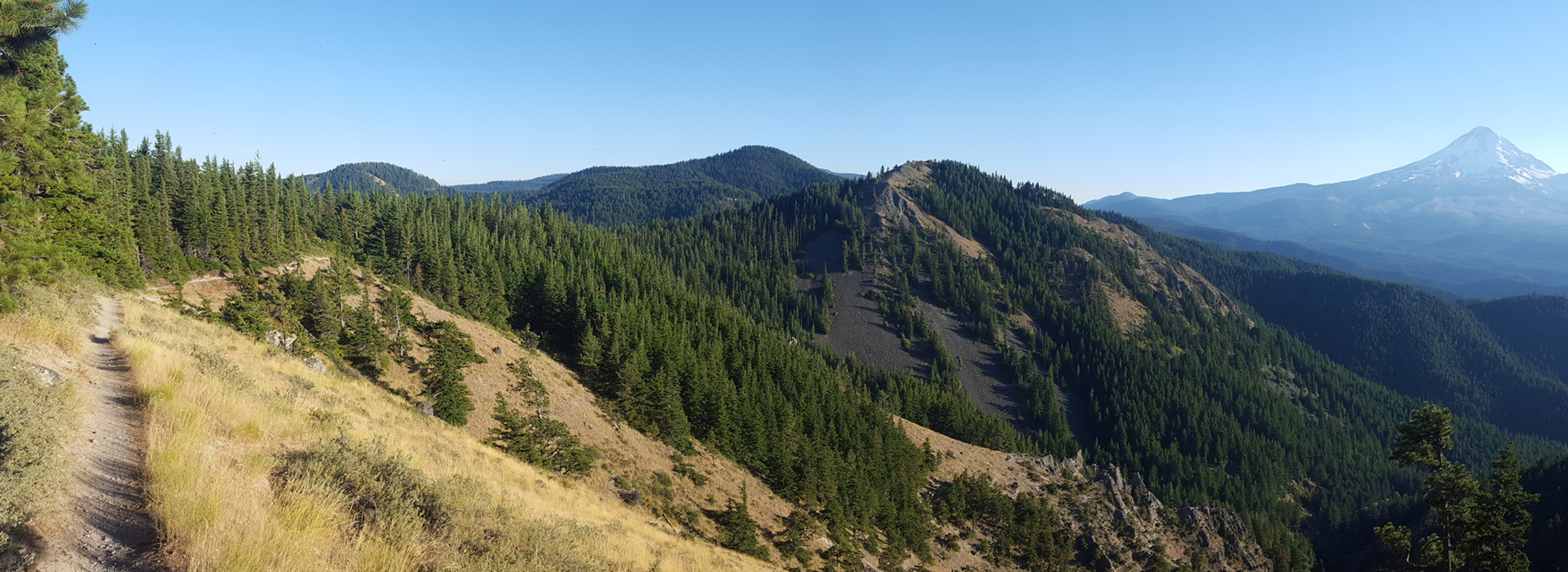
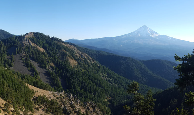
The end of the Dog River climb brings you to the Surveyors Ridge trail. After a short segment of Road 1720, use the Super Connector trail to reach the ridgelineSurveyors is named for, and get ready to be wowed. The trail dips, swoops and rises like the open ocean in a storm, and be sure not to miss opportunities to stop and smell the wildflowers – and get that frame-worthy shot of Mt. Hood bracketed by massive timber. At the crest of a short climb at mile 18.5, take a break to wander out to an old fire lookout; from here you can often see the volcanic lineup of Cascade Range peaks stringing north on the Washington side of the Columbia River.
OK, time to change riding modes: set your dial to DzNerves of Steel.dz Go for the gusto on a drop down and across jagged basalt; you’re going to be tested here, and so will your rims. While you’re holding on for dear life, you need to also pay attention so you don’t miss the left turn onto the Oak Ridge descent; this is actually an opportune time to take a little break to let your hands and arms rest, and your brakes to cool –because it’s just about to get even better. If you love – really love – descending, get ready for a new romance. This brief but heart-throbbing drop will either have you laughing crazily, or screaming like a little kid on a roller-coaster. Enjoy the switchbacks, which were blasted out of the hillside with dynamite. And if you’re really in the zone, see if you can make it all the way to the bottom without putting a foot down. Most can’t.
Once you survive the plunge you get a little dessert, in the form of a stretch that serpentines through the valley floor before you return to your car.
Time to take a breath, take stock… that was one stupendous ride. Do you even remember the views of Mt. Hood?