


One of the joys of Southern Oregon is the seemingly unending lush, shady forests and clean, tumbling water. While I was writing my guidebook about waterfall hikes in Oregon, I canvassed the state a few times and found much to love along the Rogue and Umpqua rivers. With hikes filled with cascades and fewer hikers to encounter on the trails, I found it was tough to beat the chain of waterfalls east of Roseburg along these two rivers. Here are some of my favorites.
Cascades Among Cliffs and Swimming Holes on the North Umpqua
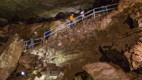
For waterfall hunters, a pilgrimage to the cascade-rich North Umpqua River area is an absolute must. You’ll still see the scars of wildfires in this region, as it was heavily impacted by the Archie Creek Fire in 2020. Be sure to respect any posted closures that remain — and to steer clear of any downed logs along the path. As you walk through the waterfall trails, many of which have now reopened and are healing from the event, take in the natural cycle and beauty of the regrowth
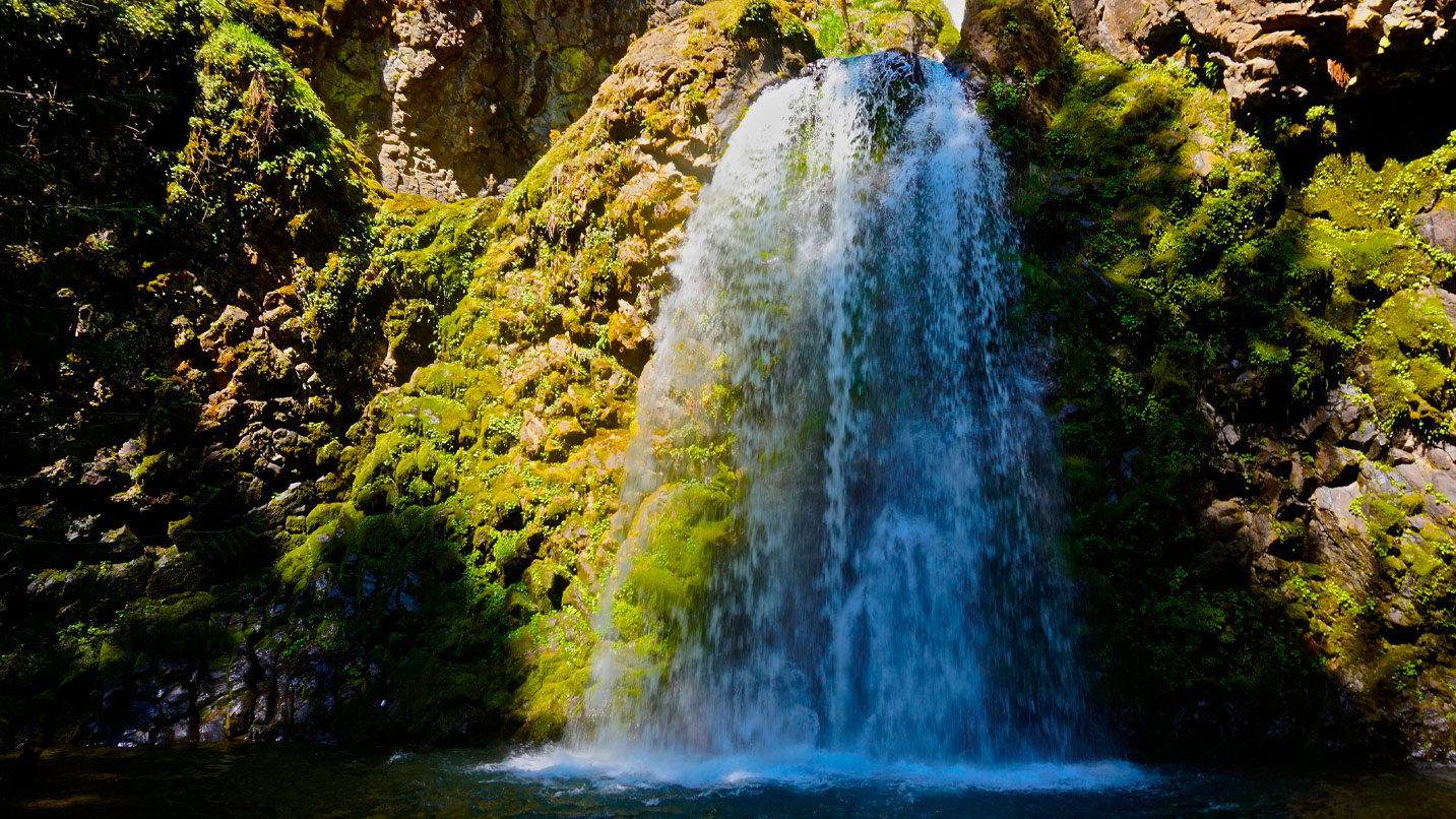
1. Susan Creek Falls
Driving on Highway 138, you’ll find Susan Creek Falls about 28 miles east of Roseburg. The 1.6-mile out-and-back trail is perfect for families and hikers looking for a gently sloped path. The picnic-ready area around the falls also has spots to stop for a quick swim. Ascending along the creek, the trail reaches a junction just before the punchbowl-style falls — a type of falls often defined by the inviting pool at the bottom. The day-use site also features the accessible, flat, gravel Emerald Trail along the Umpqua’s forested riverbank.
2. Fall Creek Falls
Head 4 miles east and you’ll find Fall Creek Falls. During the 1.8-mile round-trip trek, hikers can expect to take in some remarkable volcanic geology and incredible scenery in addition to a four-tiered, 120-foot waterfall. The hike begins by angling through a narrow but navigable bedrock crevice. You’ll pass by stacks of columnar basalt — at times these massive, honeycomb-shaped pillars jut out in all directions like strewn piles of twigs. The path parallels the creek through narrow gorges and alongside broad, cedar-lined beaches before arriving at the falls.
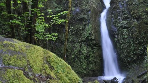
3. Watson Falls
Continue for 29 more miles along the highway to arrive at Watson Falls. At a neck-craning 293 feet, Watson is the tallest waterfall in Southwest Oregon and is billed as the third tallest in the state. The quick 1-mile loop hike that visits the falls presents visitors with a pleasant view early on. A side trail farther up the path gives visitors the option to climb to a much more intimate and memorable view of Watson’s waters careening over the sheer cliffs of a basalt amphitheater.
Tall Falls, Giant Boulders and Natural Bridges on the Upper Rogue
Born from a spring near Crater Lake, the Rogue River is as wild as its name would imply, especially near the area of its origins, where creeks plunge from great heights to meet it, and the river itself plays hide-and-seek with the earth’s surface. This wild and scenic section of the Upper Rogue takes you back in time as you see the impact of geological shifts and uprisings.
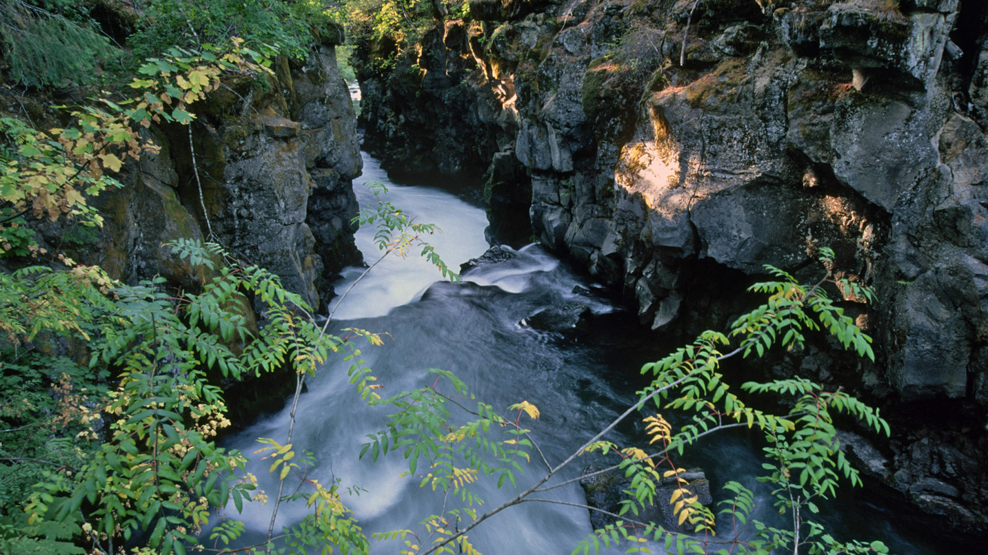
4. Rogue River Gorge Falls
Just 11.5 miles north of the town of Prospect, Rogue River Gorge Falls is a 30-foot cascade viewable from the Rogue Gorge Interpretive Trail. The impact is much larger than the diminutive stature of the falls or gorge might suggest. Here the river twists, turns and roils before forcing its way through a 10-foot-wide slot canyon just below the falls. The walk along the gorge may only be a few hundred feet, but almost every step provides a new vista or point of view.
5. Natural Bridge
Just 2 miles north along the Crater Lake Highway, the Natural Bridge Campground and day-use area is home to a longer leg stretch. During the course of the 1.4-mile loop, hikers will walk through massive stands of old-growth forest, cross over the Rogue on a pair of footbridges and watch an unusual vanishing act. At the Natural Bridge area, you’ll see a lava tube that swallows a good portion of the river before spitting it back out a couple hundred feet away. Interpretive signs detail the formation of both the region and the river.
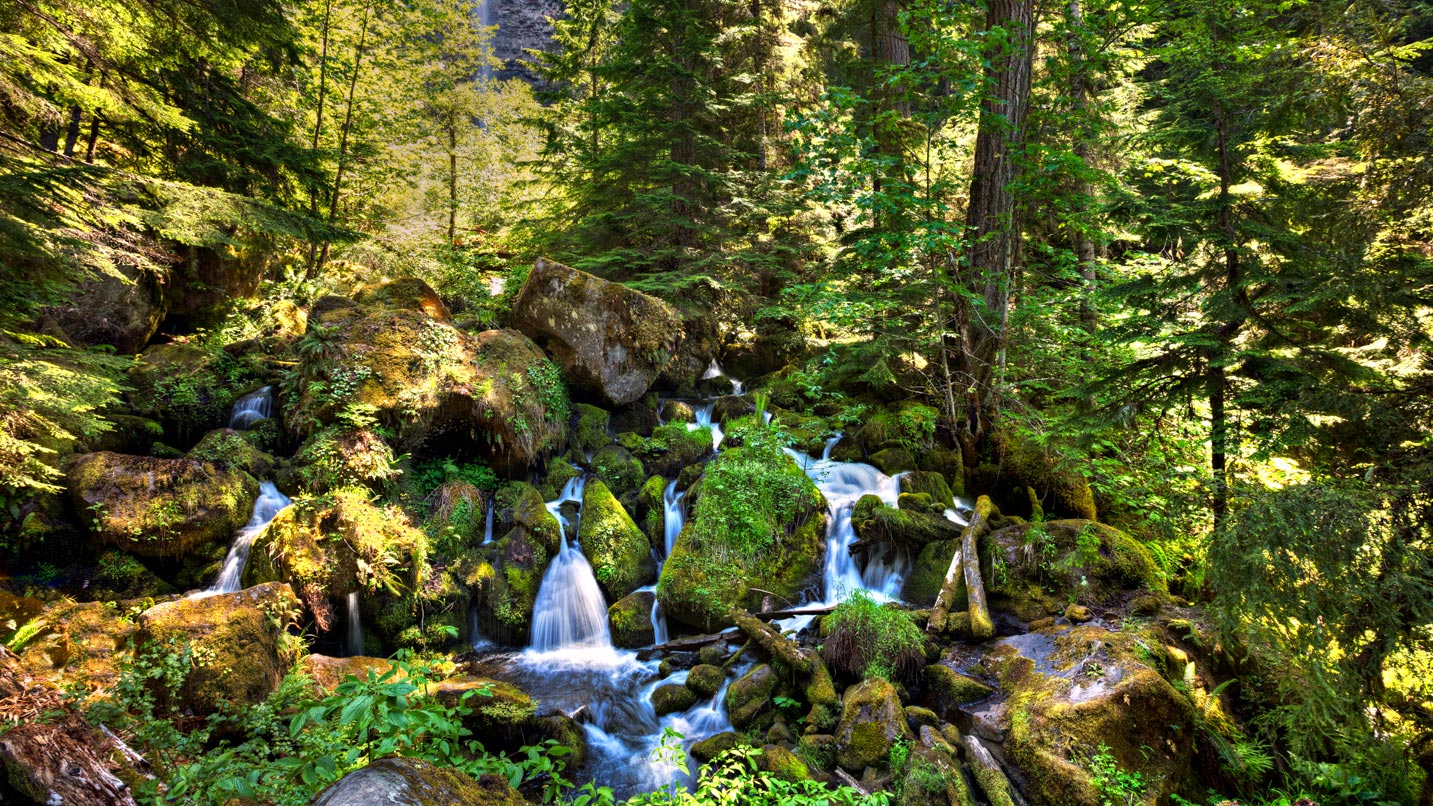
6. Mill Creek and Barr Creek Falls
Roughly a mile south of the town of Prospect, you’ll find the trailhead to Mill Creek Falls and Barr Creek Falls. At 175 and 240 feet, respectively, the two tall, tumbling cascades are accessed within the same 1.6-mile hike. A spur trail along the route delivers hikers to a canyon view of a set of large rocks called the Avenue of the Boulders. Another path descends down to the Rogue itself. A handful of spur trails lead to cross-canyon views of the massive Mill Creek Falls, and a short distance downriver, hikers will find numerous viewpoints of the multitiered Barr Creek Falls.
If You Go:
Download trail brochures from Douglas County’s Rogue-Umpqua Scenic Byway site. They include detailed guides to each section of the route, including the waterfalls along the way. Check each site you’d like to visit beforehand for dog-leash laws and best practices for parking. Don’t forget to bring along the Ten Essentials and Leave No Trace.