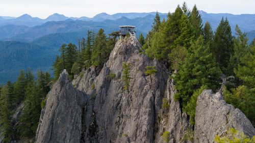
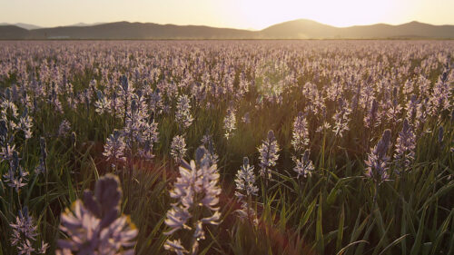
If you’ve driven along Highway 26 between the Mt. Hood area and Central Oregon, you’ve traveled through the high-desert landscape of the Confederated Tribes of Warm Springs. The state’s second-largest reservation and the largest in land size of Oregon’s nine federally recognized Tribes, this 644,000-acre reservation is home to a rich tapestry of cultures and traditions that Native people continue today. The story of the reservation is a story of the past, present and future. Read up on the fascinating history and culture of Warm Springs, and consider planning a trip to explore the museum, hike or bike the trails, camp or fish along the pristine rivers, and support local artisans through their Native crafts.
Three Tribes Consolidate Into One
The story of the confederation starts with three bands of Indigenous people who came together prior to White settlers’ arrival in the 1500s and lived in harmony for hundreds of years.
The Wasco bands of people resided along the Columbia River, near present-day Hood River and The Dalles. They created their livelihood from the abundant salmon as well as root and other native vegetation. Slightly south, the Warm Springs bands of people lived along the Deschutes and John Day river tributaries. They relied on salmon but they also traveled regionally between the summer and winter seasons to take advantage of berries, roots and live game. Both Tribes came into contact regularly with each other and communicated using a simplified language that became known as Chinook Jargon. The Paiute bands had less frequent contact with either Tribe, living in a territory that today includes part of Southeastern Oregon. The Tribe’s hunting and gathering lifestyle required that they migrate more often due to the dry landscape and climate.
Spanish and British explorers had been traveling in Oregon since the 1500s. When more waves of European settlers arrived in the 1800s, the long-established relationships between these Native Tribes began to falter. By the mid-1800s, Indian Tribes signed a series of treaties. The Wasco and Warm Springs Tribes relinquished 10 million acres of land, and the two groups together inhabited and formed the Warm Springs Reservation. The settlement of a Paiute group in Warm Springs began in 1879 after war with settlers in the Paiute territory uprooted and displaced the Tribes.
The consolidation of multiple Tribes into one reservation was challenging on several levels, including adapting to new natural resources, establishing hunting and gathering, and navigating the inevitable assimilation and loss of distinct cultural differences between the three groups. Not long after the U.S. Congress established the Indian Reorganization Act in 1934, the Wasco, Warm Springs and Paiute Tribes consolidated into the Confederated Tribes of Warm Springs.
A trip to the Warm Springs Reservation can help visitors form connections between the sacred and resourceful characteristics of the area, to better understand how its original inhabitants established their practices, beliefs and heritage within their original territories.
Museum at Warm Springs
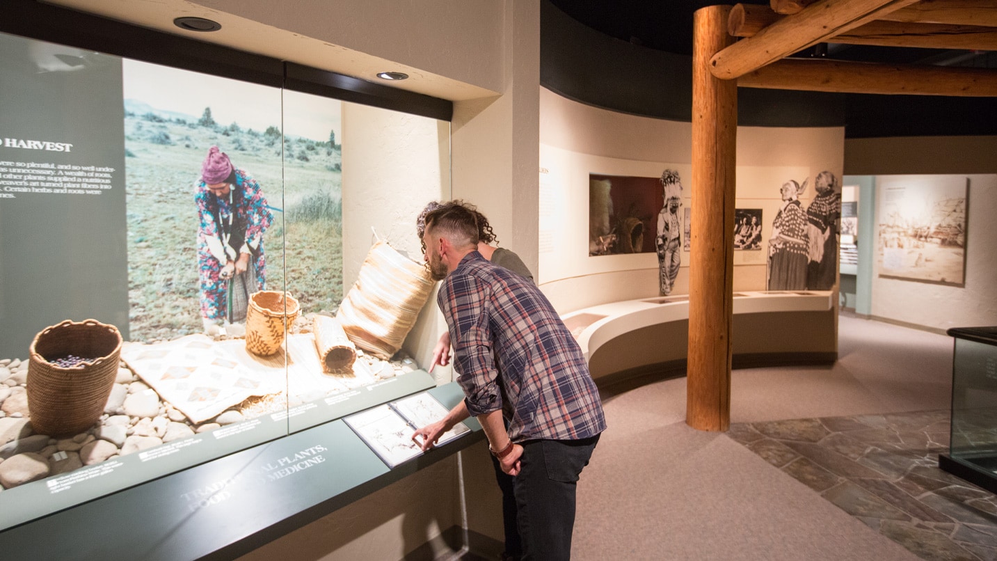
When the Museum at Warm Springs opened its doors in 1993, it became the first Tribal museum established in Oregon. This impressive 25,000-square-foot space was designed as a collaborative effort between architects and Tribal members. The exterior design of the museum resembles a traditional campsite that blends into its natural surroundings. Visitors follow the path of a stream from the exterior of the museum and then enter the lobby where inspiration from nature is woven into the building’s interior design.
The museum continues its focused efforts to acquire Native artifacts in order to conserve these items and educate the public and members of the Tribal community about the Wasco, Warm Springs and Paiute people. Treasured items such as ceremonial clothing, beadwork, paintings, masks and photographs make this one of the most expansive and thoughtfully acquired collections in the country. The museum houses both permanent and rotating exhibitions, a gift shop, an archival library, and an outdoor amphitheater for performances.

A Reimagined Kah-Nee-Ta
The public rejoiced in summer 2024 when Kah-Nee-Ta Hot Springs Resort reopened on Confederated Tribes of Warm Springs land after being closed for six years. The reimagined family vacation destination off Highway 26 in Central Oregon now offers 30 plush hotel rooms, an RV park and a teepee village for a fun rustic group camping experience.
Guests can book a day pass or stay overnight in the plush, renovated hotel rooms, at the RV park or in the teepee village — each teepee sleeps 10, for a rustic and fun group camping experience.
The big attractions include the outdoor hot spring mineral pools, lazy river, spray features for kids, and assortment of VIP cabanas with luxurious amenities. The hot spring pools offer a range of temperatures from 92 to 104 degrees and are rich in minerals like magnesium, calcium, and potassium, which carry therapeutic properties. Accessible entry into the pools is available.
The resort also offers Native-led fishing trips and a 3-mile river float along the Warm Springs River, guided horseback riding, traditional salmon bakes on Sundays, spa services and an enormous array of sport activities. The whole family can play mini golf, corn hole, volleyball, bocce ball, ping pong, pickleball and disc golf, as well as access the on-site fitness center.
There is also a network of bike trails, hiking and horseback trails to enjoy, to fully appreciate the breadth of the landscape. When it comes to food and drink, there’s a poolside bar that serves drinks and snacks, and a concession/restaurant with a menu including Native fry bread burgers and other Native-inspired foods.
About 80% of the resort staff are tribal members, and tribal members may attend at a discounted rate. Tribal elders held a blessing for the property a day before it reopened to the public.
Named after after a woman named Xnitla, meaning “root digger,” Kah-Nee-Ta’s origins go back to the 1960s with the purchase of the land next to the Warm Springs River from the government settlement from the loss of Celilo Falls. Several expansions later, the resort became a family destination in the high desert until its latest reimagined iteration. Watch a brief history of the project here.
View this post on Instagram
Hiking
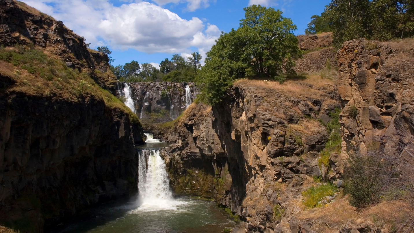
One way to explore the regional landscape is to experience it on foot. A section of the Pacific Crest Trail runs through Warm Springs as it extends southward past Government Camp and nearby Mt. Hood, then toward Olallie Lake and Mt. Jefferson. The city of Maupin along the Deschutes River, as well as Mt. Hood National Forest, offers trails that showcase the natural landscape of this area. White River Falls State Park, located in Maupin, includes the White River Falls Trail, which leads hikers on a short, steep path to the base of the falls and then continues toward the Lower White River Falls, also known as Celestial Falls. Located directly outside the northwest corner of the Warm Springs Reservation, the Clear Lake Loop Trail and Timothy Lake Trail offer hikers opportunities to view conifer and waterfowl near the waterfront.
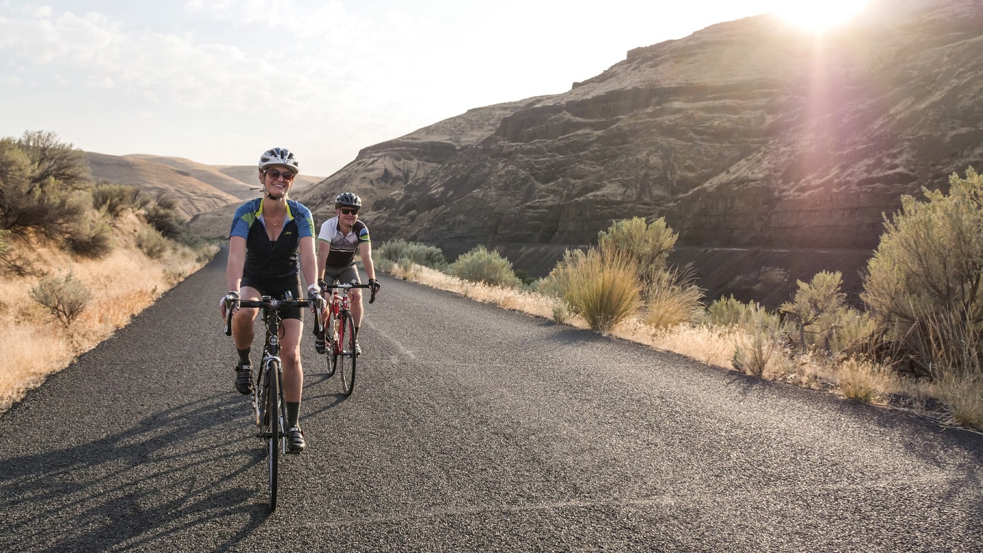
Biking
Two Oregon Scenic Bikeway routes are located in Maupin, north of the reservation, and in Madras, south of the reservation. Based in Maupin, the fully paved Sherar’s Falls Scenic Bikeway is a 33-mile loop that leads cyclists alongside a portion of the Deschutes River and into the high desert. Row Adventures offers e-bike (electric assist) tours that start in Maupin. In Madras the Madras Mountain Views Scenic Bikeway is a 29-mile loop that allows for views of the Cascade Mountains and Lake Billy Chinook.
Camping and Fishing
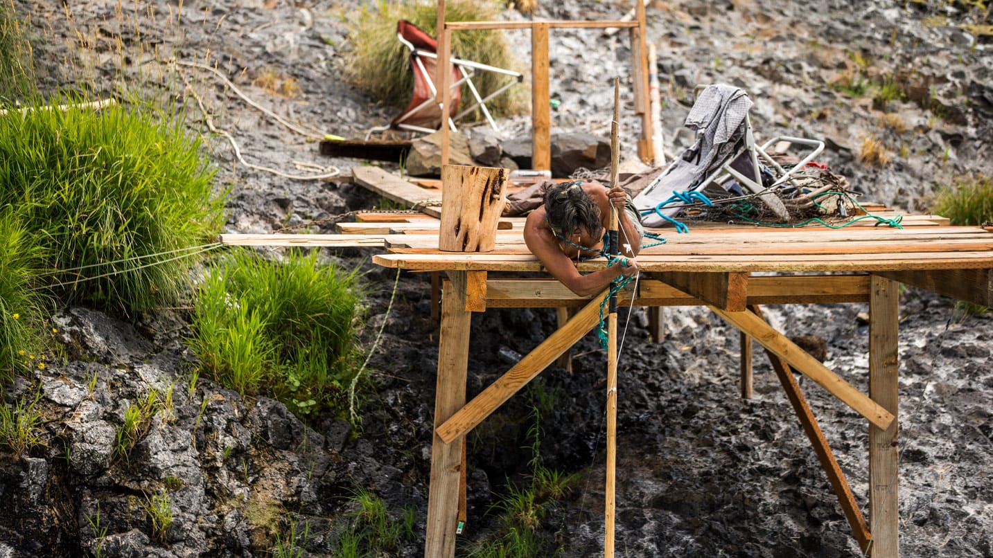
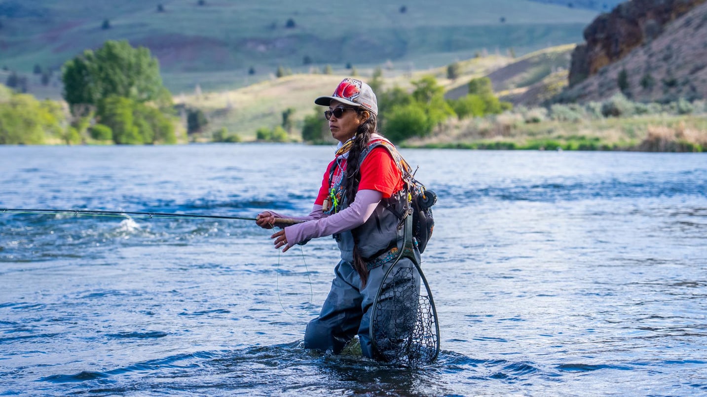
Located in Tygh Valley, along the Deschutes River, Sherars Falls is a sacred and essential fishing ground for local Tribes. It is the final waterfall alongside the Deschutes River before it merges into the Columbia River. Indigenous people continue to use traditional fishing nets and traps to catch the highly regarded native salmon. Local and visiting fishermen revere the breathtaking beauty of this wild, natural landscape, making it a well-known area for fly-fishermen and anglers.
Even though it’s located on Tribal land, visitors can camp and fish at Sherars Falls to hear the roar of the water and imagine the Indigenous people who fished for salmon from wooden scaffolds, dip nets and set nets as they have for thousands of years. An overnight permit is required for camping, and a fishing permit is required for fishing at the salmon and steelhead trap between mid-June and early November. Note that steelhead fishing is closed through Dec. 31, 2021 on the lower Deschutes River and other Columbia River tributaries. Read up on what to know about steelhead fishing in Oregon as you plan your trip.
For the best experience, consider booking a local guide like the Native-owned Littleleaf Guide Service, based on the Warm Springs Reservation. You can also fish for chinook, steelhead and coho salmon at the nearby High Lakes, Lake Simtustus, and specified areas of the Deschutes River and Lake Billy Chinook with purchase of a fishing permit.
A Bright Future
Tribal members of the Warm Springs Reservation continue into the future with relentless efforts to preserve, honor and educate their community and the public about their heritage and the vital history of the bands of people who have lived in this region since time immemorial.
In partnership with the Warm Springs Community Action Team, a nonprofit based on the reservation, an effort is underway to transform the Warm Springs Commissary — a building erected by the federal government in 1896 that holds negative associations — into a vibrant economic hub. Tribal community members will have retail space to do business and showcase their Native crafts and artwork, such as those from Tananáwit, a community of Warm Springs artists.
There’s also an ongoing effort to address the local water crisis, since more than 60% of Warm Springs’ residents lack regular, consistent access to clean water. The crisis began a few years ago with a series of breaks in key community water lines. The Friends of the Columbia River Gorge and other organizations have come together to create The Chúush Fund: Water for Warm Springs, to help residents in need. The best way to support the effort is to donate, though they will also accept your help by educating others about the ongoing crisis and advocating on the campaign’s behalf by contacting your representatives.