About a five-minute drive north of Medford, the ground abruptly rumbles skyward to form airy U-shape plateaus of ancient lava that press into the fertile fields of the Rogue Valley below.
These are Oregon’s spectacular Table Rocks (Upper and Lower), formed over seven million years ago from a volcanic explosion at Mt. Olsen. Together they offer nearly 5,000 acres’ worth of excuses to wander among rare flowers and fairy-tale views.
The Takelma people — who foraged in this homeland area for roots, berries and acorns — sought refuge here from conflicts with settlers in the 1800s. Today The Nature Conservancy and the Bureau of Land Management manage the area, which is an excellent place for getting outside almost any day of the year.
Both Upper Table Rock and Lower Table Rock offer a similar style of hiking: Switchback your way up a dramatic hillside for 700 to 800 vertical feet over a mile or so of distance before topping out on a broad plateau with sweeping views of the Siskiyous and the Cascades. No matter which one you choose, you’ll want to plan for time to linger on top of the plateaus or for walking along the escarpment. Here’s how to explore.
Birds, Wildflowers and Picnic Spots at Upper Table Rock
At just over 2,000 feet above sea level, Upper Table Rock is indeed higher than Lower Table Rock, but it’s the formation’s relative location on the Rogue River, which flows a few miles south — and not the elevations — that informs the name. Upper Table Rock, which is upstream, sits a few miles east of Lower Table Rock, with Table Rock Road running between them.
Upper Table Rock is the more forgiving of the two hikes, being a shorter route with less elevation, but it doesn’t skimp on the rewards. The trailhead starts off Modoc Road a few miles north of TouVelle State Recreation Site at a parking area on the northwest side of the road. You can keep the pace relaxed working your way up 720 vertical feet or so over about 1.3 miles to the rim. At times loose and rocky, the trail is by no means flat and still demands attention — so come prepared with sturdy shoes, plenty of water, sunscreen and all of your Ten Essentials. Especially important: Know your limits on a hot day.
Along the way, you’ll pass through forests of black oak with branches that twist like dervishes and a memorial to John Ifft, a well-liked BLM employee who designed the trail. Bring your bird book and look for western tanagers and violet-green swallows. In spring you find riots of wildflowers — think 200 species of them — making a go of it in the meadows and softer spots where their roots can gain purchase in the rocky soil. One of these flowers, the dwarf woolly meadowfoam — a delightful five-petaled white flower — only grows here.
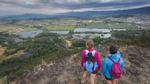
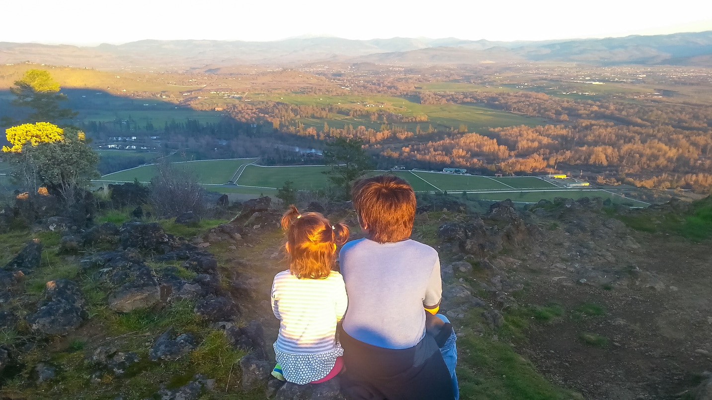
Once you reach the top, you can follow a trail to the left (or south) that will take you to a viewpoint at the edge of the rim — a fine spot for a picnic. From there you can hike a mile-long loop along the plateau. Alternatively, head straight across the plateau once you hit the rim for views off to the west.
River Views, Protected Treasures and Shady Climbs at Lower Table Rock
About a mile west of Upper Table Rock, just beyond some fields, you’ll find Lower Table Rock at 2,094 feet above sea level, an area managed by The Nature Conservancy and protected for its outstanding natural treasures. The trail here is a bit rougher underfoot than at Upper Table Rock, but it’s also woodsier with more shade.
From Interstate 5, take exit 33 to get to both the Upper and Lower Table Rock trailheads. For Lower Table Rock, you’ll want to continue on Table Rock Road north for about 8 miles to Wheeler Road, which crosses a creek off to the west and takes you to the trailhead on the northern slope of the formation.
The hike up Lower Table Rock gains about 780 feet to the rim, which is just under 2 miles from the trailhead. Once again, you’ll want to factor in time and save some energy for exploring the plateau and soaking up the views from the rim. It’s about another half-mile one way from the rim to a viewpoint overlooking the eastern rim. Alternatively, you can hike about another mile one way across an old dirt airstrip built in 1948 to reach a southern viewpoint that looms over the Rogue River coursing below. All in all, you should expect to hike about 5.5 miles round-trip. A half-mile-long trail, the Oak Savannah Loop Trail, provides an easier option that’s also accessible to wheelchairs.
In springtime and during wetter years, water will collect in pools atop the plateau thanks to a layer of volcanic rock that won’t let moisture through. Look around these seasonal pools for the five-petaled white dwarf woolly meadowfoam flower, listed as critically endangered. A threatened shrimp, the fairy shrimp, also thrives in this water. The flowers can be the real attraction, however, with specimens of pink bleeding hearts, chocolate lilies and wild celery finding home here.

If You Go:
Oregon’s Table Rocks are fragile, fire-prone treasures that demand visitor respect for their continual preservation. Please stick to the trails, leave the wildflowers for others to enjoy, and respect all laws and advisories when it comes to mitigating fire hazards. Check the air quality in the region before you go, or contact the Medford BLM office for any updates. Dogs are not permitted on these trails.
Know that cell service in this area is very limited, so download GPS and trail maps before you go. As with all outdoor adventures in Oregon, be sure to check the weather and be prepared for rapidly changing conditions, know what your group can and cannot handle, and let someone know where you’re headed and when you plan to be back.
Keep this area pristine for future generations by packing out what you pack in. For a less-crowded experience, plan your hike for the early morning or during weekdays. Find more ways to Take Care Out There.