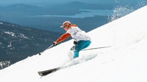
Spring Blast
Note: This page will be updated frequently throughout the ski season to alert you of approaching storm systems and powder.
Please be sure to also check the Conditions Report for info on ski area operations (including closures due to storms and weather, as well as notices on current avalanche forecasts).
UPDATED March 31, 2026:
Hey skiers and riders, while a little late in the season, this Powder Alert is great news for the intrepid powder hounds still seeking fresh snow and fun turns!
The storm arriving Wednesday is a typical winter-like system for the Northwest, the likes of which we saw far too few of this season. Ah well, let’s get it while the getting’s good, hey?
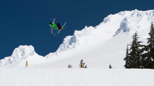
I will focus on the resorts still spinning the lifts, including Timberline, Mt. Hood Meadows, Anthony Lakes and Mt. Bachelor.
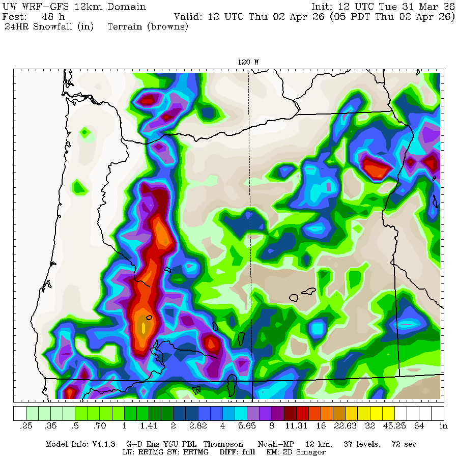
The Wednesday-Thursday snowfall will favor Central Oregon, with 12 to 18 inches of fresh on the way for Mt. Bachelor! Timberline and Mt. Hood Meadows will pick up 8 to 14 inches for some serious powdery fun, and Anthony Lakes will get between 6 and 12 inches of new snow.
THURSDAY, April 2, is the powder pick across all of Oregon!
This system will also bring strong winds, with gusts on exposed ridges and slopes in the 30 to 45 mph range on Thursday. So be prepared for cold and windy weather while you ply the Spring powder.
The snow level drops as low as 2,000 feet in the Cascades, so this will be some of the best quality snow we’ve seen all season. And if you look at the map below, you will see the snowfall forecast in Southern Oregon from Crater Lake to about Willamette Pass may reach 32 inches. This means avalanche danger will be high, so if you’re thinking about backcountry or side-country skiing, remember that between the heavy new snow and the strong winds creating wind loading of snow on lee slopes, both natural and skier-triggered avalanches will be likely. Be careful out there.
Finally, given the long-range forecast and the scheduled resort closings of April 5 for Anthony Lakes and April 12 for Mt. Hood Meadows, this may be the last Powder Alert of the season. If you’re skiing any of the areas before closing and you have a chance to give props or high-five any of the mountain operations folks, please do. They have done amazing work to keep as many slopes open and safe as possible. They have done it with a limited snowpack that was often hammered with rain and wind. It has not been easy, but their work meant we still got to have fun sliding on snow.
Thanks for reading these Powder Alerts. They combine two of my greatest passions, skiing and weather. It’s a privilege I greatly appreciate.
See ya on the slopes, if not this Spring, then next Fall!
Matt Zaffino
KGW Chief Meteorologist
Facebook: Facebook.com/MattZaffinoPortland
Twitter: @Zaffino
Instagram: MattZaffino
Ski and Snowboard Safety
Those skiing in steep and ungroomed terrain should be familiar with Deep Snow Safety and become informed on traveling and recreating in avalanche terrain. Find more tips on skiing and snowboarding safety here. Avalanche forecasts are available through the Northwest Avalanche Center (Mt. Hood), Central Oregon Avalanche Center, and Wallowa Avalanche Center in Eastern Oregon.
Skiers and snowboarders should always follow the Skier’s Responsibility Code, which exists to raise awareness that there are elements of risk in snow sports that common sense and personal awareness can help reduce:
- Always stay in control. You must be able to stop or avoid people or objects.
- People ahead or downhill of you have the right-of-way. You must avoid them.
- Stop only where you are visible from above and do not restrict traffic.
- Look uphill and avoid others before starting downhill or entering a trail.
- You must prevent runaway equipment.
- Read and obey all signs, warnings, and hazard markings.
- Keep off closed trails and out of closed areas.
- You must know how and be able to load, ride and unload lifts safely. If you need assistance, ask the lift attendant.
- Do not use lifts or terrain when impaired by alcohol or drugs.
- If you are involved in a collision or incident, share your contact information with each other and a ski area employee.