


Mt. Hood’s 11,240-foot summit doesn’t look like it would be that hard to reach — but scaling Oregon’s tallest peak requires a considerable amount of technical equipment and mountaineering skill. Fortunately, Oregon has plenty of mountains that fit hikers can tackle with a good pair of boots, solid navigational skills and determination. No rope required. Here’s where to go and how to explore.
Ridgeline Views on Diamond Peak
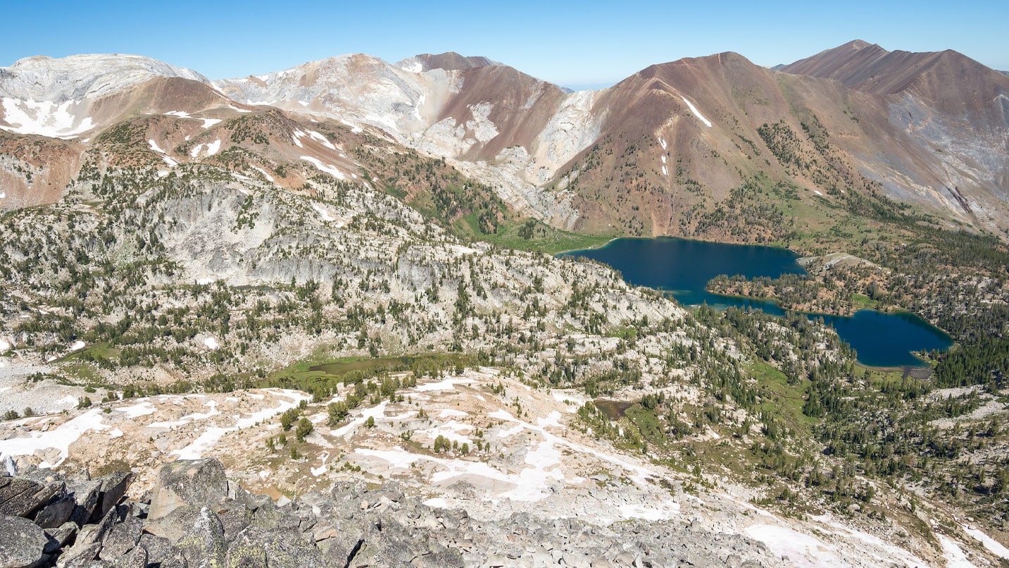
Rising 22 bird-flying miles southeast of Oakridge (about 40 miles southeast of Eugene), 8,750-foot Diamond Peak forms the centerpiece of the Diamond Peak Wilderness. There’s no real trail to the top, so reaching the summit demands just enough off-trail navigation to keep things interesting on this 12-mile round-trip route. Start out on the Pacific Crest Trail at the north end of Summit Lake off Forest Service Road 2160. That gets you pretty close to the South Ridge (visible jutting above the treeline) that leads to the summit. The views open up the higher you go, revealing magnificent vistas of the thumb-like spire of Mt. Thielsen to the south.
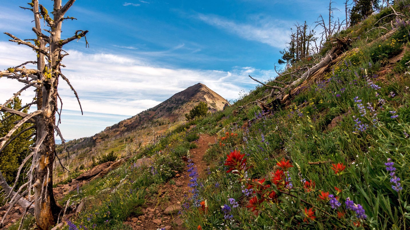
Up and Up on South Sister
The trail up this 10,358-foot volcano near Bend is so steep and relentless — gaining 5,000 feet in about 6 miles — it sends legions of hikers home well before the summit. That said, it offers unforgettable views over the Three Sisters Wilderness and, on a clear day, the entire length of the Oregon Cascades. Get a day-use permit to park at Devils Lake, and then cast off on what locals call the “climbers trail” just across the road. From there it’s up and up to a gorgeous high meadow, then a lot more up to the top. Expect to hit snow, even in August.
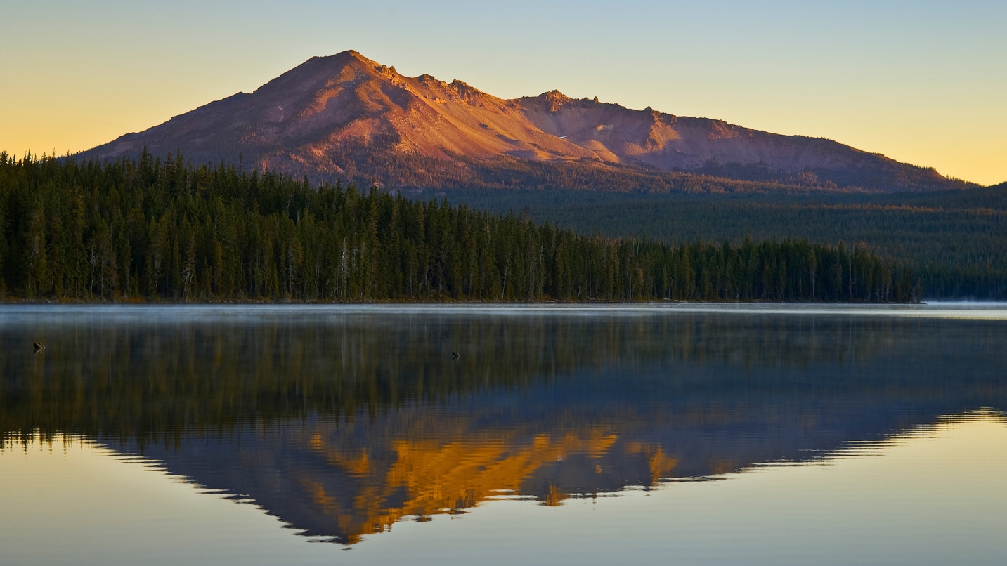
Finding the Sweetest Views on Strawberry Mountain
This 9,038-foot high point of the Strawberry Mountain Wilderness near John Day in Eastern Oregon may not have the cachet of its icy Cascade brethren, but that doesn’t matter when a 3,610-vertical-foot climb is as pleasing as this, with lakes, a waterfall and wildflower-fragrant meadows to fill your senses. Strawberry Basin Trail No. 375 takes you up to Strawberry Lake and past 50-foot-high Strawberry Falls. After reaching a saddle, follow the trail north to Strawberry Mountain’s northeast ridge, then up a summit trail another 300 feet to the top for airy views of the Blue Mountains and beyond. Mid-summer hikes can mean sharing the peak with thousands of butterflies — a worthy reward for the 13-mile round-trip effort.
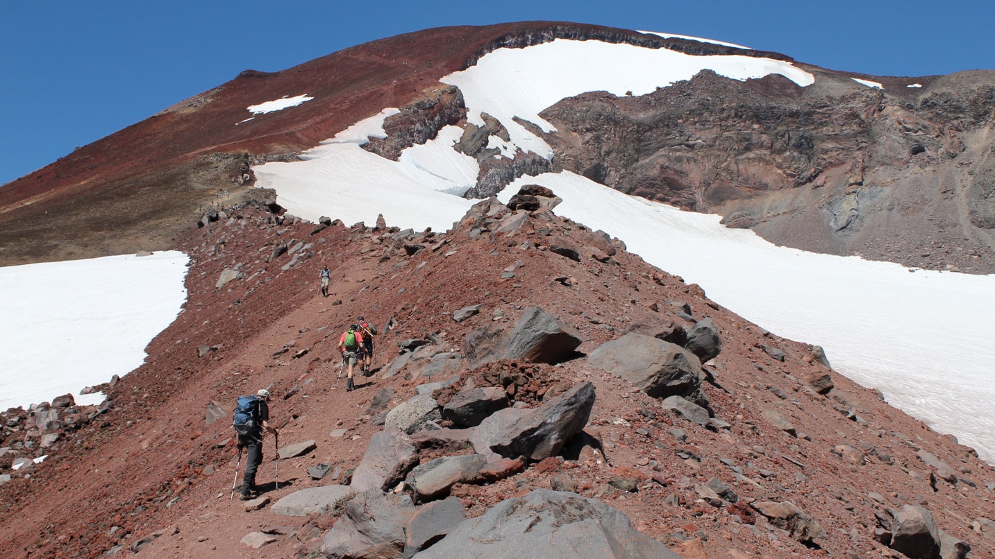
Alpine Bliss on the Other Matterhorn
Yes, Oregon has its very own Matterhorn, and like the famous Swiss landmark, this one in the Eagle Cap Wilderness is a real beauty with high limestone peaks, twinkling alpine lakes and even the chance to see mountain goats on exposed rocky ridges. Getting up and down the 9,826-foot mountain in a day is a big effort — 19 miles round-trip — so some climbers opt to do it in two days with an overnight camp at Ice Lake. Get a wilderness permit at the trailhead for the West Fork Wallowa River Trail No. 1820 near Wallowa Lake State Park and climb a series of switchbacks to reach Ice Lake at around 7,900 feet. From there a faint, steep trail pushes up into the cirque surrounding the lake; you’ll reach the summit in about 1.8 miles with roughly 1,980 feet of climbing. Yodeling encouraged.
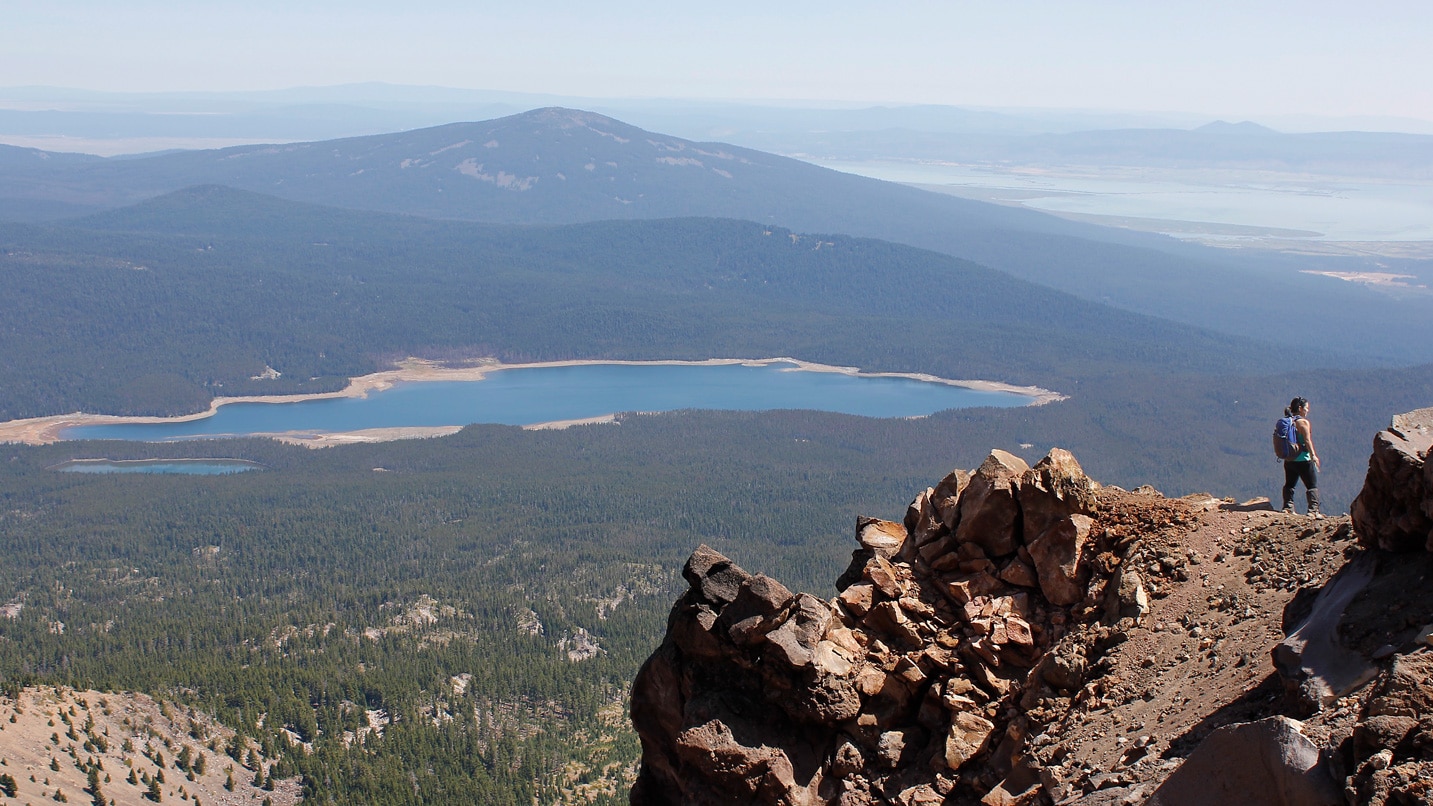
High Above the Trees on Mt. McLoughlin
Getting up Mt. McLoughlin, Southern Oregon’s highest peak at 9,493 feet, will test your mettle with a trail that gains about 4,500 feet in only 5 miles — but the 11-mile round-trip journey deep into the high-alpine country of the 113,849-acre Sky Lakes Wilderness doesn’t skimp on the pretty, either. You’ll need a day-use permit, available online. Start off the adventure at the Mt. McLoughlin Trail No. 3716 trailhead, located on Forest Service Road 3650 north of Highway 140. The route climbs steadily up an eastern ridge and punches above treeline within the first few miles with great views of the Klamath Basin to the east. The trail can be faint and slippery, but stick to it: Hikers have been known to get lost on the way down trying to find an easier route.
If You Go:
Venturing into Oregon’s high alpine country is never a walk in the park, so take the time to be prepared. Expect loose footing and faint trails, and always bring a map. Do your research before you go to obtain the proper permits. Get an early start (maybe even before sunrise) and be sure to bring plenty of water, extra food, a headlamp, a rain jacket and sturdy footwear you’ve already broken in. Trekking poles can help keep you upright on loose terrain and ease some of the pain of going down.