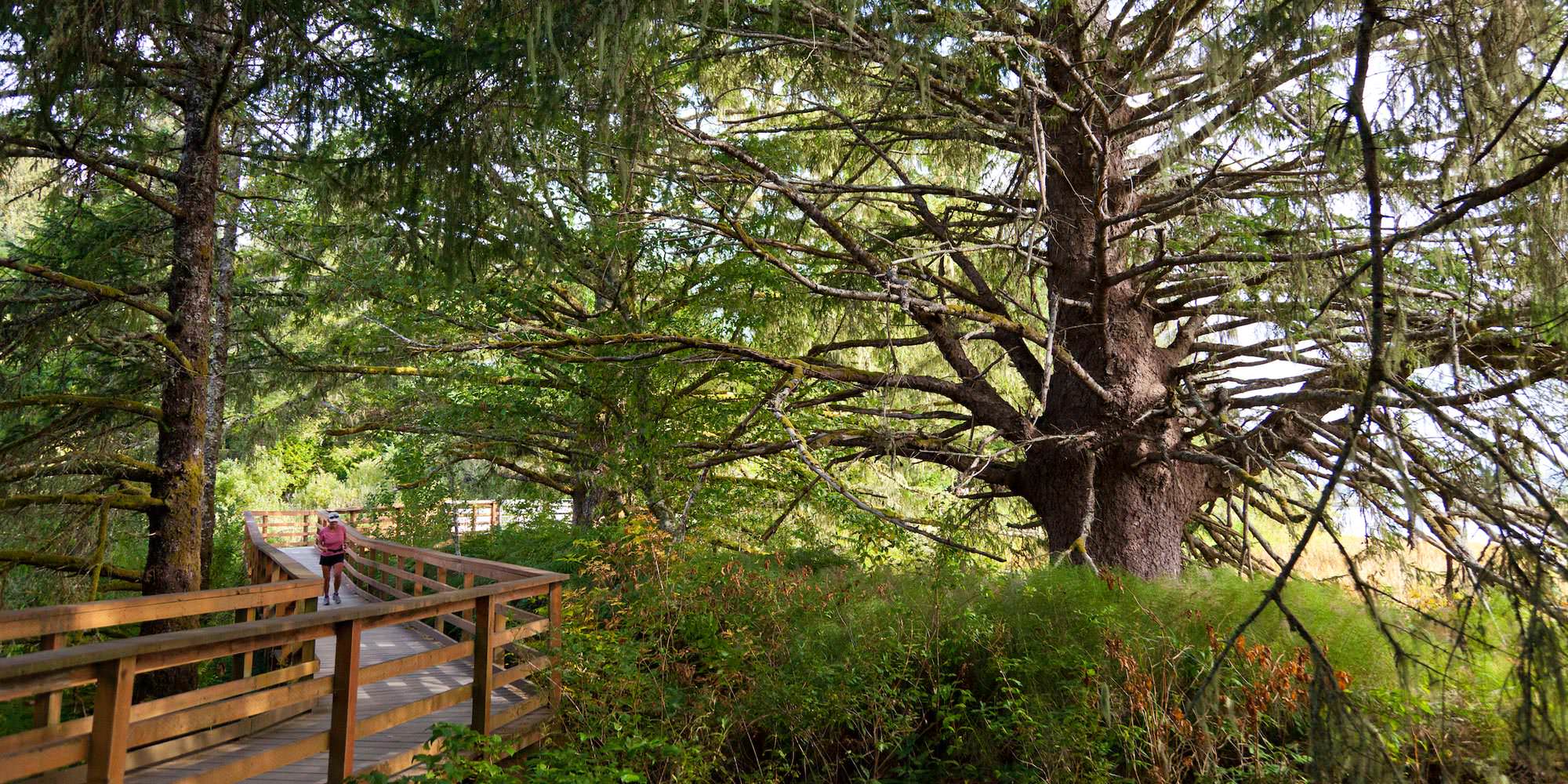
Headed to the North Coast this winter? Take a hike. The air is crisp, the old-growth forests are lush and green, and there’s no better way to brighten up to a bit of sun and blue sky peeking out. After your hike, it’s tradition to reward yourself with a scone and warm beverage at a favorite spot in town. So lace up those boots and get outside.
Astoria to Warrenton
Clatsop Spit Loop
4.6 miles, easy
elevation gain: 10 feet
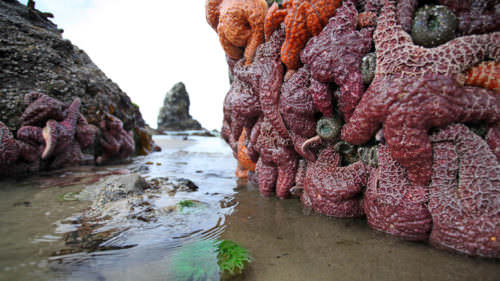
Inside Fort Stevens State Park at the mouth of the Columbia River, Clatsop Spit is a relaxing and fascinating place to walk and enjoy nature at this unique spot. On a crisp, sunny autumn day, take in the fine views of the roiling ocean, beach forests, tidal flats and the mighty river. There’s also plenty of opportunity to spot wildlife — from elk in the sedge to seal lions in the sea, plus a host of birds — including the world’s biggest colony of Caspian terns, which gorge on the Columbia’s salmon smolts. Take the counterclockwise loop, which starts and ends at Parking Lot D.
Fort to Sea
5 miles one way, moderate difficulty
elevation gain: 160 feet
Travel with a friend driving a second car to shuttle you back, and experience this one-way wonder from the trailhead in Fort Clatsop to the Sunset Beach State Recreation Site. It’s worth it: This undulating, diverse route takes you through one of Oregon’s most unique settings. First, you’ll meander across a fetch of flowers, berries and blown-down trees, then through quiet forest to the Clatsop Ridge Overlook (don’t forget your camera!). Then it’s more forest, wooden paths across skunk-cabbaged wetlands and the Skipanon River, beneath Highway 101, past a church and its cemetery, over Neacoxie Creek, and aside pastures of cows. Finally, groves of shore pine lead you to the Sunset Beach trailhead, where you can walk to a viewing platform on the dunes above the beach. Come for sunset.

Gearhart to Cannon Beach
Cullaby Lake Loop
1.5 miles, easy
elevation gain: 30 feet
Known for its fine summer fishing, in winter Cullaby Lake County Park’s interpretive nature route is generally a quiet place, home to the Gearhart Fen, one of Oregon’s biggest seaside bogs. Starting from the historic Lindgren House, wet your whistle with classic, Northwest eye candy — ferns, sedge and skunk cabbage; forests of alder, spruce and hemlock; salal, blackberry and salmonberry; dunes, pastures, tree frogs, beavers and mallards … you get the idea. The route is gravel in sections and paved in others, so even during a winter rain, you won’t get muddy. The Cullaby Ridge Trail maintains the natural splendor, though unpaved and rootsy, ending at a playground and recreation site at the park’s north picnic area.
Clatsop Loop Trail
2.5 miles, moderate difficulty
elevation gain: 700 feet
You’ll feel like a true explorer on the Clatsop Loop Trail, which traces the footsteps of a group led by Captain William Clark more than 200 years ago as they looked for a beached whale. (They found it after crossing a creek, which Clark later named for the Chinook Indian word for whale, ekoli). The trail leads through dense rainforest — which can be a bit slippery, so take, caution — but affords breathtaking views of Tillamook Head and the island lighthouse known as Terrible Tilly. Begin at the main parking area of Ecola State Park, just behind the restrooms, and head across the footbridge, then across the clifftop. You’ll soon reach Hikers’ Camp at the north end of the loop, a lovely spot to rest for a spell before the return. Head back to the parking lot via the service road from the Hikers’ Camp going south, which is easier to navigate than the clifftop trail. Indian Beach, considered one of the best surf spots on the Coast, is just below.
Cannon Beach to Manzanita
Hug Point to Arch Cape
4.5 miles, easy
elevation gain: 40 feet
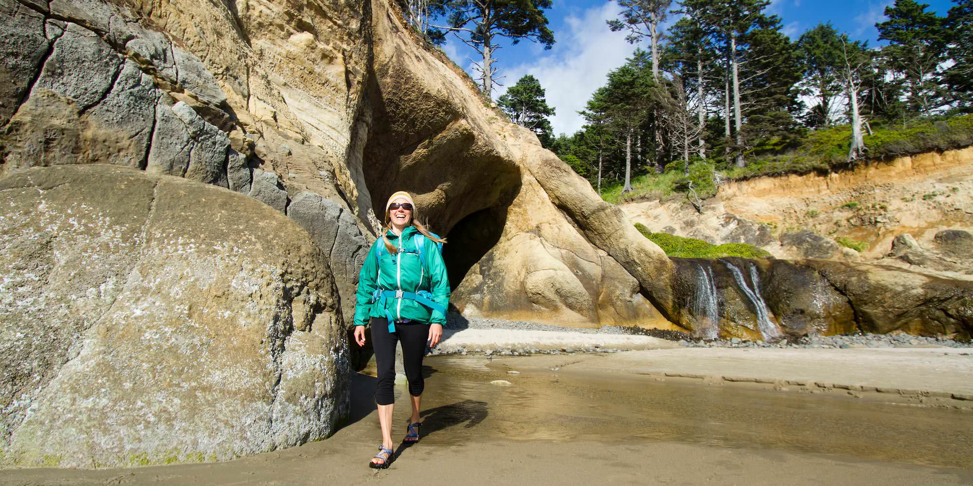
If you’re up for a nice and scenic low-tide coastal cruise, this is it. Here, a variety of natural treasures await: photogenic sea stacks, forested headlands, secluded beaches, curious caves, shifting sands, waterfalls, and the old road carved into the steep headland at Hug Point State Recreation Site, where your journey begins. Once safely south of Point Meriwether and another smaller one near it, a long glorious beach unfolds all the way to Arch Cape. You’ll make some creek crossings, so wear boots.
Neahkahnie Mountain Loop
8 miles, moderate difficulty
elevation gain: 2,300 feet
This well-known piece of the Oregon Coast Trail is unforgettable and, in winter, blissfully empty. Its northern trailhead starts at Oswald West State Park and first leads you down Necarney Creek toward popular Short Sands Beach, then zigzags south and up to views of Devil’s Cauldron and Treasure Cove below. The route stretches across meadows to Highway 101, which hikers cross to reach the North Trailhead. From there, the trek leads up Neahkahnie Mountain itself (but not its actual peak, which is inaccessible), replete with stunning views. The scenic splendor continues down to the South Neahkahnie Mountain Trailhead. From here, it’s possible to return the way you came (our recommendation), or you can walk 1.5 miles back north on a footpath along busy Highway 101 (great views abound) to rejoin the trail near Devil’s Cauldron and onward to Short Sands Beach.
If you go
Wintertime weather on the Coast is unpredictable, so bring layers, a pack full of water and snacks and be prepared for sun or rain.
Always heed safety postings and trail markers, and be extra cautious around slippery rocks and steep cliffs. Make sure to keep children and dogs safe on the trail.
Check local tide tables before going, and never turn your back on the ocean.
And don’t forget to bring binoculars and watch for whales!