You know how sometimes there’s this famous, big-name experience that everyone knows about, so people flock there to do it – and they end up never knowing there’s a possibly even better resource right next door?
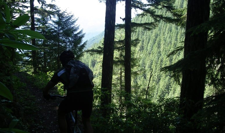
The O’Leary Trail is only a couple miles from the famous McKenzie River Trail. We would never slag on the MRT; it’s one of the most scenic natural trails in the country, and plenty challenging in parts – but if you’re in the area, leave time to check out the O’Leary route. While these two tasty trails are located in approximately the same place, they couldn’t be more different. While McKenzie offers easy access and is visible from the highway multiple times along its route, O’Leary serves up deep backcountry single-track, tight switchbacks, rock walls built decades ago, and stiff climbs rewarded with a descent that will dominate your memory for days.
Several of the O’Leary trailheads are vehicle-accessible, and you can work out a shuttle option. But if you want to do the “full pull,” start from the nearby community of McKenzie Bridge, which offers restrooms, parking, and food and beverages. From this small commercial outpost, make your way south on Horse Creek Road to National Forest Road #1993, climbing south to the Olallie North trailhead.
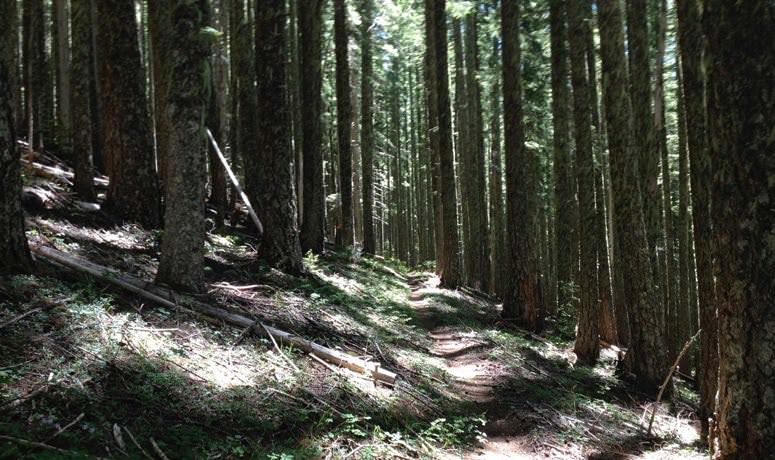
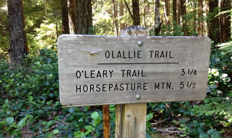
From the trailhead, choose Trail #3529. As with so many good things on a bike, you have to work for your fun – so start uphill and find your climbing groove. After an extended period of steep grinding, which is slightly less difficult given that you’re surrounded by tall trees, leafy rhododendrons and the piney tang of forest air, the trail crosses National Forest Road #340. Congratulations: you’re halfway up the mountain!
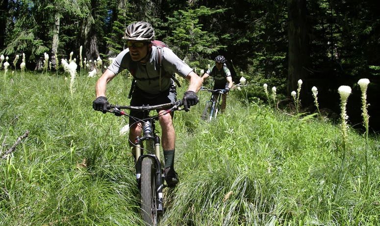
Not too far past the crossing, take a right onto Trail #3321 and head toward the ridge. As you pedal, the terrain around you will change and the trail will narrow. You’ll pass the high point next to McLennan Mountain, but your work is not done until you’ve switchbacked up to Macduff Mountain.
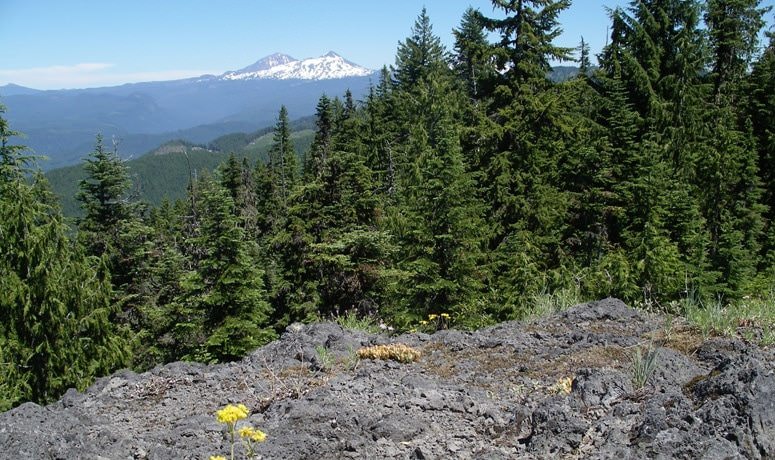
At this point, we highly suggest that you get off the bike, scramble up the scree slope and savor a panoramic view of the Cascades. If you’ve already traversed the McKenzie River Trail, you can gaze down on the valley like you own it, visually tracking the trail’s route like a powerful ruler surveying his realm.
OK, enough of this ascending. You’re tough, but we know you live for speed and G-forces. So it’s go time: tighten down everything, lock in your focus, and launch. The vertical drop is nothing short of exhilarating, and you’ll need that focus to navigate your way down an ever-changing landscape: rocks, roots, sharp turns, dense brush – all coming at you at hyper-speed.
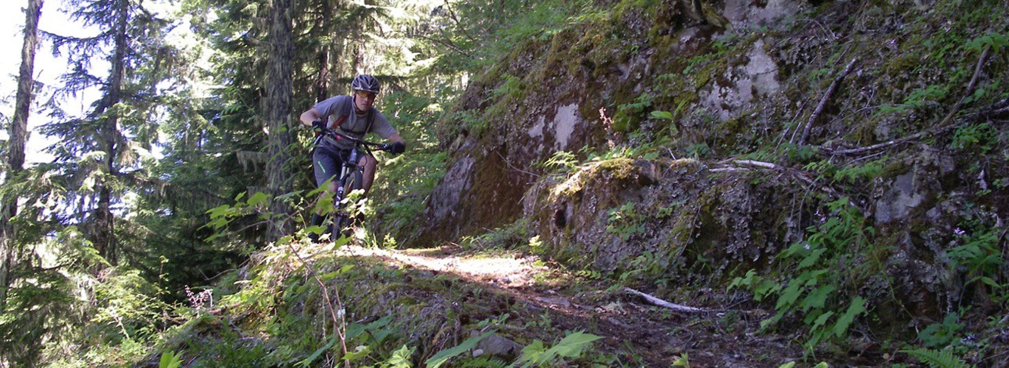
But don’t make the mistake of tuning out everything around you. If you pay attention you’ll see the remnants of a rock retaining wall that was built during the Great Depression by the Civilian Conservation Corps – not coincidentally, the same folks who built the trail you’re currently ripping almost 100 years later. Take a second to picture that work crew in your mind, and what they would think if they saw someone riding a bicycle on it. Not long after the wall, you’ll cross NF Road #411; stay sharp so you don’t miss the barely discernible tread as it heads back up the hill on the right side of the road. Once you’re back on the trail, you’ll start dropping at speed again.
After crossing Road #411 for a third and final time, keep your eyes peeled for an intersection with Trail #3506 – if you’re not paying attention, it’ll sneak by as you float contentedly through the emerald woods. Hang a right and take a breath, as you cruise a rolling section overseen by massive fir trees. Then re-engage your climbing legs up to the intersection with Trail #4362.
And now for the grand finale. The final descent serpentines through deep woods, offering plenty of drift; treasure it as you’re riding it. Eventually you’ll emerge at the King’s Castle trailhead, endorphins still humming. Relish the fact that you’ve just tasted something available only to those who look beyond the obvious.
Note: Ride O’Leary from spring to fall. Because it crests above 5,000 feet, the upper reaches of the trail can be covered into late spring during years with heavy snowpack. Other years bring blowdown that has the Forest Service and volunteers working hard to clear. Always check trail conditions with the McKenzie River Ranger Station at (541) 822-3381.