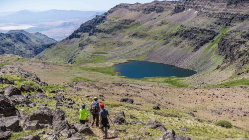
We heard it before we saw it. A light, breezy whisper through the firs and cedars that gradually gained volume. Tree branches swayed and, at last, gave way, opening onto what felt like an atrium in the forest. The sound amplified, and the six of us moved quietly toward its source. Nobody said anything, just sidled up; some dropped our heavy packs and sat down, others just stopped and stared.
Streaming down a jumbled staircase of dark basalt were the white, misty ribbons of Ramona Falls, a 120-foot-tall waterfall that tumbles down from the western flanks of Mt. Hood. The setting was serene — even luminescent, as a friend once described it — and set a reverent mood.
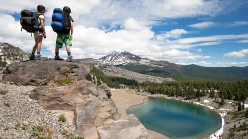
Best of all, this was just one of the many faces and facets of Mt. Hood that our group of six backpacking friends would experience over a four-day, 40-mile hike around Oregon’s tallest peak on the storied Timberline Trail. Here’s how to plan your own trip to circumnavigate Mt. Hood when the conditions allow, generally mid-July through September.
What to Know Before You Go
Built by the Civilian Conservation Corps in the 1930s, the trail has become a classic multiday backpacking circuit for adventurous trekkers — or an impressive push for the occasional beasts who blaze their way around the mountain in a single day.
It’s a challenging hike at any speed, but it’s one of the most rewarding ways to really get to know Mt. Hood. Every time I make the trip — and I’ve been around the mountain four times now — it’s a new adventure.
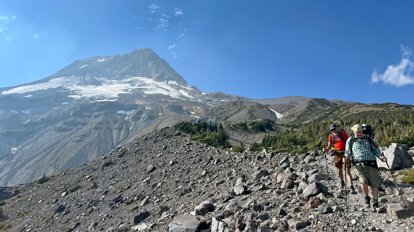
From afar, with the mountain’s smooth, picturesque slopes, it could appear that walking all the way around Mt. Hood might not be that arduous of an endeavor. This is not the case. The Timberline Trail is not a beginner trail, but backpackers with some miles under their belts can pull it off.
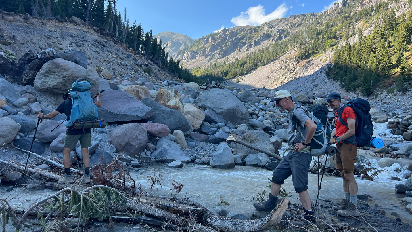
In addition to its roughly 40 miles — more depending upon side treks and route choices — the trail has an estimated elevation gain of some 10,000 feet. That means lots of long, slow descents into valleys and canyons and long, slow climbs back out. The trail’s low point is just above 3,000 feet; its high point tops 7,300. Trekking poles help with this elevation and also with the myriad stream and river crossings that cut the trail. Crossing earlier in the day, before the glaciers and snow melt later on, can be helpful, and there’s often an obvious preferred path over logs or rocks.
The majority of hikers take on the Timberline Trail over four days and three nights. Most hit it clockwise, starting at Timberline Lodge on the south side of the mountain and making their way to various campsites over roughly 8 to 11 miles per day.
Days 1 and 2: Starting the Hike and Indulging in a Lodge Stay
When we planned our trip for last September, our six schedules only aligned for a particular weekend that unfortunately coincided with an early-season deluge over one of the planned days. We brainstormed options and came up with an alternate plan. Rather than start at Timberline Lodge, which would have found us in the heavy rain for most of day and night two, we opted to begin our hike on the north side of the mountain at Cloud Cap Saddle Campground.
Doing so found us hiking a relatively short 7 miles the first day, camping near Newton Creek, then hiking another almost 8 miles the second day, in the rain, but ending up at Timberline Lodge where we could dry off for the night and hopefully avoid the worst of the weather.
That first day was a joy, albeit a strenuous one. We had sunshine and blue skies, full-on mountain views, friendly folks on the trail and campsites just across Newton Creek.
The next morning, as expected, the drizzle started just as we hit the trail. It wasn’t unbearable — thanks in part to rain gear and pack covers — but it certainly wasn’t ideal. We powered forward across icy streams and under ski lifts on the grassy expanses of the Mt. Hood Meadows ski area, comforted that our destination for the night was Timberline Lodge. We’d soon be relaxing with a luxurious swimming pool and hot tub, enjoying pizza and brews at the tucked-away Blue Ox Bar. We took advantage of it all, glad to be out of the rain and readying for the remaining two days on the trail.
Days 3 and 4: Crossing Rivers and Scenic Solitude
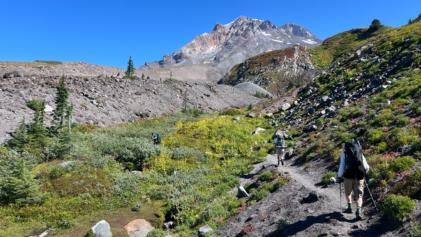
It would have been easy to sleep in and hit brunch in the lodge’s Cascade Dining Room, but we had about 13 miles to go for day three. Blue skies and sunshine had pushed out the rain. It started out easy and flat, just above the tree line and with the mountain big and bold up above.
Crossing the Zigzag River, we climbed relentlessly up to Paradise Park. There, in one of the most popular backcountry areas on the mountain, we ate lunch alone — it was a Monday, reminding us of the fortune that comes with hiking during the week — and we relished views of Mt. Hood’s western face. The rest of the day took us down and across the Sandy River, which is tricky but wide for crossing, to our pilgrimage at Ramona Falls and a little farther on to a quiet campsite amidst the trees.
On our final day, we hiked 15 miles. We crossed creeks, passed McNeil Point — a scenic viewpoint home to one of the mountain’s old stone shelters — as well as Cairn Basin and Elk Cove, a lovely meadow with rushing streams and a gargantuan view of the mountain’s north face. Toward the end of the day, we approached Eliot Creek with caution. Here the creek drains off Hood’s largest glacier, and it’s considered one of the Timberline Trail’s more difficult crossings. This time the creek itself was a breeze, but getting down to it across an unstable talus slope littered with shifting scree was a challenge.
Luckily, we all made it, but the slog back up to Cloud Cap Saddle Campground — where we’d set out four long, adventurous days earlier — was no joke. Just when we thought we were home free, the Timberline Trail gave us one last mile of burly switchbacks and 500 feet of elevation to gain before we could get back to the car. There, high up on Hood’s stunning shoulder, we high-fived and gazed up at the mountain — seeing it, appreciating it and knowing it in an entirely new way.

If You Go:
Start with Leave No Trace principles and the Ten Essentials, and build your trip from there.
- The only permits required for the Timberline Trail are the free, self-issued permits provided at various points along the trail. They are required from May 15 to October 15.
- One of the most popular ways to hike the trail is to begin at Timberline Lodge and hike clockwise, spending nights near the Sandy River, Elk Cove and Newton Creek.
- Some camping areas, such as Elk Cove, can get crowded during the peak season, so you may have to scout more diligently to find sites, especially over summer weekends.
- Copious streams and creeks are available for filtering drinking water.
- Cellphone coverage can be spotty along some stretches of the trail — download maps or bring physical maps before heading out.