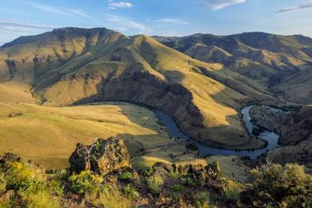
The Lower Deschutes River was designated an Oregon Scenic Waterway in 1970 and a Federal Wild and Scenic River in 1988. The river runs through a deep rimrock-lined canyon that ranges from 900 feet to 2,600 feet in depth. The elevation drops from 1,393 feet at Pelton Reregulation Dam to 160 feet at its confluence with the Columbia River. The average gradient is 13 feet per mile and is relatively constant throughout its length. The most significant drops in gradient are Sherars Falls (River Mile 44), with a vertical drop of 15 feet, and Whitehorse Rapids (River Mile 75), with a vertical drop of approximately 35-40 feet over one mile. Within this canyon you will experience an incredible geologic and cultural history and a diverse community of fish, wildlife and vegetation. The Lower Deschutes River is an increasingly popular river for all kinds of recreationists. Thousands of people visit each year to enjoy its incredible fishing, exciting whitewater, and beautiful scenery. The river offers a variety of opportunities for both day and overnight trips. Recreational activities include boating, fishing, hunting, mountain biking, and hiking.
Lower Deschutes Wild And Scenic River
Maupin,
Central Oregon