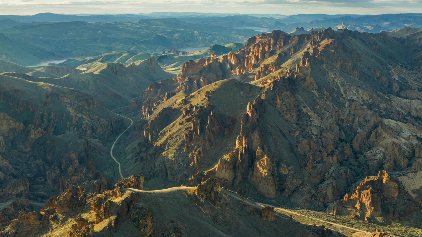
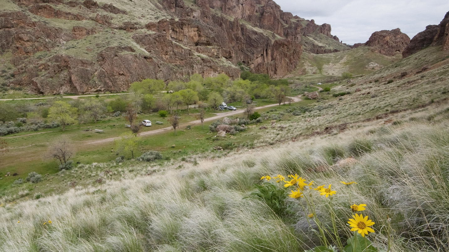
Sitting in Oregon’s southeastern corner, the 2.5-million-acre Owyhee Canyonlands is a collection of khaki- and cinnamon-hued rock spires, honeycomb cliffsides, and winding river gorges. At the heart of it all is Leslie Gulch, a ravine where you’ll pass towering rock formations along hiking trails, spy plants that grow only in the Owyhee (pronounced oh-WHY-hee) and watch shooting stars from a quiet campground.
Here’s more about what makes Leslie Gulch so special, along with how to prepare for a memorable trip to the Owyhee Canyonlands.
See Unique Plants, Animals and Geology
Nearly 20 million years of volcanic activity left behind the deep canyons, towering hoodoos, honeycomb formations and colorful layers of basalt that are the hallmark of the Owyhee today. That fascinating geology, along with extreme temperatures, creates a variety of habitats for endemic flora and fauna.
Leslie Gulch is one of the few places in Oregon where water-loving plants and trees — such as dogwood and arrowleaf balsamroot — grow alongside dry-land species typically found further south, including curl-leaf mountain mahogany and greasewood shrubs. Watch for the bright yellow Ertter’s groundsel, the golden Packard’s blazingstar or the pink blooms of the Owyhee clover — all of which are found in the Owyhee and nowhere else on earth.
Keep an eye out for some of the rich variety of wildlife that lives around Leslie Gulch, including mule deer, Rocky Mountain elk, coyotes, bobcats, several species of raptor and a herd of more than 200 bighorn sheep.
What to Do in Leslie Gulch
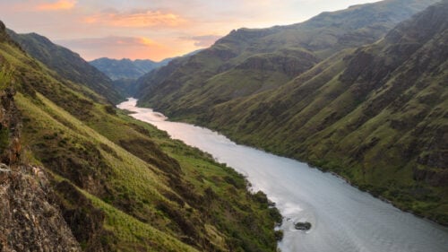
Leslie Gulch Road, the only thoroughfare through the ravine, ends at the foot of the Owyhee Reservoir, a 52-mile-long waterway on the Owyhee River. Put your vessel or paddlecraft in the water at a provided boat ramp for a relaxing day surrounded by towering rock formations. If you’re fishing, cast a line for bass, crappie and several species of trout.
For an unforgettable hike, choose from among several short trails that begin along Leslie Gulch Road and traverse the area’s narrow canyons. Hike about 1.6 miles round-trip into Juniper Gulch for views of the Owyhee’s famed red-rock formations. Nearby, follow the 1.2-mile round-trip Timber Gulch trail past honeycomb formations to an amphitheater of rugged, hoodoo-like pinnacles. Finally, check out a slot canyon and bask in the area’s otherworldly topography on the 2.3-mile (round-trip) Dago Gulch trail.
Back at your campsite, stay up late for stargazing under some of the darkest night skies anywhere in the contiguous United States.
Where to Eat and Sleep
Choose from two campgrounds within the Owyhee, where sites are available on a first-come, first-served basis. Near the mouth of Leslie Gulch, and not far from the shore of Owyhee Reservoir, pitch your tent or park a small RV at one of nearly 10 sites in Slocum Creek Campground. The campground may fill to capacity as early as Thursdays ahead of summer weekends, so visit midweek for your choice of sites. Roughly 20 miles to the northeast, choose from among nearly 20 sites alongside the namesake waterway at Succor Creek State Natural Area, open April to October. Dispersed camping is allowed on Bureau of Land Management lands throughout the region; contact the district office for more information.
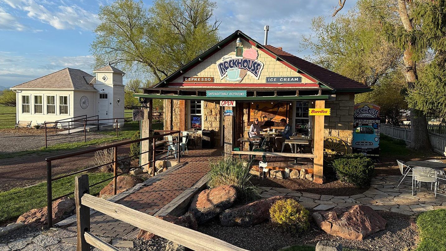
About 40 miles south of Leslie Gulch, in the hamlet of Jordan Valley, fill up on burgers at the Brett’s Cozy Kitchen food truck, or grab ice cream and snacks at Skinners Rockhouse Coffee. If you drive through Ontario, beyond the northern edge of the Owyhee, swing by Far East Restaurant for mafa chicken, a savory dish that was invented in Ontario.
If You Go:
- Abide by the Leave No Trace principles, such as staying on durable surfaces and packing out what you pack in.
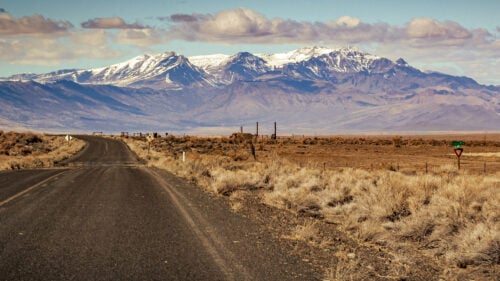
- Roads within the Owyhee are gravel, rutted and not maintained, so a high-clearance vehicle with four-wheel drive is strongly recommended. Gas stations are available in Ontario and Jordan Valley. Always stay on mapped roads.
- Prepare for a self-reliant trip by filling your gas tank before heading out, bringing a spare gas can, carrying a full-size spare tire and packing all the food you expect to eat. Since drinking water is unavailable anywhere in the Owyhee, bring at least 1 gallon of water per day that you plan to spend in the area. Don’t forget extra toilet paper.
- Services and cell coverage are limited to nonexistent, so download and/or print maps.
- Pack the Ten Essentials for hiking, which include maps and sun protection. Be mindful of ticks and rattlesnakes in spring and summer.