Like a tiny tide pool brimming with life, this short 41-mile/66- kilometer route off the Pacific Coast Scenic Byway packs a lot of natural wonders into a concentrated coastal area.
Charleston and Cape Arago
The fishing port of Charleston sits at the entrance to the deep-water port of Coos Bay, where fishing fleets and freighters find refuge from the open ocean. Fishing charters and whalewatching excursions depart from the Charleston marina.
The Cape Arago Highway leads west to a rocky headland rising high above the Pacific. Just beyond the Cape Arago Lighthouse, Sunset Bay State Park wraps around a shallow, protected cove warm enough for swimming. A cliffside trail offers views of sea stacks and the lighthouse.
Just 1 mile/1.6 kilometers south, Shore Acres State Park occupies the magnificent bluff-top site of a lumber baron’s estate, where visitors enjoy the estate’s grand formal gardens and even grander ocean views. Continuing toward road’s end at Cape Arago State Park, an overlook lets you peer down at the boisterous barking sea lions and bobbing seals at Simpson Reef, and trails lead down to the beach.
Seven Devils Road to Bandon
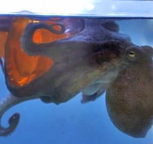
To continue the tour, retrace your route 6 miles/9.6 kilometers and turn left on Boat Basin Road. Learn about coastal ecosystems and see a variety of sea creatures at the Charleston Marine Life Center. Next, head back to Cape Arago Highway and turn left on Seven Devils Road. Explore the boardwalk trails or slip a kayak into the quiet waters of the South Slough National Estuarine Research Reserve. These rich tidal flats are an important nursery for a variety of marine life, including shellfish, salmon and seabirds.
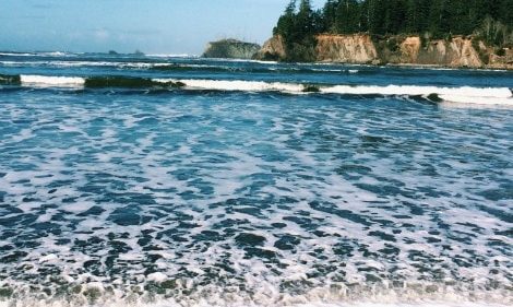
Continuing south, you’ll see the low-lying cranberry bogs that make this region one of the nation’s top cranberry producers. A short diversion off the byway takes you to Bandon Dunes Golf Course, an award-winning links course. An 1896 lighthouse marks the mouth of the Coquille River, which flows between Bullards Beach State Park and Bandon Marsh National Wildlife Refuge. The tour route skirts the fishing village of Bandon before ending at the beach, a stunning seascape of craggy stacks and surf.
Want more details?
Order a free Oregon Scenic Byways guide, or view a map of the Charleston to Bandon Tour Route online.