You won’t find shops hawking nutcrackers or colorful light displays in Christmas Valley — even if this quiet Southern Oregon community, roughly 95 miles southeast of Bend, is home to the likes of Snowman Road and Christmas Tree Lane.
But what the no-stoplight hamlet lacks in Christmas cheer, it more than makes up for with easy access to some of the most dramatic natural curiosities in the Oregon Outback. Within an hour’s drive of Christmas Valley, for instance, sits Crack-in-the-Ground, a 2-mile-long volcanic fissure that’s home to a below-ground hiking trail that stays nice and cool — a great break from the heat. And while the mention of sand dunes might conjure up ocean waves and windswept beachgrass, these are nowhere near the Oregon Coast. The largest inland sand-dune system in the Pacific Northwest sits just a short drive from Christmas Valley and boasts an otherworldly setting for hiking, off-road riding and other fun activities.
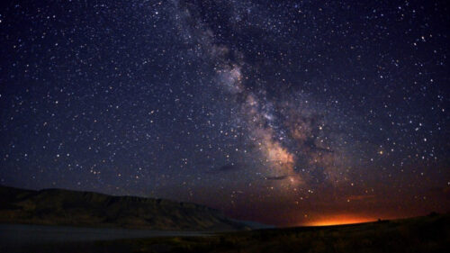
In a dry climate with precious little shade, some of these ancient wonders can feel blistering at the height of summer but cool off dramatically in fall and offer a sense of solitude under sunny yet crisp skies. At roughly two hours from the likes of Bend, Lakeview and Klamath Falls, these unique sites make for easy and fun day-trip destinations. As you seek to explore Christmas Valley this season, here’s how to make the most of your visit.
Scramble Through a Volcanic Fissure at Crack-in-the-Ground
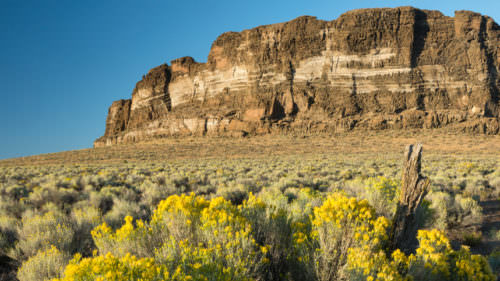
Crack-in-the-Ground is exactly what it sounds like: a large crack in the ground stretching more than 2 miles long and 70 feet deep. Roughly 10 miles north of Christmas Valley, the natural attraction showcases the region’s explosive history.
The eponymous crack (technically speaking, a volcanic fissure) formed more than 1,000 years ago in the wake of several nearby eruptions. These types of fissures aren’t uncommon, but what’s unusual is that most gradually fill with soil, rock and sediment over time. Not so at Crack-in-the-Ground, where the Christmas Valley’s arid climate has preserved the exposed fissure.
Today a hiking trail descends to the base of the crack, where temperatures can be at least 20 degrees cooler than on the surface. The 2-mile-long trail twists and turns through the entire length of the craggy, cave-like setting, where hikers might spy western fence lizards sunning themselves on the rocks. The fissure’s boulders and tight spaces can be difficult for small children, and a little scrambling is required at times; a 1.7-mile trail good for all skill levels parallels Crack-in-the-Ground’s rim if you’d rather peer down into the crack from ground level.
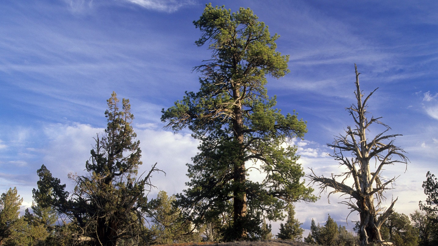
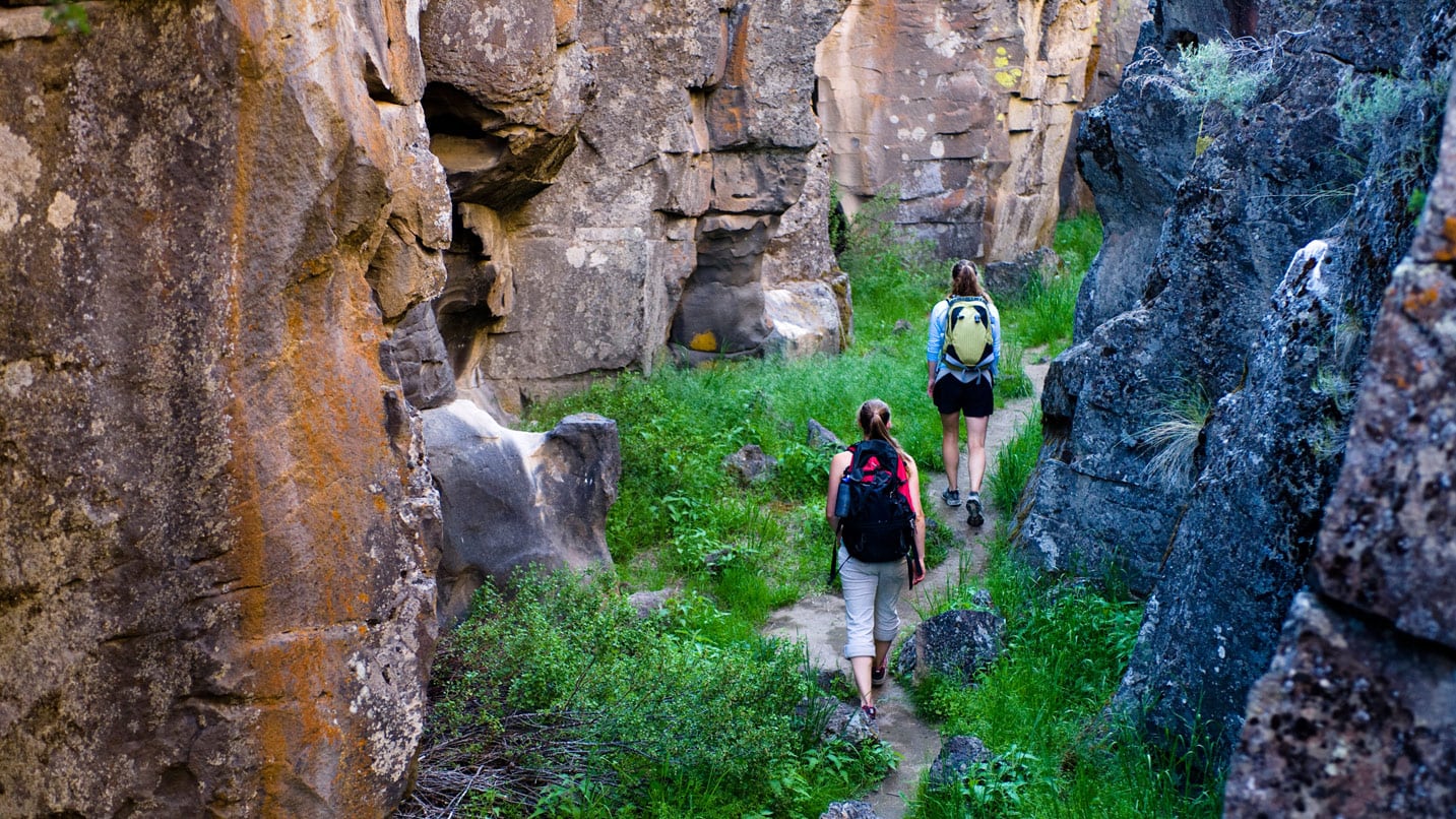
Find Fun and Adventure in the Unlikely Lost Forest
From afar the Lost Forest Research Natural Area, roughly 28 miles northeast of Christmas Valley, looks like a mirage in the midst of a barren landscape. The 9,000-acre forest resides between the always shifting Christmas Valley Sand Dunes and the region’s arid Oregon Outback, with no underground springs or surface-water sources to feed it. The region’s meager rainfall, meanwhile, is far less than what similar forests require to survive.
Put another way: The Lost Forest is a self-sustaining island of ponderosa pine in a vast sea of sagebrush.
The surreal stand, roughly 40 miles from the nearest forest, first grew several thousand years ago when the Christmas Valley region was far wetter and cooler than it is today. But even as the region has dried considerably, the forest remains an odd attraction, rich with rocky outcrops and populated by all manner of wildlife — including black-tailed jackrabbits, porcupines, mule deer, red foxes, bobcats, cougars and raptors.
While the Lost Forest is an ecologically sensitive area, visitors can nevertheless enjoy a few options for outdoor recreation. Most notably, a few short hiking trails offer views within the forest and from above the treetops. Given the forest’s remote and rugged nature, wildlife viewing is another popular activity. A few primitive campsites dot the Lost Forest if you’d like to stay the night as well. Make sure to keep this protected environmental area pristine for the next generation by packing out all of your trash and following local fire safety rules. Check with the BLM’s Lakeview District Office for the latest guidelines.
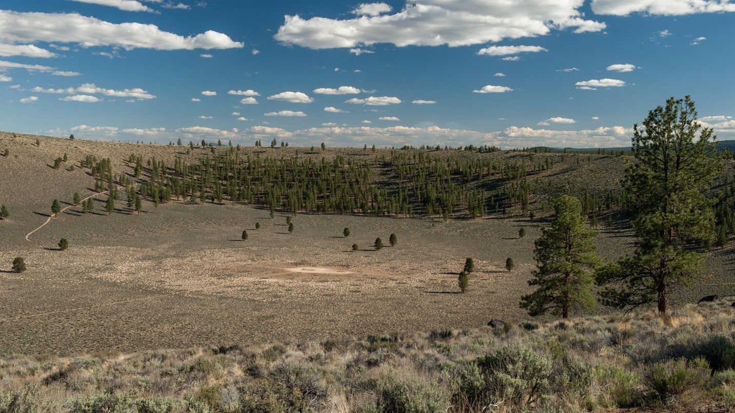
Hike Into a Hole in the Ground
Whoever gave Hole in the Ground its moniker didn’t mince words: It is, in fact, a half-mile-wide hole in the ground. But that’s where the generic descriptors end; the unusual crater is home to a pair of pleasant hiking trails that descend to its base — and into thousands of years of natural history.
From afar, Hole in the Ground resembles a crater — which it is, though it wasn’t created by a meteor strike. Rather, Hole in the Ground is a volcanic maar (a crater formed by eruption) that formed roughly 15,000 years ago, when the surrounding Fort Rock Basin was a massive lake. Magma bubbled up to the surface and, upon hitting groundwater, created a steam explosion that sent rock, ash and other debris cascading in every direction. A massive crater eventually formed, and Hole in the Ground was born.
Today the base of the crater sits more than 300 feet below the surrounding ground level and can be accessed by a well-defined hiking trail loop that totals about 2.5 miles. Half of the loop is a shorter, steeper trail that ends at the center of the crater, while the other half takes a longer, more gradual route around the rim to the same destination. The trails cut through a landscape blanketed in sagebrush, with the occasional ponderosa pine tree growing in the bowl and a small forest lining the rim. From the rim, the massive Fort Rock formation is visible to the southeast.
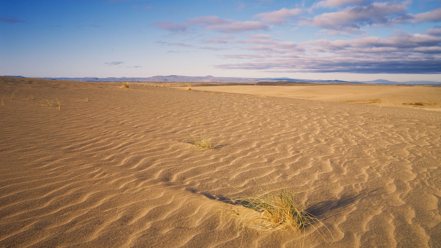
Scale the Windswept Christmas Valley Sand Dunes
When Mt. Mazama erupted nearly 8,000 years ago, forming what we know today as Crater Lake, all that pumice and ash it sent into the sky had to fall somewhere. Much of it fell throughout Oregon, but a particularly large concentration fell to the east, beyond the foothills of the Cascade Range — essentially creating the modern-day Christmas Valley Sand Dunes.
Roughly 22 miles northeast of Christmas Valley sits the series of dunes, the largest inland shifting sand-dune system in the Pacific Northwest.
Of the dune system’s 11,000 acres — roughly one-third the size of the Oregon Dunes National Recreation Area on the Oregon Coast — nearly 9,000 are open to public use and are popular with off-highway vehicle riders, usually on all-terrain vehicles (ATVs) and dirt bikes. It’s also a popular spot for photographers and bird-watchers, as raptors can routinely be seen soaring over the dunes. Visitors may walk on the sand, which can reach 60 feet or higher at its peak; just be sure you have a downloaded map to find your way back to the parking area, as cell phone reception can be unreliable.
If You Go:
- Before visiting any of these attractions, keep in mind that access roads may be rocky, bumpy and muddy; low-clearance cars can generally access most of these sites, especially if driving slowly and cautiously, but trucks and other high-clearance vehicles are recommended (especially if it has rained recently and roads are muddy).
- Given the limited services in the region, be sure to fill your gas tank and stock up on water and other provisions in Christmas Valley before heading out.
- Know that cellphone service is extremely limited here — make sure to download maps for trails and GPS navigation ahead of time.