If you ask 10 people in Oregon to name their favorite hiking trail, they’ll likely give you 10 different answers. From Portland’s Wildwood Trail, to the Pacific Crest Trail, to the Oregon Coast Trail and every trailhead in between, Oregon is a hiker’s dream come true. For prolific outdoors writer Zach Urness, it’s Southern Oregon that steals his heart.
The co-author of “Hiking Southern Oregon: A Guide to the Area’s Greatest Hiking Adventures,” Urness has spent the past 10-plus years hiking throughout the Southern Cascades and Klamath-Siskiyou Mountains as much as possible, learning about the geology, history, flora and fauna as he went along.
At first, he explored on his own, while working in Grants Pass. He soon met his wife, and the now Salem-based couple brings their two young daughters along when they hike the Rogue River Trail.
Why Southern Oregon? “There are just fewer people on the trails and backcountry campsites, especially in the Klamath-Siskiyous,” Urness says. “You can really find solitude a lot easier than in the northern half of the state, and I’d say there are more little-known gems if you look hard enough.”
Add to that the diverse landscapes and the region’s warmer, drier climate — with early springtimes and crisp, sunny winter days — and you’ll be falling in love with these trails too.
We asked Urness for his top five stress-busting hikes that he likes to hit up in the winter. Below are his recommendations, in his own words. Whatever trail you choose, he reminds you to follow steps to Take Care Out There: pack it in, pack it out and leave these gobsmacking trails better than you found them.
Rogue River Trail
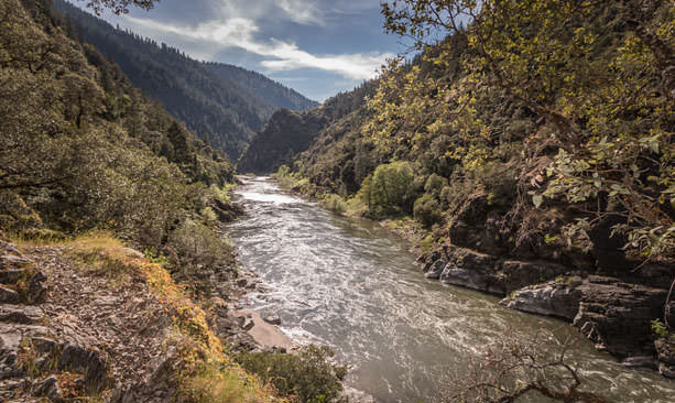
“This 40-mile hike cuts through the heart of the Klamath-Siskiyou mountains in one of the world’s most beautiful canyons. A good option is the Rainie Falls hike, 3.6 miles out and back, on the Rainie Falls Trail. (Despite the name, the trail isn’t always wet.) The trail ends at a big roaring rapid. The other, official Rogue River Trail, on the opposite side of the river, can take you as far as you want to go, but you can turn back at the historic Whiskey Creek Cabin for a nice 6-mile round-trip. The trail is often used by anglers accessing the river for winter steelhead.”
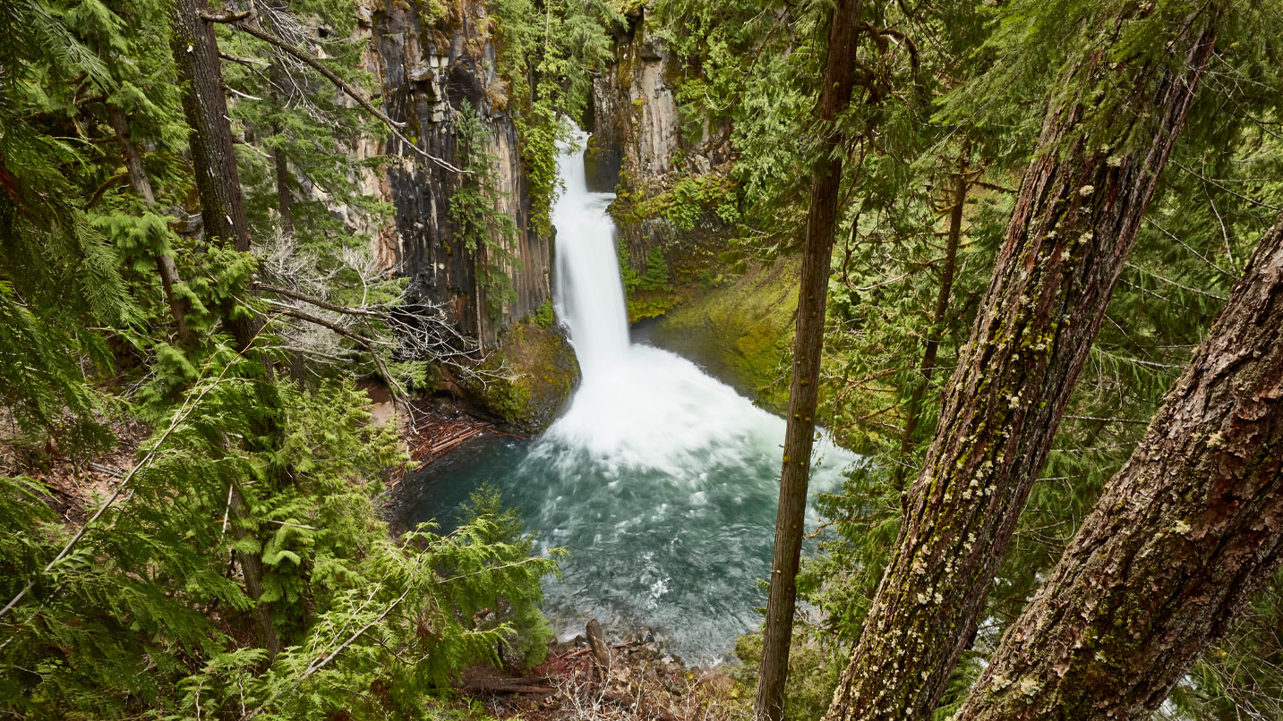
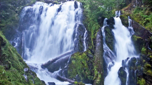
North Umpqua Canyon
“I sometimes refer to this area as the Columbia River Gorge of Southern Oregon. That’s because of the number of waterfalls. There are so many that are so interesting and diverse. From State Highway 138, you can access a number of different waterfall hikes, many very easy, but a few of my favorites are Fall Creek Falls (temporarily closed due to fire damage), Wolf Creek Falls, Watson Falls and Toketee Falls. These waterfalls occasionally get some snow, but it’s never too much and they’re still fairly easy to access, and the snow just makes them better. Most of the time, they’re just roaring waterfalls in a thick, dripping forest.”
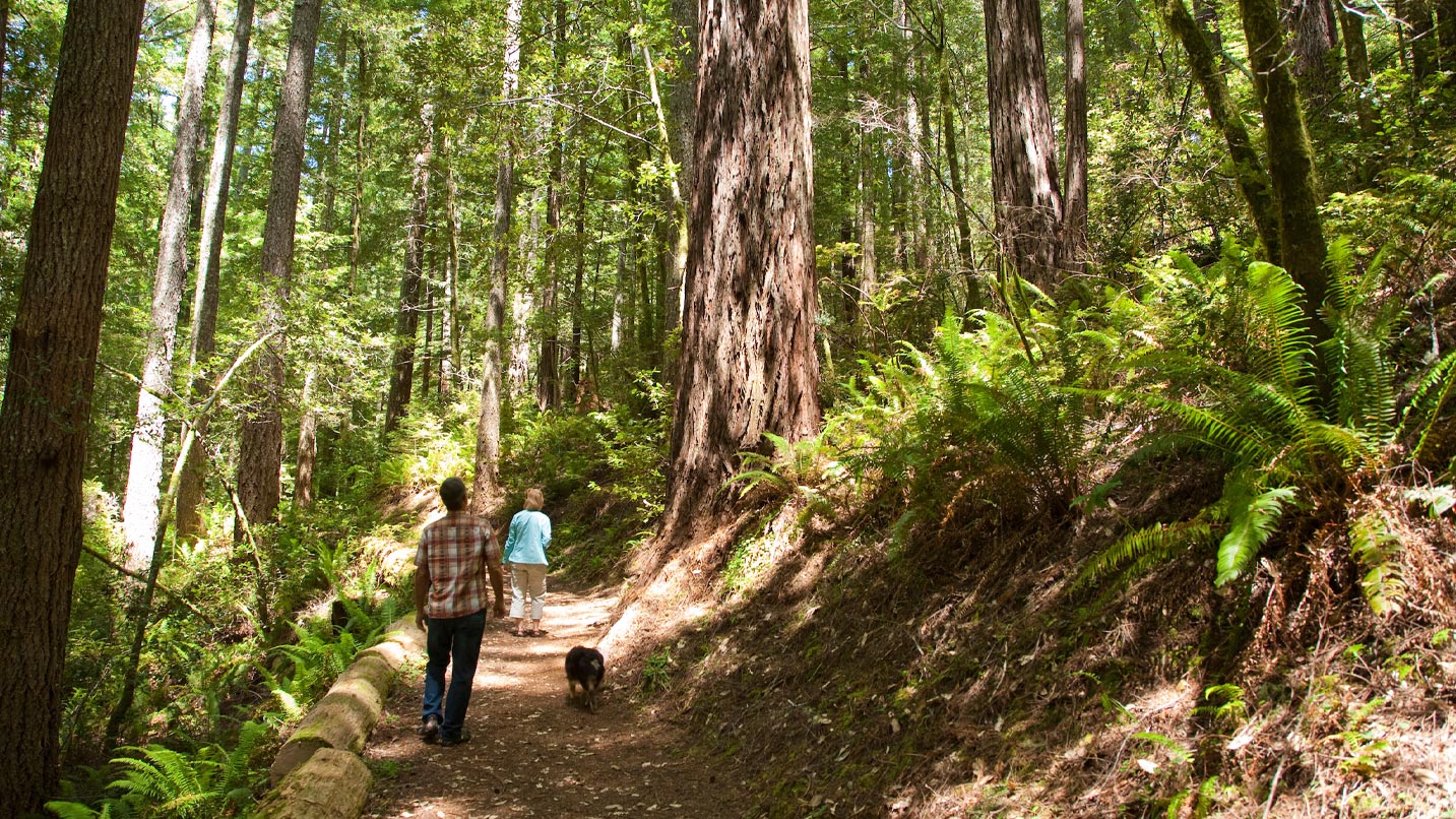
Oregon Redwoods
“There’s only a handful of places to see old-growth redwoods on Oregon soil, but both are located on the southwest Oregon Coast near Brookings. Both trails are short and worthwhile. The first can either begin at Alfred E. Loeb State Park and include a wonderful hike along the Chetco River to start, or just begin at Oregon Redwoods Trail (trails from Loeb lead here). The loop features dense forest and a handful of giant redwoods. The second hike is a bit more remote but features a larger collection of redwoods — as well as a short wooden deck with access to the inside of a hollowed redwood tree. Both trails are fairly short and great for kids.”
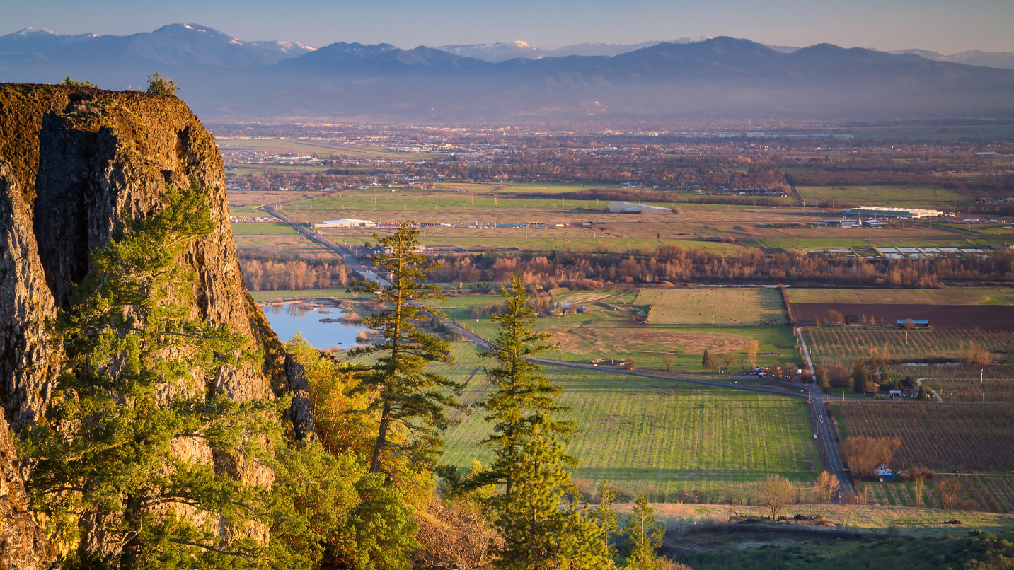
Table Rocks
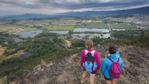
“These two iconic mesas that comprise Table Rocks, in Central Point, look like mountains with their tops sliced off. Although they are best during spring with the arrival of wildflowers, they make a great and easy-to-reach hike from the Rogue Valley any time of year. Both require a fairly steep climb to the top, but once you’re up there, the very odd, flat-as-a-pancake geology provides excellent views of the Rogue River canyon and all the way to Mount McLoughlin on a clear day.” Here’s how to hike Oregon’s Table Rocks.
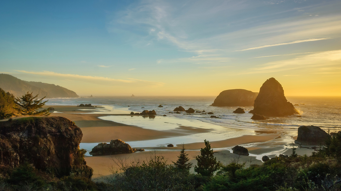
Samuel H. Boardman Scenic Corridor
“The Oregon Coast between Brookings and Gold Beach offers some of the most scenic coastline hiking in the state. The Samuel H. Boardman Scenic Corridor, right off U.S. Highway 101 north of Brookings, offers up to 11 different and accessible hikes. A favorite of mine is on the easy side — the 1-mile Cape Ferrelo loop. A longer option is the Whaleshead Beach trail, which leads from the Whaleshead Picnic Area, along the Oregon Coast Trail, to Thomas Creek Bridge trailhead. At six miles out and back, it traces the edge of cliffs and passes the beautiful cliffside sand dunes called Indians Sands.”
If You Go:
Always check weather and road conditions before you head out, and make sure to fuel up and carry plenty of water, snacks and your Ten Essentials for hiking since some services and local amenities may be limited. Cell service may also be limited so download any trail maps and GPS routes you might need. It’s also a good idea to check the air quality in the region you’ll be visiting since some communities are feeling the impacts of regional wildfires. Finally, remember to be kind to those you meet along the way, and support local communities whenever possible.