Travelers get a sampling of Oregon’s diversity along this 66-mile/106-kilometer byway, climbing through five ecosystems on its route from the Willamette Valley to the West Cascade Mountains.
Some of Oregon’s earliest settlements can be found along the Willamette Valley, the fertile swath of land between the Coast and Cascade ranges that was a destination for many Oregon Trail pioneers. Not surprisingly, archaeologists discovered signs of much early occupation, too. Today this rich and bountiful region provides a pleasurable day trip wandering from the valley up into the forests and rivers of the Cascade Mountains.
East Through the Willamette Valley
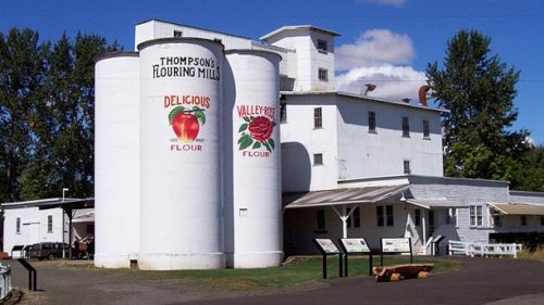
From I-5, the byway quickly reaches Brownsville, Oregon’s third oldest town, founded in 1846. A self-guided downtown walking tour leads visitors past numerous century-old buildings. The Linn County Historical Museum, housed in the Brownsville train depot and six adjacent rail cars, includes a pioneer wagon and replicas of early shops. The well-preserved town impressed Hollywood; Brownsville was the setting for the 1986 film “Stand by Me,” an event still celebrated every July with cast visits and tours on Stand by Me Day.
The grassy fields outside Brownsville attract large numbers of tundra swans and bald eagles each winter. The byway follows OR-228 toward Crawfordsville, where the 105-foot Crawfordsville Covered Bridge, built in 1932, spans the Calapooia River. Near the small logging town of Holley, which dates back to 1847, the byway bends north toward Sweet Home and meets US-20.
Climbing into the Foothills
Pioneers settled Sweet Home in the mid-19th century, building sawmills and felling the towering trees in the nearby Cascade Mountains. A prehistoric forest once thrived here, making the Sweet Home area a prime destination for fossils, agates and petrified wood.
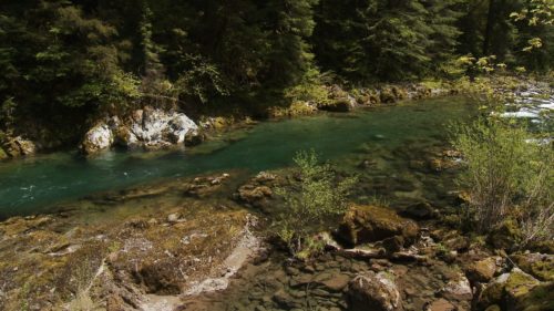
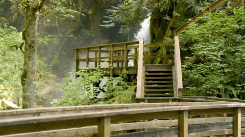
The route follows US-20 east past Foster Reservoir, a flowage of the South Santiam River and a popular fishing spot for trout. Above that is Green Peter Reservoir known for kokanee salmon. Below the dam, anglers pursue spring chinook and summer steelhead. As the road ascends into the Cascades, Cascadia County Park has pretty campsites under old-growth trees, swimming holes along the river and a short hiking trail to mossy Soda Creek Falls.
Wagon Route Through the Cascades
From Cascadia, the byway winds uphill, generally following the route of the Historic Santiam Wagon Road. Unlike most routes across the Cascades that drew pioneers west, this road was built to lead settlers east from the Willamette Valley to pastureland in Central Oregon and to gold mines in Eastern Oregon and Idaho. The wagon route also was part of the first transcontinental auto race in 1905, when two cars left New York City for Portland. The winner made it in 40 days!
Soon the byway enters the Willamette National Forest. Stretching more than 100 miles/ 161 kilometers along the western slope of the Cascade Range, the forest is a key resource for wildlife, recreation and timber production. Several U.S. Forest Service campgrounds and trailheads can be found along the route. The ADA-accessible Walton Ranch Interpretive Trail leads to a viewing platform of the meadow where elk often congregate and graze during winter months.
About 20 percent of the 1.6-million-acre national forest is protected as wilderness, including the Menagerie Wilderness along the north side of the route. Here, rocky spires rise above the trees, a popular destination for rock climbers. The name of the wilderness, in fact, was prompted by climbers who had given the pinnacles nicknames such as Rooster Rock, Hen Rock and Turkey Monster.
The byway ascends to 4,236 feet/1,291 meters at Tombstone Pass. Just beyond, the Hackleman Old Growth Trail loops through an impressive stand of old-growth Douglas fir, hemlock and red cedar. Another loop leads along Hackleman Creek, home to the Hackleman trout, a subspecies of cutthroat trout. The tour ends shortly at the junction of OR-126, OR-22 and US-20, where more intriguing journeys await: the West Cascades Scenic Byway and the McKenzie Pass- Santiam Pass Scenic Byway.
Want more details?
Order a free Oregon Scenic Byways guide.