Some people crave adrenaline when they travel. Me? I’m generally looking for the opposite: a chance to slow down, chill out and studiously avoid anything that might be referred to as fast-paced. I’m not alone — others are finding the joys of “slow travel” for more mindful wanderings. So when I got the chance to experience the Oregon Dunes National Recreation Area on a guided walking tour with Wavecrest Discoveries — a customized tour operator in Coos Bay specializing in the natural history of various coastal habitats — I couldn’t wait to lace up my hiking boots.
The dunes are a popular destination for thrill-seekers drawn by the chance to zoom up and down sandy slopes on off-highway vehicles, but by moving on foot, we could soak up every detail of this fascinating landscape. Here’s how to experience the dunes at a slower pace.
Sand, the Origin of the Dunes
After fueling up with fried eggs, crispy hash browns and our very own personal carafe of coffee at The Stockpot Restaurant in Coos Bay, my husband and I head to Horsfall Beach to meet our guide, Marty Giles. She’s been leading guided nature walks since the 1970s and says the best way to understand the dunes is to start where they start — the beach.
“Sand is not a thing,” says Giles, as we stand on the grass-covered crest of a ridgeline of sand known as a foredune overlooking the Pacific. “Sand is a size.” She hands me a tiny magnifying glass and invites me to get a closer look at a few granules of sand stuck to the tip of my finger.
I admit, I had never considered looking at sand up close. But under magnification, I realize my finger is covered in glittering translucent crystals, including a few granules of inky black and the occasional fleck of deep jade green. This is typical of the mineral sands on Oregon’s beaches, says Giles, which has been swept up and down the Oregon Coast by tides, storms and currents for many thousands of years. “It’s experienced sand,” she says with a laugh.
So how did sand get from the beach to the dunes a few miles inland, I ask?
During the last ice age, the sea level was much lower than it is today, she explains. Back then, the iconic rocky headlands and sea stacks of today’s Oregon Coast were inland hills and mountains, and Oregon’s beaches were long, windswept stretches of uninterrupted sand. But when the ice age ended, the sea level rose, creating the coastline we know today. Those rocky headlands started to act like the stitching in a puffy sleeping bag, trapping sand between them rather than allowing it to sweep freely up and down the Coast. Over thousands of years, enough sand built up to create the dunes, which stretch several miles inland.
And that’s exactly where we’re heading next.
Islands of Forests in Open Sand
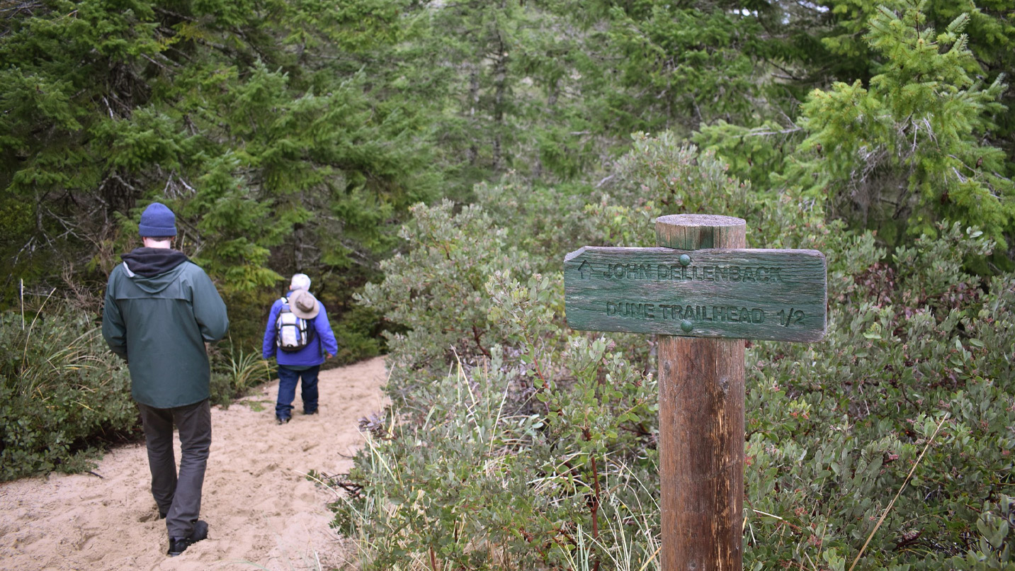
We hop in our car and follow Marty a quick 15 minutes north to the John Dellenback Dunes trailhead in Lakeside. Looking around, it isn’t at all obvious that we are actually in the middle of one of the largest swaths of temperate coastal sand dunes in the world. Alder, Douglas fir and pine trees ring the parking lot, and as we set off down the trail, we cross a burbling stream and pass placid wetlands.
Driven by wind and rain, the dunes actually encompass sections of coastal forest, Giles explains. That creates today’s otherworldly landscape, where islands of forest are interspersed with sections of open sand and multi-armed interdunal lakes. It’s a habitat in a constant state of flux, and it supports a surprising number of plants and animals.
On the trail, we pass through a stand of madrona, manzanita, salal and rhododendron, all plants in the heath family that are able to thrive on this nutrient-poor soil by partnering with fungi to trade nutrients. The ground is carpeted in mosses, mushrooms and lichens. Up close, they’re like tiny sculptures shaped like antlers, feathers and fronds. Giles draws our attention to several small rosettes of green leaves striped with white: rattlesnake orchids, one of a dozen different species of native orchids in Coos County. Without her sharp eye, I may never have noticed them.
Climbing the Open Dunes
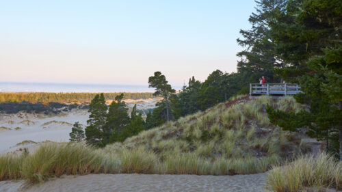
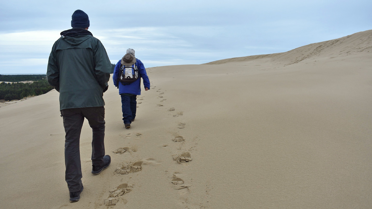
After a short hike, we emerge from the forest at the foot of an immense dune, at least 100 feet high. My quads tense at the idea of slogging to the top, but winter rains have left the sand damp and firm, and before I know it, we arrive at the crest of the dune. “One advantage of visiting the dunes in winter is wet sand is a lot easier to walk on,” says Giles.
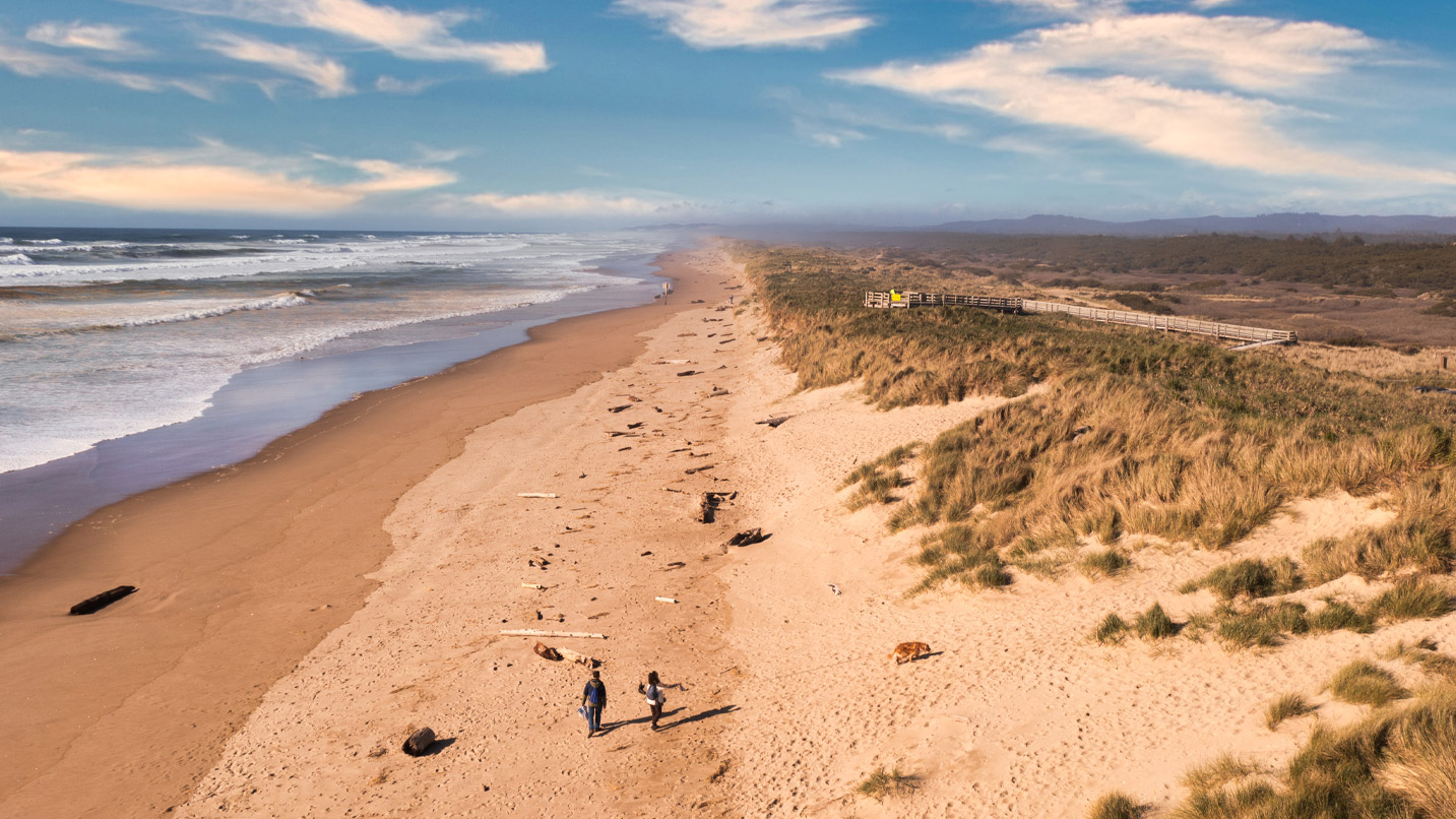
From there, we look out onto an ocean of sand, carved by the wind into sculptural shapes called yardangs and rippled with subtle striations of dark and light granules. Giles points out the navigation markers — posts painted white on the top — that mark the trail on its way to the beach. In most places and times of year, visitors are free to walk anywhere in the dunes, though some sensitive areas are marked as off limits, and there are seasonal beach restrictions to protect western snowy plover nesting grounds. It’s wise to keep in sight of one of these markers, because it’s easy to get turned around. Walkers should also keep an eye out for chimneys, which are made when a dune moves in around a tree which then rots under the sand, finally decaying completely and leaving a deep hole.
Even here in open sand, signs of life are everywhere. We see plenty of European beach grass, an introduced species now spreading aggressively in the dunes, but Giles also points out native grasses and sedges. I’m surprised by how many plants are able to find a foothold in this seemingly inhospitable environment.
And it’s not just plants. On the way back to the car, my husband spots a small movement on the ground. It’s a rough-skinned newt. Giles points out its bright-orange belly, a not-so-subtle hint that this adorable little animal is actually extremely poisonous and shouldn’t be handled. “There’s a lot to see,” she says. “It would surprise people who pass by at 30 miles per hour.” The newt moseys off, eventually disappearing beneath an evergreen huckleberry bush. Just like us, he appears to be in no particular rush.
Other Ways to Enjoy Coos Bay
Book your adventure with Wavecrest Discoveries ahead of time. In addition to the dune walk, Giles also offers nature walks in beach, marsh, forest, and dock settings, plus tide pooling and clam digging (both tide-dependent).
Coos Bay is a natural home base for experiencing the Dunes. Along with nearby North Bend and Charleston, it’s the most populous metropolitan area on the Oregon Coast. It’s fun to stay downtown within walking distance from restaurants and shops (including the visitor center, where you can get a parking pass for all the destinations mentioned here). Another alternative is The Itty Bitty Inn in North Bend, which offers fun themed rooms and bikes to borrow.
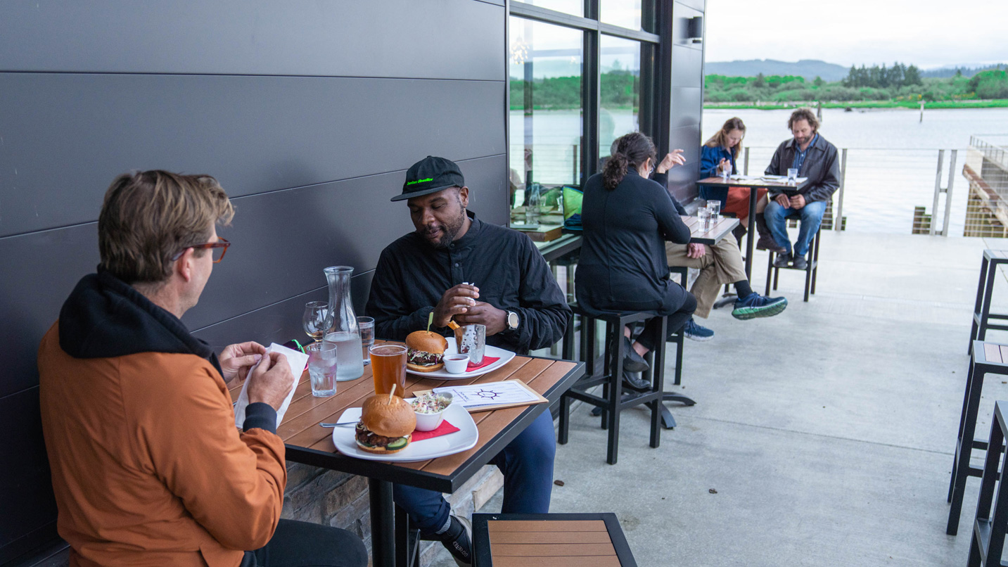
The 7 Devils Brewing Company has two locations in Coos Bay, both serving their ales and elevated pub grub featuring local seafood. Also in town, Himalayan Restaurant and Bar offers delicious Indian and Nepalese dishes like momo (steamed dumplings), curries and biryani. For more tasty options, check out the Wild Rivers Coast Food Trail.