The Pacific Coast Scenic Byway is one of the world’s most stunning scenic drives. When traveling Oregon’s South Coast you don’t even have to leave the highway to enjoy some pretty spectacular views. But venture off the highway you should, because a few not-to-be-missed places are just a detour away. These are some of my favorite short diversions off Highway 101 when traveling along the South Coast.
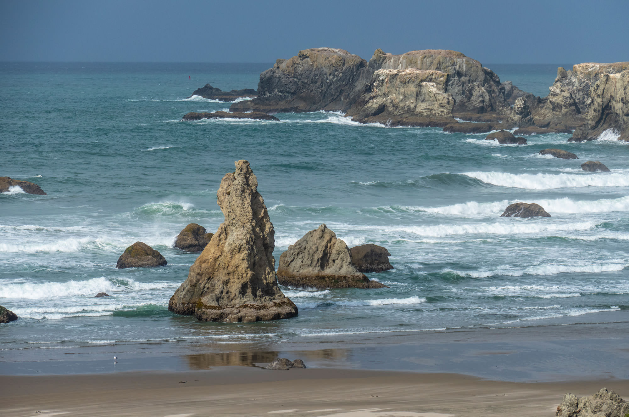
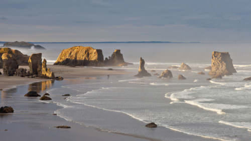
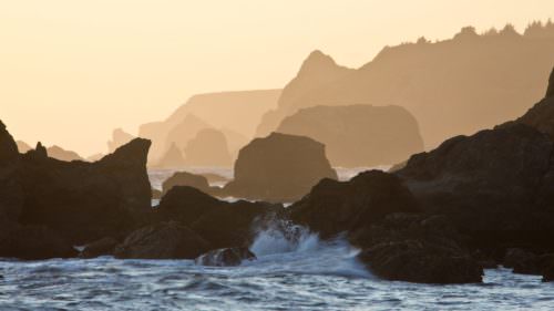
Bandon’s Beach Loop Drive
It’s easy to drive through the small town of Bandon and not realize that one of Oregon’s most dramatic stretches of beach and two remarkable viewpoints are just a short loop drive off the highway. Bandon’s Beach Loop Road provides access to Face Rock State Scenic Viewpoint and Coquille Point. Both are must stops. Both viewpoints offer beach access and walking paths for various scenic perspectives of this scenic beach with numerous sea stacks and offshore rocks. A short diversion to South Jetty Park offers views of the Coquille River Lighthouse and Bandon’s Old Town and riverfront boardwalk are also highlights of this off-the-highway loop drive.
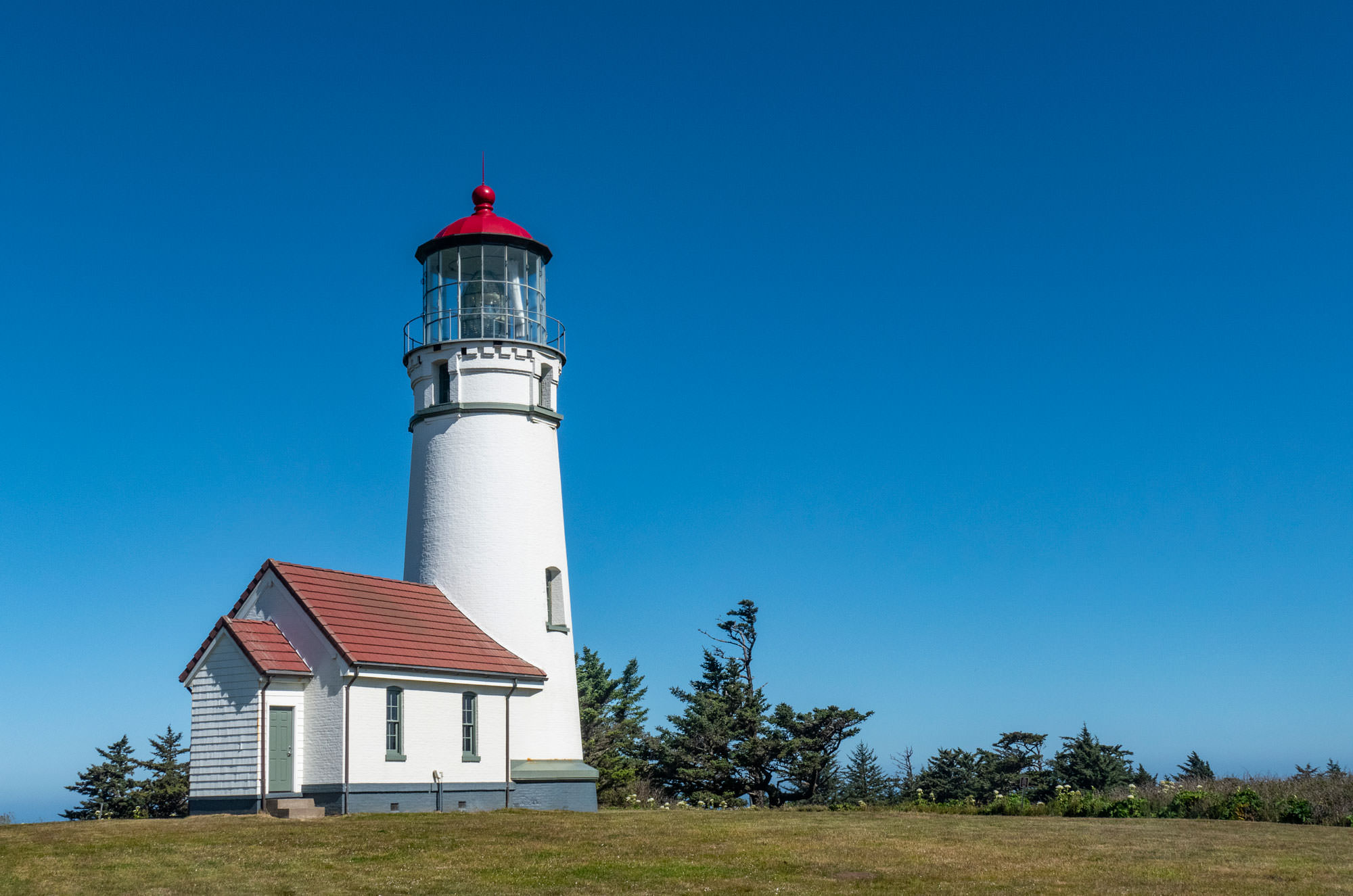
Cape Blanco Lighthouse
It only takes a five-mile side trip from the Coast Highway north of Port Orford to see one of Oregon’s prettiest lighthouses perched on the bluff of Cape Blanco. The Cape Blanco Lighthouse is situated in a panoramic setting with sweeping views to the north and south from the westernmost point in Oregon. The lighthouse can be toured (check seasonal hours) and hikers will find trails along the bluffs on either side of the cape. Just before reaching Cape Blanco, visitors can get a glimpse into coastal life at the turn of the century where the Hughes House, a restored late 19th century Victorian home, is open to the public.
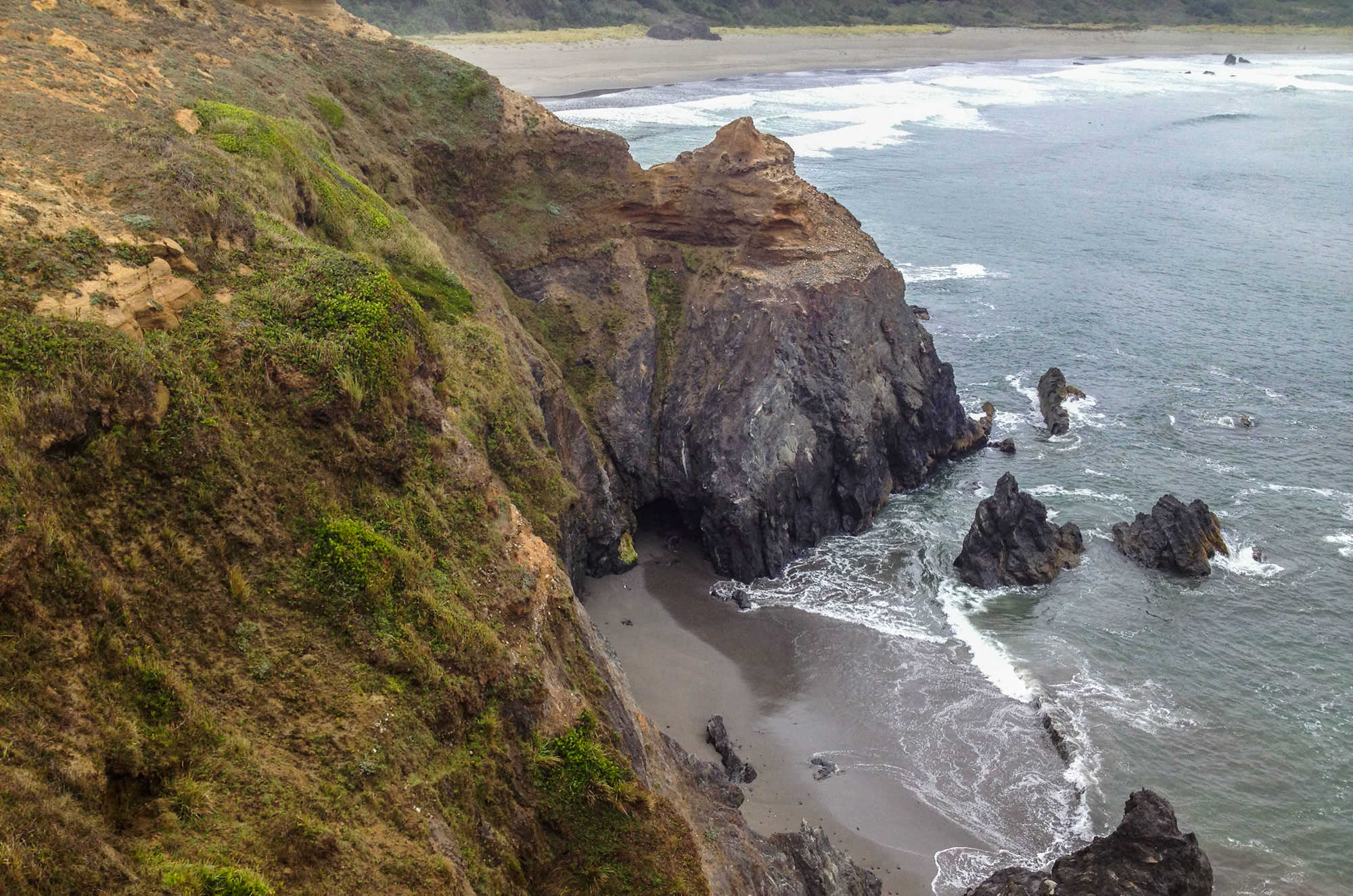
Old Coast Road and Otter Point
Just north of Gold Beach, US 101 runs just inland, but if you turn off onto Old Coast Road you’ll find Otter Point State Recreation Site that may be one of the Oregon Coast’s top undiscovered secrets. Trails from the parking area lead to views of sculpted sandstone rock formations, arches and secluded beaches.
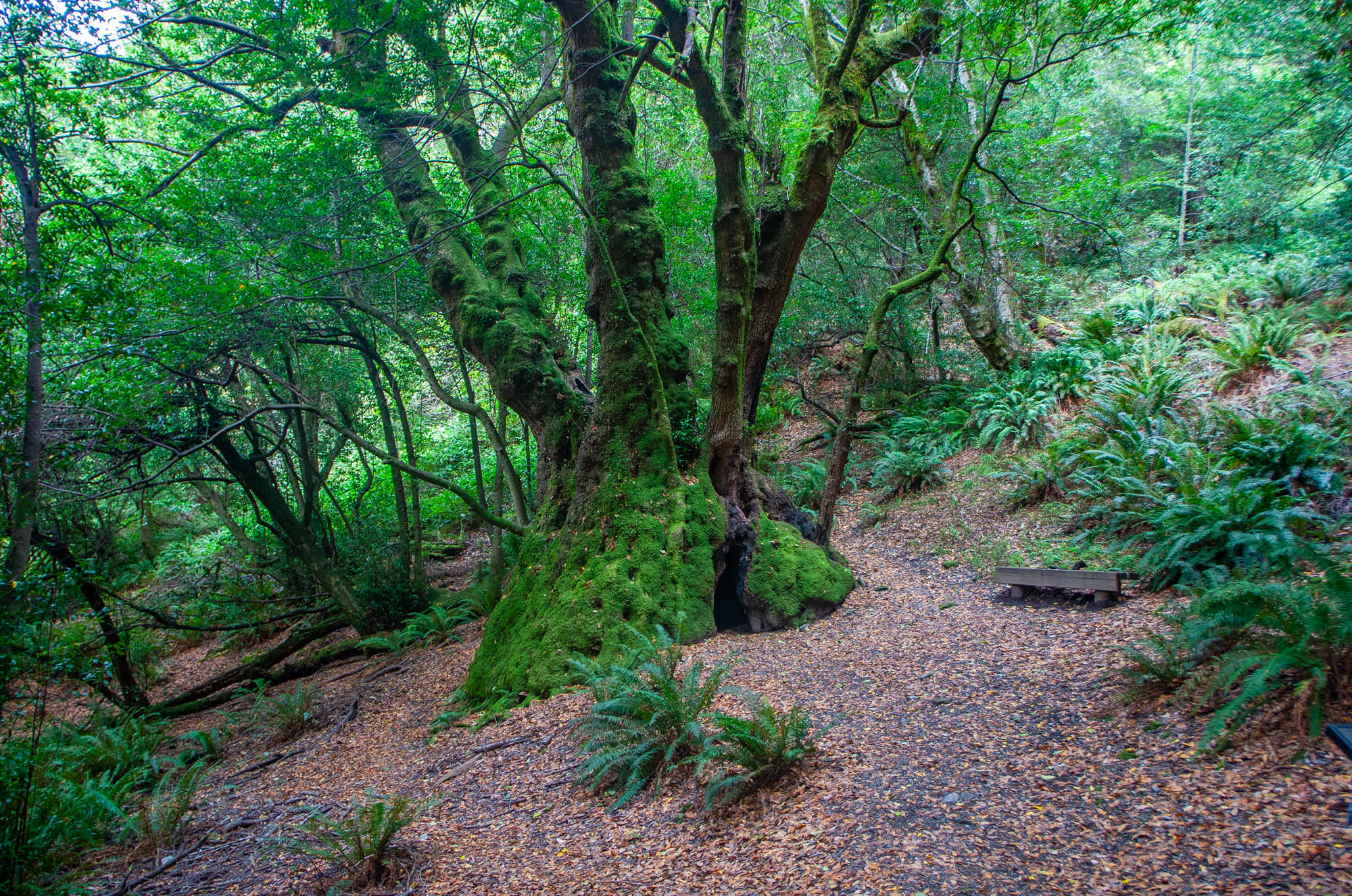
The Rogue River, Old Growth and a Giant Myrtle Tree
Most people venture up the Rogue River on the famous jet boat tours into the wild and scenic river’s wilderness areas, but hikers especially will find this to be a worthwhile driving side trip too. From the south side of the Rogue River in Gold Beach, follow Jerry’s Flat Road to the east where you will enjoy river views. After 10 miles, turn right on Forest Service Road 060 to reach the Frances Shrader Old Growth Trail, an easy 1.5-mile loop trail through towering old growth Douglas Fir including some as tall as 220 feet and 10 feet in diameter. Your adventure can continue by crossing over the nearby Lobster Creek Bridge and turning right on Silver Creek Road for about a quarter mile to the Myrtle Tree Trail. It’s a short walk through aromatic Myrtle trees to reach the world’s largest known myrtle tree, 42 feet in circumference and with a canopy approaching 70 feet across. It’s then easy to return to US 101 along the North Bank Rogue River Road for a different perspective.
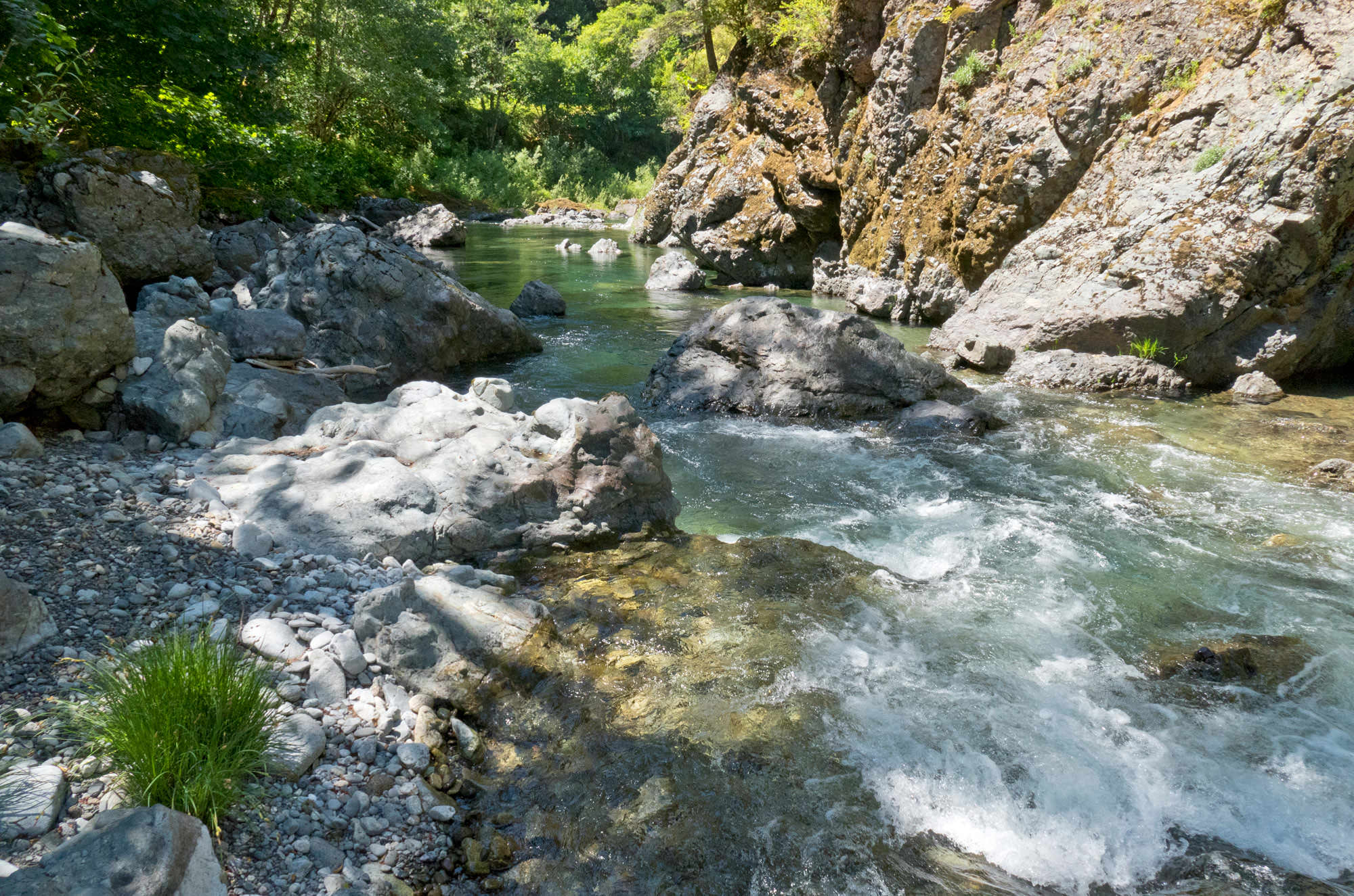
Wild & Scenic Elk River near Port Orford
Just north of Port Orford, you can explore another one of Oregon’s nationally designated Wild and Scenic Rivers by turning east on Elk River Road. Elk River Road quickly transitions from pastureland to wild river surrounded by wilderness areas. Look for places to stop and view the Wild and Scenic Elk River and its magnificent pools of endless greens and crystal-clear water. At mile 22, you reach Butler Bar Campground where you can enjoy the view or take a dip in one of the river’s stunning pools. On your return trip, stop at the fish hatchery to learn about salmon and the hatchery’s operation.
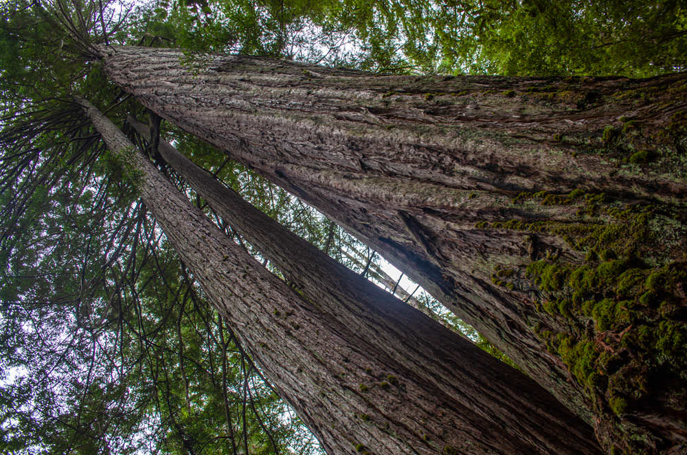
Myrtle Grove and Redwoods near Brookings
A 15-minute drive from downtown Brookings up the Chetco River leads to Alfred A. Loeb State Park where you can explore a beautiful riverside forest of myrtle trees, many of which are well over 200 years old. Walk the short Riverview Trail with the eucalyptus-like aroma of the Myrtle leaves filling the air. At the end of the trail, cross the road to find the trailhead of the Redwood Loop trail, a one-mile walk through Oregon’s largest stand of giant Redwoods.
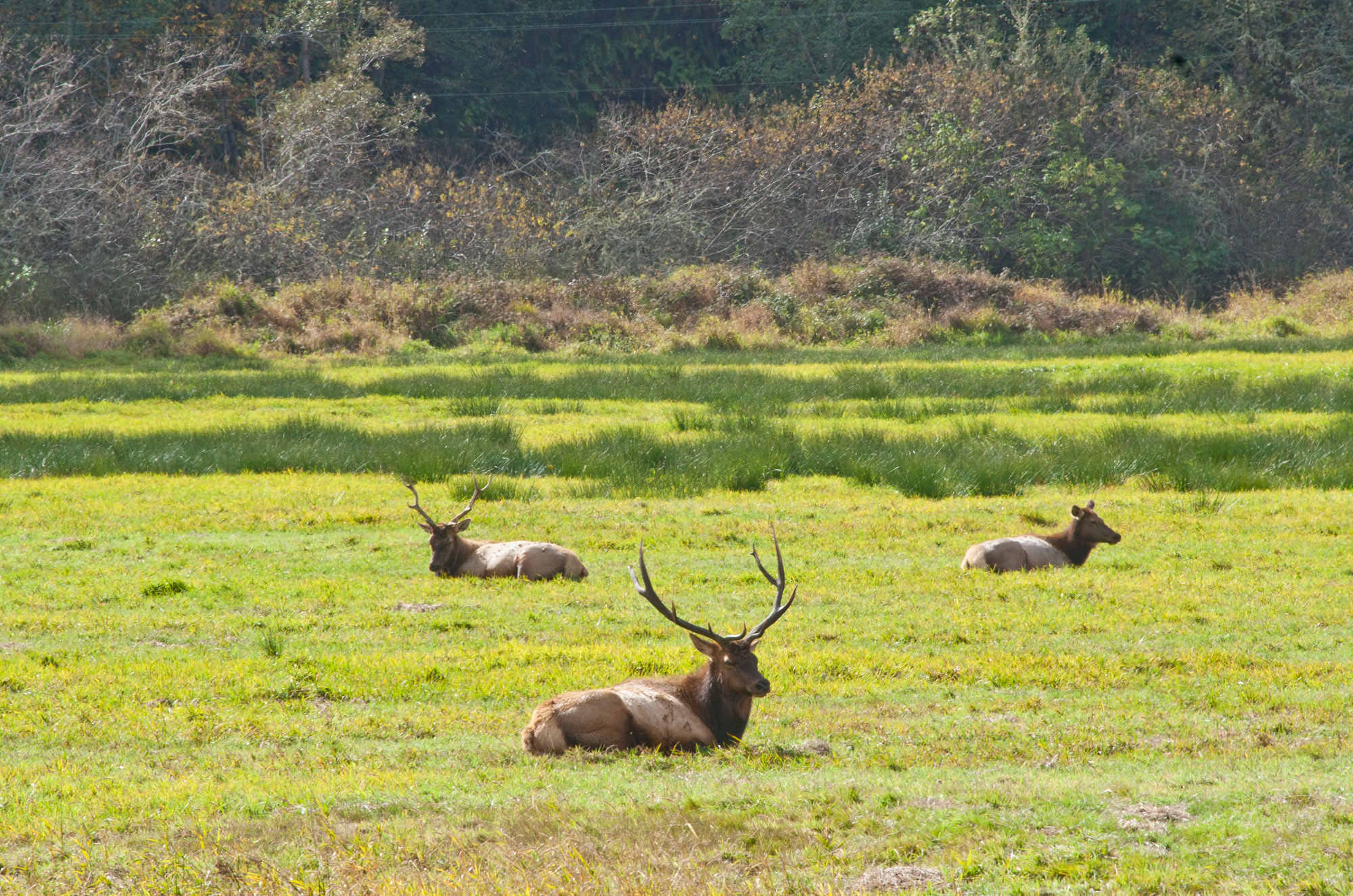
Elk viewing minutes from Reedsport
Just a five-minute drive from US-101 in Reedsport up the Umpqua Highway (OR-38) leads to one of the most reliable spots on the Oregon Coast for spotting herds of Roosevelt Elk. The Dean Creek Elk Viewing Area includes several pull-outs along the highway where herds of 60 to 100 elk are visible nearly every day of the year.
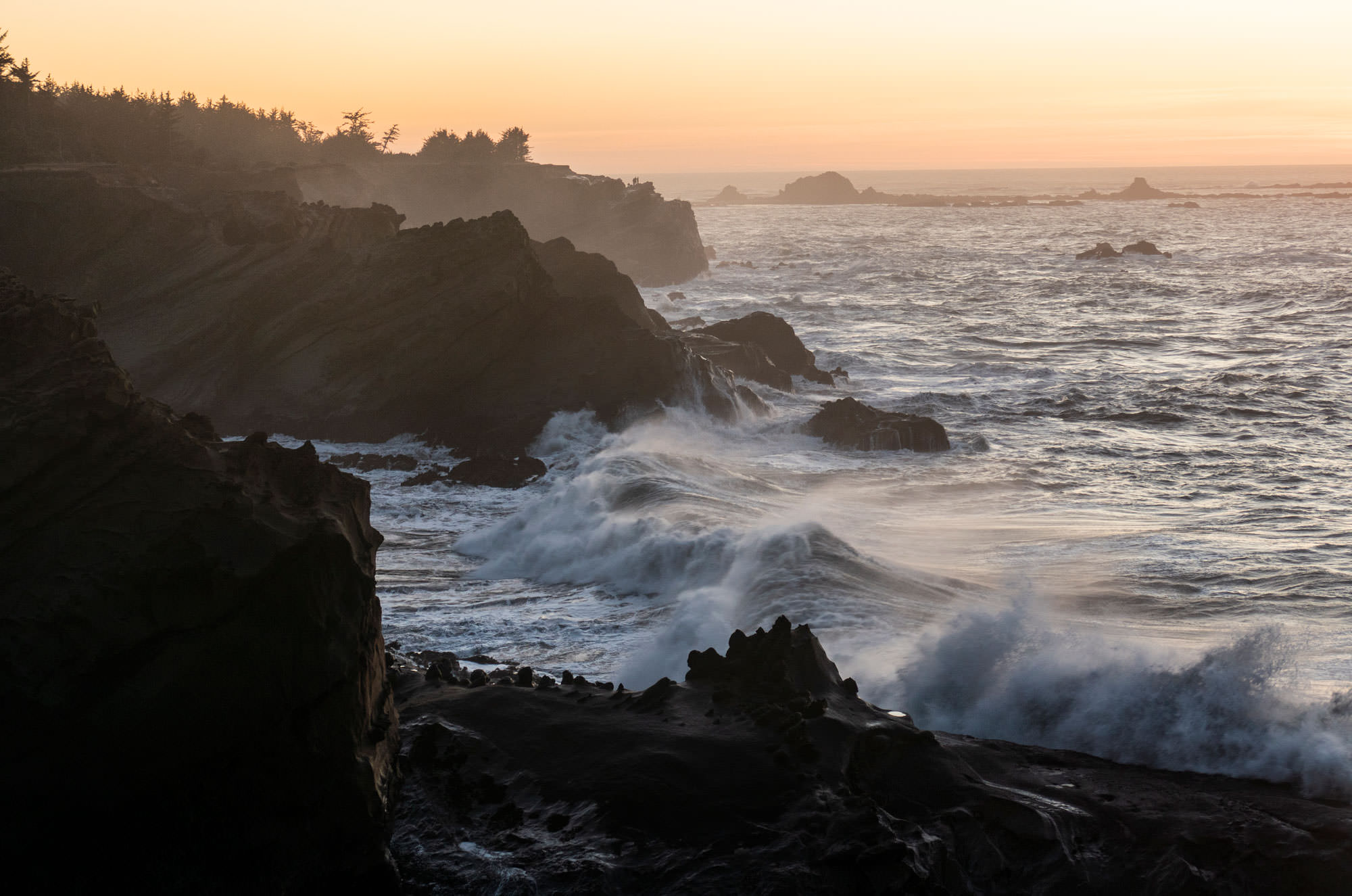
Cape Arago Highway
Between North Bend and Bandon, the Coast Highway runs inland, but just to the southwest of Coos Bay is one of the most scenic stretches of the Oregon Coast. Not far from the working fishing town of Charleston, the Cape Arago Beach Loop is an out and back road passing through three stunning interconnected state parks. Sunset Bay is a protected cove beach and just south of the state park campground is a viewpoint looking back at the Cape Arago Lighthouse. Just a little further is Shore Acres State Park with sheer sandstone cliffs and weathered reefs famous for great wave watching. Cape Arago State Park is the end of the road, but it offers some of the most amazing view picnic areas you will find anywhere and trails to nearby coves that teem with sealife. The nearby Simpson Reef Overlook looks out over one of the Oregon Coast’s most populated sea lion haul outs and the action and the sound of sea lions can be heard throughout the area. You can reach the Cape Arago Highway from the south via the Charleston to Bandon Tour Route or from the north from downtown North Bend.