Looking out at the rocky mesas and sagebrush grasslands of Central Oregon, it’s difficult to imagine that this high desert was formed in part by a massive volcanic explosion nearly 30 million years ago. This cataclysmic event happened in one of the largest known volcanoes in Oregon’s history. It formed what’s now known as the Crooked River Caldera, an area 25 miles long and 17 miles wide — also known as Central Oregon’s supervolcano.
Visitors can see some pretty cool remnants of this ancient geological history at numerous recreation sites in Central Oregon. Jason McClaughry, a geologist for the Oregon Department of Geology and Mineral Industries, first identified the caldera with his colleague Mark Ferns in 2005. Here are some of McClaughry’s favorite places to see how the blast shaped Central Oregon’s rocky landscape.
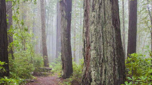
Rock Viewing on Great Hikes Near Bend
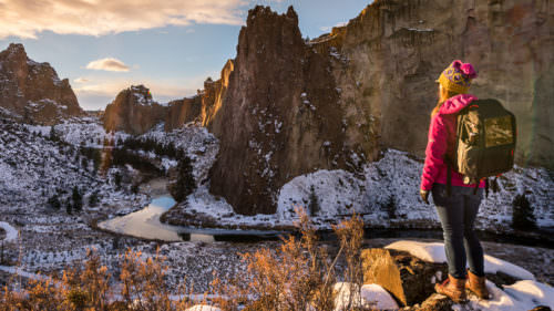
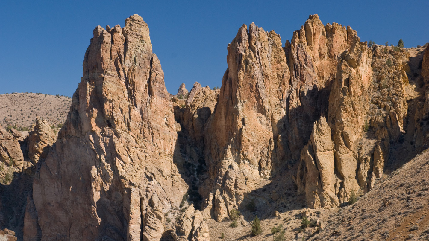
McClaughry says the premier spot to view the caldera is Smith Rock State Park in Terrebonne, about 30 miles northeast of Bend. The park is immediately recognizable by its golden rocky spires rising above the meandering Crooked River. A popular climbing and hiking destination, the park is known for its tan-colored tuffs — rocks formed from compacted volcanic ash and debris — created in the explosion. Pro tip: It’s good to head to the area midweek or in cooler months to avoid crowds. You’ll need a parking pass, which you can purchase on-site.
Popular trails at Smith Rock include the challenging Reverse Misery Ridge Loop Trail — offering sweeping vistas and a 1,500-foot elevation change when you head out on the 3.7-mile trip from the Welcome Center — and the 2.5-mile River Trail, which is great for slower mobility since it’s mostly flat. As you travel, imagine how powerful the volcanic explosion must have been to release over 240 cubic miles of volcanic material across the land. On close inspection, you can see pumice and 280-million-year-old limestone fragments that were blown outward and are now embedded in the rocks. Look for honeycomb features in the tuff formed through weathering and also reddish spires of lava rock.
Spectacular Volcanic Action Near Prineville
If you’re planning to camp at Prineville Reservoir State Park, 35 miles southeast of Smith Rock — or just spend the day hiking or boating along the waterfront — check out the west end of the reservoir. You’ll notice slanted cliffs of multicolored tuff that dip north. They were laid askew during the caldera’s collapse. Look for layering in the cliffs; older rock was topped by younger, horizontal layers of volcanic matter formed during the caldera’s eruptions. Be sure to stick around for some of the best dark-sky viewing in Oregon — the park often has guided programs open to all.
Another great Prineville area nature stop is Barnes Butte Recreation Area. Here a network of trails runs up and along a dome made of a fine-grained, often gray rock called rhyolite, formed from lava that erupted from fissures along the caldera’s edge. You’ll see reddish-colored and pistachio-green caldera tuff on the lower trails, and lichen-encrusted, weathered rocks that stand out against the sagebrush and juniper slopes of the butte.
For those who want to combine a more strenuous hike with a scramble to the top of the butte, you’ll be rewarded with glimpses of the snowcapped High Cascades with rimrock plateaus surrounding Prineville and smaller peaks in the foreground as you hike up. At the top of the butte, you’ll be greeted by 360-degree-views of the caldera. When you’re done hiking, grab some barbecue and a craft brew at Dillon’s Grill or a steak and a cocktail at Club Pioneer, both popular local hangouts.
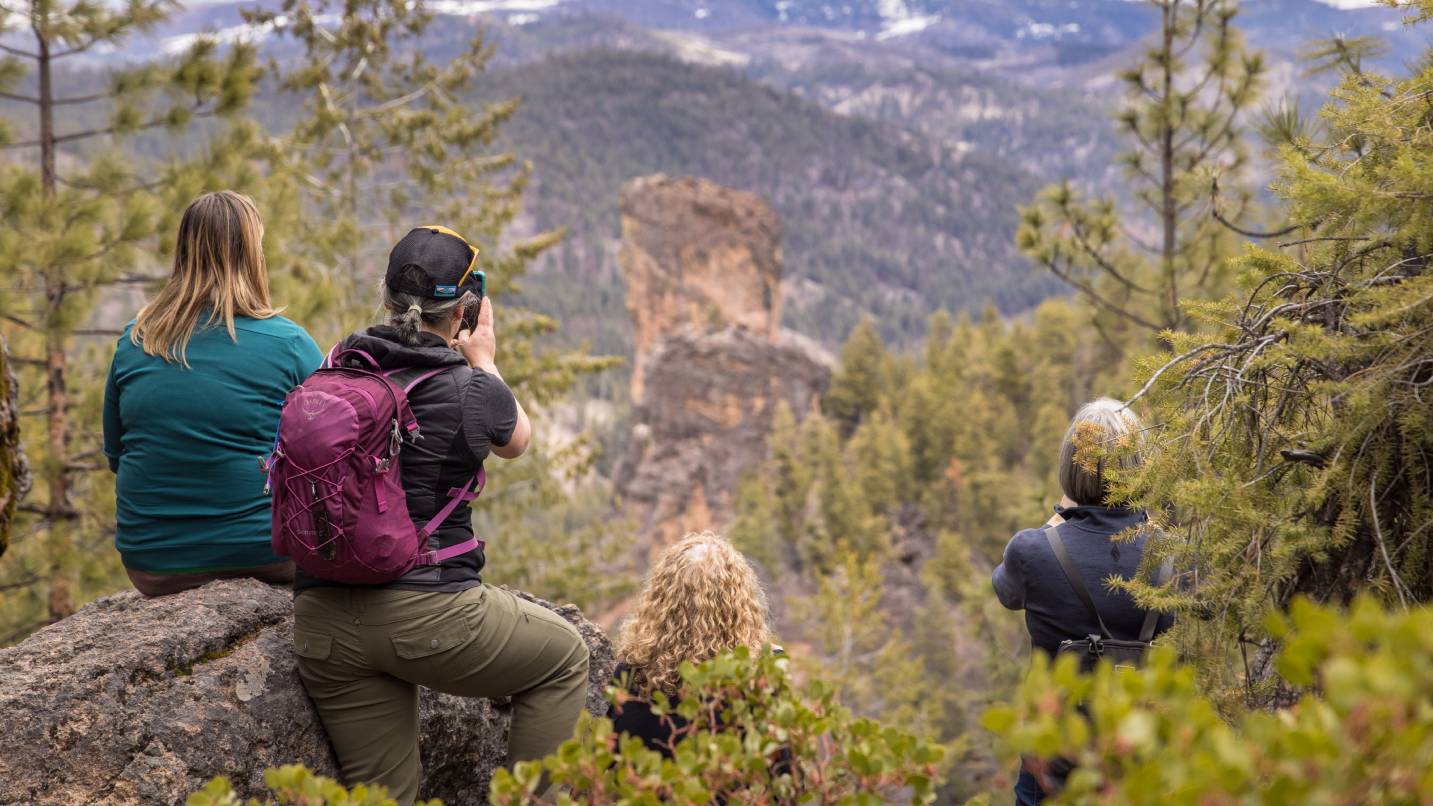
Venture just east of the caldera to see another volcanic formation near Prineville, the Steins Pillar. You’ll have unobstructed views of this 350 feet tall geological marvel from the Steins Pillar Trail, making it a popular destination for hikers and nature enthusiasts alike.
Three Places for Panoramic Views of the Caldera
An easy way for road-trippers to experience the caldera, the Peter Skene Ogden State Scenic Viewpoint — back in Terrebonne just 5 miles outside of Smith Rock — provides jaw-dropping views into the Crooked River Canyon. Layers of lava rock filled this area about 400,000 years ago, and a canyon was slowly cut into the rock by the river over time. Looking east from the viewpoint affords views of the northwestern edge of the caldera. Gray Butte, with its radio-tower top, sits near the fracture zone where earlier rocks from the John Day and Clarno formations can be seen along the caldera’s northern edge.
Want to get into the heart of the caldera? At Ochoco Wayside State Scenic Viewpoint, located about a mile west from Prineville, you can stand on top of a lava plateau at its center and take in the panoramic views. A 1,000-foot layer of tuff engulfs the city of Prineville, visible below the viewpoint, and volcanic domes mark the caldera’s boundaries in all directions. Look north and you’ll see the recognizable profiles of Smith Rock and Grizzly Mountain — the largest of the caldera’s rhyolite domes.
To take in an expansive view of the caldera, McClaughry recommends Pilot Butte State Scenic Viewpoint in Bend. Take one of two routes that climb about 450 vertical feet to the top of the 4,141-foot extinct cinder cone that erupted about 188,000 years ago. There’s a mile-long nature trail hike and a paved, seasonal Summit Road — open April 15 through Nov. 1 — which spirals up at roughly the same distance. From the top, the entire eastern skyline is filled by the caldera and the rhyolite domes that encircle it. To the west are stunning views of the much younger Cascades peaks of the Three Sisters, Three Fingered Jack and Mt. Jefferson.