This 69-mile/111-kilometer drive highlights the unusual volcanic formations known as the Diamond Craters as it loops through a variety of high-desert habitats and evocative ranching outposts.
Across the Malheur National Wildlife Refuge
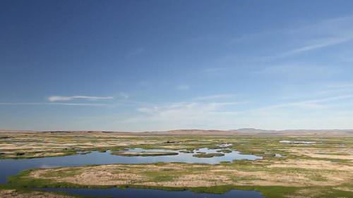
The tour route begins at OR-205, heading east through the Malheur National Wildlife Refuge. This immense freshwater oasis in the middle of the high desert attracts hundreds of species of birds and other wildlife.
Diamond Craters Outstanding Natural Area
Turn north on Lava Beds Road, and the lowlands of the Diamond Swamp suddenly turn into a desolate landscape of blackish, barren rock. These lava fields were formed 25,000 years ago, when molten basalt billowed up through fissures in the earth and spread across a dry lakebed. Before the initial layer cooled, more molten rock thrust it upward, creating some of the most diverse basaltic features found anywhere in the United States.
For the next several miles, the route leads through Diamond Craters Outstanding Natural Area, a curious array of collapsed craters, lava domes, lava tubes, wrinkled ridges, cones, spires and other formations. To learn more, download the federal Bureau of Land Management’s “Diamond Craters: Oregon’s Geologic Gem” brochure, or pick up a copy at the Harney County Chamber office in Burns.
Toward Princeton
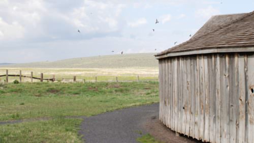
About 3 miles/4.8 kilometers beyond Diamond Craters, the tour route soon intersects with Happy Valley Road and the Peter French Round Barn. Part of the 100,000-acre French-Glenn cattle empire that once dominated this region, the unusual 1880s structure was designed for training draft horses during the harsh high-desert winters. A visitor center and Jenkins Ranch family museum sit just at the entrance of this historical building.
From here, the tour route heads in two directions: To meet up with the East Steens Tour Route, continue north through New Princeton to Crane. To complete a smaller loop and return back to OR-205, follow Happy Valley Road through the small ranching community of Diamond.
Want more details?
Order a free Oregon Scenic Byways guide.